
Very cold weather next week with a high chance of snowfall
Good evening everyone here is the latest update on the expect cold spell for next week.
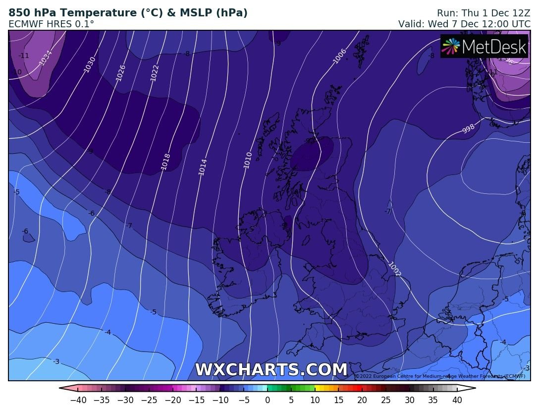
Today forecasting models continue to show a rather chilly cold spell arriving at the end of this weekend with a deep plunge of colder weather arriving down across Ireland from Tuesday or Wednesday onwards. The European and American forecast models now show the chance of wintry falls of snow moving into the end of the week with the northwest and north of the country receiving the first snowfall of the season as early as Wednesday night into Thursday next week.

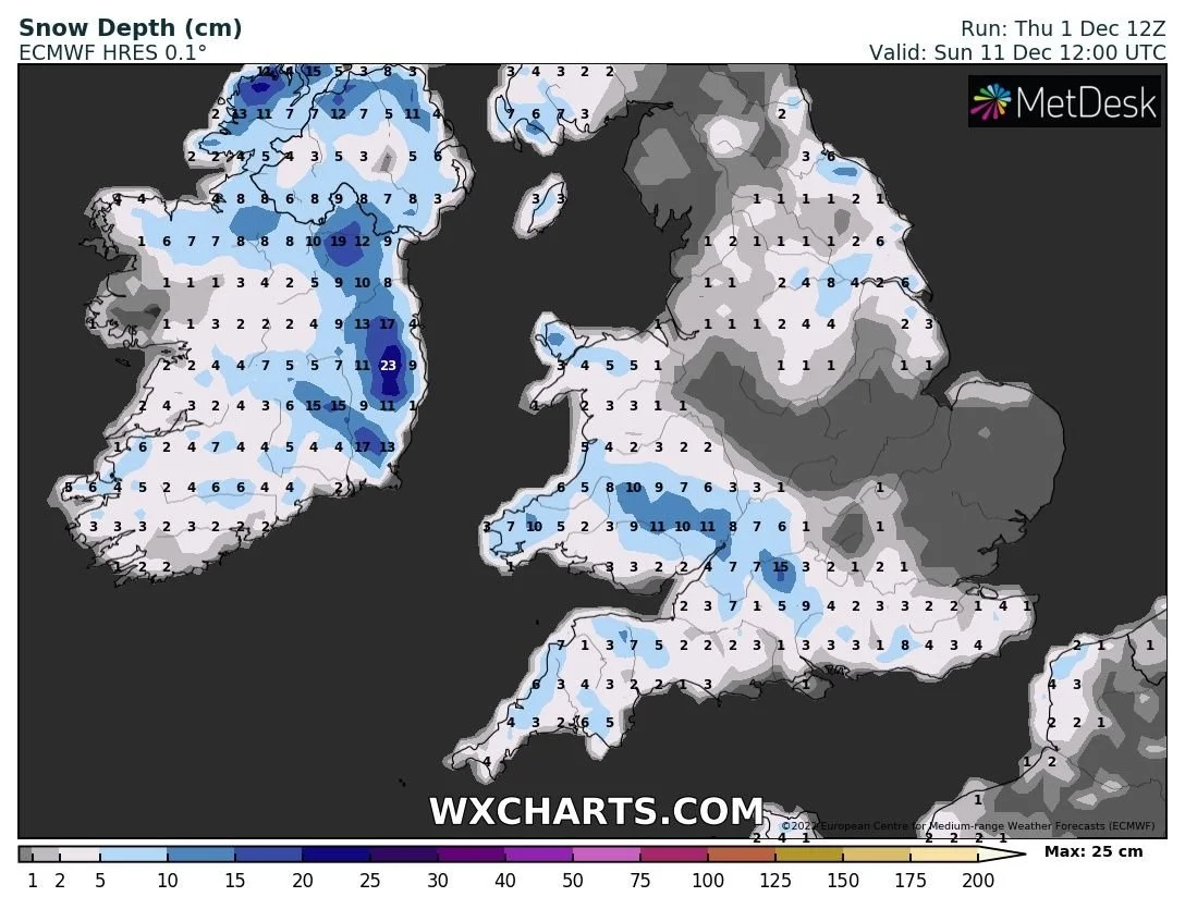
Based on the latast models this could turn into a long sustained cold spell lasting up to at least 7 days and if the Ecmwf and GFS models are anything to go by this evening most of the country could have snow on the ground come next weekend.
The below chart is from the European forecast model showing a covering of snow across the whole country come next weekend
Temperatures will start it fall back from Sunday night into early next week but come Tuesday night onwards we will see a big drop in temperature below -5C and possibly lower heading into the end the week and next weekend and with snow on the ground this can lead to even colder temperatures. Day time temperature come Wednesday next week and over the end of next week could well struggle to rise above freezing level.
This is only now around 5 to 6 days out so come Saturday we should have a fairly solid idea on some of the finer details.
Stay tuned for further updates over the coming days
Kenneth from the Donegal Weather Channel
LATEST NEWS


