
Monthly Long Range Forecast Update Ireland - 18th September until 25th October 2021

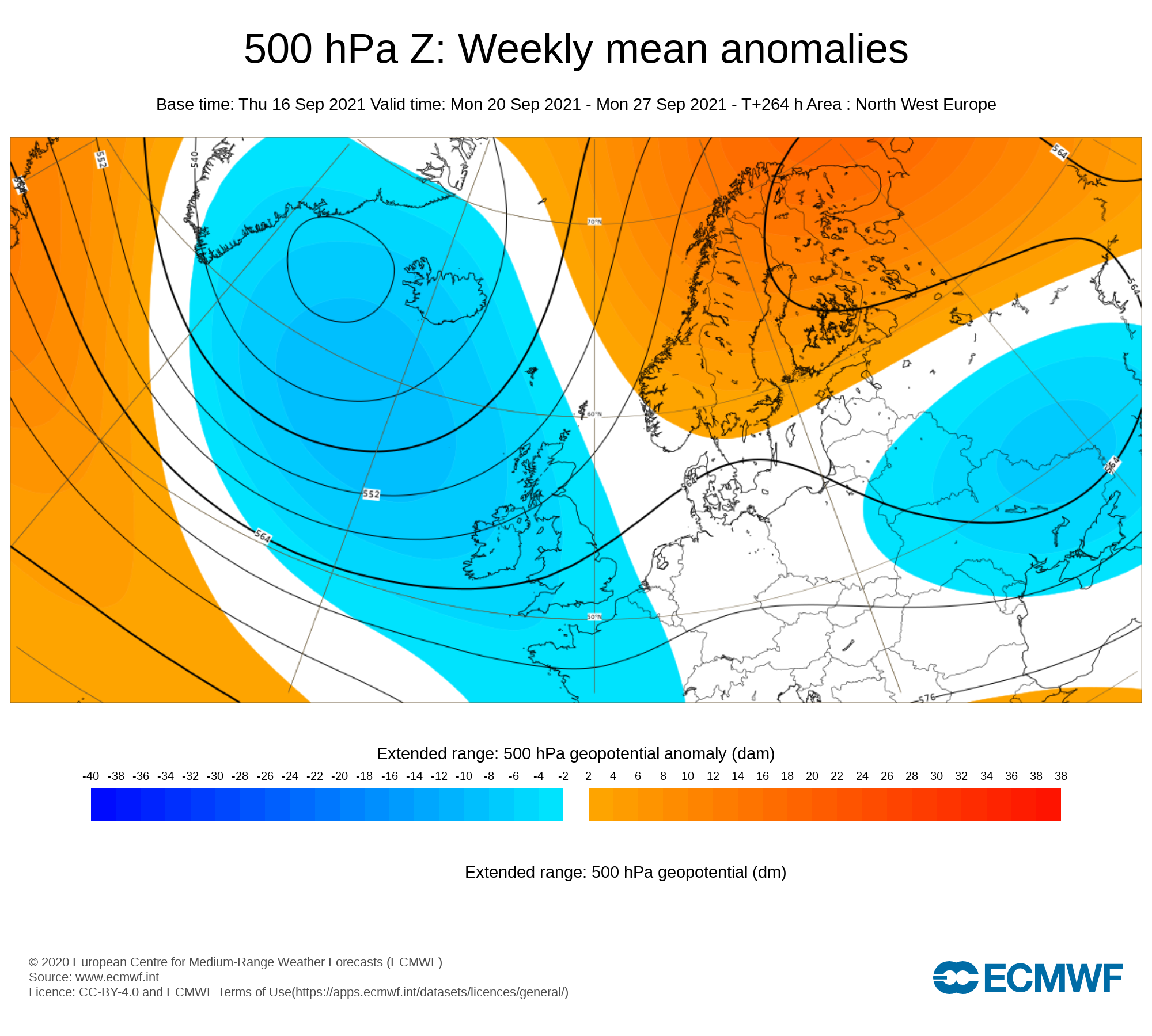
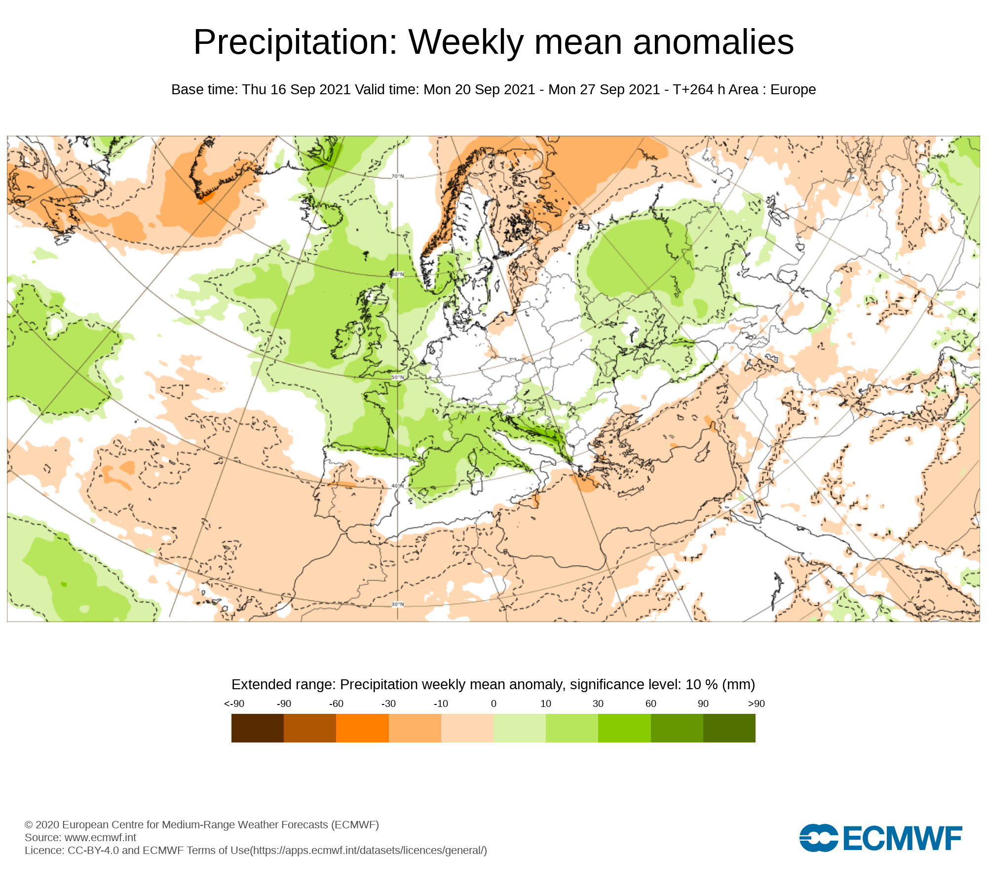
Week 1 - Monday 20th September 2021 - Monday 27th September 2021
The latest outlook for next week is for a rather unsettled week across Ireland with some heavy spell of rain at time especially across the western and northern half of Ireland where the highest rainfall amounts will be over the coming week. Towards the end of the middle and end of the week the most rainfall amounts will fall from Wednesday afternoon and evening into Thursday.
At present there is some uncertainty but the latest forecast from the ECMWF model shows a low pressure system rapidly Deepening of the northwest and north of Ireland on Friday afternoon and evening bring the risk of some strong even severe wind gusts in places, Keep tuned to the latest forecast over the coming days as changes are likely between now and then.
The latest outlook for next weekend is for a cooler and unsettled weekend of weather with some heavy rainfall again possible. Some blustery weather also looks possible at this stage.
Temperatures over next week will be in the mid to high teens.
RAINFALL AND WIND WARNING COULD BE ISSUED AT TIMES OVER THE WEEK

Week 2 - Monday 27th September 2021 - Monday 04th October 2021
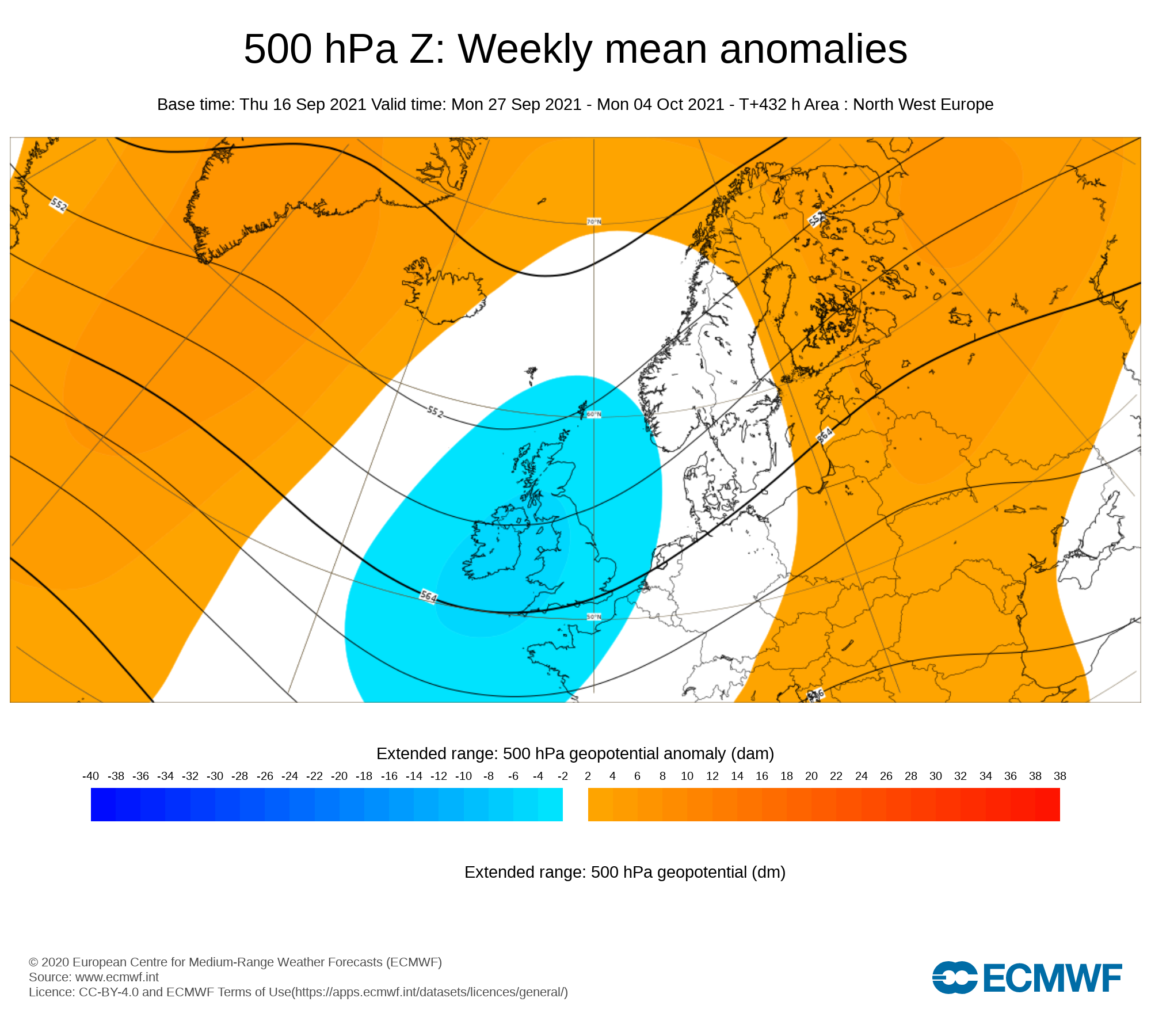
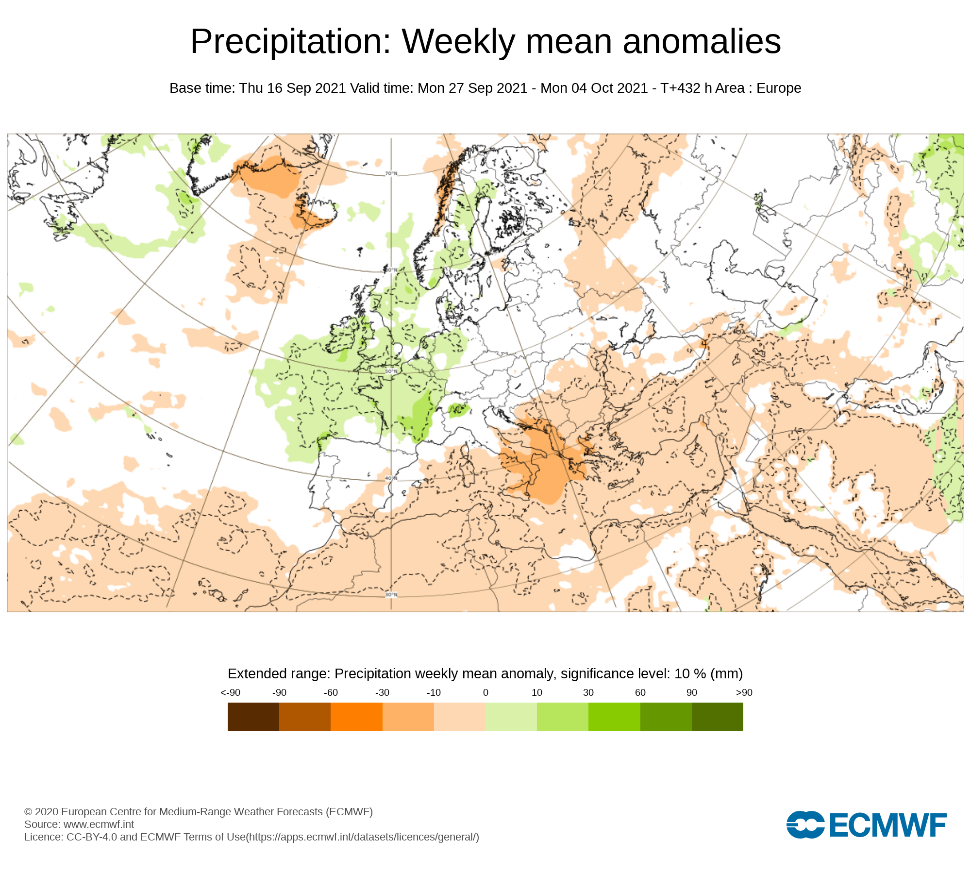
As we head into the last week of September and the first few days of October the latest signals are for lower pressure than average which will mean the weather will remain on the unsettled side. Rainfall amounts this week are also expected to be above average for all areas.
Some heavy spells of rain moving in from the Atlantic will be possible over week 2 with rainfall warnings possible over the week. Some wind warnings also can’t be ruled out especially with the risk of lower pressure.
Temperatures over week 2 will be near normal for the time of year.

Week 3 - Monday 04th October 2021 - Monday 11th October 2021
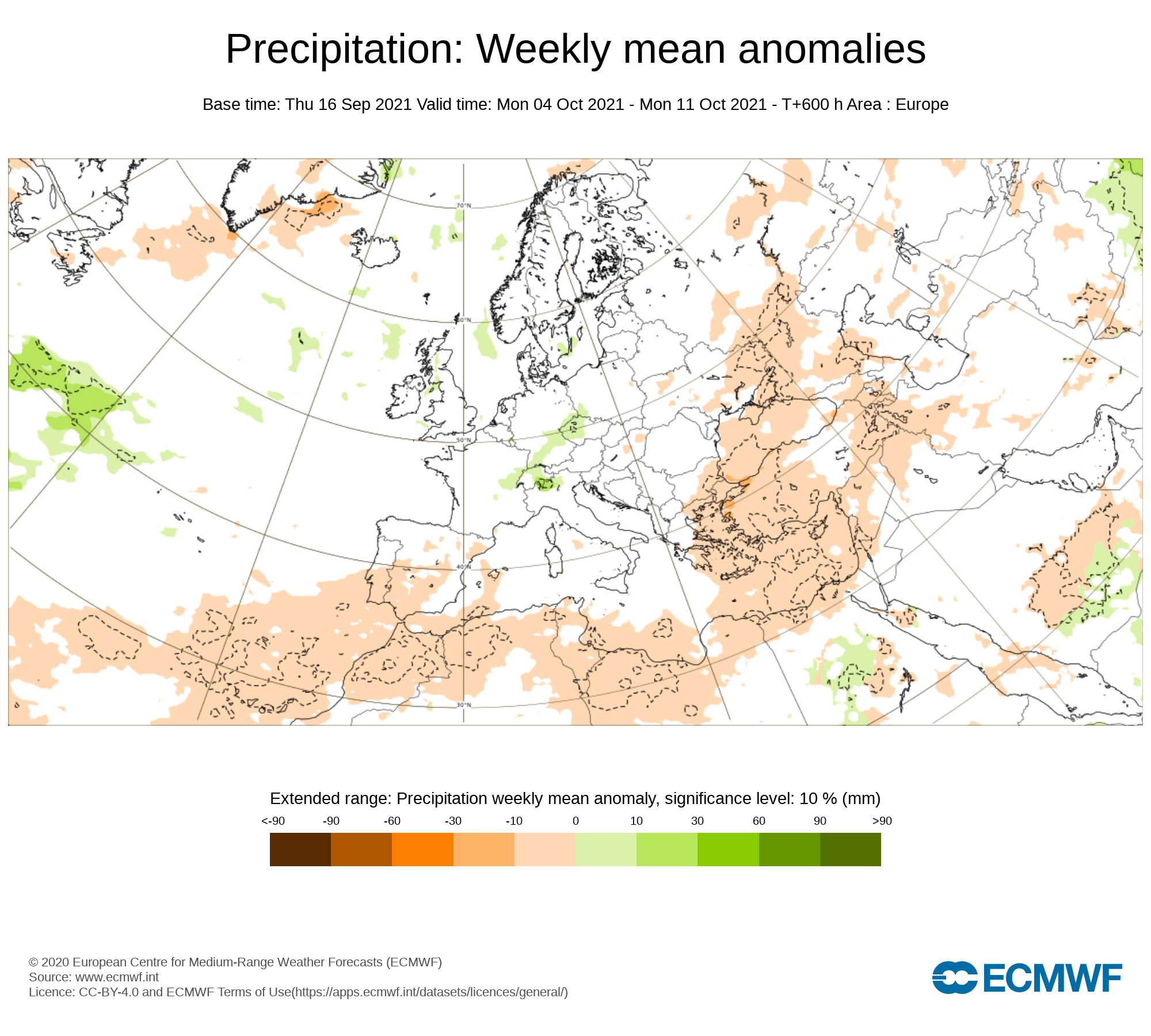
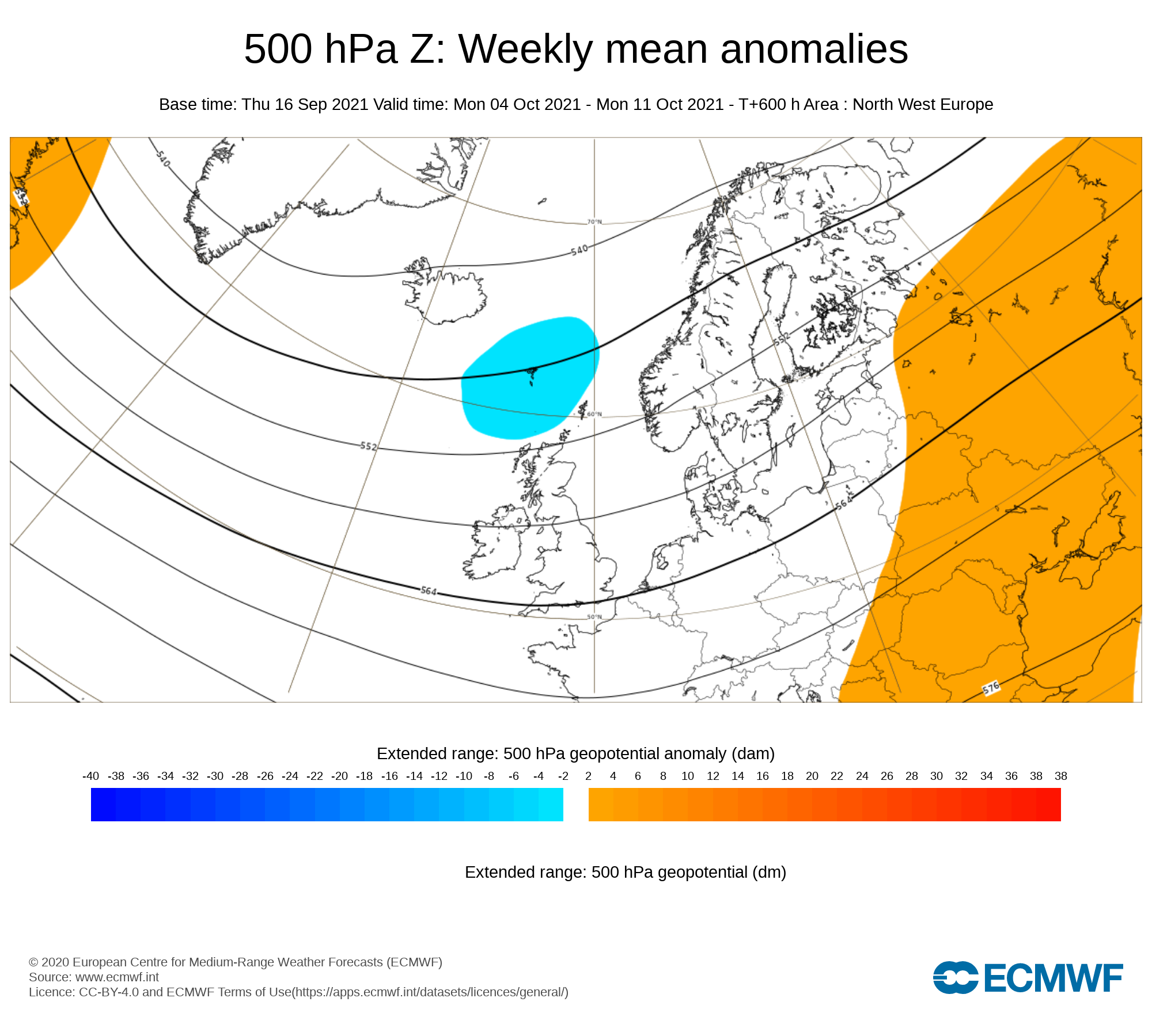
For week 3 the signals are a little more weaker but the latest signals are for lower pressure than average especially near the northern half of Ireland and over Scotland.
The latest forecast also signals another west week with bands of rain possibly moving westwards at times in from the Atlantic.
The risk of some windy conditions will also be a factor especially with lower pressure than average been signaled.
Temperatures again are signaled to be average for this week with temperatures in the mid teens possibly into the high teens.
Week 4 - Monday 11th October 2021 - Monday 18th October 2021
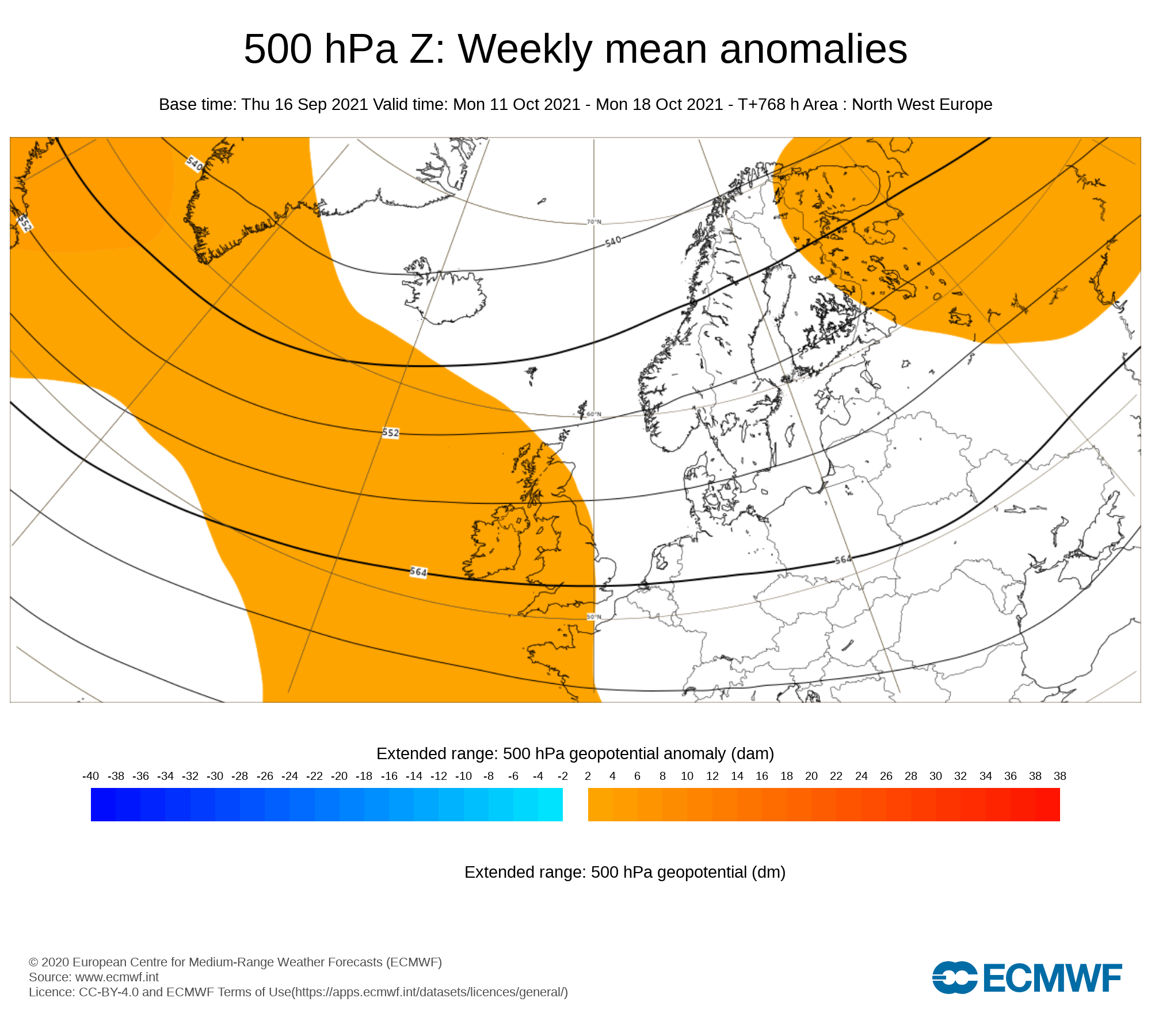
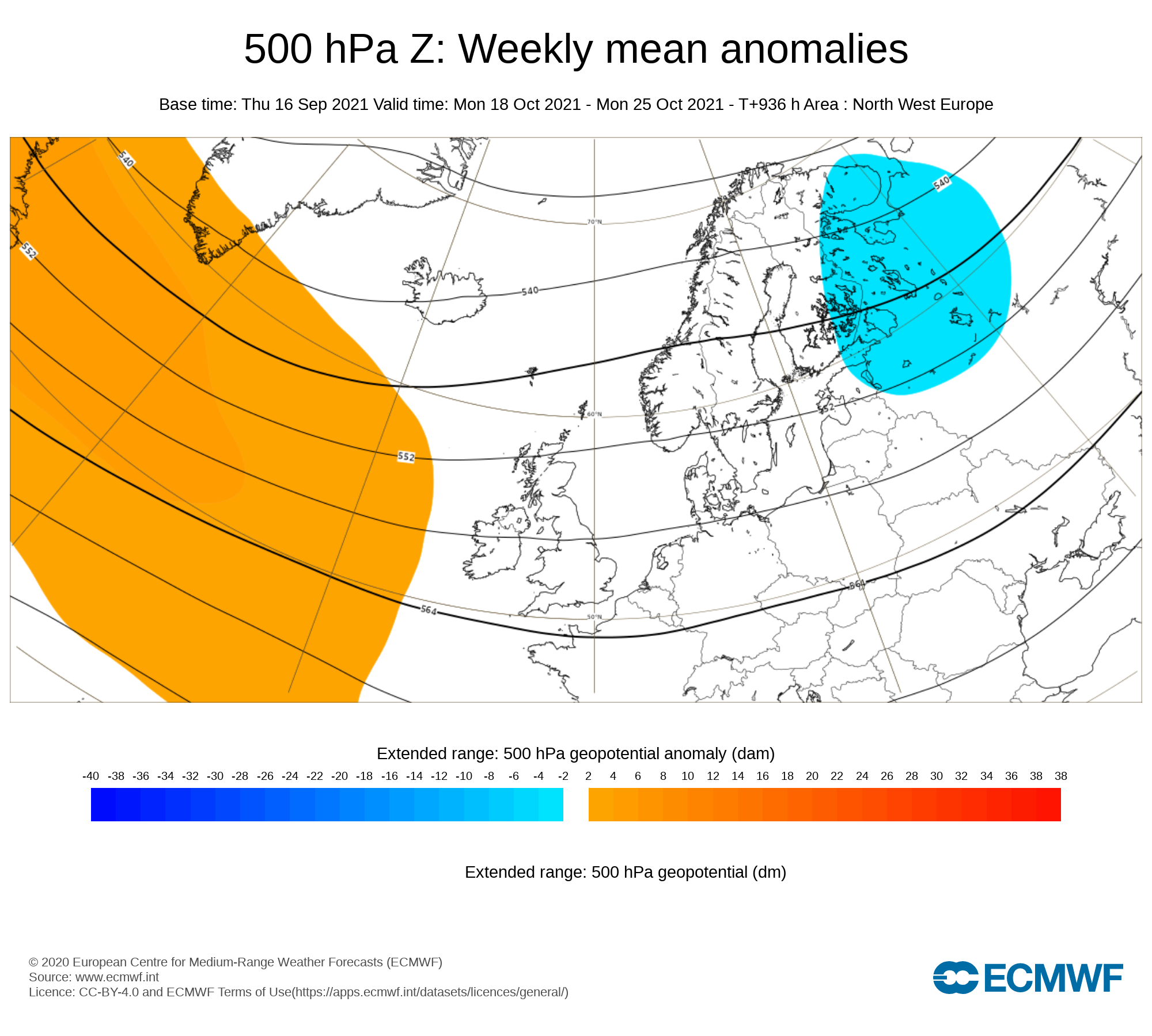
Week 4 signals are low but the latest signals are for higher pressure than average which would bring a more drier period of weather into the middle of October.
The latest long term forecast model outlook from the ECMWF model shows a less active westerly pattern and less risk of weather fronts moving into from the Atlantic. Some frost could return to the forecast for this period.
Temperatures overall are trending to be average this week.
Donegal Weather Channel 2022 Calendar
A selection of photos by Donegal Weather Channel over the last year in different locations through out Ireland, during different weather conditions and sky events to capture the best images for you. You can now pre order your Calendar 2022 which will be available for postage at the end of September 2021 and no later than early October 2021
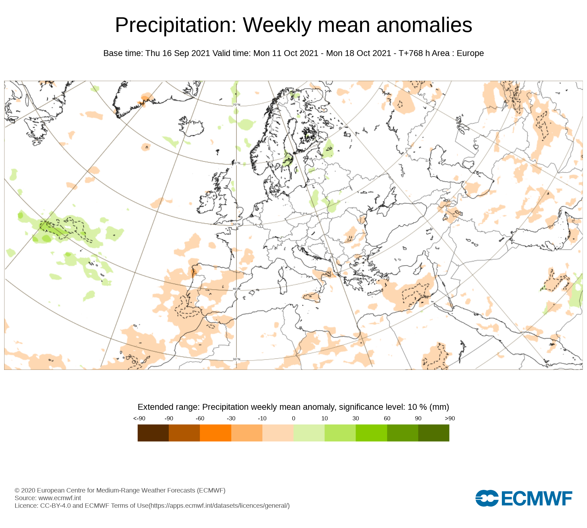
Week 5 - Monday 11th October 2021 - Monday 18th October 2021
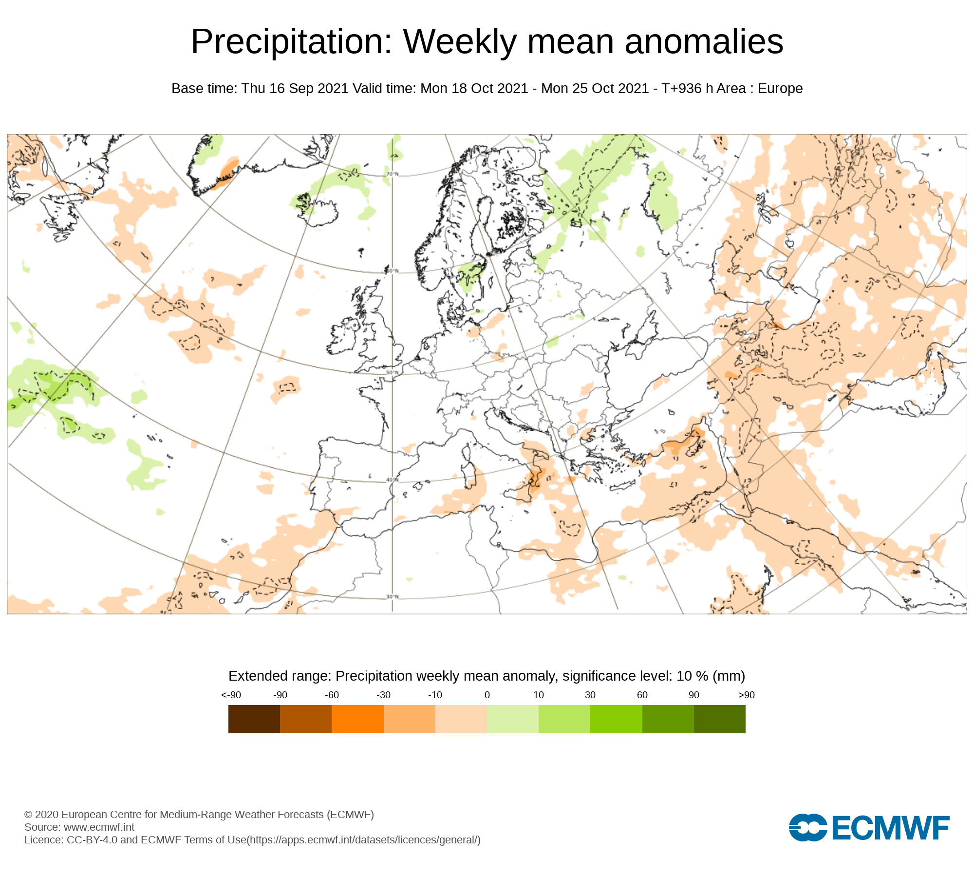
For Week 5 the latest indications are for higher pressure than average with the weather staying on the drier side. Temperatures look set to be around average but some overnight frosts could be possible in places. Signals for this week are weak but the latest signals for the end of October heading into Halloween are for higher pressure and drier conditions but that doesn’t mean it will be totally dry with some rain possible.
Monthly Long Range Forecast


Latest News


