
Monthly Long Range Forecast Update Ireland -3rd August until 30th August 2021

The Donegal Weather Channel Monthly Long range forecast issued every week looking up to a month ahead using data from the ECMWF and GFS models.
Please note that the longer range forecasts are more uncertain and should not be used to plan outside activities from over a week out.
Extended Range Output
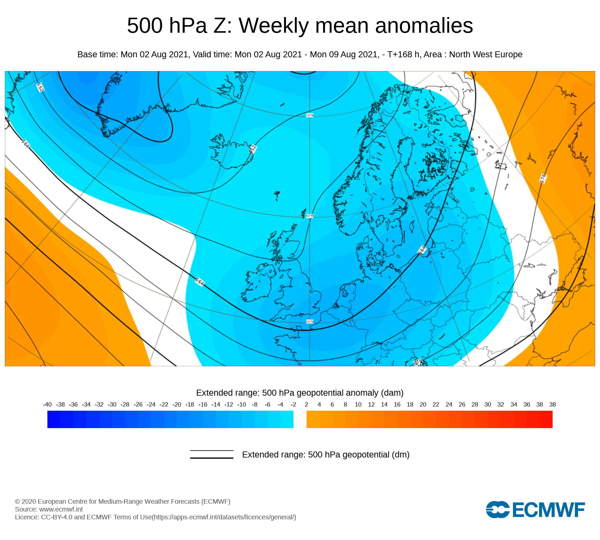
The output is rather different from the shorter period output of HRES and ENS products. It provides a more general overview of the forecast up to Day 46, focusing mainly on the week-to-week changes in the weather rather than attempting to give unsupportable detail on individual days. Output is mostly in the form of anomalies relative to ER-M-climate and is mainly shown as 7-day means for calendar weeks Monday-Sunday. Specialised products for the extended range also include information on potential tropical cyclone activity and the MJO during the coming month.
SPONSOR THE LONG RANGE FORECAST
If you have a business and would like to sponsor our weekly month long range forecast for a period of 1 week or 1 month please do contact Donegal Weather Channel at info@donegalweatherchannel.ie or message our Facebook page . Donegal Weather Channels service relies on sponsorship/advertising. Without sponsorship/advertising Donegal Weather Channel would not be able to give so many hours and a daily service.

The forecast will be issued by myself Kenneth and i will try to keep it simple making it easy for everyone to understand. If there is a term I use in the forecast which you may not know what it means I will explain what I am talking about .
Before I start with the long range forecast I will just explain what we will be looking at and how the forecast will work.
The forecast will be broken up into 4 section Example below :
Week 1 - Monday 2nd July 2021 -Monday 9th August 2021
Week 2 - Monday 9th August 2021 - Monday 16th August 2021
Week 3 - Monday 16th August 2021 - Monday 23rd August 2021
Week 4 - Monday 23rd August 2021 - Monday 30 August 2021
Things we will look at in the forecast:
Mean sea level pressure: Weekly mean anomalies
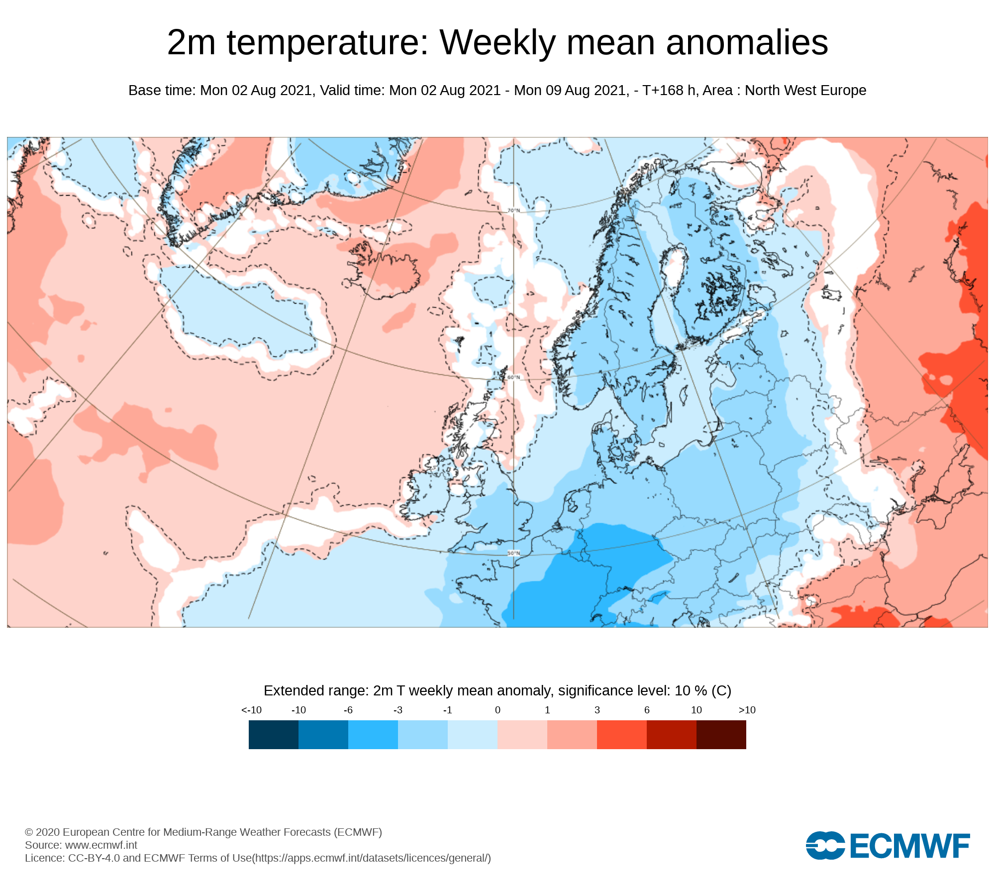
2m temperature: Weekly mean anomalies
Wind
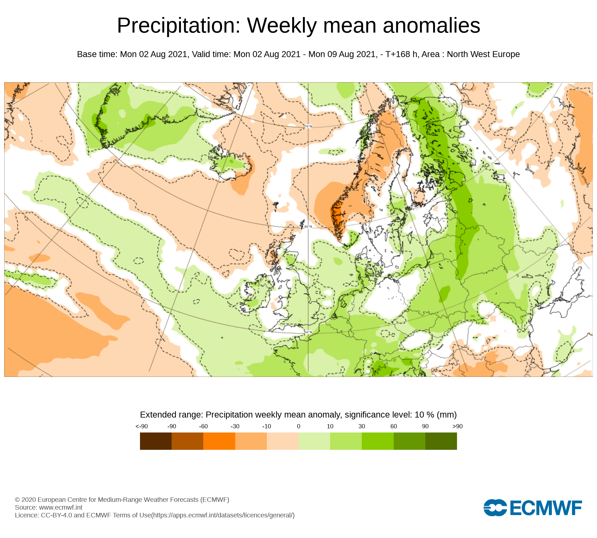
Precipitation: Weekly mean anomalies (eg. rainfall and snowfall for a example.
Dust forecast ( Only in Week 1)
UV forecast outlook
Potential Pollen Levels

Forecaster - Kenneth Mc Donagh
Week 1 - Monday 2nd July 2021 -Monday 9th August 2021
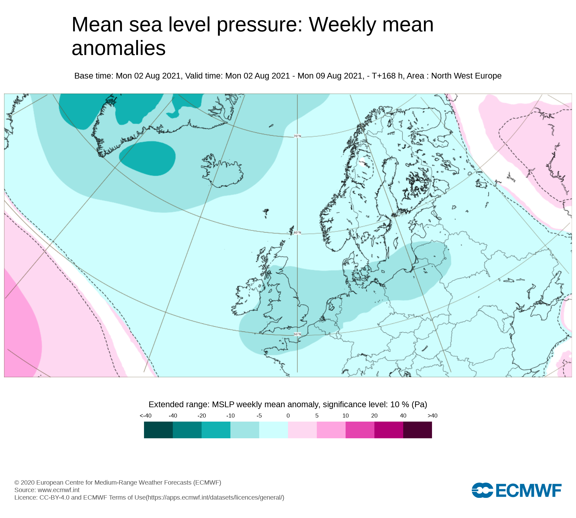
Mean sea level pressure: Weekly mean anomalies
Week 1 - will see below average pressure with low pressure bringing heavy showers of rain at time with unsettled weather conditions. The airflow will be from the northwest for much of the week.
Precipitation ( Rainfall ): Weekly mean anomalies
Rainfall amounts over the last week have been above average for the time of year across the eastern half of Ireland with up to 30mm in some places there but totals where below average in the midlands and west for the time of year with only 10mm to 20mm in places there.
Rainfall amounts will be above average this week across the west and north especially across the northwest where up to 100mm of rain could fall between Tuesday and Sunday.
On Wednesday night and Thursday heavy thundery rain will affect much of Ireland with the risk of flooding in places.
Again the latest outlook is for further heavy rainfall on Friday into Saturday especially across Connacht, Ulster and North Leinster where some spot & localised flooding will occur. Across the northwest Donegal, Sligo & Leitrim there is some indications big rainfall amounts could cause some big flooding issues with how slow moving this rain will be as it passes especially over Friday with north Sligo, south Donegal and much of Leitrim at risk. The latest outlook would bring these areas under a Orange rainfall warning but this should become more clear come late Wednesday.
Rainfall amounts between Tuesday 3rd August to Sunday 7th August 2021
ULSTER
Large Rainfall amounts in west Ulster between Tuesday and Sunday with up to 80mm to 100mm in west Ulster between 30mm to 50mm across mid Ulster and 15mm to 35mm across east Ulster.
CONNACHT
Large rainfall amounts across west and north Connacht with 60mm to 100mm highest amounts across the northeast of Connacht over the mountains. Across the rest of Connacht rainfall amounts will range between 30mm to 50mm
MUNSTER
Rainfall amounts across west and north Munster highest between 25mm to 50mm elsewhere across Munster rainfall amounts will range between 20mm to 35mm.
LEINSTER
Rainfall amounts highest across north Leinster with between 30mm to 50mm elsewhere across Leinster amounts will range between 15mm to 30mm amounts lowest across south Leinster

Rainfall amounts between Tuesday 3rd August to Sunday 7th August 2021
Temperature: Weekly mean anomalies
Temperatures over this week will range in the mid teens to high teens which is around average for this time of year. Temperatures are forecast to remain the same over the next 5 to 7 day across Ireland.
Wind forecast
No Strong wind are forecast over the next 7 days, Wind on Thursday and Friday will be rather gusty especially around coastal areas
UV forecast
UV level will be low to moderate this week
Pollen Forecast
Pollen levels will be Low to Moderate over the week with pollen levels lowest during cloudy and wet weather and highest during any sunny & dry periods. The main type of pollen will be grass this week.
Dust forecast
Dust levels will be low this week

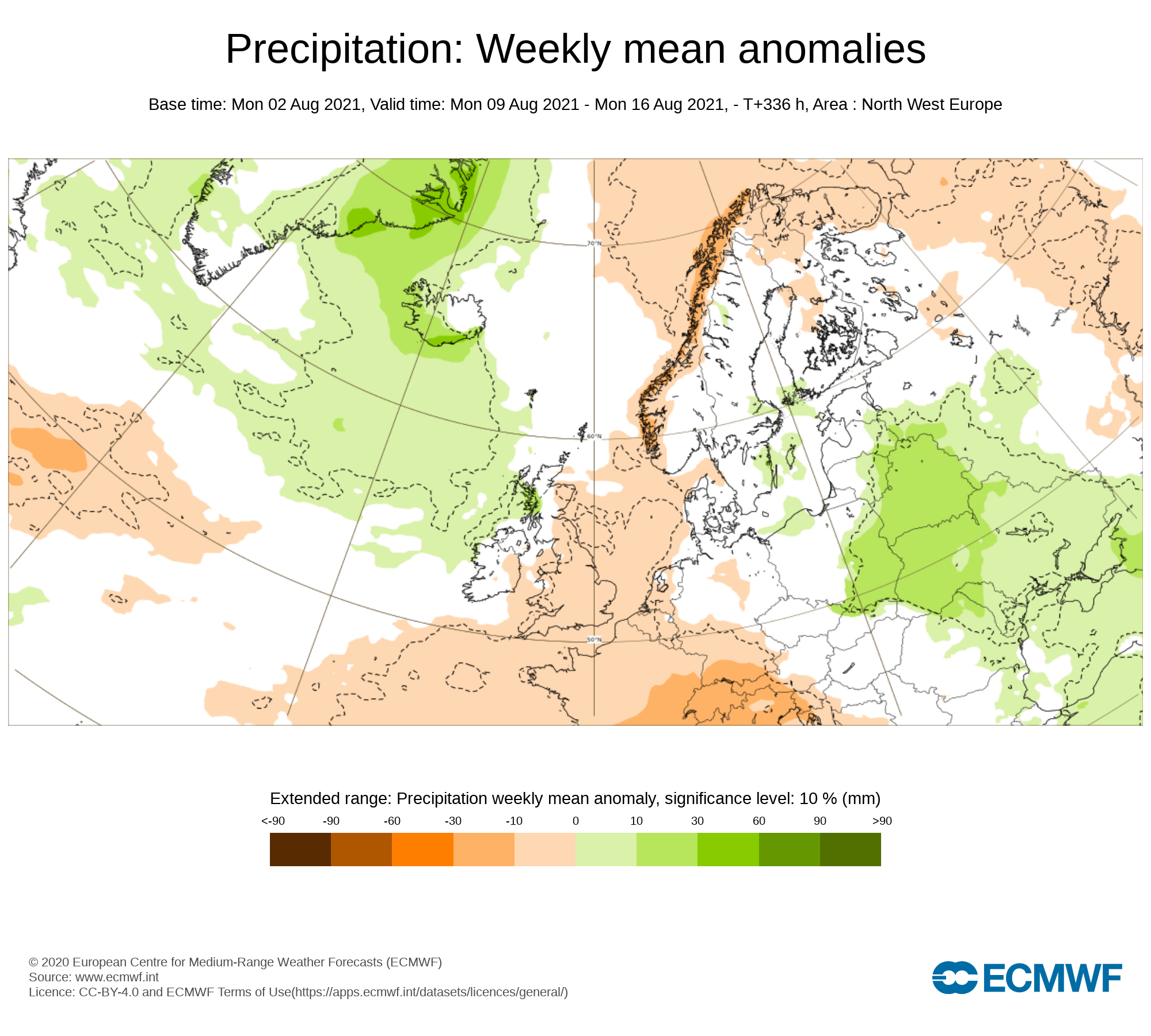
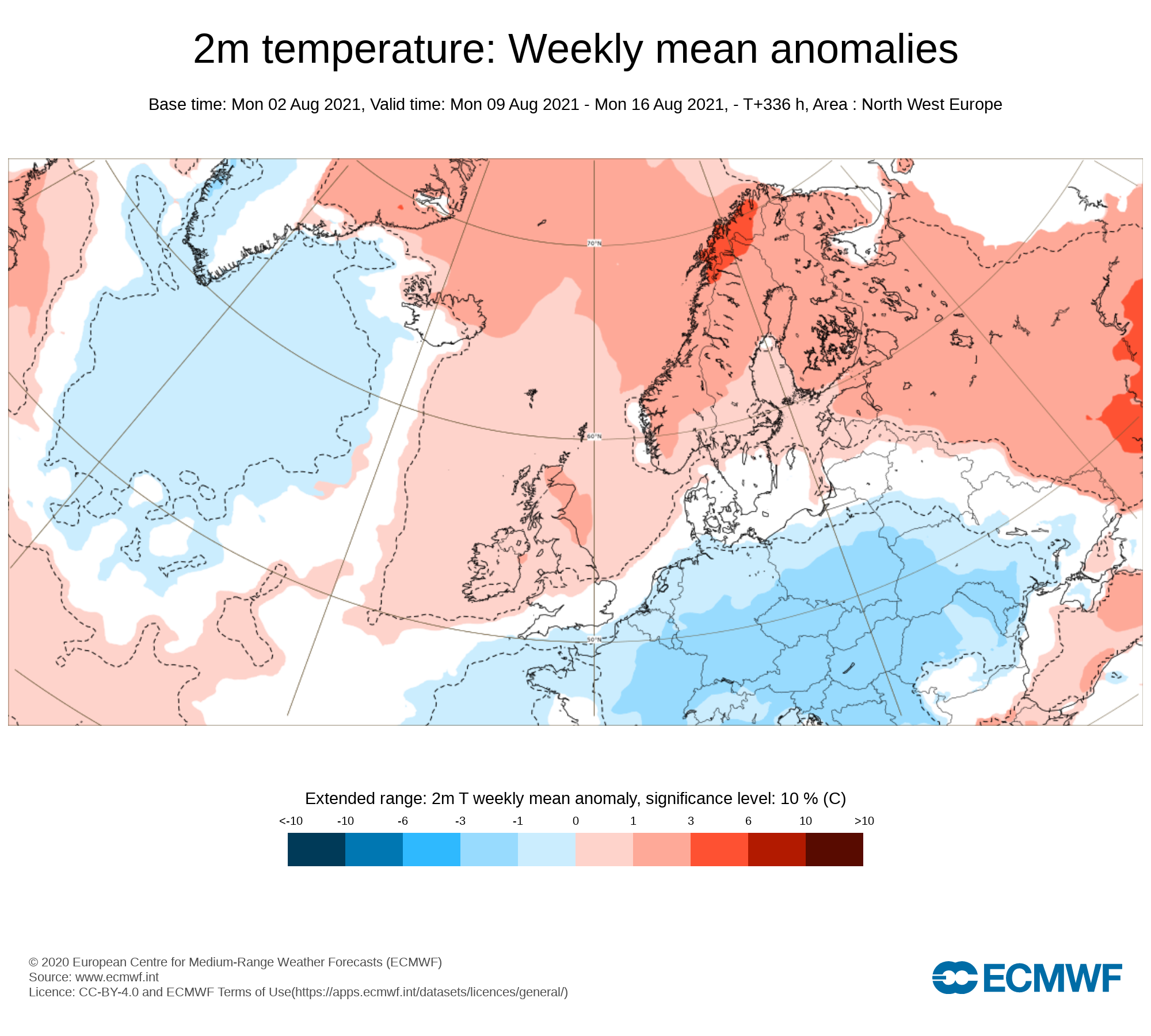
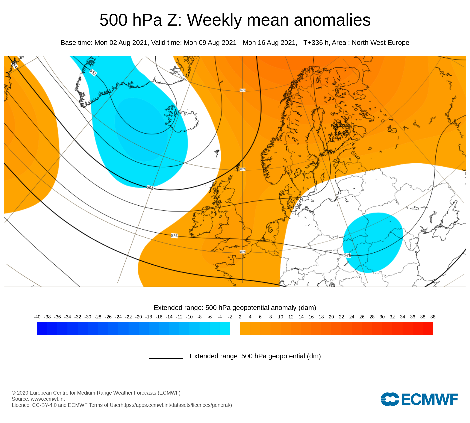
Week 2 - Monday 9th August 2021 - Monday 16th August 2021
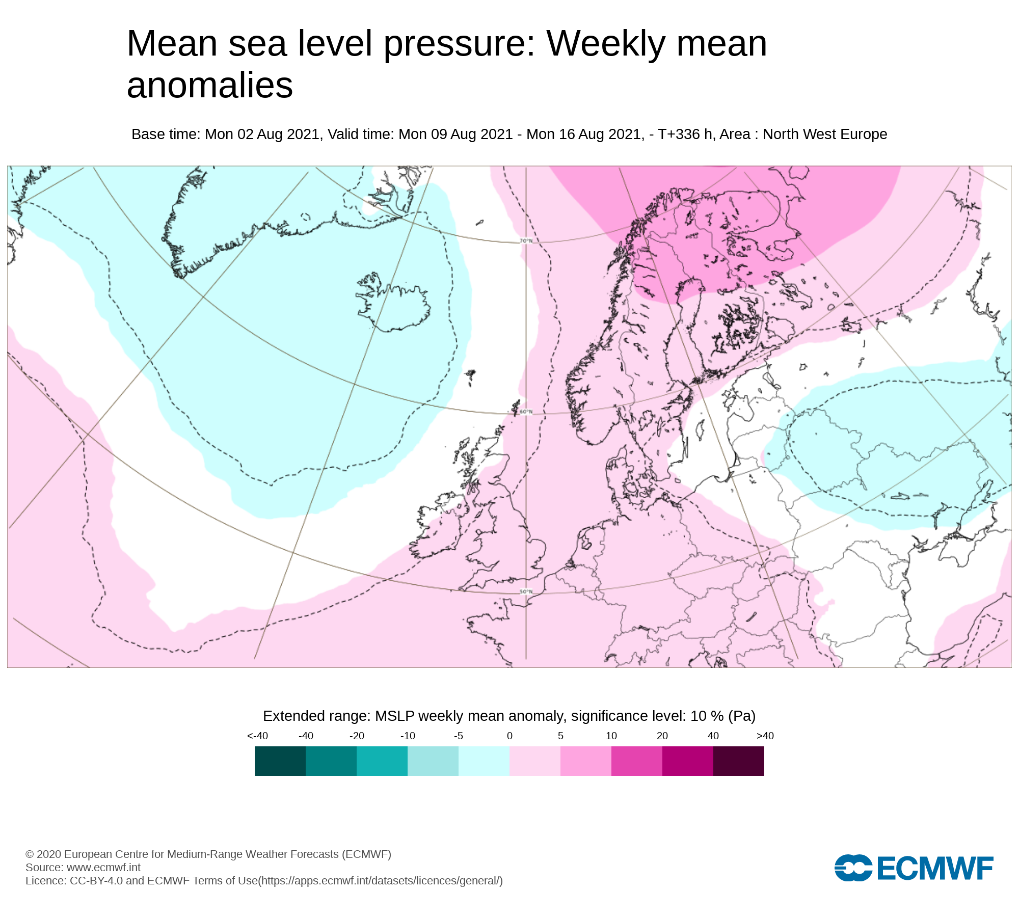
Mean sea level pressure: Weekly mean anomalies
Week 2 will see low pressure continuing to dominate the weather across Ireland bringing unsettled weather and a northwesterly flow. Higher pressure may build towards the end of the week into the weekend.
Precipitation ( Rainfall): Weekly mean anomalies
Rainfall amounts over week 2 are forecast to be just above normal in places with possibly below in some southeastern and eastern counites.
2m temperature: Weekly mean anomalies
Temperatures over week 2 are forecast to average across Ireland in the mid to high teens & possibly into the low 20s later in the week.
Wind Forecast
No strong winds across currently in the forecast.
UV forecast
UV levels will be low to moderate in any sunshine with the risk of sun burn.
Pollen Forecast
Pollen levels will be low to moderate over the week with pollen levels lowest during cloudy and wet weather and highest during any sunny dry periods. Grass pollen will be the main type.


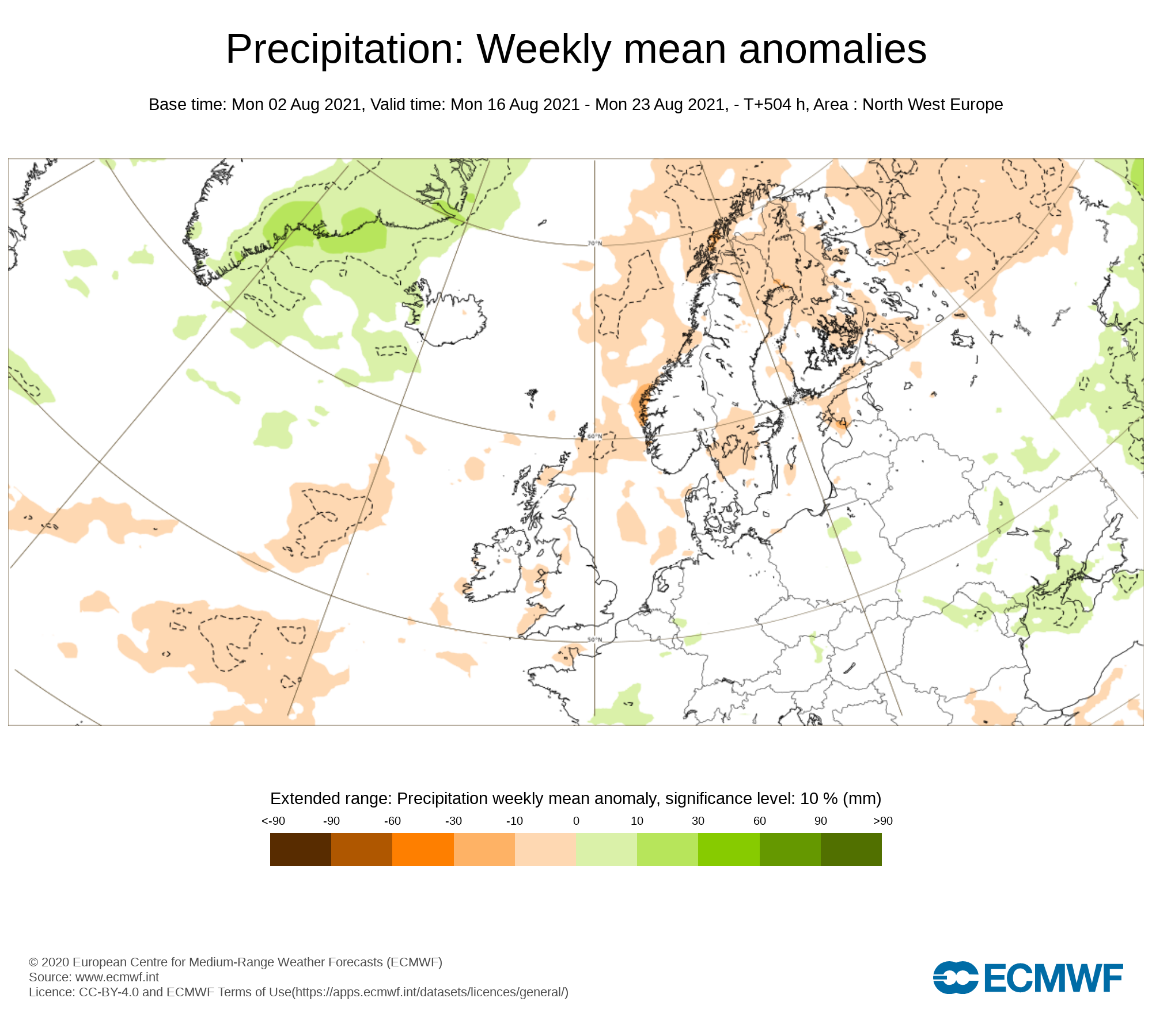
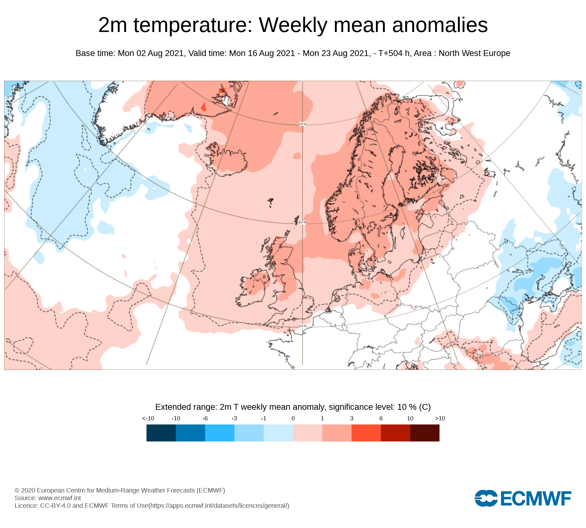
Week 3 - Monday 16th August 2021 - Monday 23rd August 2021
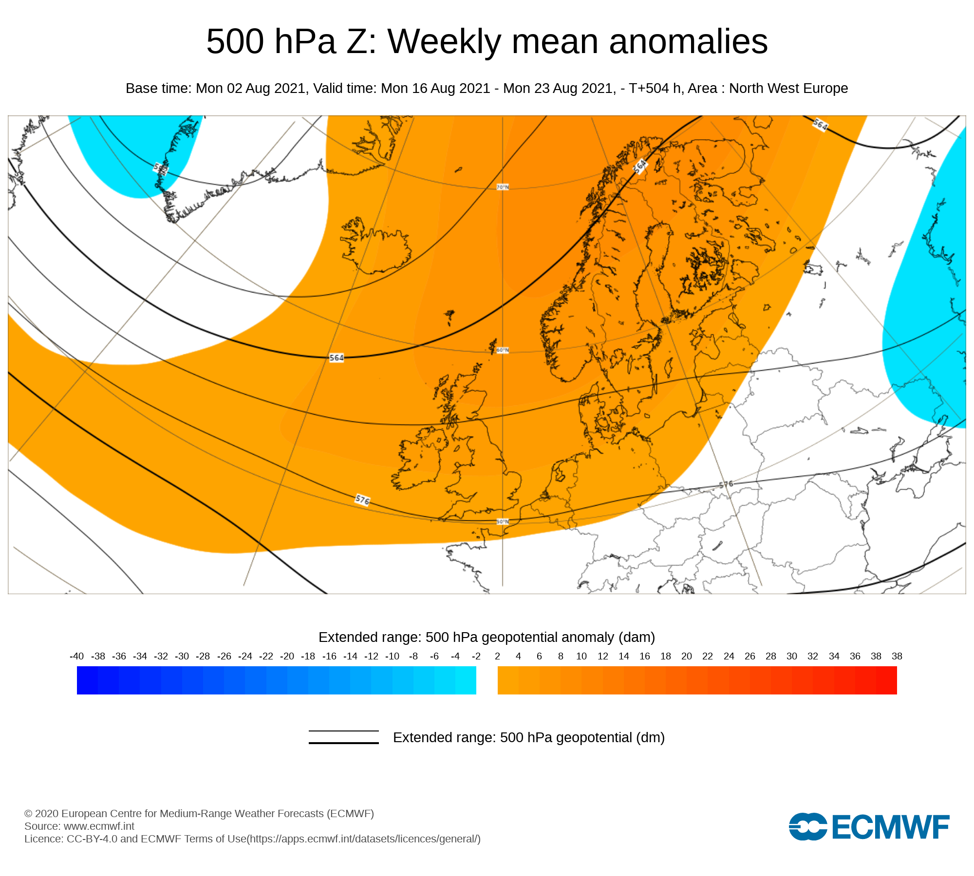
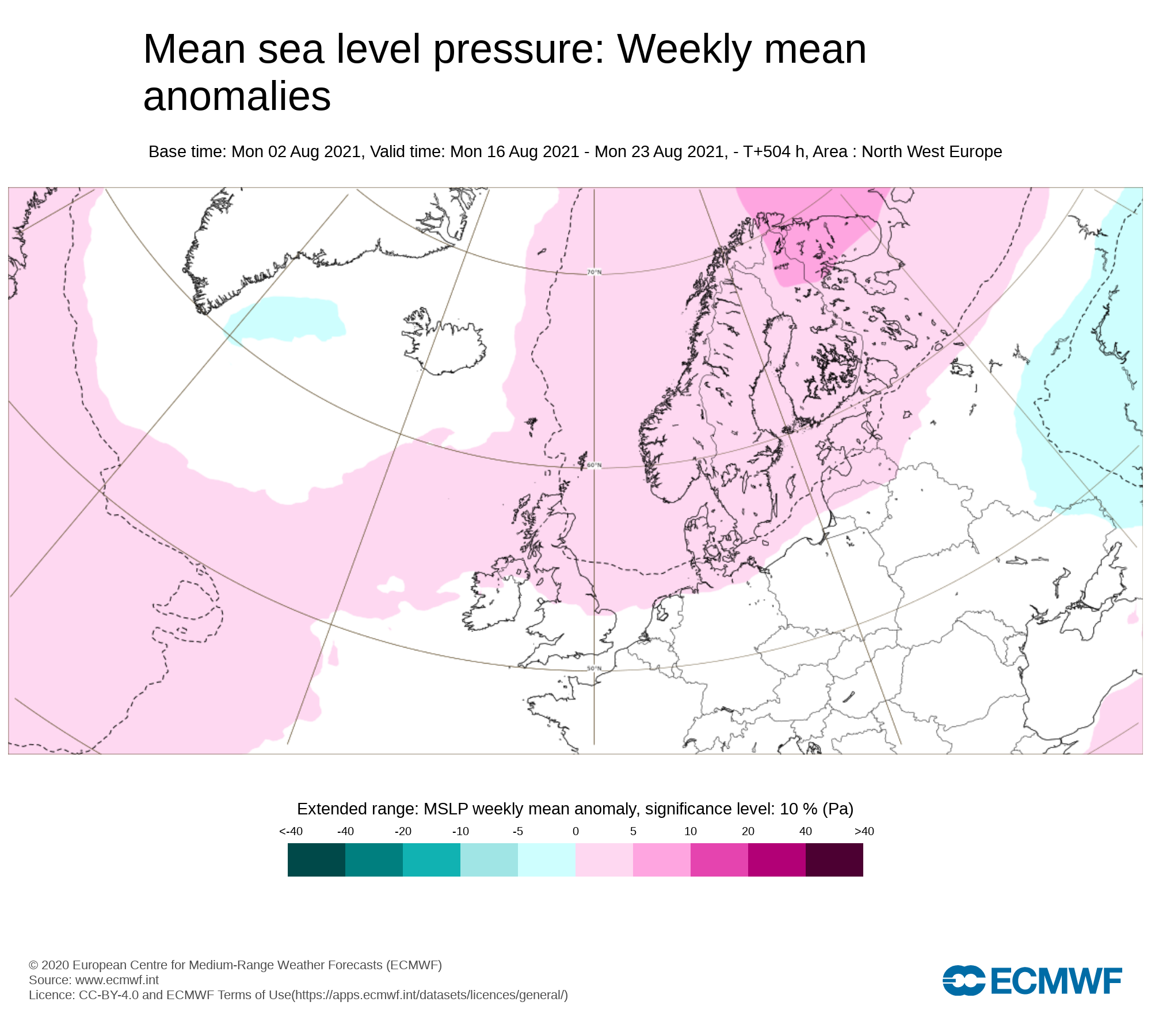
Mean sea level pressure: Weekly mean anomalies
Week 3 is currently forecast to see high pressure position itself across Ireland which will bring drier weather across Ireland
Precipitation ( Rainfall): Weekly mean anomalies
The latest outlook is for below average rainfall amounts across Ireland on Week 3 with higher pressure keeping the weather on the drier side but this does not mean there will be no rain a few showers will be possible
2m temperature: Weekly mean anomalies
There are signals it may become rather warmer at some stage over week 3 with temperatures generally in the mid 20s but possibly higher into the high 20s in places.
Wind forecast
No strong winds are signaled for week 3
UV forecast
UV levels will be moderate to high in any sunshine with the risk of sun burn.
Pollen forecast
Pollen levels will be moderate to high over the week with pollen levels lowest during cloudy and wet weather and highest during any sunny dry periods. Grass pollen will be the main type
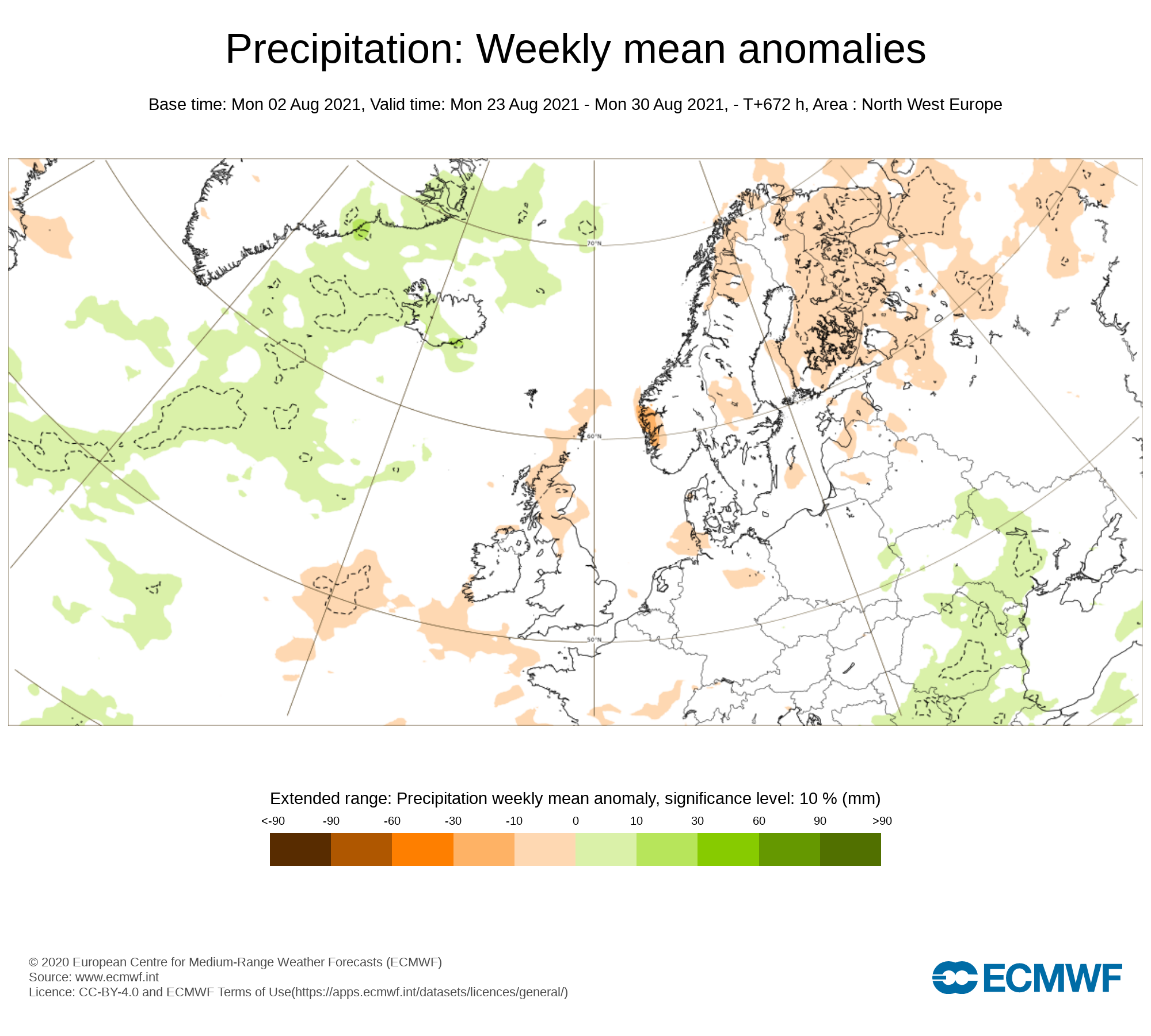
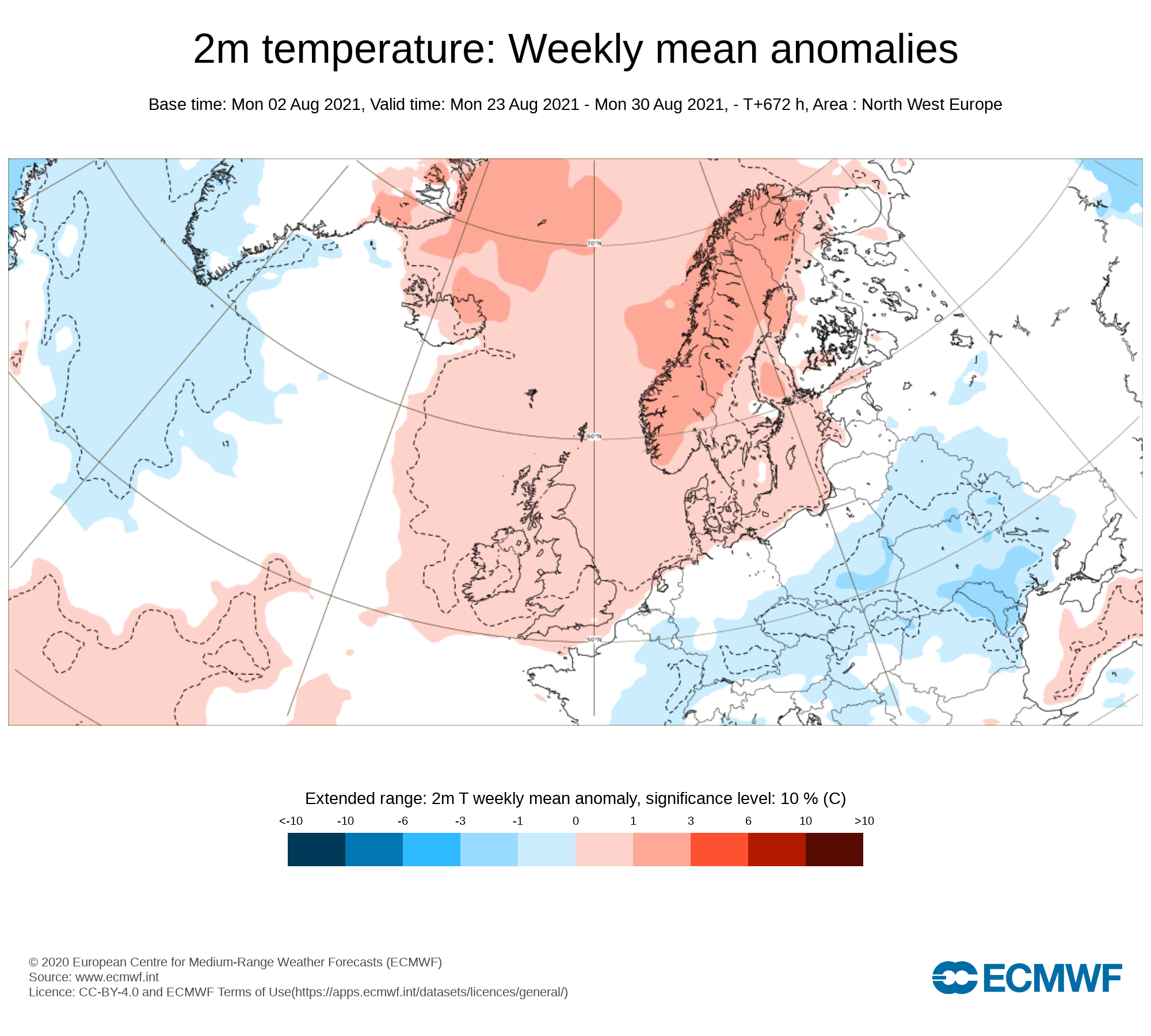
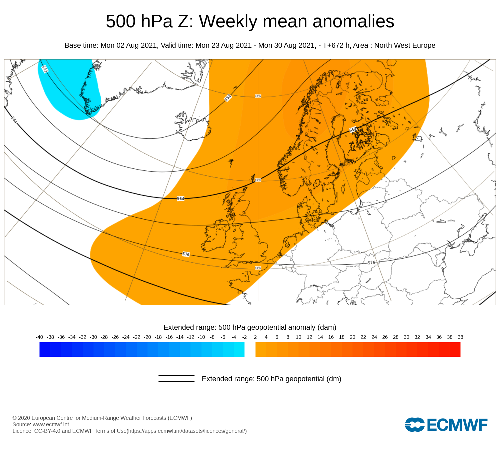
Week 4 - Monday 23rd August 2021 - Monday 30 August 2021
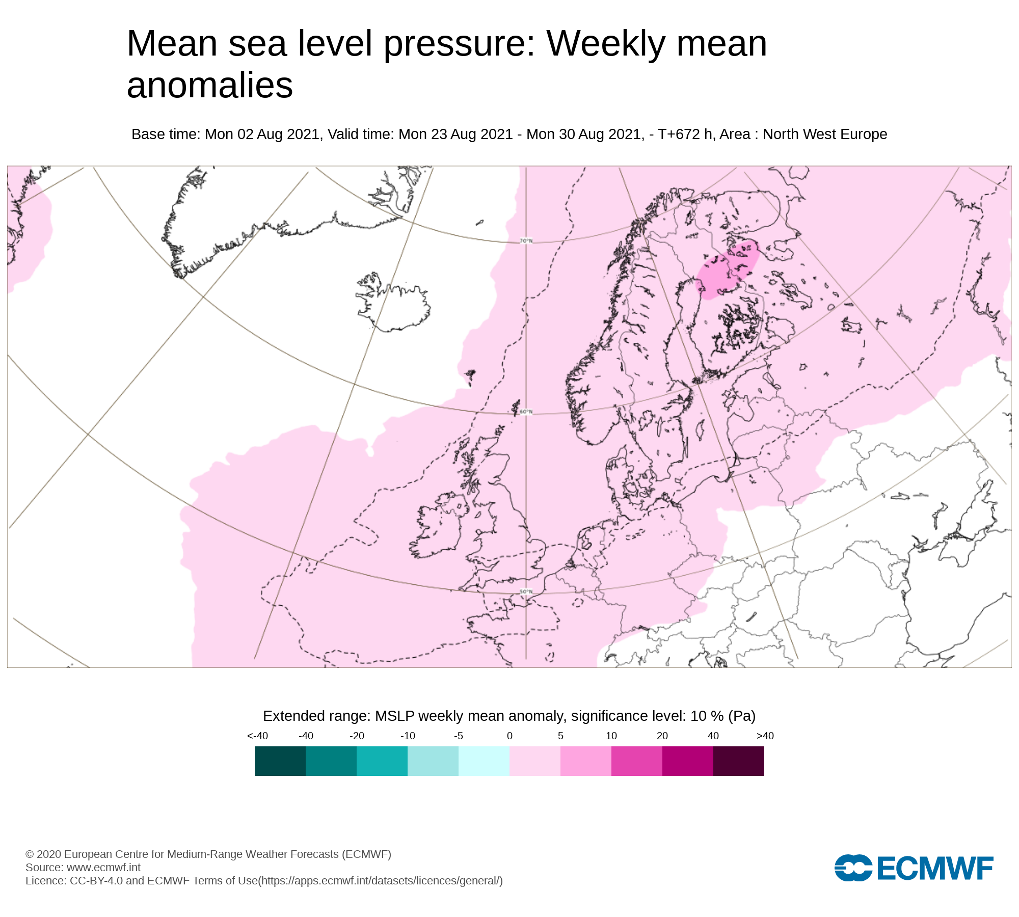
Mean sea level pressure: Weekly mean anomalies
Signals are very weak for week 4 but there are signs that high pressure will sit across Ireland with a south to east flow
Precipitation ( Rainfall): Weekly mean anomalies
Rainfall amounts are forecast to below average with drier weather on week 4.
2m temperature: Weekly mean anomalies
Temperatures are forecast to be in the 20s this week with a possible warm spell ongoing and even the chance of heatwave conditions.
Wind forecast
There area no strong winds signaled for this week
UV forecast
UV levels will be Moderate to high in any sunshine with the risk of sun burn even with cooler weather as the sun this time of year is stronger.
Pollen forecast
Pollen levels will be Moderate to high over the week with pollen levels lowest during cloudy and wet weather and highest during any sunny dry periods. Grass pollen the main type
Monthly Long Range Forecast


Latest News


