
April monthly forecast update - signs of better weather ahead
Using the ECMWF 48 day long range model we will have a look what it shows over the month of April and what trends. Note this model will not give you a pinpoint forecast but one thing it can do is give a idea to what could lie ahead over the next 3 to 4 weeks.
In this forecast we will be looking at
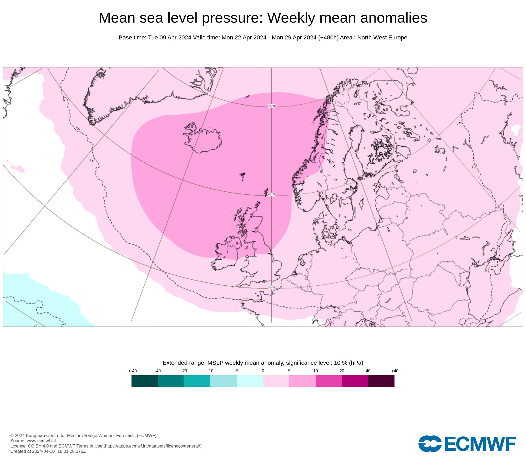
Mean sea level pressure: Weekly mean anomalies
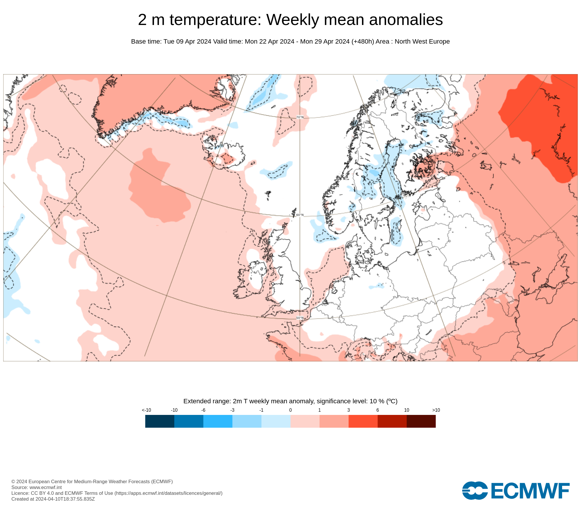
2 m temperature: Weekly mean anomalies
Precipitation: Weekly mean anomalies
On some occasions the Ensemble forecast (ENS)
Higher pressure building over the 3rd week of April
Back to the outlook now and following on from our update 2 and a half weeks ago I talked about low pressure dominating into the 3rd week of April when we then are looking at a potential change to high pressure over the end of the 3rd week in April.
The latest update from the 48 day forecast from the Ecmwf has higher pressure building over the final half of next week with an improving trend and much needed drier weather.

Into the final week of the month the weather does look like it will remain on the drier side with high pressure but maybe not fully dry.
There are also good indications high pressure will be more dominant into the first and 2nd week of May.

Rainfall amounts will return to normal and below normal for the next 3 weeks
Rainfall amounts from next week should also reduce with lower amounts than normal which should allow the ground to start and dry out.
There are weaker signals over the next 3 to 4 weeks for rainfall amount to be lower than normal again for the time of year which should help the ground recover.

Temperatures expected to remain normal for April into early May
Temperatures over the month of April will be normal or just above normal for some places. No real signs of above normal temperature expected. In general this time of year you can expect max temperatures of 17C or 18C and up to around 19C or 20C moving into early may.
LATEST NEWS


