
Monthly Long Range Forecast Update Ireland - 23rd August until 20th September 2021

The Donegal Weather Channel Monthly Long range forecast issued every week looking up to a month ahead using data from the ECMWF and GFS models.
Please note that the longer range forecasts are more uncertain and should not be used to plan outside activities from over a week out.
Extended Range Output
The output is rather different from the shorter period output of HRES and ENS products. It provides a more general overview of the forecast up to Day 46, focusing mainly on the week-to-week changes in the weather rather than attempting to give unsupportable detail on individual days. Output is mostly in the form of anomalies relative to ER-M-climate and is mainly shown as 7-day means for calendar weeks Monday-Sunday. Specialised products for the extended range also include information on potential tropical cyclone activity and the MJO during the coming month.
SPONSOR THE LONG RANGE FORECAST
If you have a business and would like to sponsor our weekly month long range forecast for a period of 1 week or 1 month please do contact Donegal Weather Channel at info@donegalweatherchannel.ie or message our Facebook page . Donegal Weather Channels service relies on sponsorship/advertising. Without sponsorship/advertising Donegal Weather Channel would not be able to give so many hours and a daily service.

The forecast will be issued by myself Kenneth and i will try to keep it simple making it easy for everyone to understand. If there is a term I use in the forecast which you may not know what it means I will explain what I am talking about .
Before I start with the long range forecast I will just explain what we will be looking at and how the forecast will work.
The forecast will be broken up into 4 section Example below :
Week 1 - Monday 23rd August 2021 - Monday 30 August 2021
Week 2 - Monday 30th August 2021 - Monday 06th September 2021
Week 3 - Monday 06th September 2021 - Monday 13th September 2021
Week 4 - Monday 13th September 2021 - Monday 20th September 2021
Things we will look at in the forecast:
Mean sea level pressure: Weekly mean anomalies
2m temperature: Weekly mean anomalies
Wind
Precipitation: Weekly mean anomalies (eg. rainfall and snowfall for a example.
Dust forecast ( Only in Week 1)
UV forecast outlook
Potential Pollen Levels

Forecaster - Kenneth Mc Donagh
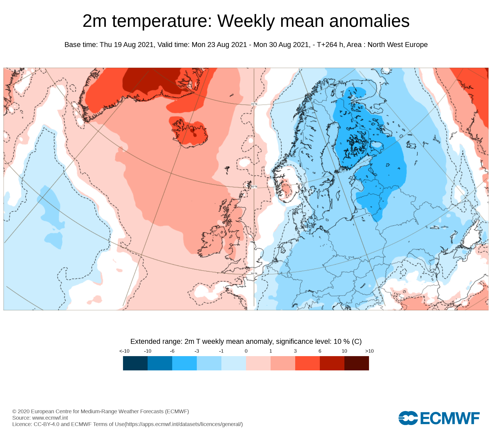
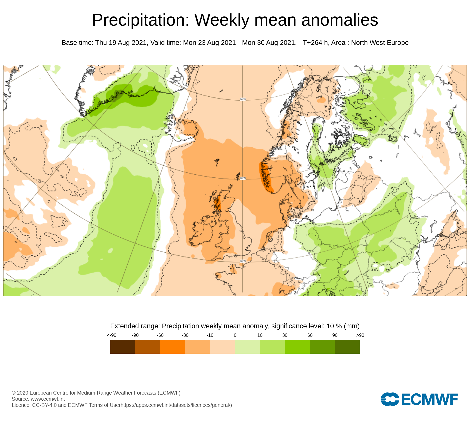
Week 1 - Monday 23rd August 2021 - Monday 30 August 2021
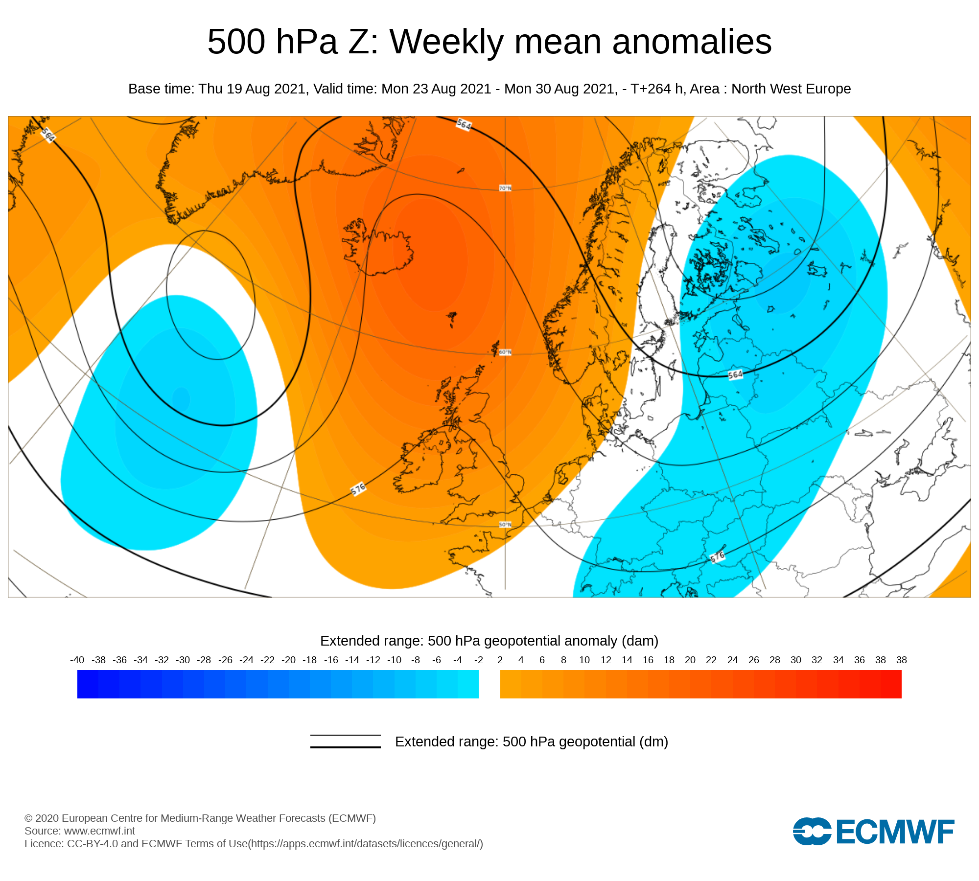
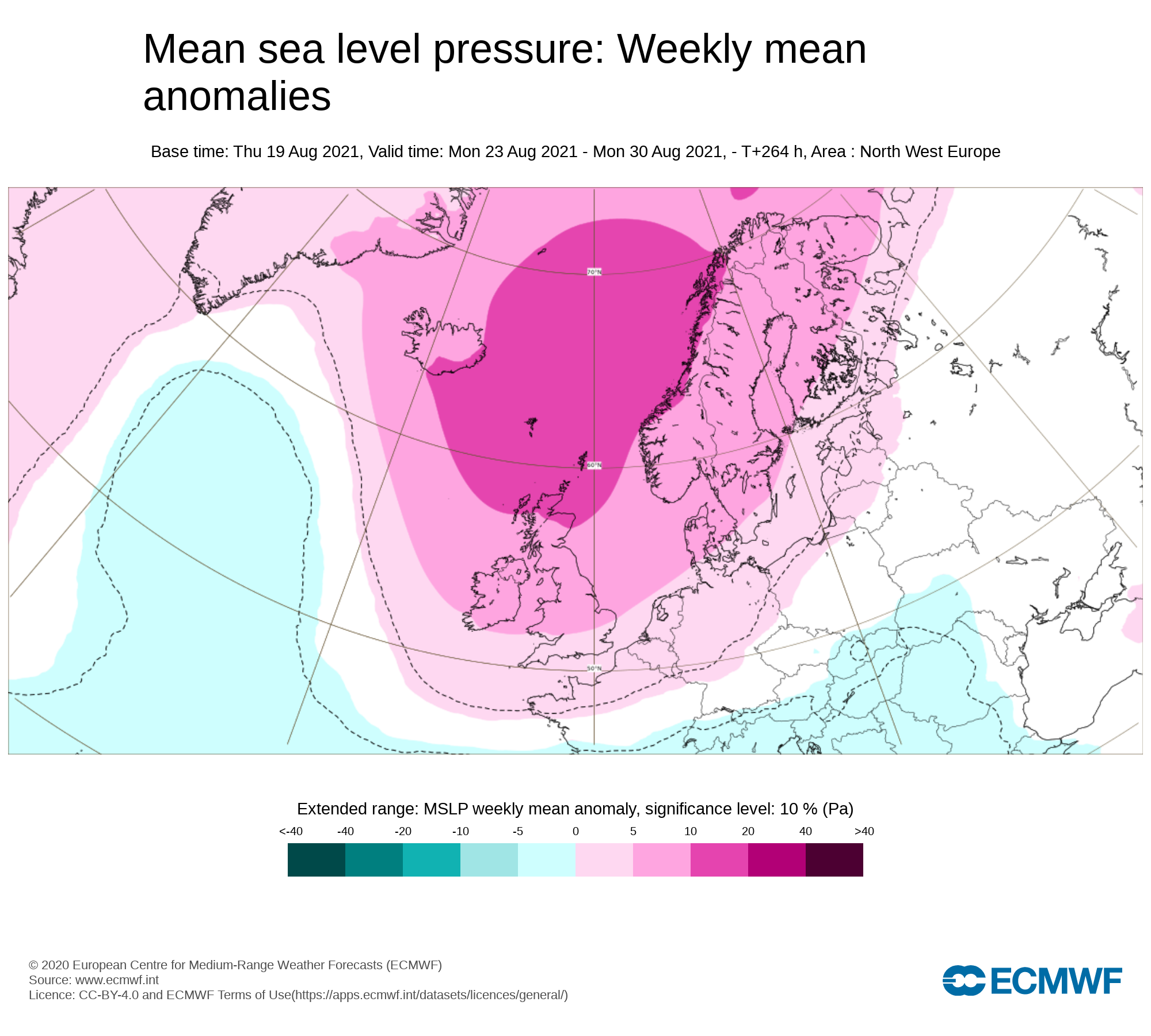
Mean sea level pressure: Weekly mean anomalies
A rather settled pattern will develop across Ireland over the coming week (Week 1). The airflow during next week will be mostly easterly. An area of high pressure will start move in across Ireland on Sunday 22nd August and will strengthen over (week 1).
Precipitation ( Rainfall ): Weekly mean anomalies
Rainfall amount over the week 1 will be well below average with some areas receiving very little of no Precipitation at all. Any precipitation coming in the way of a light drizzle or mist. Monday to Friday looks set to be dry with most areas at this stage also looking dry next week also but there is some uncertainty as a little rain may effect some areas especially the southern half of the country.
Rainfall amounts between Tuesday 23rd August to Sunday 29th August 2021
Overall rainfall amounts at least up until Friday of week one will be under 1mm to 2mm for much of the country with many area seen no rain. Some rain may effect southern parts next weekend with the risk of some thundery falls but there is some mixed signals for next weekend with some of the models showing the dry spell been more prolonged into week 2 this will become more certain over the coming days so keep a eye on the national forecast for updates
Temperature: Weekly mean anomalies
Temperatures will be above average next week (week 1) with temperatures set to rise into the 20s for most of the country over the week with temperatures between 19C to 25C/26C. Some parts of the east may be a little cooler due to a easterly breeze there.
Wind forecast
No Strong wind are forecast over the next 7 days,
UV forecast
UV level will be to moderate to high this during week 1
Pollen Forecast
Pollen levels will be Moderate over the week with pollen levels lowest during cloudy and wet weather and highest during any sunny & dry periods. The main type of pollen will be weed this week.
Dust forecast
Dust levels will be low this week

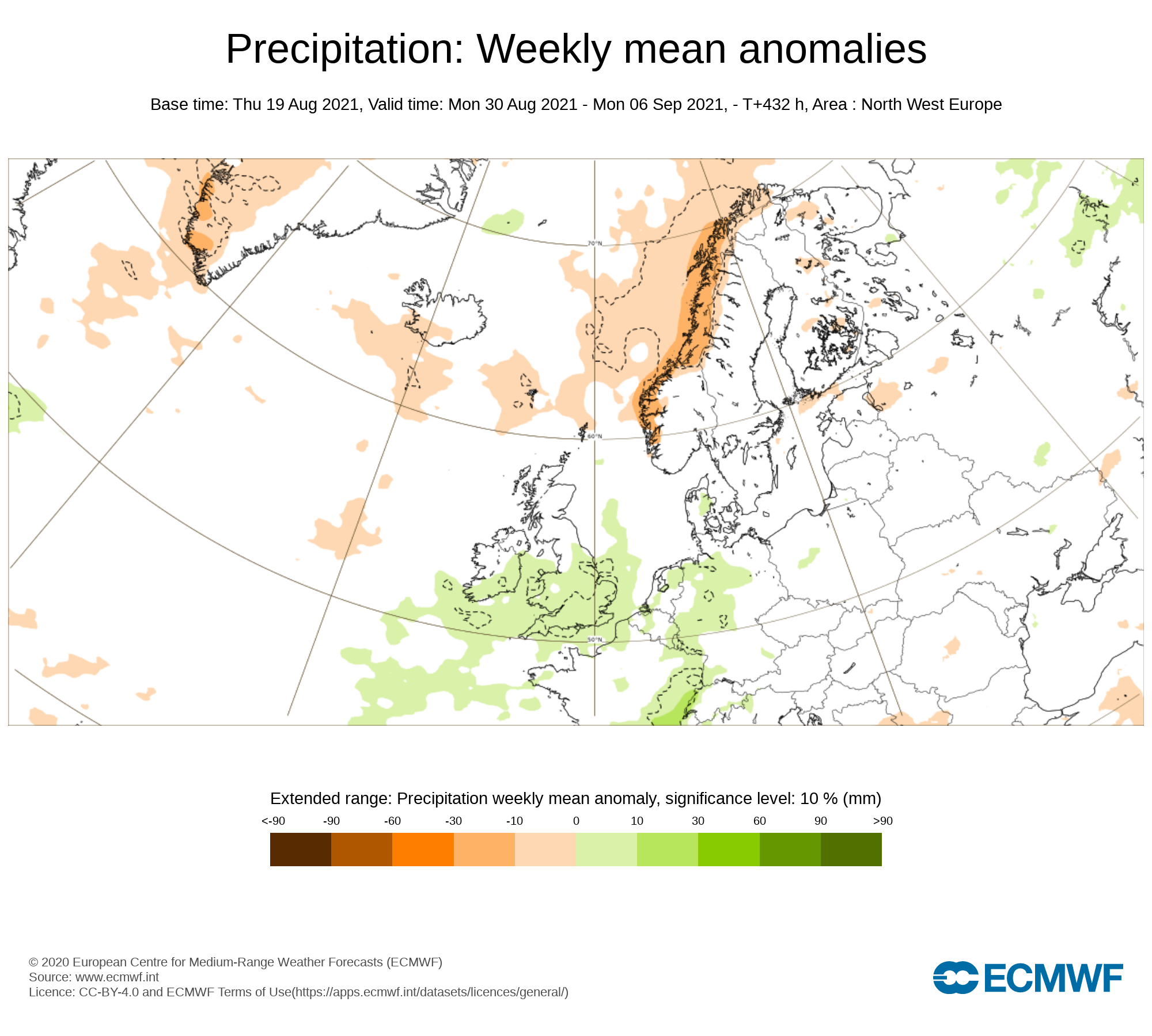
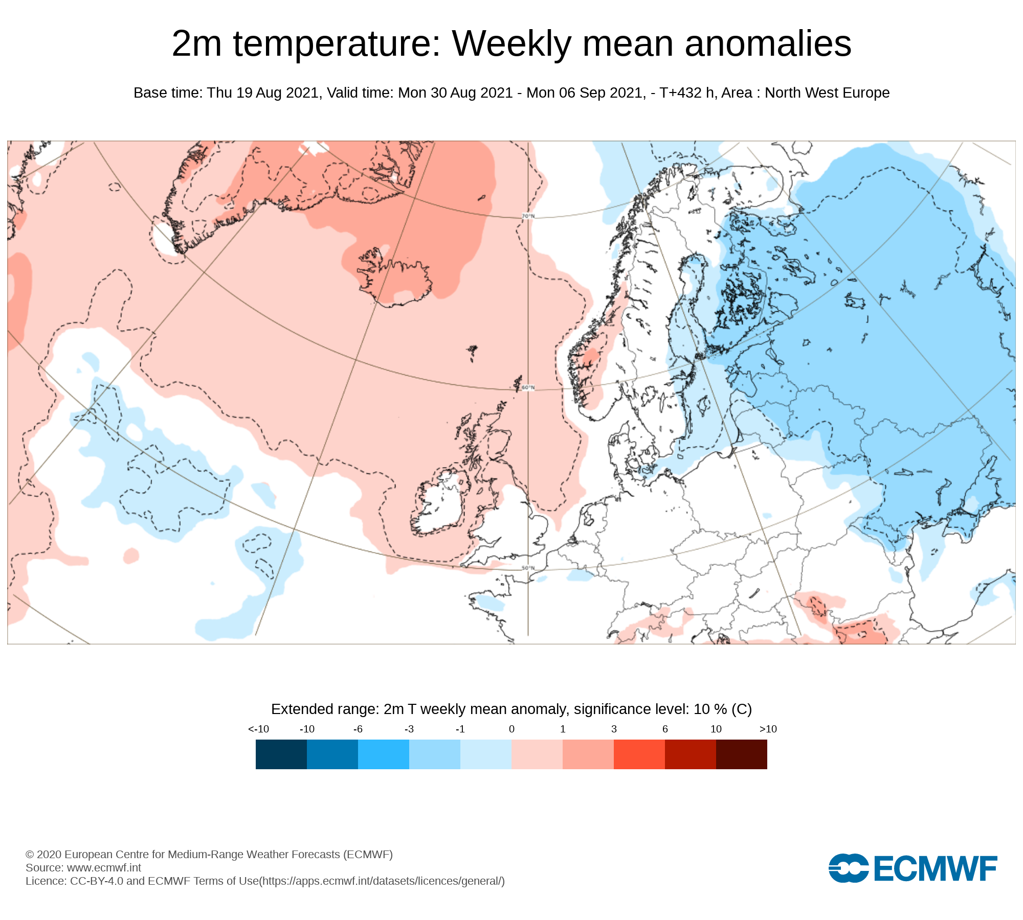
Week 2 - Monday 30th August 2021 - Monday 06th September 2021
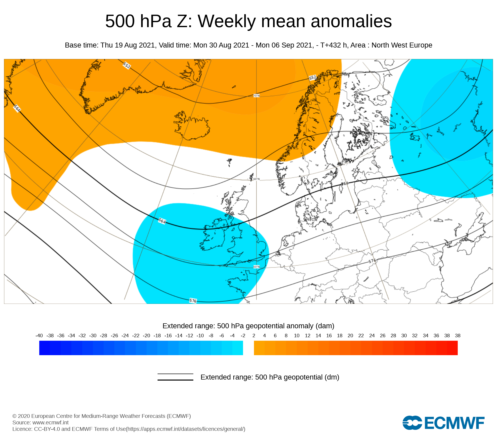
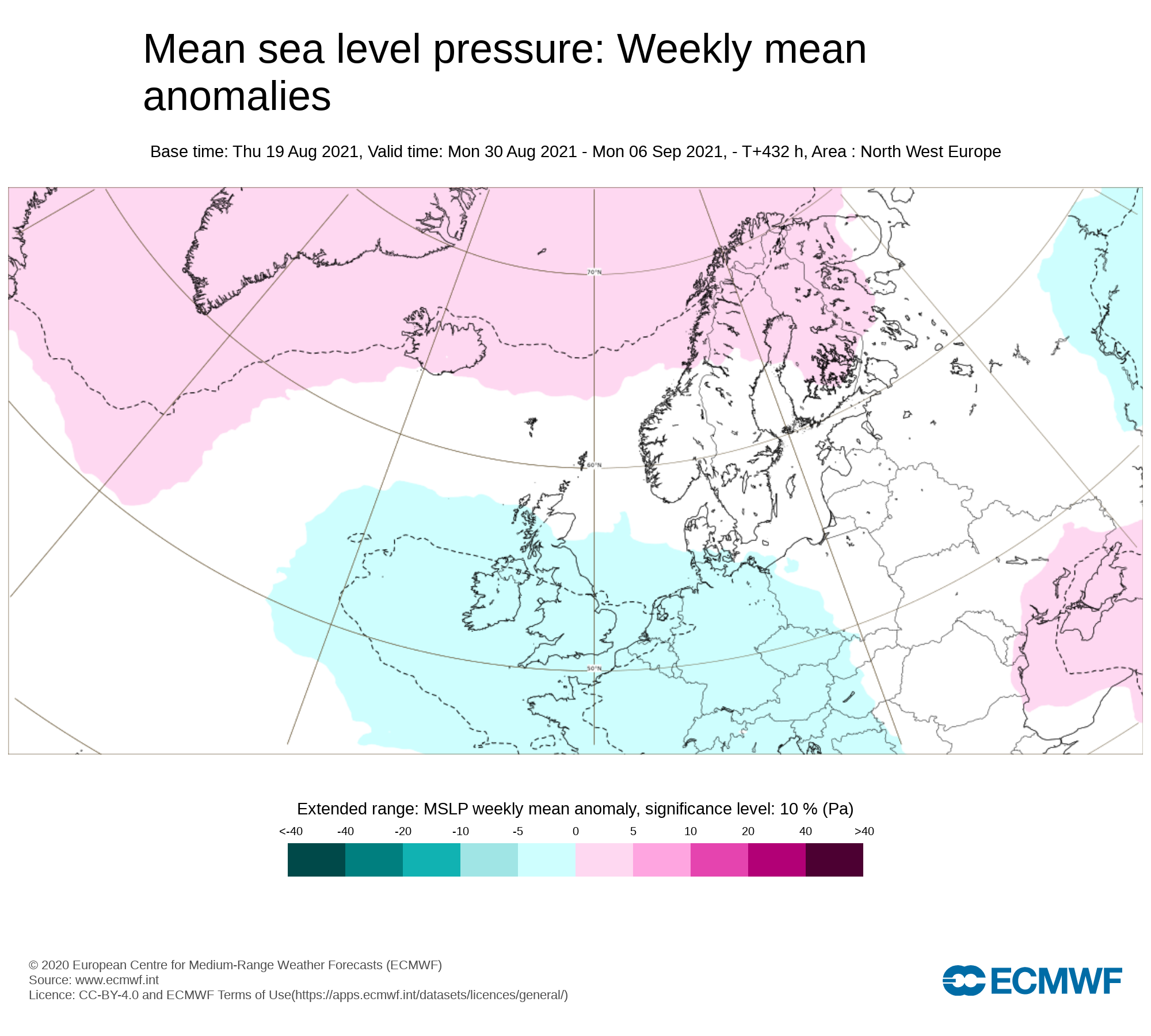
Mean sea level pressure: Weekly mean anomalies
There is some uncertainty into week 2 and the last 2 days of August with the European model showing lower pressure coming back bring the risk of some unsettled weather.
However the GFS model runs differs and shows high pressure across Ireland during week 2 with a dry end to August and dry start to September. The previous European model runs also where showing this trend with higher pressure again for week 2 so there is a chance that this mornings run may be just a possible outcome with the trend at the moment going for a dry spell of weather
Precipitation ( Rainfall): Weekly mean anomalies
Rainfall amounts will be normal or above in some places if low pressure returns but it the trend of drier conations continues the we can expect well below average rainfall amounts.
2m temperature: Weekly mean anomalies
If higher pressure sits around the we can expect a warmer start to September with temperatures in the high teens and low 20s.
Wind Forecast
No strong winds across currently in the forecast. But if any low pressure systems manage to break through for this week then some gusty wind could be possible
UV forecast
UV levels will be low to moderate in any sunshine with the risk of sun burn.
Pollen Forecast
Pollen levels will be Moderate over the week with pollen levels lowest during cloudy and wet weather and highest during any sunny & dry periods. The main type of pollen will be weed this week.
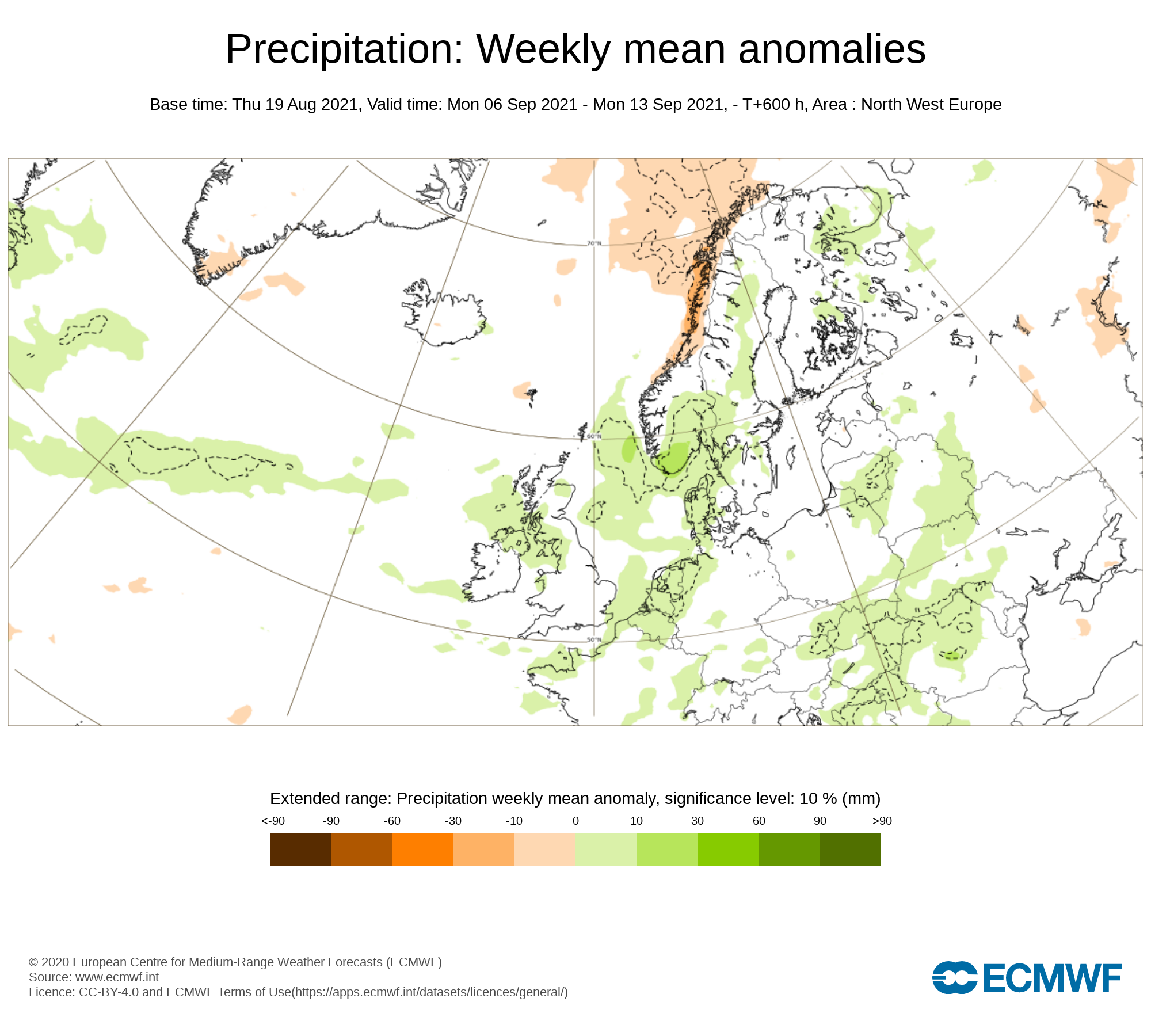
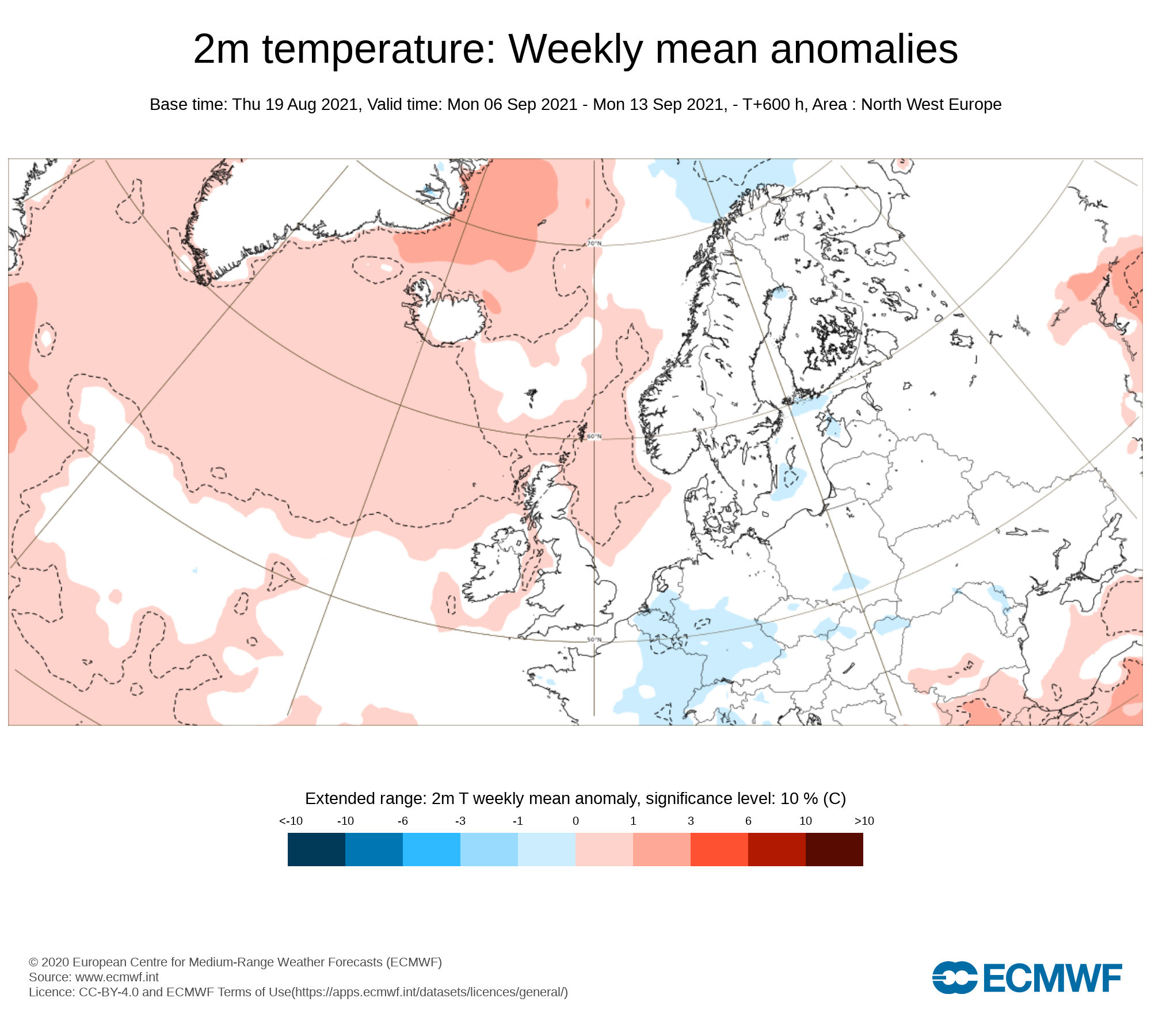
Week 3 - Monday 06th September 2021 - Monday 13th September 2021
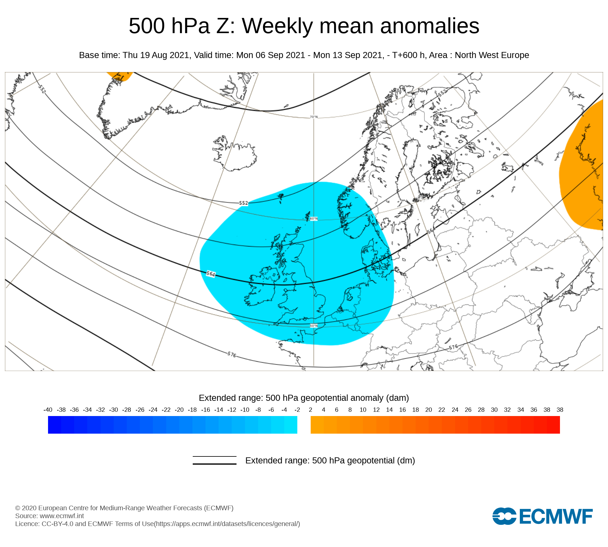
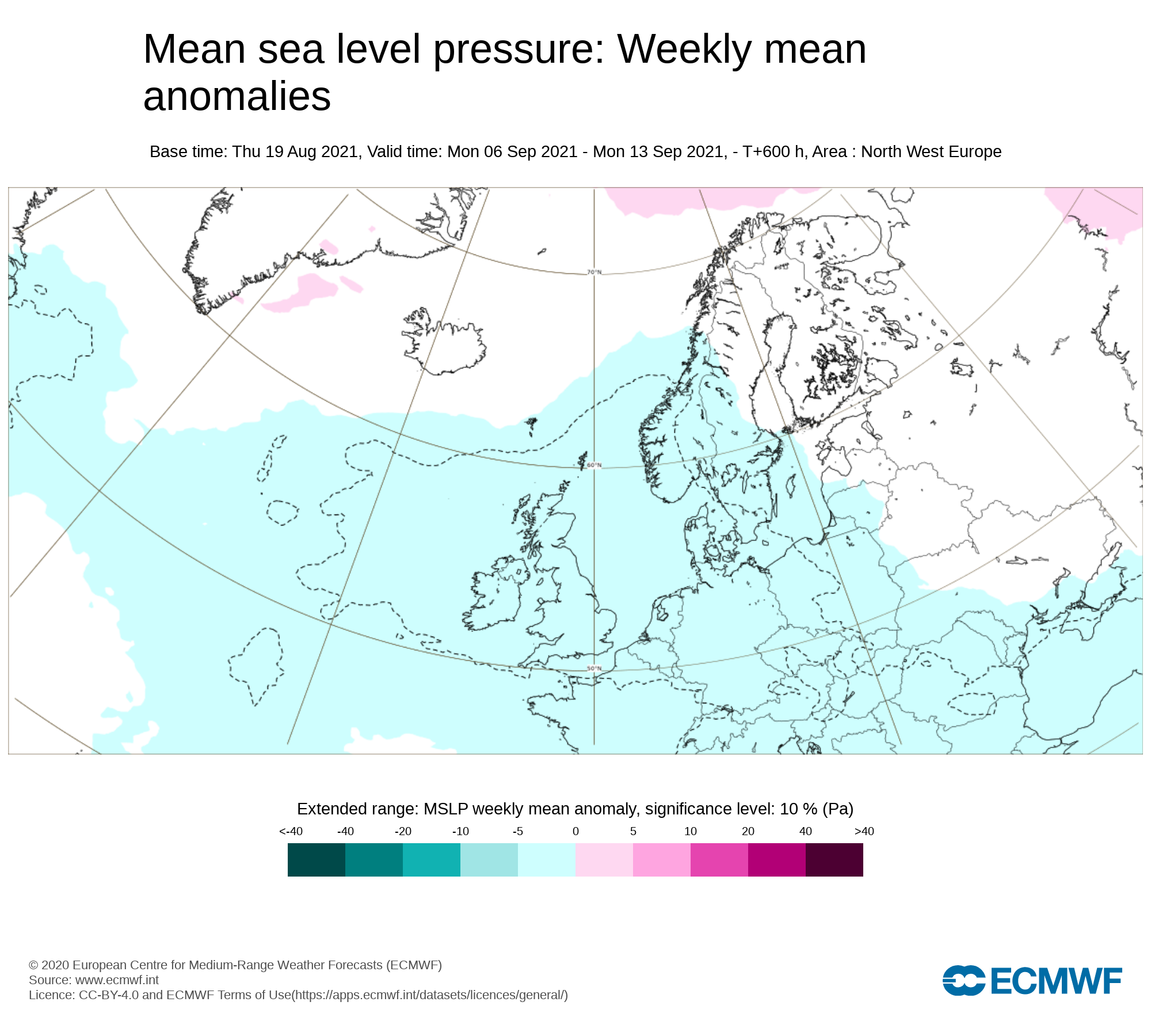
Mean sea level pressure: Weekly mean anomalies
Week 3 is currently forecast to see high pressure position itself across Ireland which will bring drier weather across Ireland
Precipitation ( Rainfall): Weekly mean anomalies
The latest outlook is for below average rainfall amounts across Ireland on Week 3 with higher pressure keeping the weather on the drier side but this does not mean there will be no rain a few showers will be possible
2m temperature: Weekly mean anomalies
There are signals it may become rather warmer at some stage over week 3 with temperatures generally in the mid 20s but possibly higher into the high 20s in places.
Wind forecast
No strong winds are signaled for week 3
UV forecast
UV levels will be moderate to high in any sunshine with the risk of sun burn.
Pollen forecast
Pollen levels will be moderate to high over the week with pollen levels lowest during cloudy and wet weather and highest during any sunny dry periods. Grass pollen will be the main type
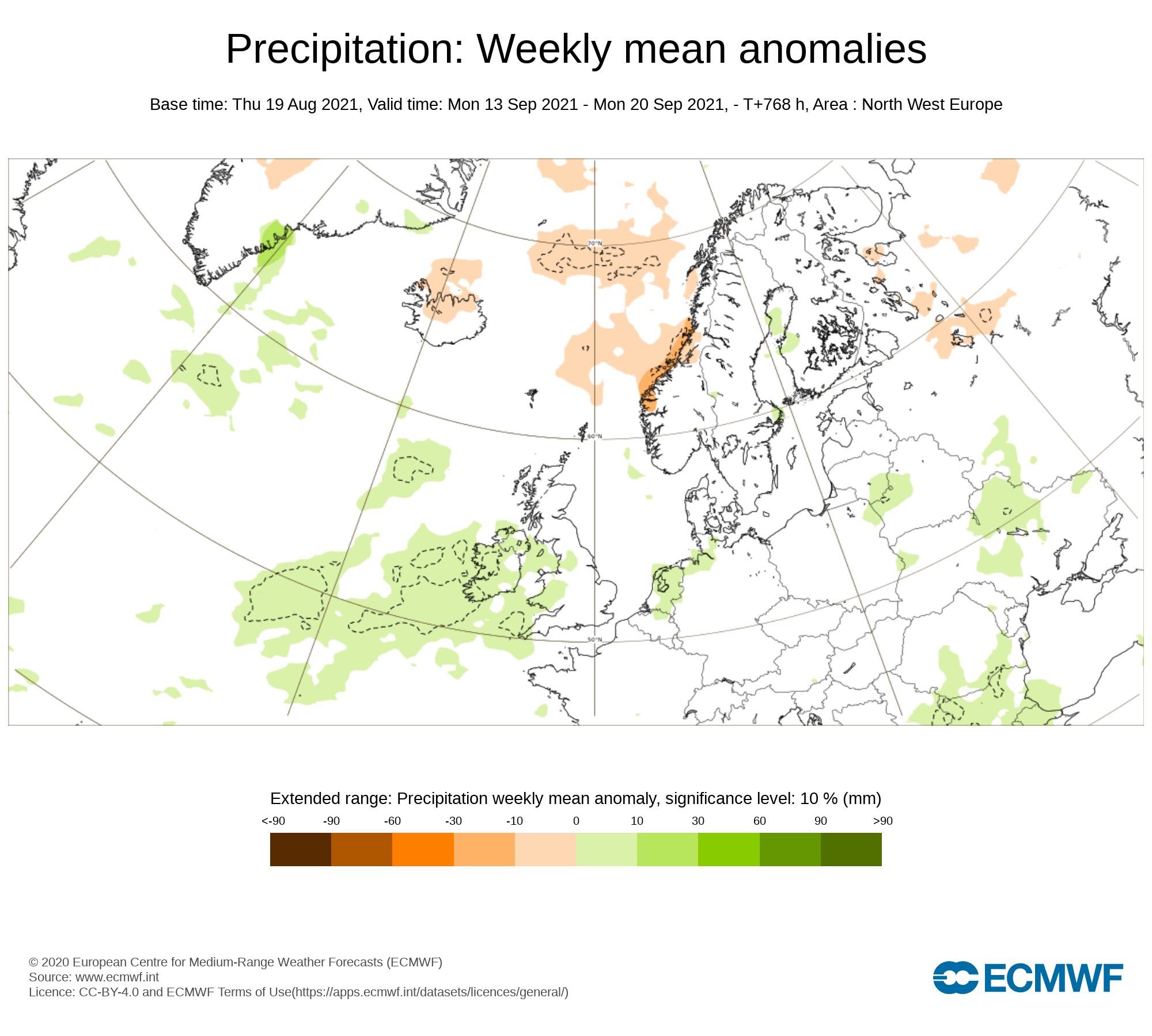
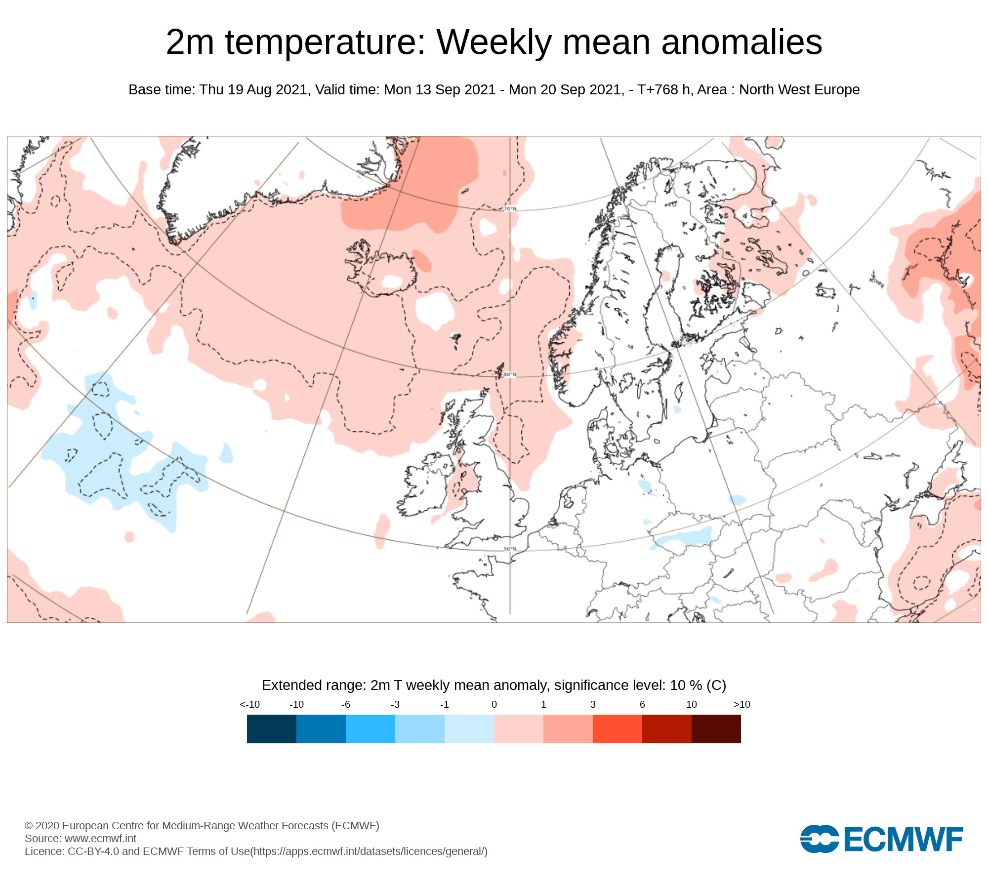
Week 4 - Monday 13th September 2021 - Monday 20th September 2021
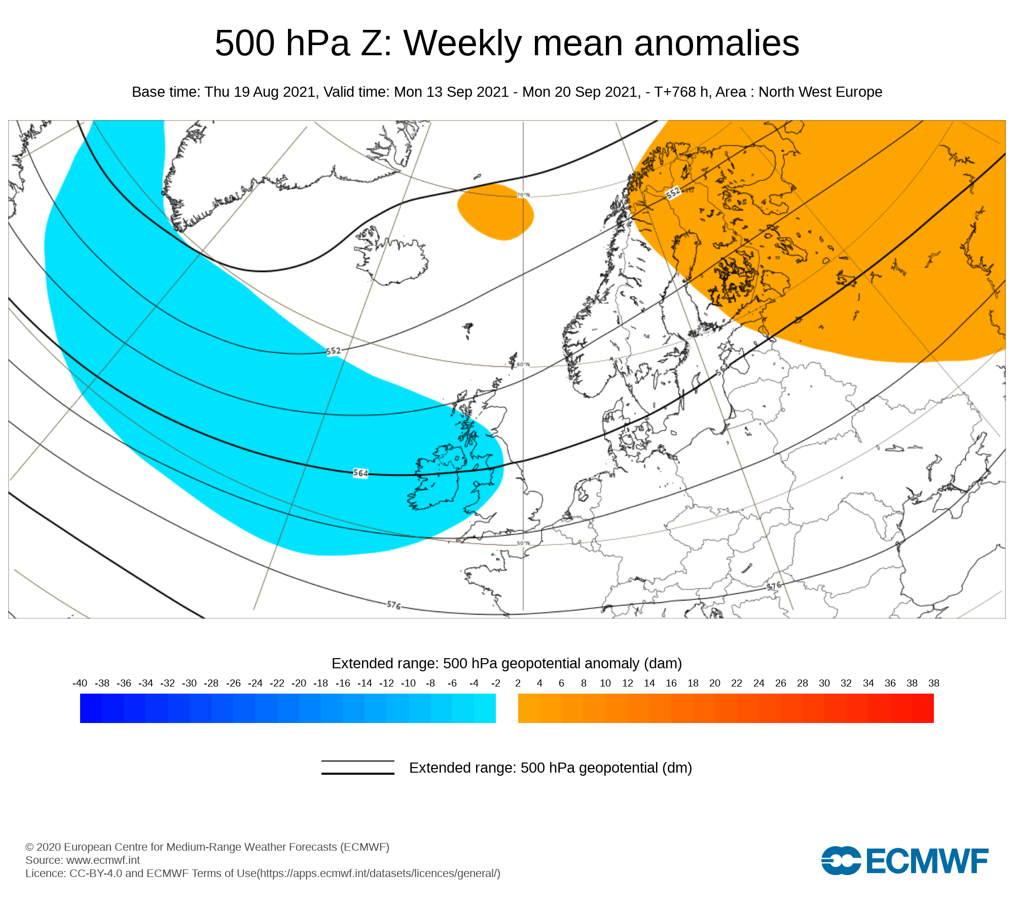
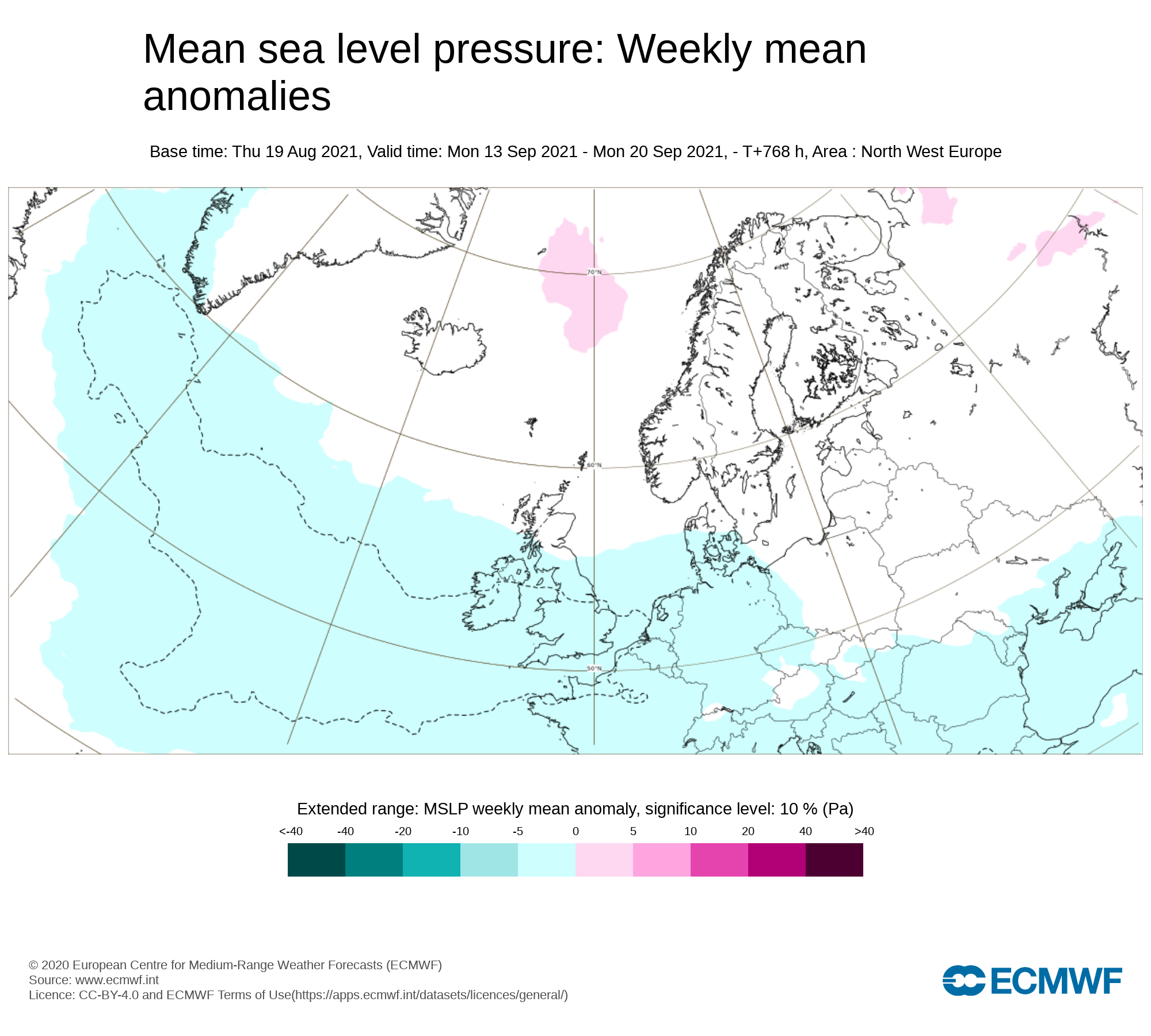
Mean sea level pressure: Weekly mean anomalies
Signals are very weak for week 4 but there are signs for low pressure again during week 4 bringing unsettled weather.
Precipitation ( Rainfall): Weekly mean anomalies
Rainfall amounts are forecast to be above average for week 4 with again the possibility of some flooding and heavy rain at times,
2m temperature: Weekly mean anomalies
Temperatures this week will be average and possibly just below for some places
Wind forecast
Some strong wind could effect Ireland this week as areas of low pressure will effect Ireland.
UV forecast
UV levels will be mostly low this week.
Pollen forecast
Pollen levels will be low over the week with pollen levels lowest during cloudy and wet weather and highest during any sunny & dry periods. The main type of pollen will be weed this week.
🎉ENTER OUR COMPETITION BELOW 🎈
Monthly Long Range Forecast


Latest News


