

National WEATHER Forecast - IRELANd
FRIDAY 29TH May 2026
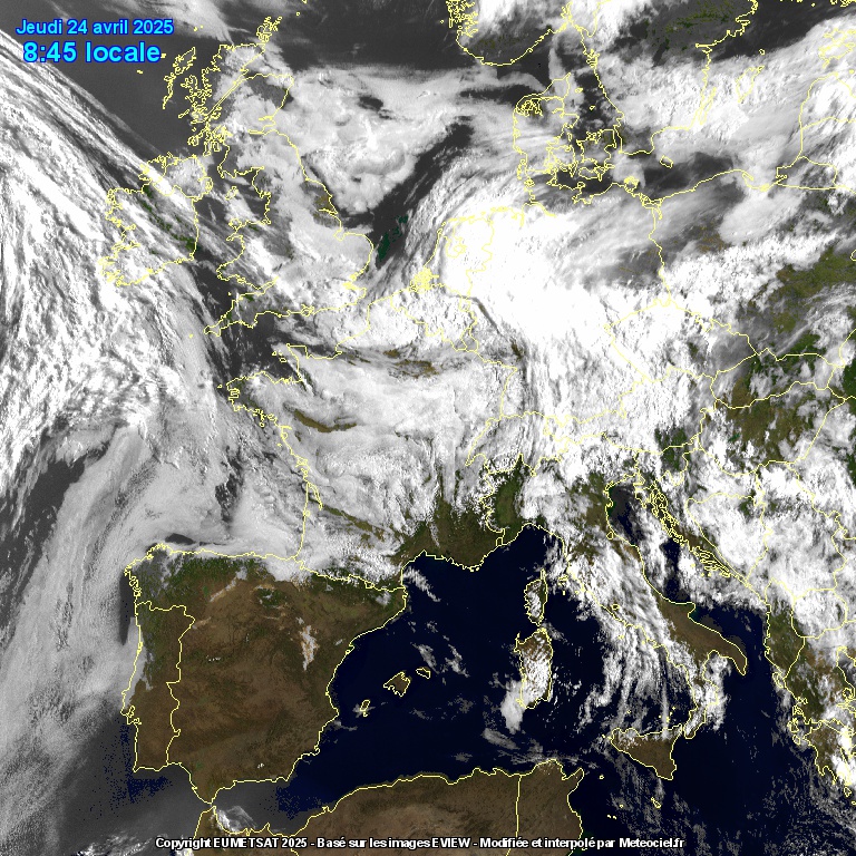
Some mist and drizzle on Friday morning in the northwest and north, while drier conditions are expected elsewhere. By the afternoon and evening, conditions will improve with bright or sunny spells and hazy sunshine in some areas. Temperatures will range from 15°C to 23°C, with the warmest weather in the east.
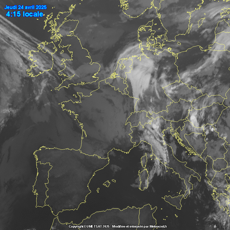
Friday night will start off dry, but clouds will build later, bringing outbreaks of rain moving from west to east after midnight. Temperatures will drop to between 10°C and 13°C.
SATURDAY 30th may 2026
Expect outbreaks of rain moving from west to east on Saturday morning and afternoon some thunderstorm activity will be possible in the northwest and north during the afternoon and evening with heavy downpours, lightning and hail . However, it will become drier from the west in the evening , with sunny spells developing by evening. Temperatures are set to range from 16°C to 23°C.
Many areas will begin dry on Saturday night, but some rain will affect the northwest later, continuing from west to east. Temperatures will also be between 10°C and 13°C.
Sunday 31st may 2026
Scattered showers will occur across the country on Sunday, easing through the evening and night. Expect drier conditions with potential sunny breaks in the north while further south may remain cloudier. Sunday night will generally be dry, but a few patches of drizzle could affect southern parts of Ireland. Temperatures will range between 16C to 22C.
BANK HOLIDAY MONDAY 1st JUNE 2026
The first day of meteorological summer will start with heavy showers moving west to east across Ireland, with a potential for thunderstorms in Ulster during the afternoon and evening. Showers will clear most of Ulster by evening, leading to drier conditions and a few sunny spells, although heavy showers will continue in Munster and south Leinster. Temperatures will range from 16°C to 22°C.
Further showers are expected overnight.

TUESDAY 2ND JUNE 2026
Another showery day is anticipated across Ireland with drier conditions and sunny spells developing later.
Outlook (WEDNESDAY onward)
The outlook beyond Tuesday suggests continued showery weather through the week, with a risk of thunderstorms at times. Looking ahead, there are indications that high pressure may build around mid-June, bringing more settled and warmer weather.
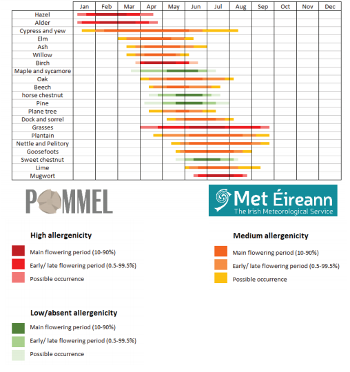
POLLEN FORECAST
Type - None
Pollen levels will be low over the coming days main type will be tree
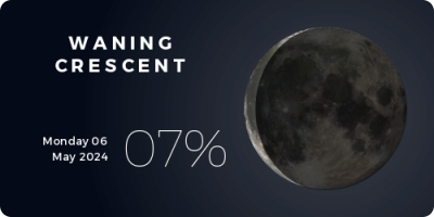
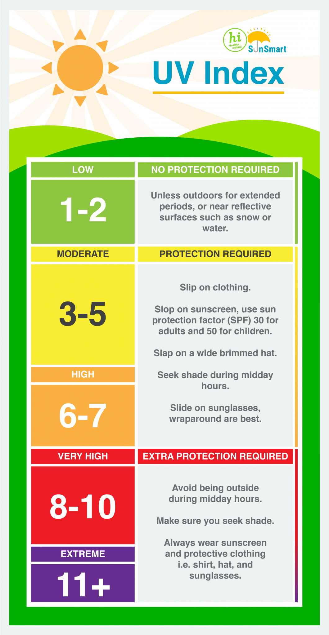
UV FORECAST
UV levels will be low over the coming days
USE the WEATHER VIEWER TO VIEW THE LATEST CONDITIONS IN REAL TIME AND 10 DAYS AHEAD ON THIS chart
Wind Gust
Wind Speed
Temperature
Precipitation Forecast
Precipitation Radar
Dew Point
UV Index
Feels Like Temperatures
Cloud Cover Forecast
MSL Pressure


The stunning Leitir Mhic An Bhaird (Lettermacaward) Donegal during May 2018

I was in Albufeira Portugal I was waiting for the full moon to come up and it did not let me down.
The orange and red tints that the Moon sometimes take on rising and setting are caused by the particles in the Earth's atmosphere. When light (or more specifically, packets of light called photons) from an astronomical object passes through the Earth's atmosphere, it scatters off of particles in the latter.

What a unbelievable night and morning out storm chasing, These number of thunderstorms had to be the best in years as most of the lightning was CG bolts. I even manage to captures Two to three CG bolts in one shot.

This was a shot of a sunset i got back on May 2016 from Creevy Donegal Ireland while watching the sunset for over 2 hours.

One of the most beautiful views of Slieve league From sea and got some nice photos.
Photos from this angle I have not seen yet and it was wonderful to finally capture that moment.


Follow Donegal Weather Channel on other social media platforms by clicking the icons below

CLICK TO ADD ON FACEBOOK

CLICK TO ADD ONSNAPCHAT

CLICK TO ADD ON INSTAGRAM

CLICK TO ADD ON TWITTER