
Risk of thunderstorms, hail and flooding this afternoon and evening in places

This afternoon and evening heavy convective showers will develop across the western half of Ireland with the risk of some thunderstorms developing with heavy downpours, hail and lightning.
In a few places these convective showers may merge into longer spells of rain especially across the soutwest of the country.
Some spot or flash flooding cannot also be ruled out.
The eastern and northern half of Ireland will miss these showers and stay mostly dry.
The below image is a CAPE chart. (CAPE or Convective Available Potential Energy is the amount of fuel available to a developing thunderstorm.)
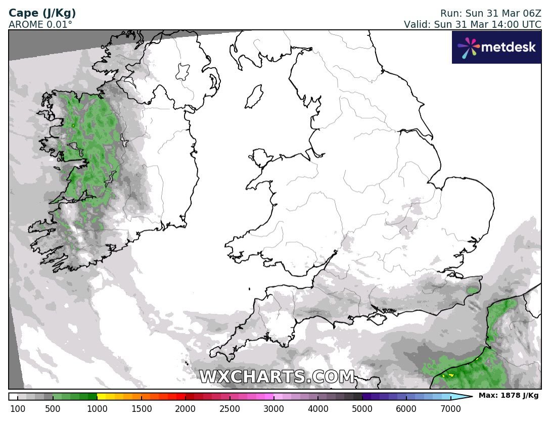
The main risk area will be across Mayo, Galway, Clare, Limerick, Kerry and Cork so don't be surprised to see flash warnings issued for Met Eireann this afternoon if some kicks off.
There will also be a potential for funnel clouds along with the mentioned above lightning and hail.


Make sure to send on your reports, videos and photos if you see any of these convective showers.
LATEST NEWS


