
Potentially turning stormy and very unsettled as we head into this weekend

If you have outdoor plans for next weekend it would be worth keeping a eye on the forecast over the next few days as models for the last few days have been signalling for a area of low pressure to move up across Ireland Friday night into Saturday bringing wet and very windy conditions for the time of year to places.
The Ecmwf European weather model and Gfs American model takes the low pressure up across Ireland sometime between 21:00hrs Friday and 18:00hrs Saturday.
As seen below the rain forecast between today and Saturday midnight shows between 40mm to 80mm for some areas.


As that band of rain clears to the north later Saturday morning the center of the low at present looks set to track northwards up of the west and northwest coast and as it does some places could see strong winds fore a time which could trigger weather warnings been issued. As the rain clears and the center of the low moves northwards close to the west and northwest of the county it will also bring the risk of heavy thundery showers with the risk of hail and even a potential water spout or tornado can't be ruled out. Some parts of Connacht and west Ulster could see a period of fairly active Thunderstorm activity for a time during the afternoon and evening on Saturday.
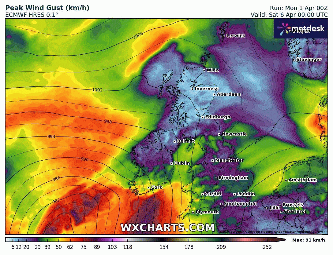
Over the next 2 or 3 days the forecast should become more clear and we should have a better idea of the track of that low pressure system moving northwards. I would keep a eye on the forecast for this weekend if you do have plans and it might also be no harm getting ahead of yourself if you have anything lose around the garden which many would this time of year.
At the moment it is only looking like a yellow warning storm but it would not take much for that to change as we get closer.
LATEST NEWS


