
A much colder spell of weather is brewing heading into December
Following on from our update a number of days ago on the possibility of colder weather on the way moving into early December I have the latest update below.
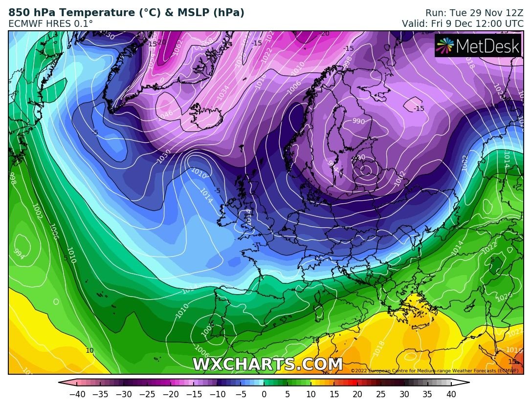
Since our last update a number of days ago there is some very strong signals now of a cold spell of weather arriving at the end of this weekend and for next week.
The below chart shows high confidence, much higher than normal for northern blocking and the NAO (North Atlantic Oscillation) to go negative. Once this happens we see a increasing chance a reversal of the normal westerly pattern and winds to a more northerly or easterly air source and winds hence the weather model output we are now getting across multi models.


At the moment from the end of next weekend we are looking at drier weather but turning much colder with frosty nights as we go through the start of next week. As we move through the end of next week into next weekend there are some indications it could turn even colder with some wintry falls possibly moving down from the north with the main air source coming from the Arctic that's looking the most likely source of the coldest air at the moment.

Another scenario we are looking at is low pressure over the bay of Biscay later next week moving northwards towards Ireland preventing it getting to cold. In this scenario depending on how far southwards the cold gets and how cold them upper air temperature are we could get warm moist air moving up from the south mixing with that colder air to the north which could result in wintry precipitation falling as snow but that would depend on the cold and mild boundery line and were it lies.
With these sort of set ups normally once the cold arrives it can open the door for something more colder and sharper especially with a negative NAO.
Kenneth from the Donegal Weather Channel
LATEST NEWS


