
Monthly Long Range Forecast Update Ireland -13th July until 9th August 2021

The Donegal Weather Channel Monthly Long range forecast issued every week looking up to a month ahead using data from the ECMWF and GFS models.
Please note that the longer range forecasts are more uncertain and should not be used to plan outside activities from over a week out.
Extended Range Output
The output is rather different from the shorter period output of HRES and ENS products. It provides a more general overview of the forecast up to Day 46, focusing mainly on the week-to-week changes in the weather rather than attempting to give unsupportable detail on individual days. Output is mostly in the form of anomalies relative to ER-M-climate and is mainly shown as 7-day means for calendar weeks Monday-Sunday. Specialised products for the extended range also include information on potential tropical cyclone activity and the MJO during the coming month.
SPONSOR THE LONG RANGE FORECAST
If you have a business and would like to sponsor our weekly month long range forecast for a period of 1 week or 1 month please do contact Donegal Weather Channel at info@donegalweatherchannel.ie or message our Facebook page . Donegal Weather Channels service relies on sponsorship/advertising. Without sponsorship/advertising Donegal Weather Channel would not be able to give so many hours and a daily service.

The forecast will be issued by myself Kenneth and i will try to keep it simple making it easy for everyone to understand. If there is a term I use in the forecast which you may not know what it means I will explain what I am talking about .
Before I start with the long range forecast I will just explain what we will be looking at and how the forecast will work.
The forecast will be broken up into 4 section Example below :
Week 1 - Monday 12th July 2021 -Monday 19th July 2021
Week 2 - Monday 19th July 2021 -Monday 26th July 2021
Week 3 - Monday 26th July 2021 -Monday 2nd August 2021
Week 4 - Monday 2nd July 2021 -Monday 9th August 2021
Things we will look at in the forecast:
Mean sea level pressure: Weekly mean anomalies
2m temperature: Weekly mean anomalies
Wind
Precipitation: Weekly mean anomalies (eg. rainfall and snowfall for a example.
Dust forecast ( Only in Week 1)
UV forecast outlook
Potential Pollen Levels

Forecaster - Kenneth Mc Donagh
Week 1 - Monday 12th July 2021 -Monday 19th July 2021
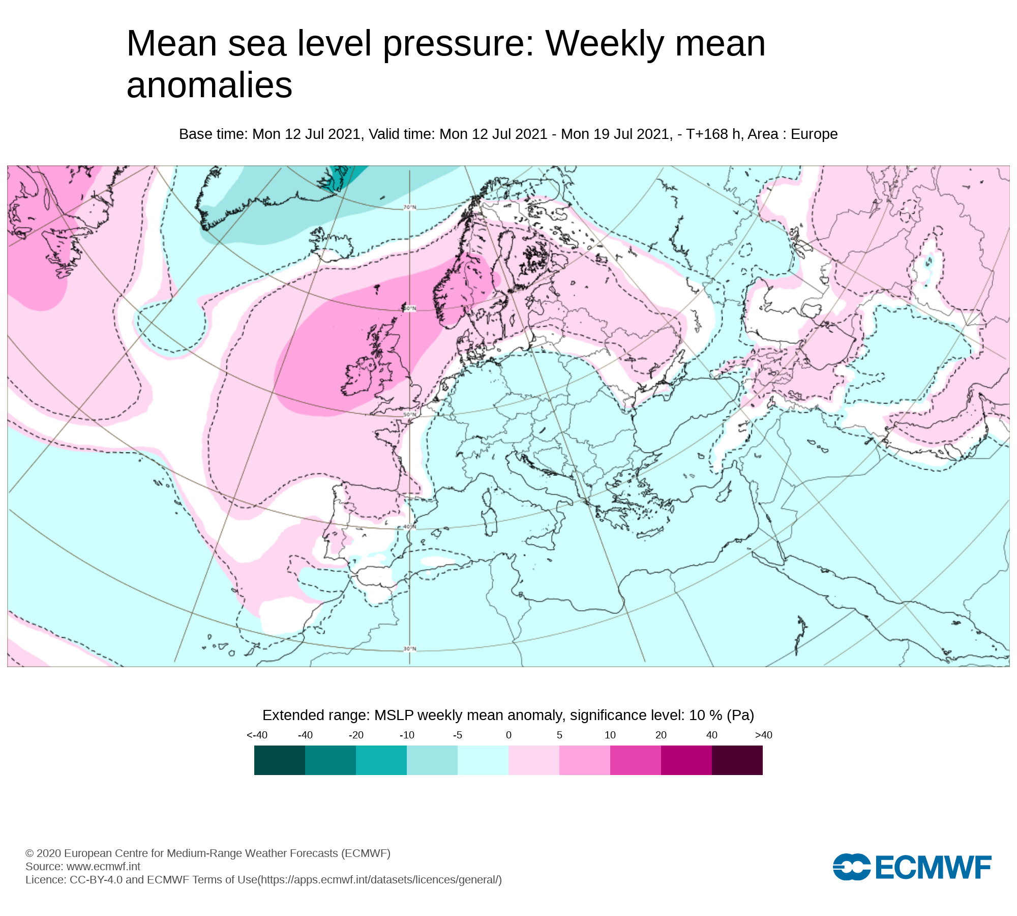
Mean sea level pressure: Weekly mean anomalies
Week 1 this week will see higher pressure across Ireland with an Azores high moving northwards and positioning itself across Ireland over the end of the the week and through the weekend.
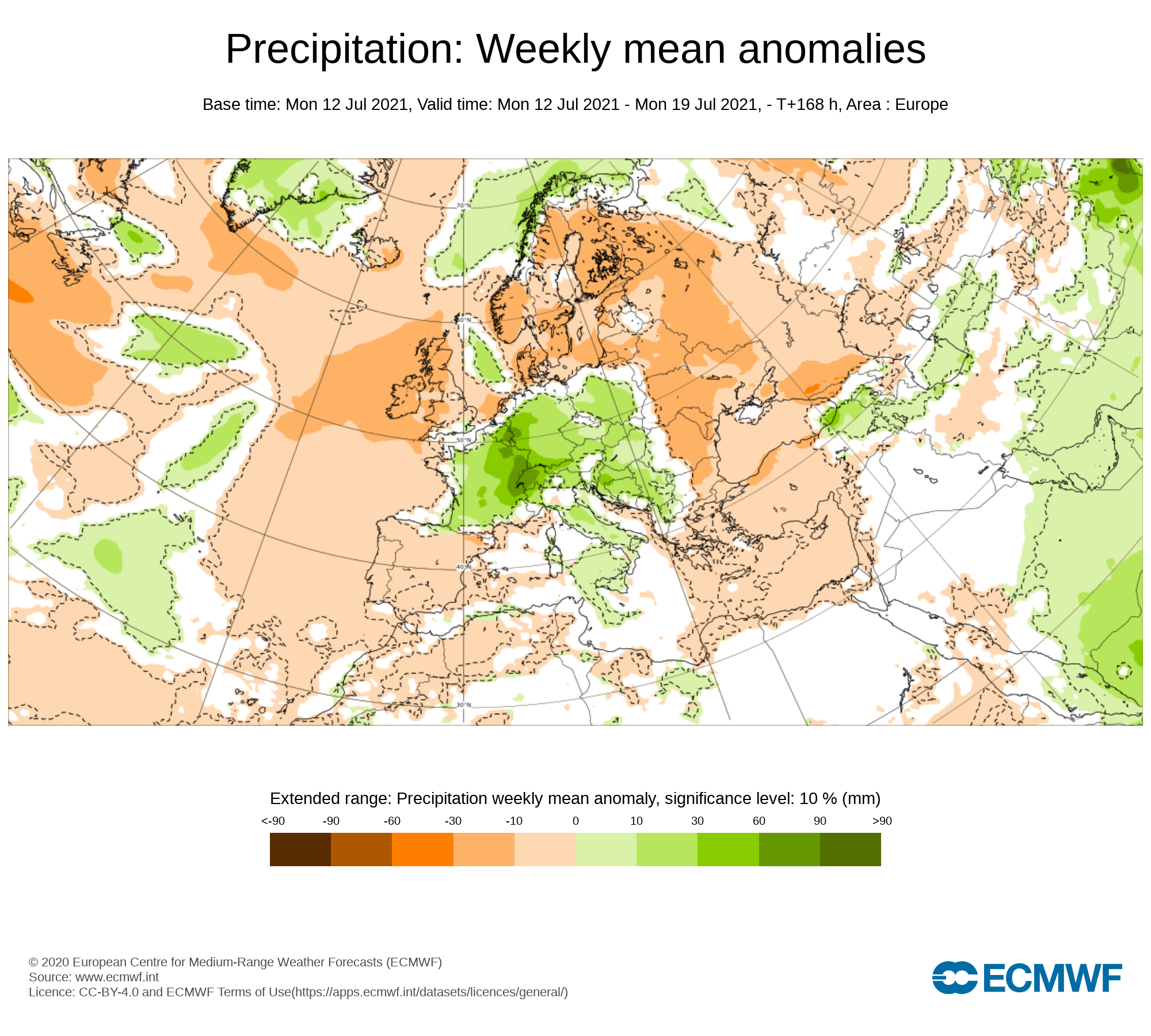
Precipitation ( Rainfall ): Weekly mean anomalies
Rainfall amounts over the last week gone by where well above average for much of Ireland mainly coming in the way of heavy downpours which lead to most of the rainfall amounts. However rainfall amounts where below average across south Munster, the north Midlands and Parts of Ulster. Malin head weather station Donegal record the least amounts of over the last number of days with 0.9mm there. South Connacht and south Leinster seen the biggest rainfall totals with Gurteen in Co. Tipperary recording 49.9mm there at the Met Eireann Weather station.
Over the next week rainfall amounts will be well below average with some place receiving 0mm to 2mm of rain. Northwestern and counties will see the most of any rainfall coming in the way of drizzle with mentioned above very low amounts at that of 2mm or less. Elsewhere it will be dry especially across the southeast and east.
Some drizzle will will effect parts of the west and northwest overnight Tuesday drier elsewhere
Some drizzle will will effect parts of the west, northwest and north again on Wednesday especially over the evening with some mist or drizzle across parts of Leinster and Munster overnight Wednesday.
Some mist and drizzle on Thursday morning mainly in the west and northwest but over the afternoon and evening cloud will lift with sunny spells developing for a bulk of Ireland Thursday evening as higher pressure moves northwards.
Some light drizzle possible early Friday morning but sunny spells developing in all areas come the later afternoon and evening.
The weekend is set to be dry with sunny spells nationwide.
Rainfall amounts between Wednesday 7th July to Sunday 11th July 2021
ULSTER
Rainfall amounts below average across all of Ulster over the coming week with between 0mm to 2mm with the lowest amounts in east Ulster. Highest in the west of Ulster
CONNACHT
Rainfall amounts below average across all of Connacht over the coming week with between 0mm to 2mm with the lowest amounts in south Connacht. Highest in the west and north of Connacht
MUNSTER
Rainfall amounts below average across all of Munster over the coming week with between 0mm to 2mm with the lowest amounts in south, east and north Munster. Highest in the west of Munster
LEINSTER
Rainfall amounts below average across all of Leinster over the coming week with between 0mm to 1mm. Amounts low everywhere with the most chance of any kind of precipitation across higher ground areas of Leinster
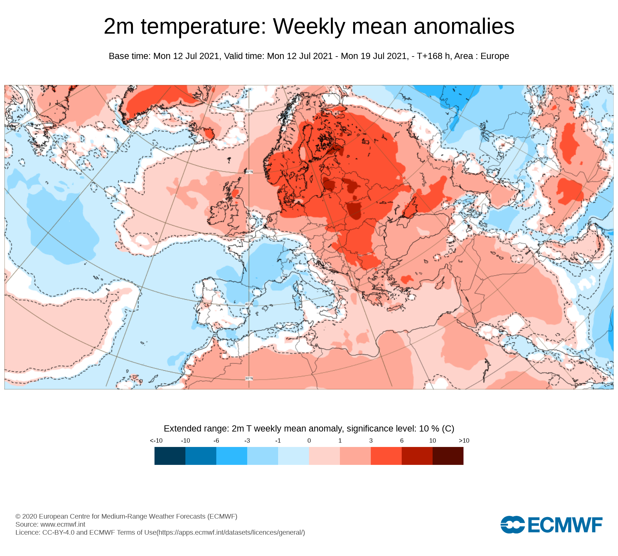
Temperature: Weekly mean anomalies
Well above average temperatures are expected across Ireland over the coming week especially over the later stages of this week and over the weekend.
7 day temperature forecast
Tuesday - 18°C to 22°C
Wednesday - 18°C to 23°C
Thursday - 19°C to 24°C
Friday - 22°C to 25°C
Saturday - 23°C to 27°C
Sunday - 23°C to 28°C
Monday - 20°C to 28°C
Night time temperatures will be warm Thursday into the early days of next week with highs of around 17C to 18C and lows of 13C to 14C. It will be rather humid from Friday onwards.
Wind forecast
There are no risk of any strong winds this week.
UV forecast
⚠ ALERT - UV levels will be very high over the end of the week, this weekend and early next week
Pollen Forecast
Pollen levels will be high to very high over the week with pollen levels lowest during cloudy and wet weather and highest during any sunny & dry periods. The main type of pollen will be grass this week.
Pollen levels could increase to very high the end of this week and over this weekend for all areas
Dust forecast
Dust levels are due to increase over the end of the week and weekend as that Azores high move northwards bring a increase across Ireland. Levels should remain below moderate levels not having any impact on people with breathing difficulties.

Week 2 - Monday 19th July 2021 -Monday 26th July 2021
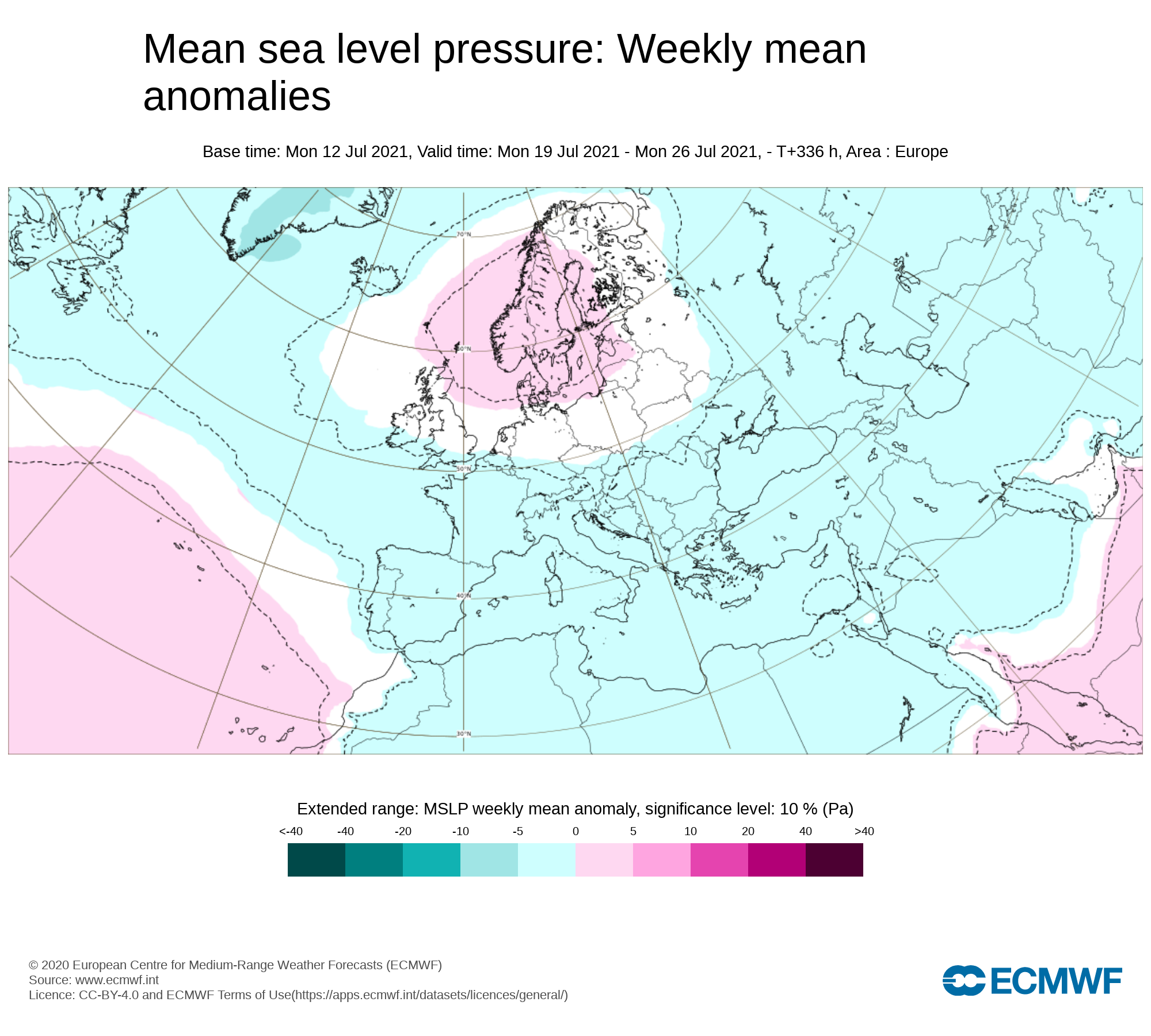
Mean sea level pressure: Weekly mean anomalies
Week 2 next week will start of with high pressure across Ireland but high pressure is forecast at present to slip away to north/northeast bring less unsettled weather from around mid week next week.
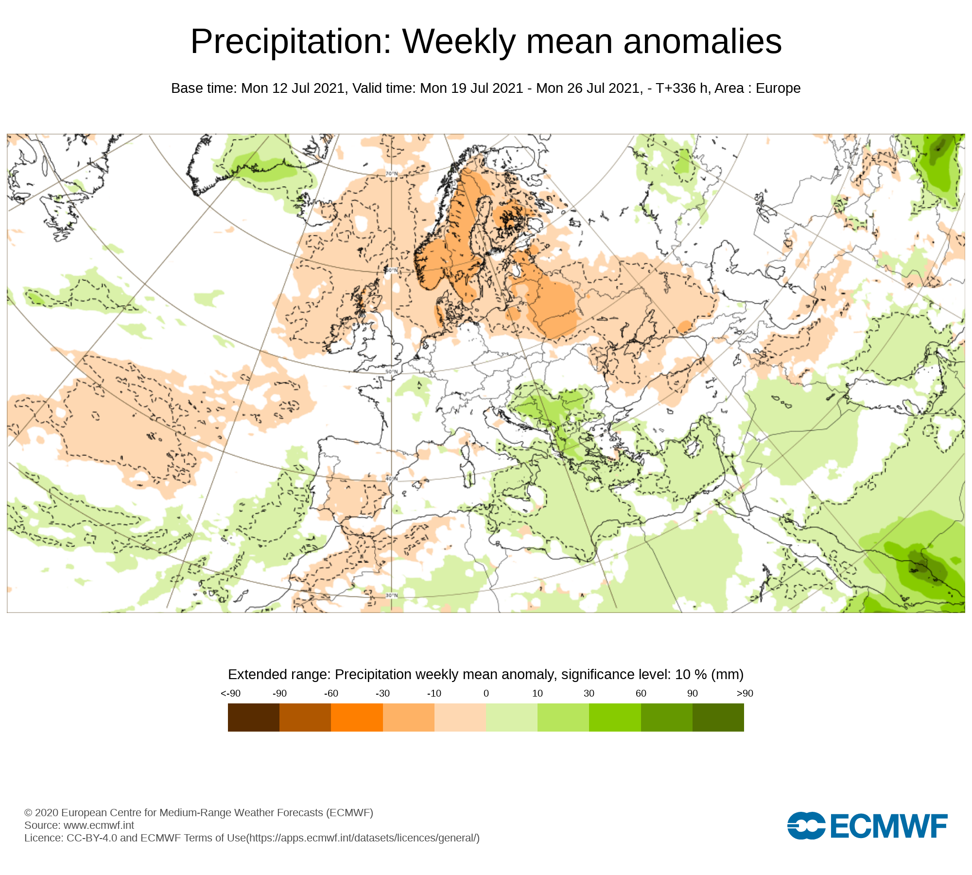
Precipitation ( Rainfall): Weekly mean anomalies
Dry to start on Monday and for many places on Tuesday but a breakdown looks likely to happen as that high pressure moves northwards. This will lead to the risk of heavy showers and thunderstorms some which may give some localised flooding in places from later Tuesday though to Thursday. This will become more certain over the coming weekend where we will keep you updated in the National forecast .
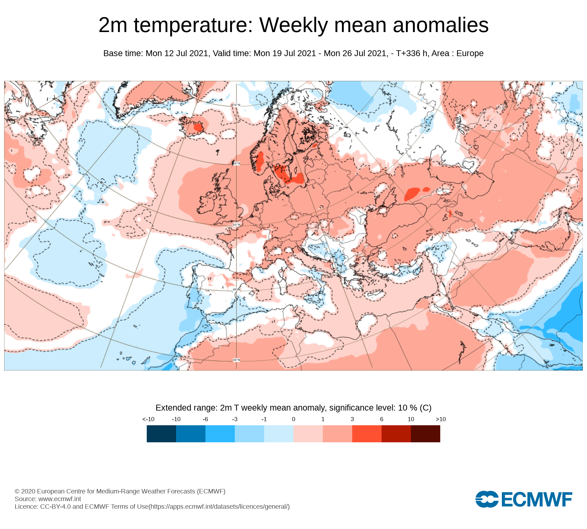
2m temperature: Weekly mean anomalies
temperatures next week are forecast to be above average with the warmest days of the week likely to be next Monday and Tuesday. Monday and Tuesday are likely to see temperatures between 22C to 28C with the warmest day at present looking like Monday next week. Temperatures over the rest of the week into next weekend look set to drop back to the high teens to low 20s still feeling warm with some areas seen above average Temperatures.
Wind Forecast
There are no signs of any strong winds during week 2.
UV forecast
UV levels will be high to very high in any sunshine with the risk of sun burn.
Pollen Forecast
Pollen levels will be high to to very high over the week with pollen levels lowest during cloudy and wet weather and highest during any sunny dry periods. Grass pollen will be the main type.
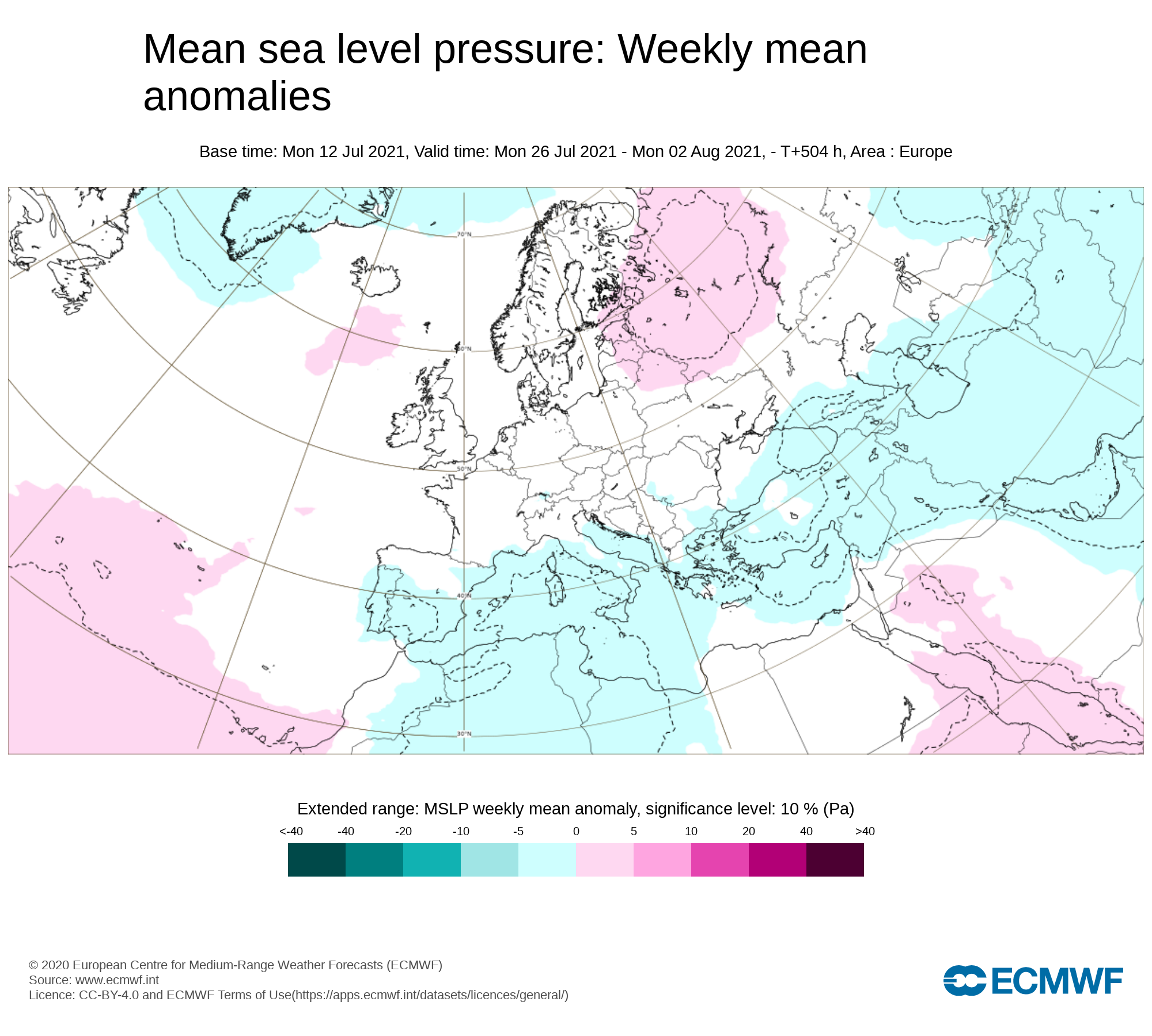
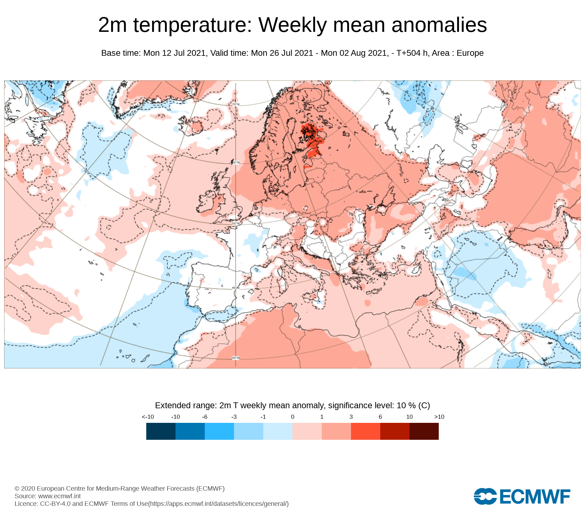
Week 3 - Monday 26th July 2021 -Monday 2nd August 2021


Mean sea level pressure: Weekly mean anomalies
At week 3 there there is some uncertainty but the latest forecast is for higher pressure but the pressure may not be very strong.
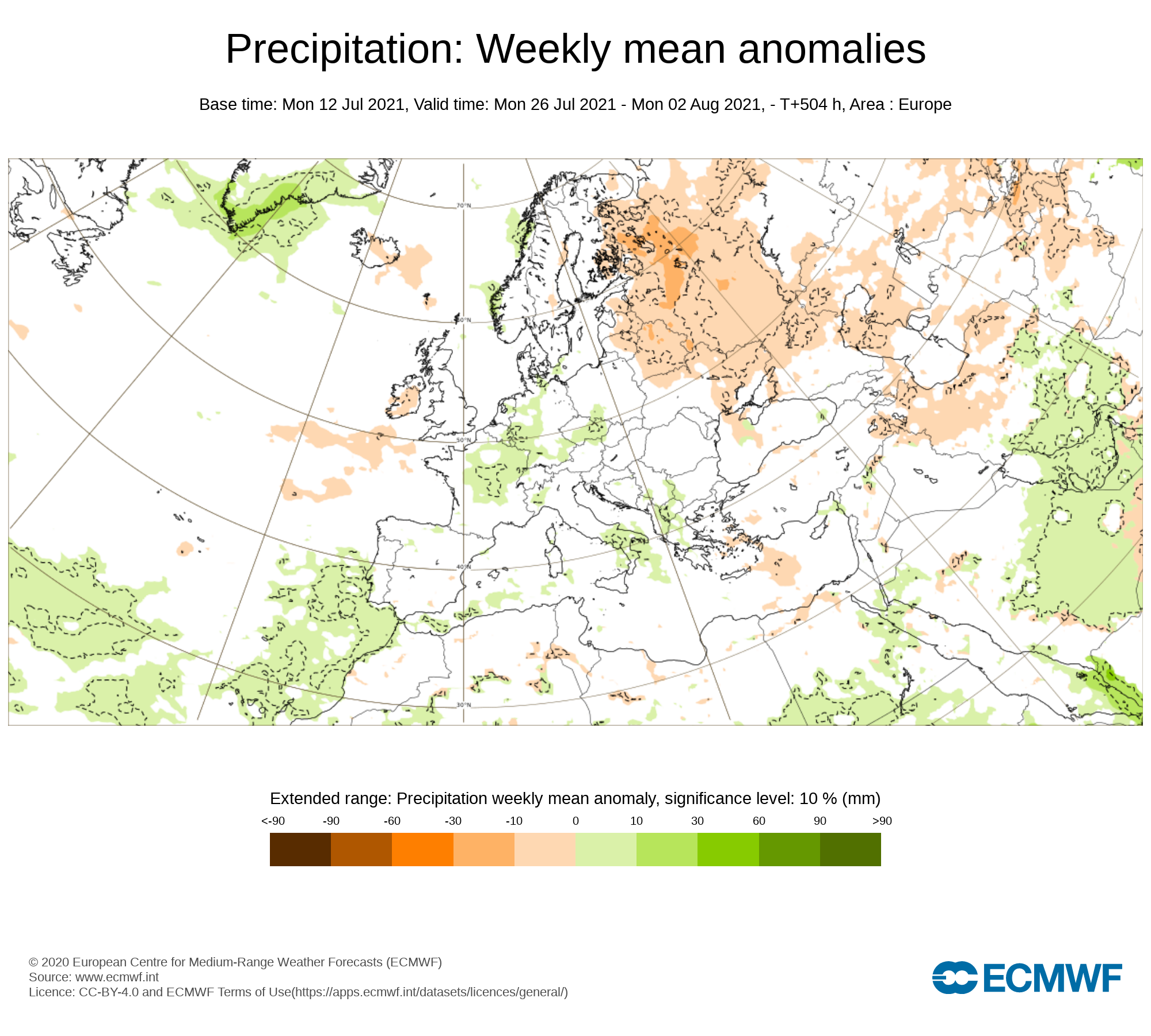
Precipitation ( Rainfall): Weekly mean anomalies
The latest forecast of for below average rainfall amounts across Ireland during week 3 but some showery weather may occur this week coming in the way of heavy downpours with thunderstorm activity.
2m temperature: Weekly mean anomalies
This week is currently forecast to be warm with temperatures above average possibly in the high teens to low 20s and maybe even into the mid 20s for a few places at times over the week.
Wind forecast
There are no strong signals for windy conditions over week 3
UV forecast
UV levels will be High to very high in any sunshine with the risk of sun burn.
Pollen forecast
Pollen levels will be high to very high over the week with pollen levels lowest during cloudy and wet weather and highest during any sunny dry periods. Grass pollen will be the main type
Week 4 - Monday 2nd July 2021 -Monday 9th August 2021
Mean sea level pressure: Weekly mean anomalies
Signals are very weak for week 4 with no real clear signs of what will happen. The week could be see more unsettled weather with lower pressure near Ireland.
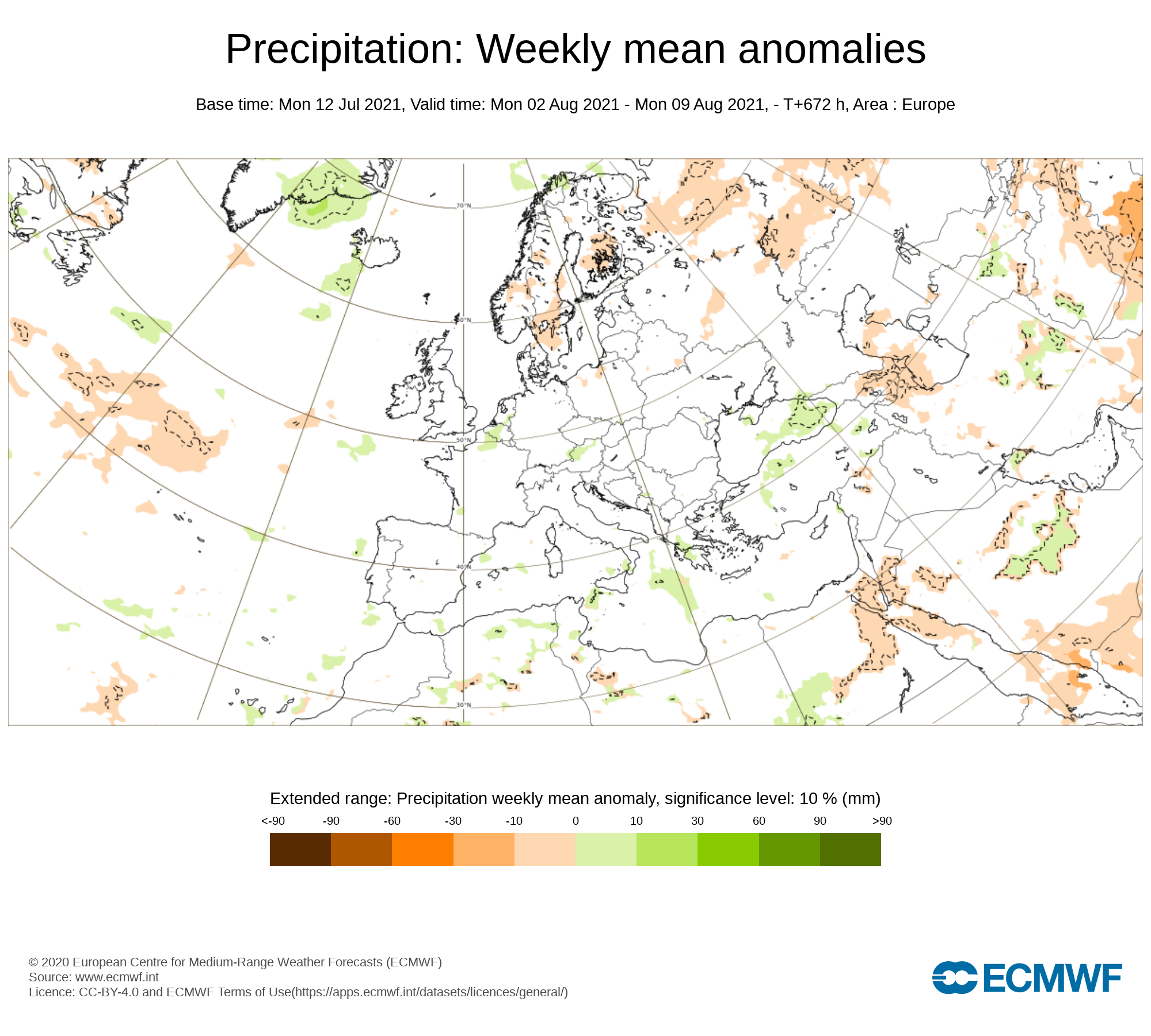
Precipitation ( Rainfall): Weekly mean anomalies
Again signals are weak for this week and it is likely that more near normal rainfall amounts can be expected.
2m temperature: Weekly mean anomalies
Temperatures this week are mostly likely to be in the mid to high teen around average for August
Wind forecast
There area no strong winds signaled for this week
UV forecast
UV levels will be Moderate to high in any sunshine with the risk of sun burn even with cooler weather as the sun this time of year is stronger.
Pollen forecast
Pollen levels will be Moderate to high and possible very high over the week with pollen levels lowest during cloudy and wet weather and highest during any sunny dry periods. Grass pollen the main type


