
Monthly Long Range Forecast Update Ireland -20th July until 16th August 2021

The Donegal Weather Channel Monthly Long range forecast issued every week looking up to a month ahead using data from the ECMWF and GFS models.
Please note that the longer range forecasts are more uncertain and should not be used to plan outside activities from over a week out.
Extended Range Output
The output is rather different from the shorter period output of HRES and ENS products. It provides a more general overview of the forecast up to Day 46, focusing mainly on the week-to-week changes in the weather rather than attempting to give unsupportable detail on individual days. Output is mostly in the form of anomalies relative to ER-M-climate and is mainly shown as 7-day means for calendar weeks Monday-Sunday. Specialised products for the extended range also include information on potential tropical cyclone activity and the MJO during the coming month.
SPONSOR THE LONG RANGE FORECAST
If you have a business and would like to sponsor our weekly month long range forecast for a period of 1 week or 1 month please do contact Donegal Weather Channel at info@donegalweatherchannel.ie or message our Facebook page . Donegal Weather Channels service relies on sponsorship/advertising. Without sponsorship/advertising Donegal Weather Channel would not be able to give so many hours and a daily service.

The forecast will be issued by myself Kenneth and i will try to keep it simple making it easy for everyone to understand. If there is a term I use in the forecast which you may not know what it means I will explain what I am talking about .
Before I start with the long range forecast I will just explain what we will be looking at and how the forecast will work.
The forecast will be broken up into 4 section Example below :
Week 1 - Monday 19th July 2021 -Monday 26th July 2021
Week 2 - Monday 26th July 2021 -Monday 2nd August 2021
Week 3 - Monday 2nd July 2021 -Monday 9th August 2021
Week 4 - Monday 9th August 2021 - Monday 16th August 2021
Things we will look at in the forecast:
Mean sea level pressure: Weekly mean anomalies
2m temperature: Weekly mean anomalies
Wind
Precipitation: Weekly mean anomalies (eg. rainfall and snowfall for a example.
Dust forecast ( Only in Week 1)
UV forecast outlook
Potential Pollen Levels

Forecaster - Kenneth Mc Donagh
Week 1 - Monday 19th July 2021 -Monday 26th July 2021
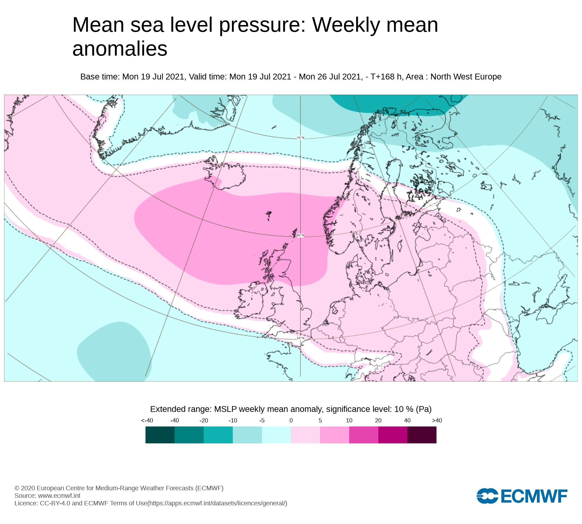
Mean sea level pressure: Weekly mean anomalies
High pressure across Ireland this week will keep the weather dry, warm and hot across Ireland
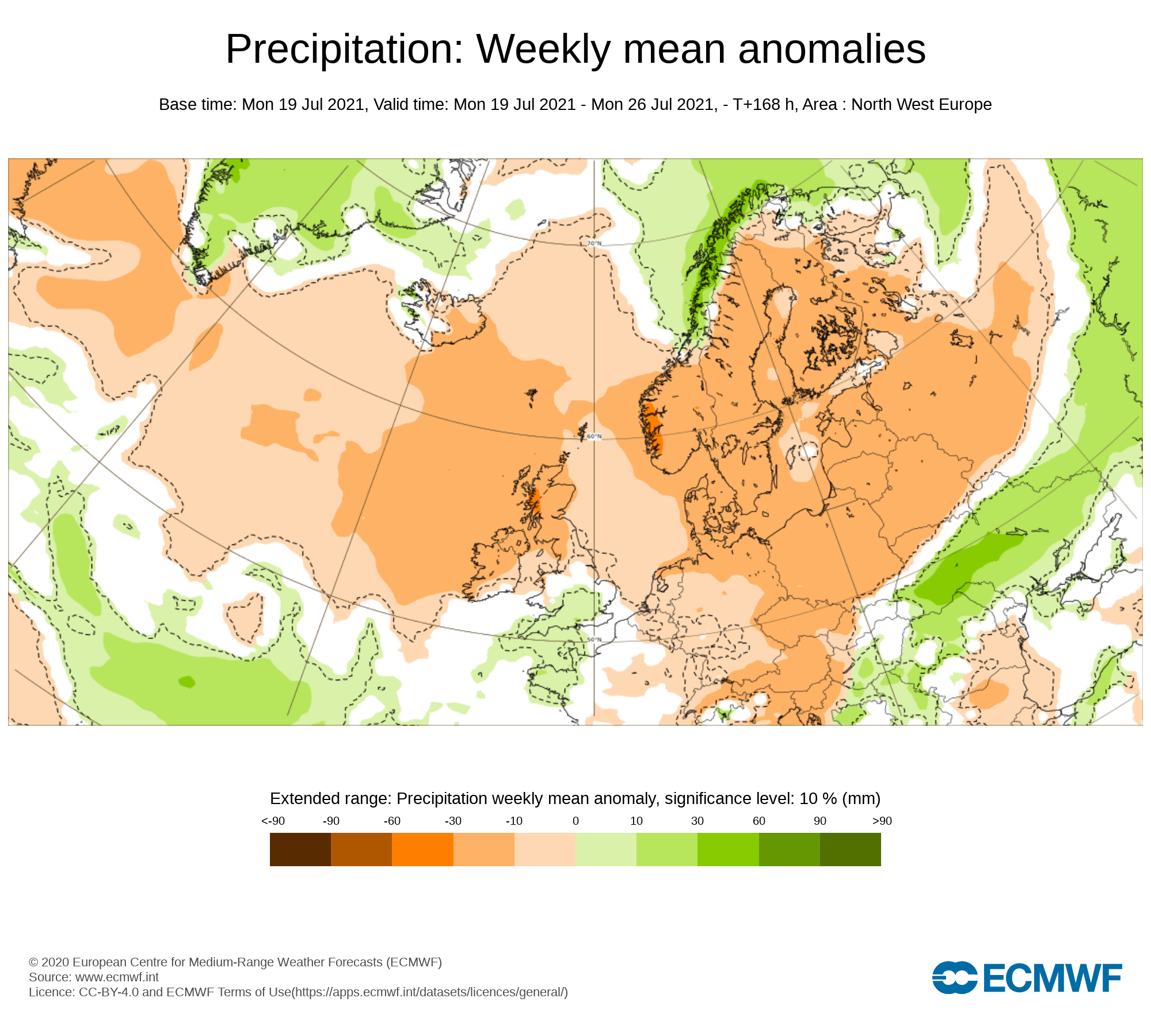
Precipitation ( Rainfall ): Weekly mean anomalies
Rainfall amounts over the last week gone by where well below average across the whole country. The highest rainfall accumulation was recorded at Gurteen, Co. Tipperary with 8.8mm recorded, which is 66% of its average. Ballyhaise in Co. Cavan, was the driest spot with just 0.1mm recorded in the last week, which is 1% of its average.
This week is set to be dry across much the country with the only risk of showers coming from the heat across Ireland which may trigger some slow moving showers or thunderstorms but this risk is even rather low.
Tuesday the northwest will be a the small risk of a heavy shower been triggered by the heat.
Friday there will be the risk of some heavy showers breaking out these slow moving with the risk of some thunder, Highest risk in the west and south.
Apart from them two days above the rest of the days will be largely dry with only the small risk of some mist or drizzle in some place to start during the morning hours.
Rainfall amounts between Tuesday 20th July to Sunday 25th July 2021
ULSTER
Littleror no rain across Ulster will rainfall amounts less than 1mm
CONNACHT
Little or no rain across Connacht will rainfall amounts less than 1mm for many but some heavy showers in a few places on Friday may give higher totals anywhere that sees slow moving thundery showers. South Connacht most a risk.
MUNSTER
Little or no rain across Munster will rainfall amounts less than 1mm for many but some heavy showers in a few places on Friday may give higher totals anywhere that sees slow moving thundery showers. North Munster most a risk.
LEINSTER
Little or no rain across Leinster will rainfall amounts less than 1mm
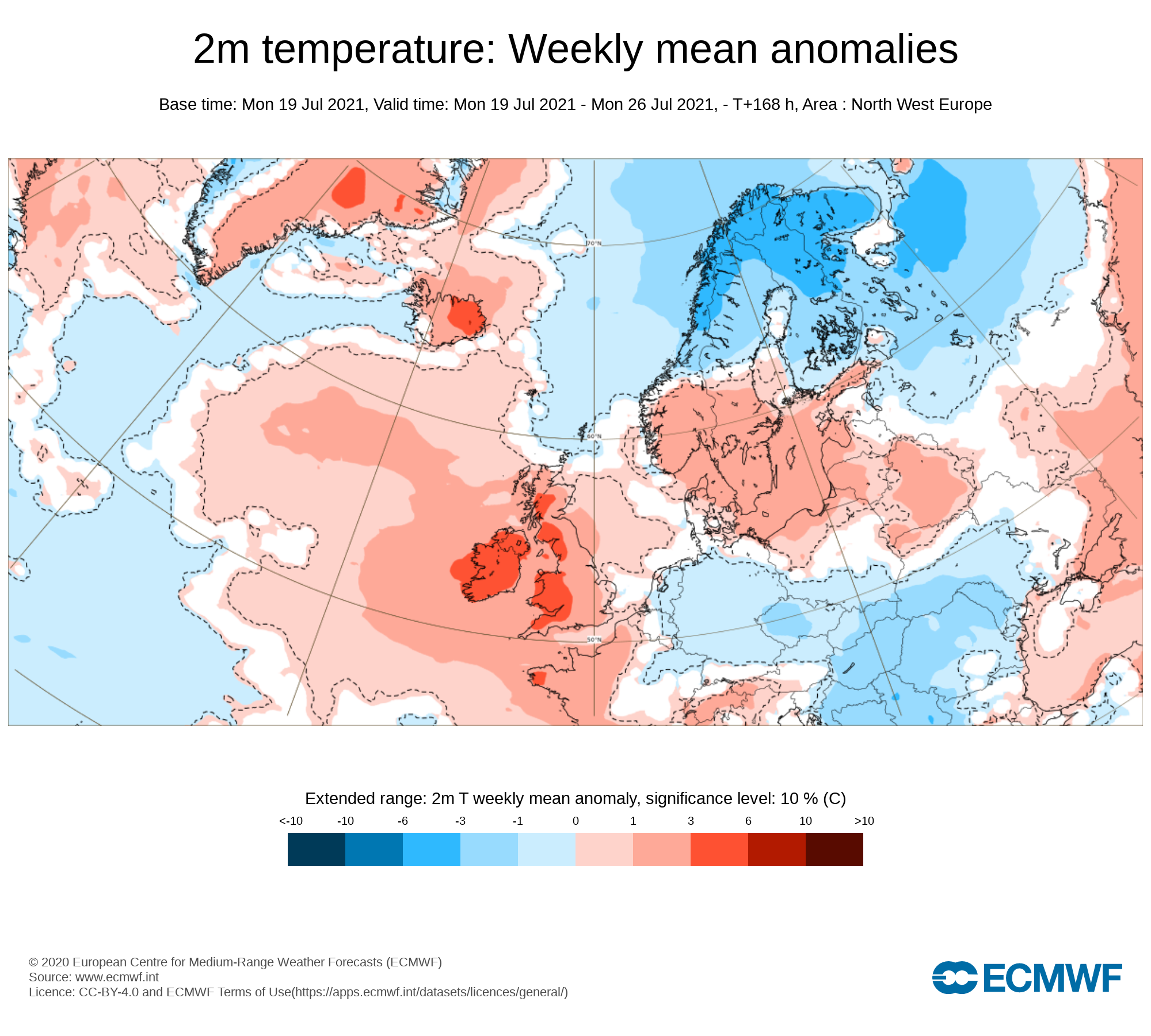
Temperature: Weekly mean anomalies
Well above average temperatures are expected across Ireland over the coming week especially over the middle and end of the week
7 day temperature forecast
Tuesday - 23°C to 31°C
Wednesday - 23°C to 31°C ( 31°C to 34°C locally possible in places inland)
Thursday - 25°C to 30°C ( 30°C to 34°C locally possible in places inland)
Friday - 24°C to 30°C
Saturday - 19°C to 26°C
Sunday - 19°C to 25°C
Monday - 17°C to 23°C
Night time temperatures will be warm Wednesday night & Thursday night highs around 17C to 21C. It will be very humid and uncomfortably warm at night.
🟠Status Orange - High Temperature warning for Cavan, Monaghan, south Leitrim, Roscommon, Longford, Westmeath
🟠Amber - Heat warning for Antrim, Armagh, Down, Fermanagh, Tyrone, Derry
🟡Status Yellow - High Temperature warning for Ireland
Wind forecast
There are no risk of any strong winds this week.
UV forecast
⚠ ALERT - UV levels will be very high over the end of the week, this weekend and early next week
Pollen Forecast
Pollen levels will be high to very high over the week with pollen levels lowest during cloudy and wet weather and highest during any sunny & dry periods. The main type of pollen will be grass this week.
Pollen levels could increase to very high the end of this week and over this weekend for all areas
Dust forecast
Dust levels are due to increase over the end of the week and weekend as that Azores high move northwards bring a increase across Ireland. Levels should remain below moderate levels not having any impact on people with breathing difficulties.

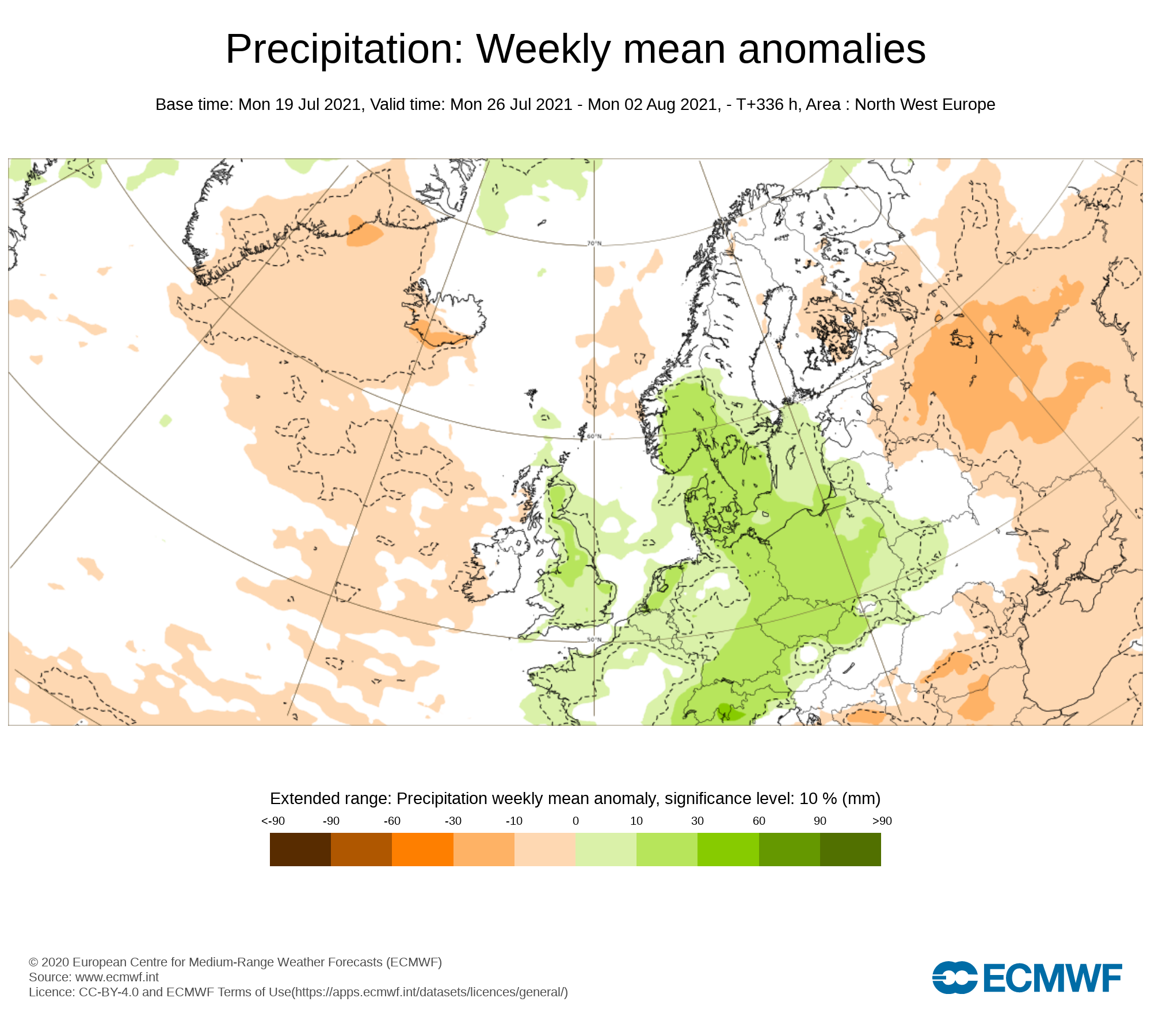
Week 2 - Monday 26th July 2021 -Monday 2nd August 2021
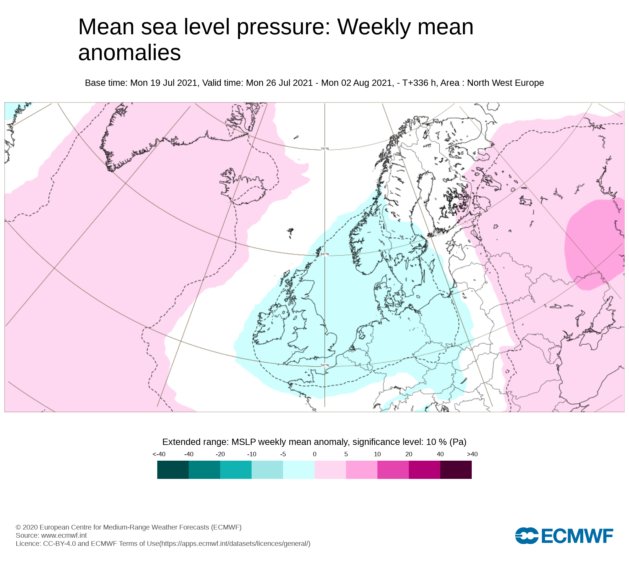
Mean sea level pressure: Weekly mean anomalies
Week 2 next week will start of with high pressure across Ireland but high pressure is forecast to to not be as strong across the country which will mean some rain returning to the forecast
Precipitation ( Rainfall): Weekly mean anomalies
Overall rainfall amounts look like the will be below average over week 2 and over the last few days of July. There will be some showers at times but some good dry weather also at stages over the week in place.
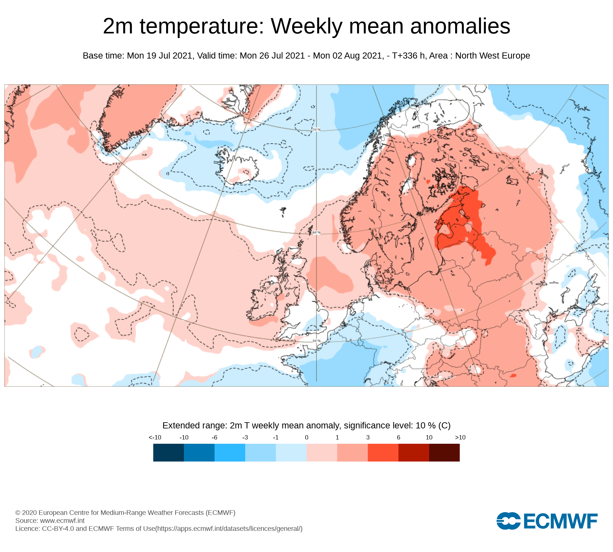
2m temperature: Weekly mean anomalies
Temperatures next week over week 2 are forecast to be in the high teens to low 20s possibly reaching into the mid 20s in a few places but overall a cooler week than week 1
Wind Forecast
There are no signs of any strong winds during week 2.
UV forecast
UV levels will be high to very high in any sunshine with the risk of sun burn.
Pollen Forecast
Pollen levels will be high to to very high over the week with pollen levels lowest during cloudy and wet weather and highest during any sunny dry periods. Grass pollen will be the main type.
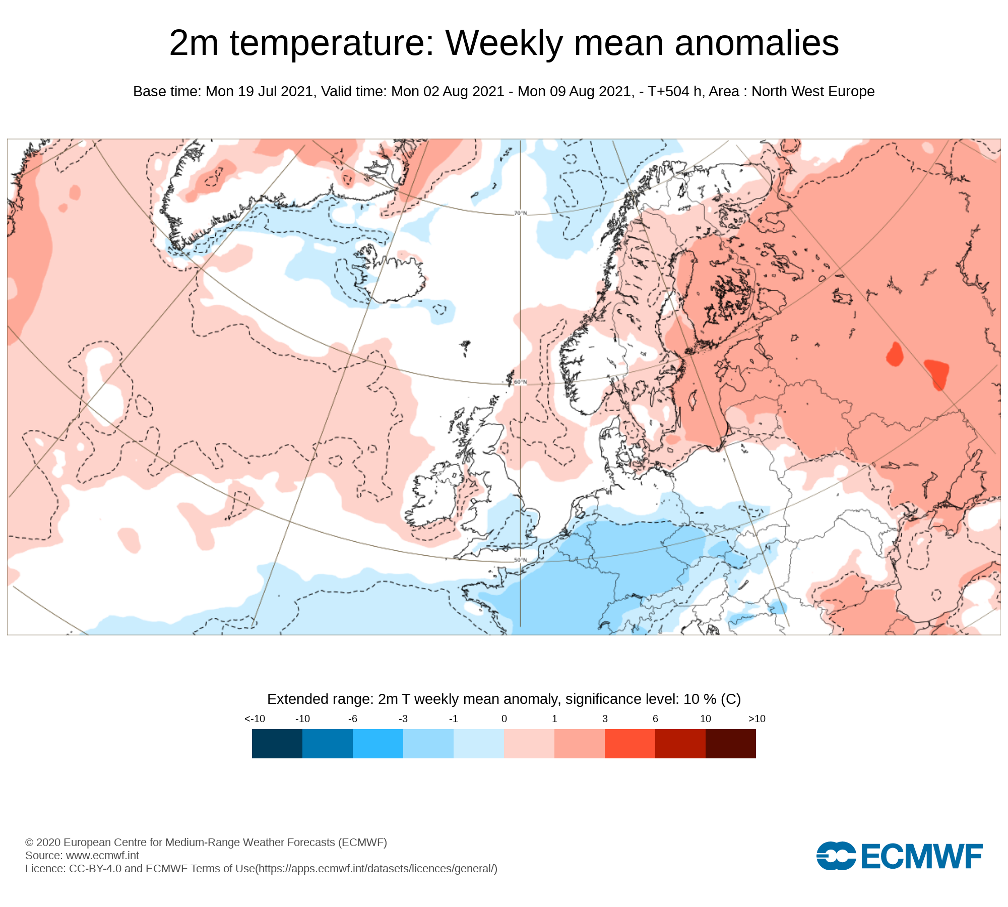
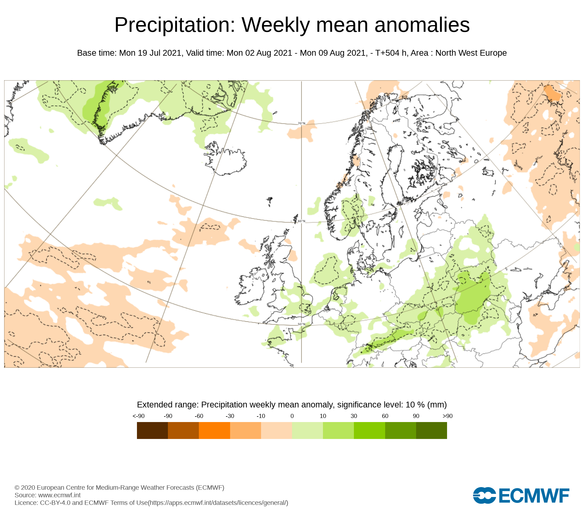
Week 3 - Monday 2nd July 2021 -Monday 9th August 2021
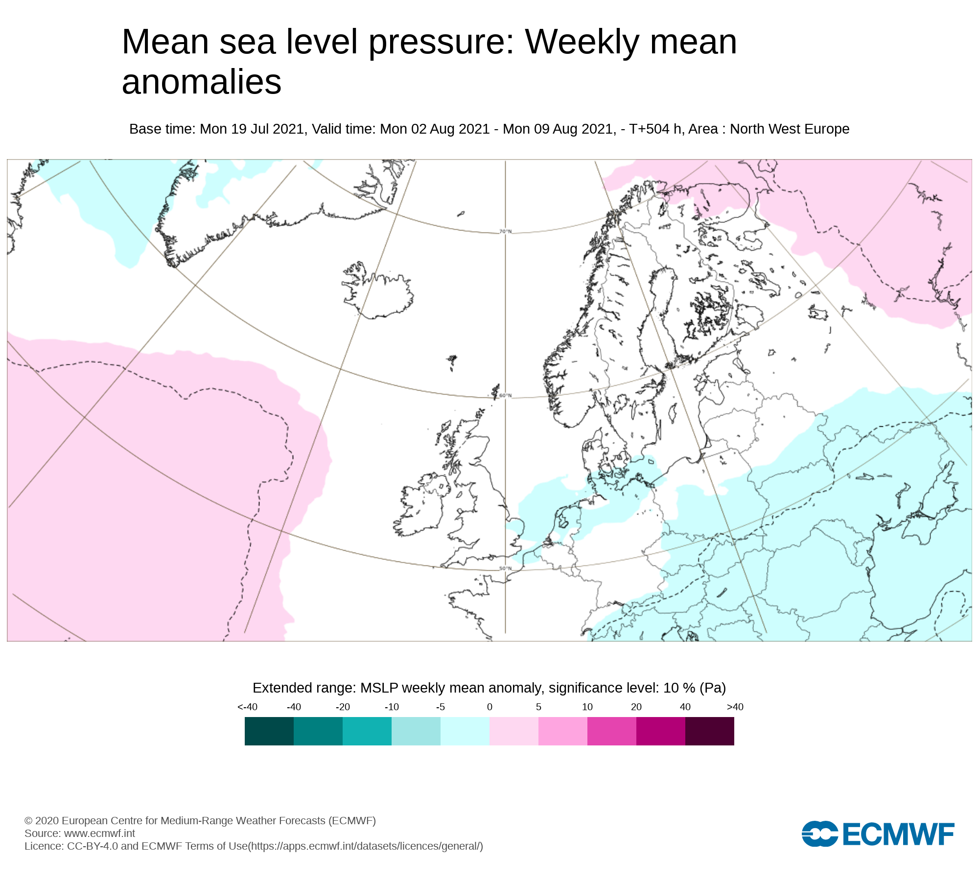
Mean sea level pressure: Weekly mean anomalies
A little more unsettled this week with perhaps low pressure giving the risk of more rain but there area no real clear indcations at the moment what will happen this week
Precipitation ( Rainfall): Weekly mean anomalies
The latest forecast of for near normal rainfall amounts this week with showery weather at times but this is not fully clear as of yet.
2m temperature: Weekly mean anomalies
Temperatures are forecast to be near normal over week 3 in the mid to high teens possibly into the low 20s in a few places.
Wind forecast
There are no strong signals for windy conditions over week 3
UV forecast
UV levels will be High to very high in any sunshine with the risk of sun burn.
Pollen forecast
Pollen levels will be moderate to high over the week with pollen levels lowest during cloudy and wet weather and highest during any sunny dry periods. Grass pollen will be the main type
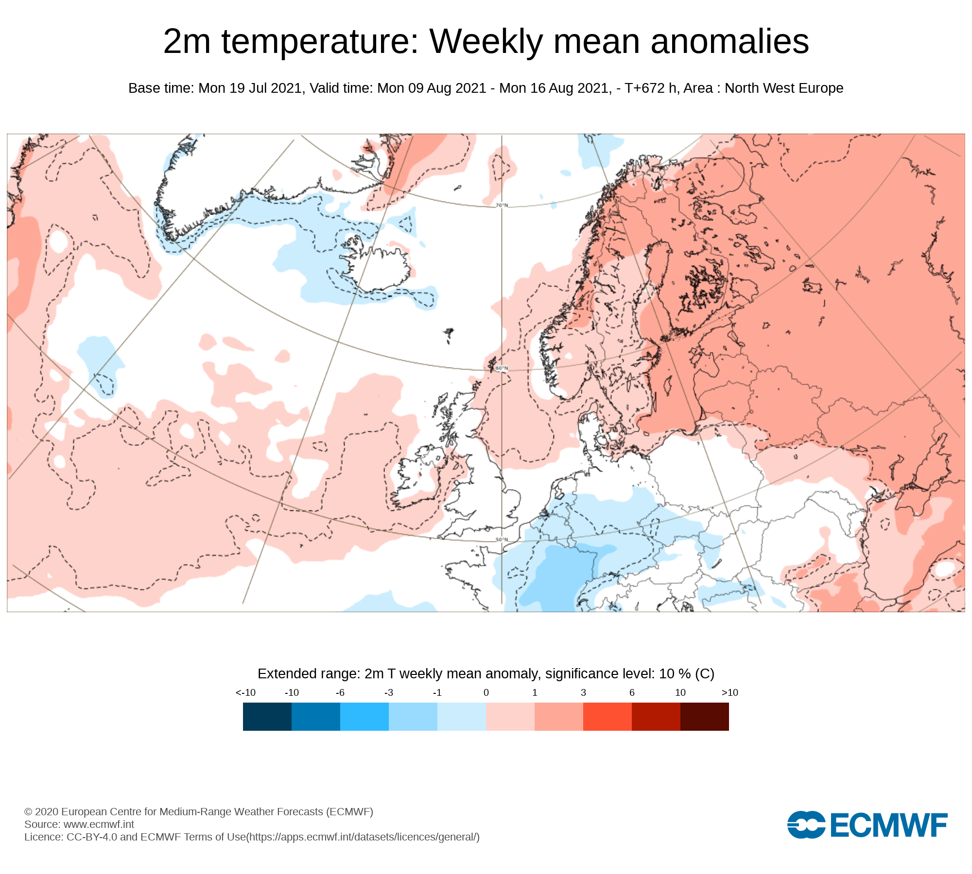
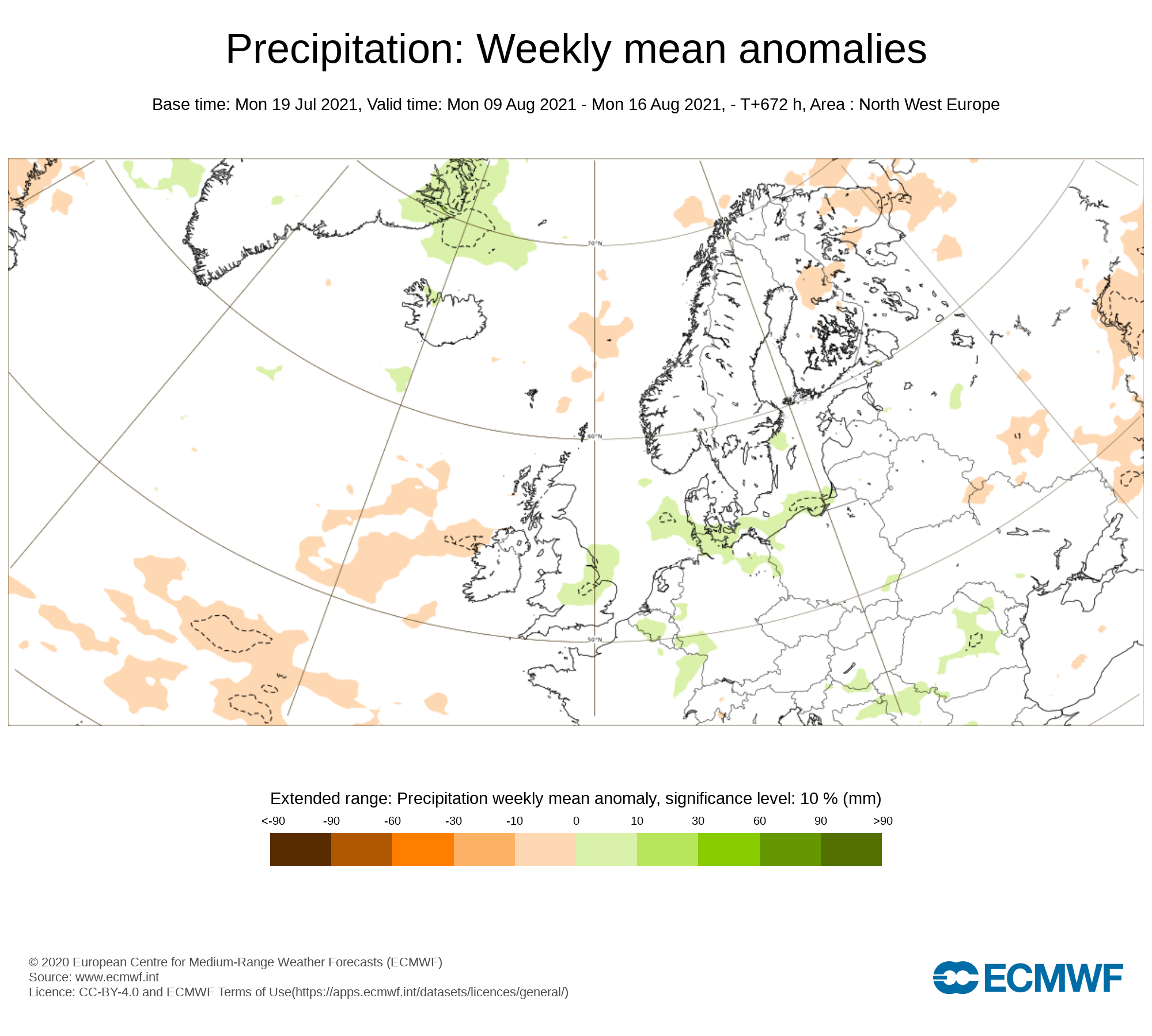
Week 4 - Monday 9th August 2021 - Monday 16th August 2021
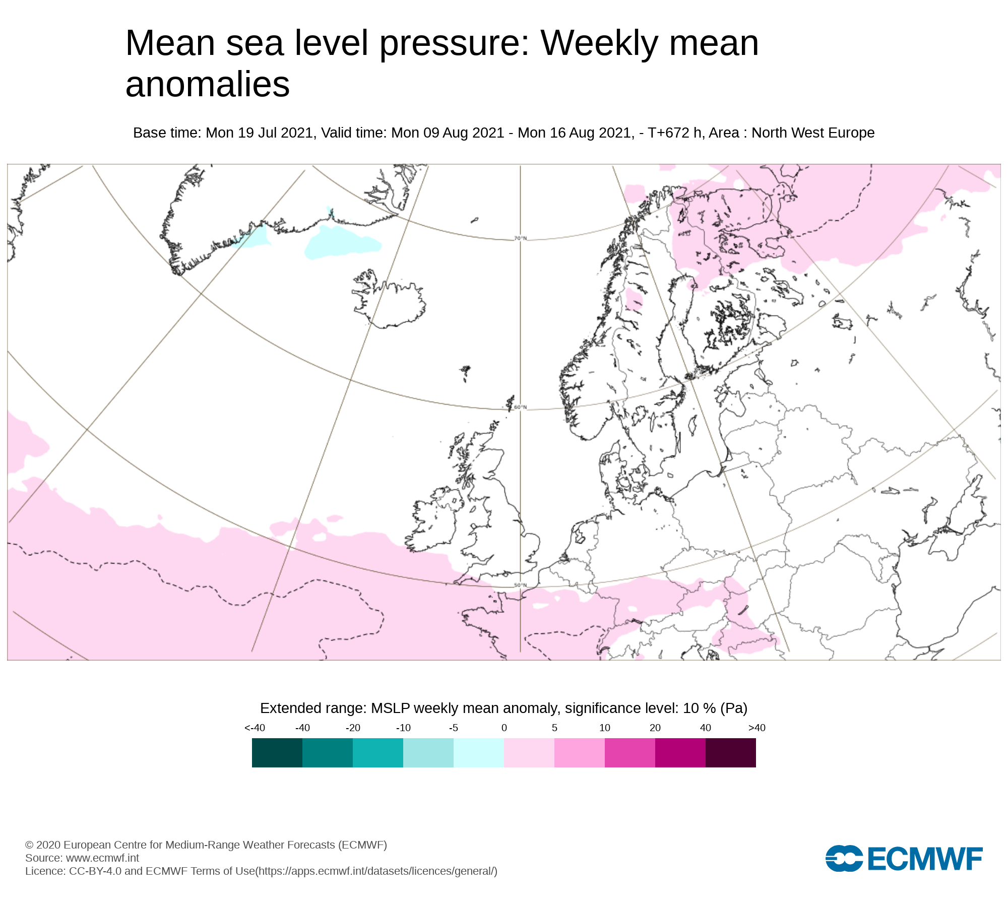
Mean sea level pressure: Weekly mean anomalies
Signals are very weak for week 4 but there are signs that high pressure may move across Ireland again turning things more settled.
Precipitation ( Rainfall): Weekly mean anomalies
Rainfall amounts are forecast to below average this week with a return of drier weather around mid August
2m temperature: Weekly mean anomalies
Temperatures this week are mostly likely to be near normal or just above possibly around the high teens to low 20s and that bit higher in some areas.
Wind forecast
There area no strong winds signaled for this week
UV forecast
UV levels will be Moderate to high in any sunshine with the risk of sun burn even with cooler weather as the sun this time of year is stronger.
Pollen forecast
Pollen levels will be Moderate to high and possible very high over the week with pollen levels lowest during cloudy and wet weather and highest during any sunny dry periods. Grass pollen the main type


