
Monthly Long Range Forecast Update Ireland - 7th July until 2nd August 2021

The Donegal Weather Channel Monthly Long range forecast issued every week looking up to a month ahead using data from the ECMWF and GFS models.
Please note that the longer range forecasts are more uncertain and should not be used to plan outside activities from over a week out.
Extended Range Output
The output is rather different from the shorter period output of HRES and ENS products. It provides a more general overview of the forecast up to Day 46, focusing mainly on the week-to-week changes in the weather rather than attempting to give unsupportable detail on individual days. Output is mostly in the form of anomalies relative to ER-M-climate and is mainly shown as 7-day means for calendar weeks Monday-Sunday. Specialised products for the extended range also include information on potential tropical cyclone activity and the MJO during the coming month.
SPONSOR THE LONG RANGE FORECAST
If you have a business and would like to sponsor our weekly month long range forecast for a period of 1 week or 1 month please do contact Donegal Weather Channel at info@donegalweatherchannel.ie or message our Facebook page . Donegal Weather Channels service relies on sponsorship/advertising. Without sponsorship/advertising Donegal Weather Channel would not be able to give so many hours and a daily service.

The forecast will be issued by myself Kenneth and i will try to keep it simple making it easy for everyone to understand. If there is a term I use in the forecast which you may not know what it means I will explain what I am talking about .
Before I start with the long range forecast I will just explain what we will be looking at and how the forecast will work.
The forecast will be broken up into 4 section Example below :
Week 1 - Monday 5th July 2021 -Monday 12th July 2021
Week 2 - Monday 12th July 2021 -Monday 19th July 2021
Week 3 - Monday 19th July 2021 -Monday 26th July 2021
Week 4 - Monday 26th July 2021 -Monday 2nd August 2021
Things we will look at in the forecast:
Mean sea level pressure: Weekly mean anomalies
2m temperature: Weekly mean anomalies
Wind
Precipitation: Weekly mean anomalies (eg. rainfall and snowfall for a example.
Dust forecast ( Only in Week 1)
UV forecast outlook
Potential Pollen Levels

Forecaster - Kenneth Mc Donagh
Week 1 - Monday 5th July 2021 -Monday 12th July 2021
Mean sea level pressure: Weekly mean anomalies
Week 1 this week will see lower than average pressure dominate the weather across Ireland which will bring showery weather at time with the weather on the more unsettled and cloudy side.
Precipitation ( Rainfall ): Weekly mean anomalies
Rainfall amounts over the week gone by where above average across the north, west and midlands. Southern and eastern parts of Ireland where drier than normal for this time of year. Much of the rain in the last 7 days fell on Sunday when heavy showers give some localised flooding with heavy thundery falls. highest accumulations were recorded in Shannon, with 45 mm, lowest accumulations were recorded at Johnstown Castle, with 9 mm.
Further showery rain is expected up until the at least early next week with rainfall amounts near normal
Some scattered showers on Wednesday to start but becoming drier over the afternoon and evening with some bright or sunny spells in places but also a lot of cloud in areas also.
Further scattered showers and patches of drizzle on Thursday these most frequent in the west, midlands and northwest during the morning and early half of the afternoon but drier weather towards evening in places.
Further scattered showers during Friday with some of these heavy and possibly thundery across the southwest and south during the afternoon and evening, Elsewhere there will be a mix of scattered showers with some bright and sunny spells in between. Best of any sunshine in the evening across the northern half of Ireland
Scattered showers on Saturday across Ireland but also some nice sunny spells these best in the northern half of Ireland.
Heavy showers on Sunday across the country with the risk of some thunderstorms.
Rainfall amounts between Wednesday 7th July to Sunday 11th July 2021
ULSTER
Rainfall amounts will range between 2mm to 25mm with the most rain across west Ulster and least amounts in eastern parts.
CONNACHT
Across Connacht rainfall amounts will range between 5mm to 25mm with much the highest totals across west and north Connacht and the least amounts across south and southeast Connacht.
MUNSTER
Again rainfall amounts will range between 5mm to 25mm across Munster with much of the provenance receiving over 5mm of rain by the weekend. Highest totals over the southwest and south of Munster with the lowest totals across northeast Munster
LEINSTER
Rainfall amounts across Leinster will range between 2mm to 20mm with the highest totals across south Leinster and lowest totals across north Leinster
Temperature: Weekly mean anomalies
Temperatures over the week will range between 15C to 22C. It will be warmest in the south and east of Ireland on Wednesday and Thursday but winds turning south to southeast on Friday to Sunday will see the warmest weather across west and north of the country. The warmest day looks set to be Saturday with max temperatures of around 22C to 23C in the west, north and midlands.
Wind forecast
There are no risk of any strong winds this week.
UV forecast
UV levels this week will be high to very high in places in sunshine
Pollen Forecast
Pollen levels will be high to very high over the week with pollen levels lowest during cloudy and wet weather and highest during any sunny & dry periods. The main type of pollen will be grass this week.
Pollen levels could increase to very high this weekend in places
Dust forecast
Dust levels will be low across Ireland during week 1.
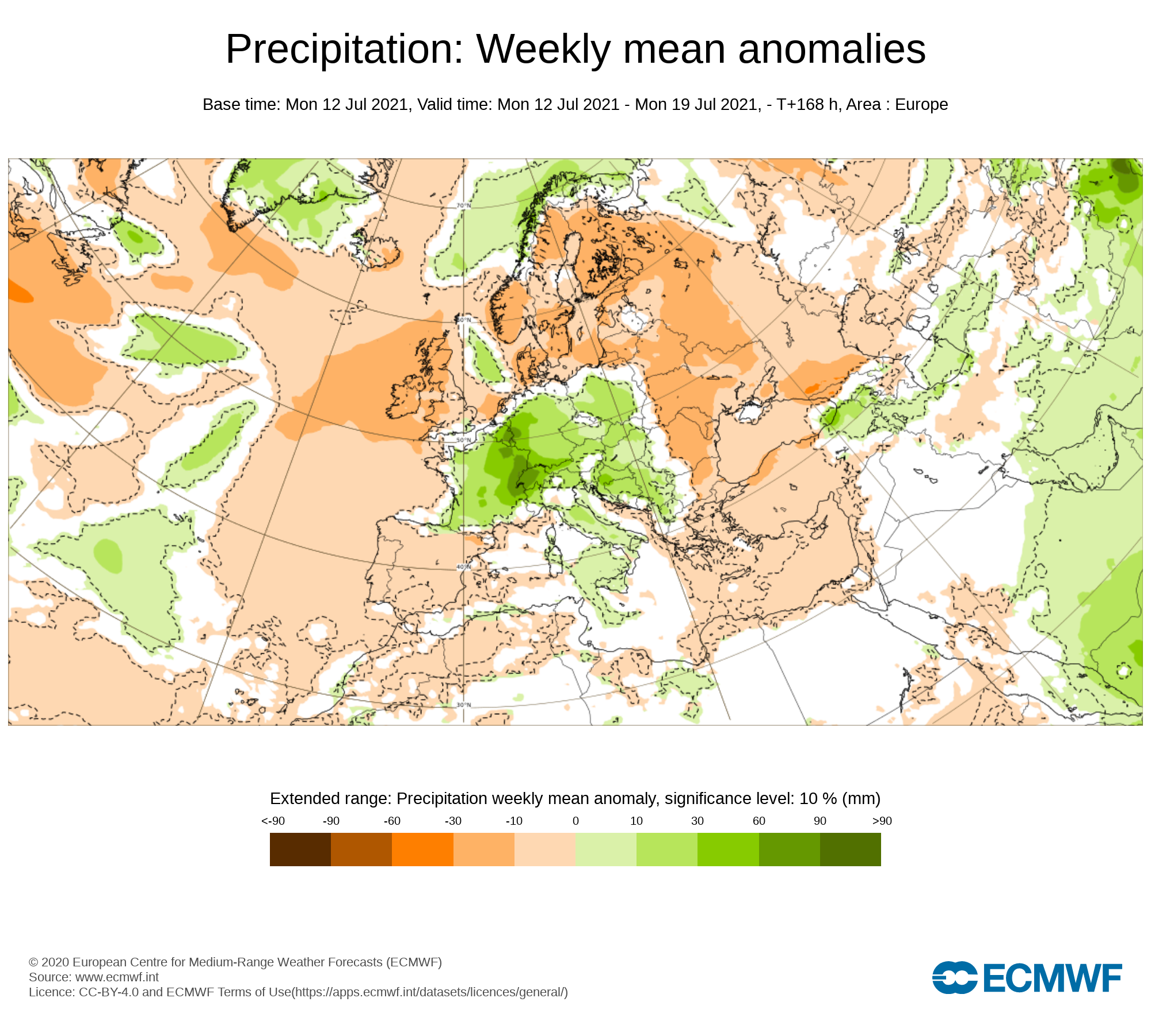
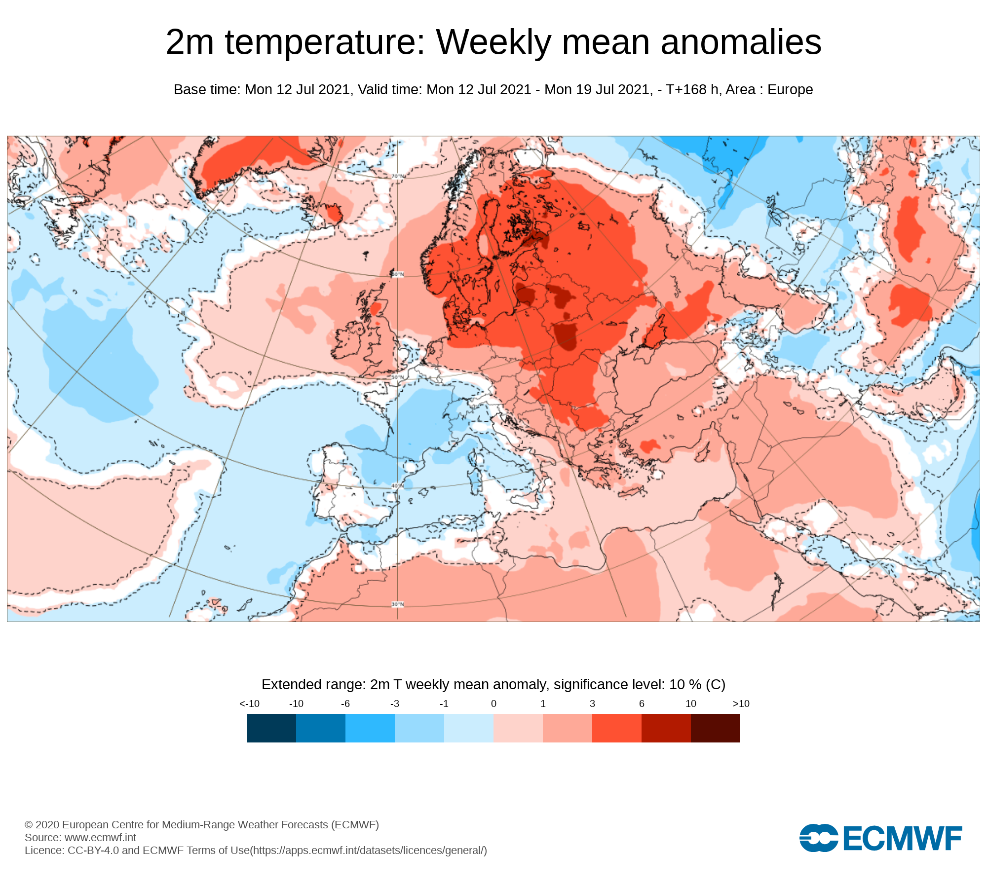
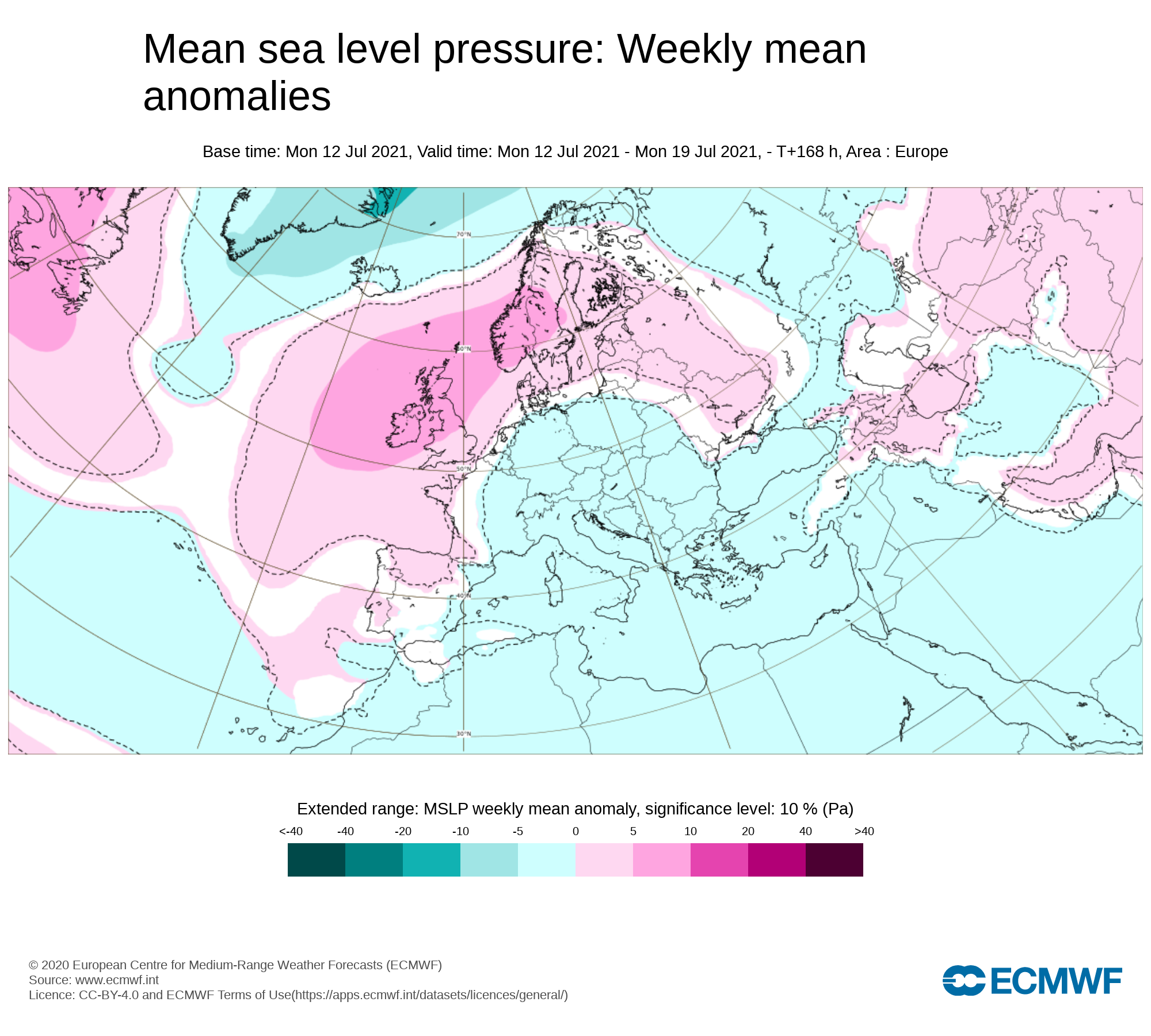
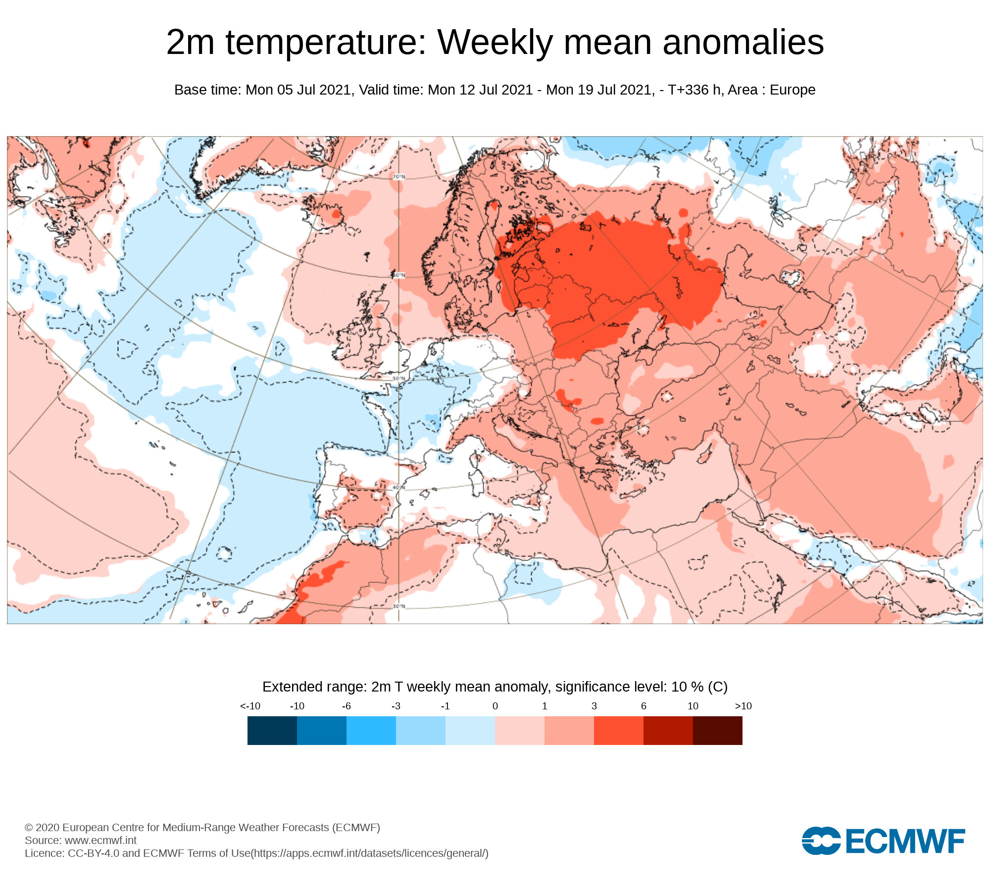
Week 2 - Monday 12th July 2021 -Monday 19th July 2021
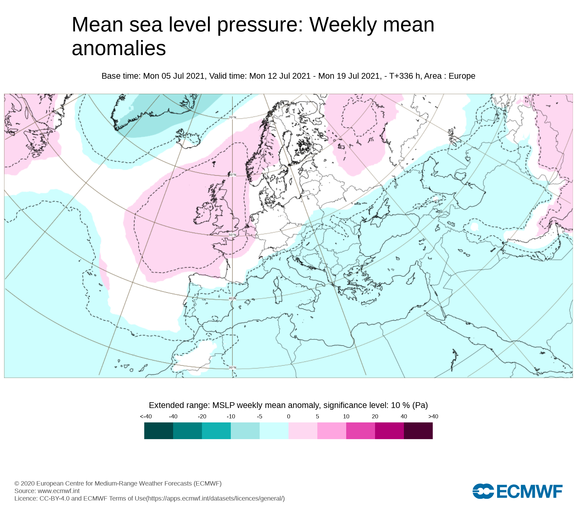
Mean sea level pressure: Weekly mean anomalies
Week 2 next week will start of with some showers some that could be heavy with thunderstorms but over the week there are some signals for a Azores high pressure system to build from the south/southwest of the country reaching Ireland later next week & weekend.
Precipitation ( Rainfall): Weekly mean anomalies
With higher pressure currently looking like it will build at some stage later next week into next weekend this will also mean rainfall amounts been below average across much of the country. Much of the rain during week 2 may come from heavy thundery showers early next weekend with a improving trend the from mid week next week.
2m temperature: Weekly mean anomalies
With higher pressure building from the south and southwest it should also see a rise in temperatures into the mid 20s at least in places with above average temperatures for many. The positioning of the high pressure system would determine which areas sees the warmest weather.
Wind Forecast
There are no signs of any strong winds during week 2.
UV forecast
UV levels will be high to very high in any sunshine with the risk of sun burn.
Pollen Forecast
Pollen levels will be high to to very high over the week with pollen levels lowest during cloudy and wet weather and highest during any sunny dry periods. Grass pollen will be the main type.
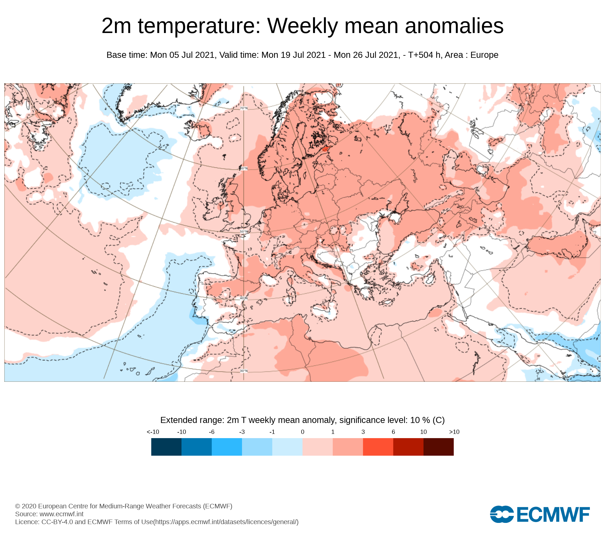
Week 3 - Monday 19th July 2021 -Monday 26th July 2021
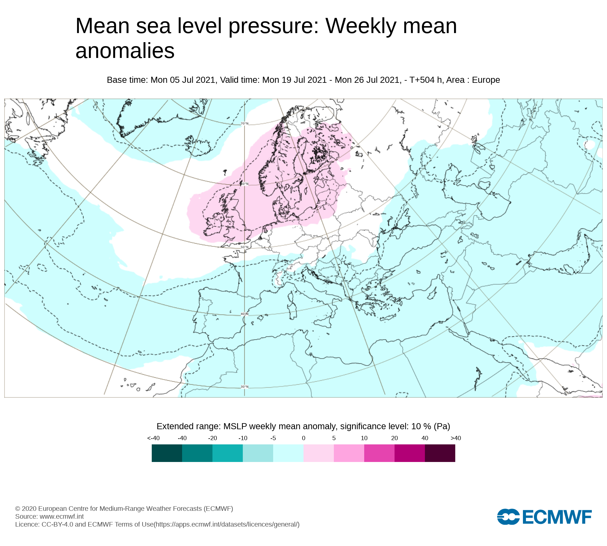
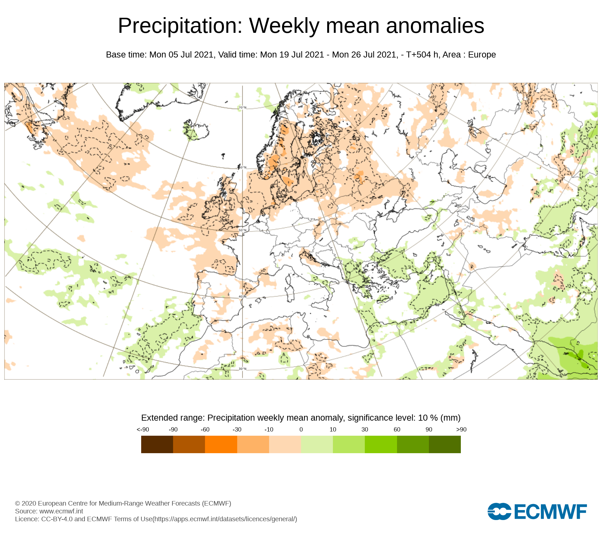
Mean sea level pressure: Weekly mean anomalies
At week 3 there there is some uncertainty but the latest forecast is for higher pressure than average Ireland with settled weather across the country
Precipitation ( Rainfall): Weekly mean anomalies
Rainfall amounts are also forecast at present to be below average for this week.
2m temperature: Weekly mean anomalies
Temperatures are also forecast to be above average across Ireland during week 3 with warm conditions.
Wind forecast
There are no strong signals for windy conditions over week 3
UV forecast
UV levels will be High to very high in any sunshine with the risk of sun burn.
Pollen forecast
Pollen levels will be high to very high over the week with pollen levels lowest during cloudy and wet weather and highest during any sunny dry periods. Grass pollen will be the main type
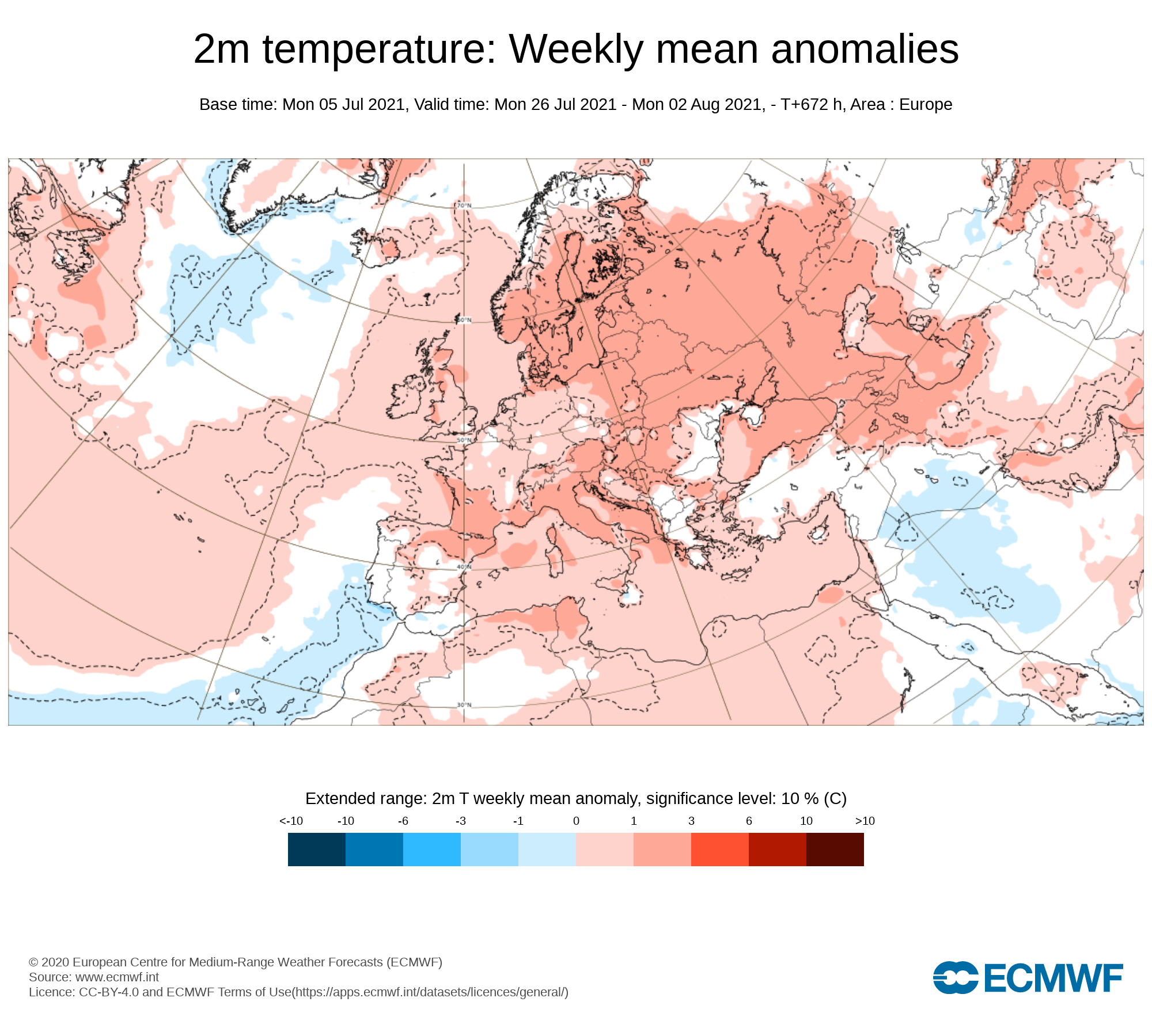
Week 4 - Monday 26th July 2021 -Monday 2nd August 2021
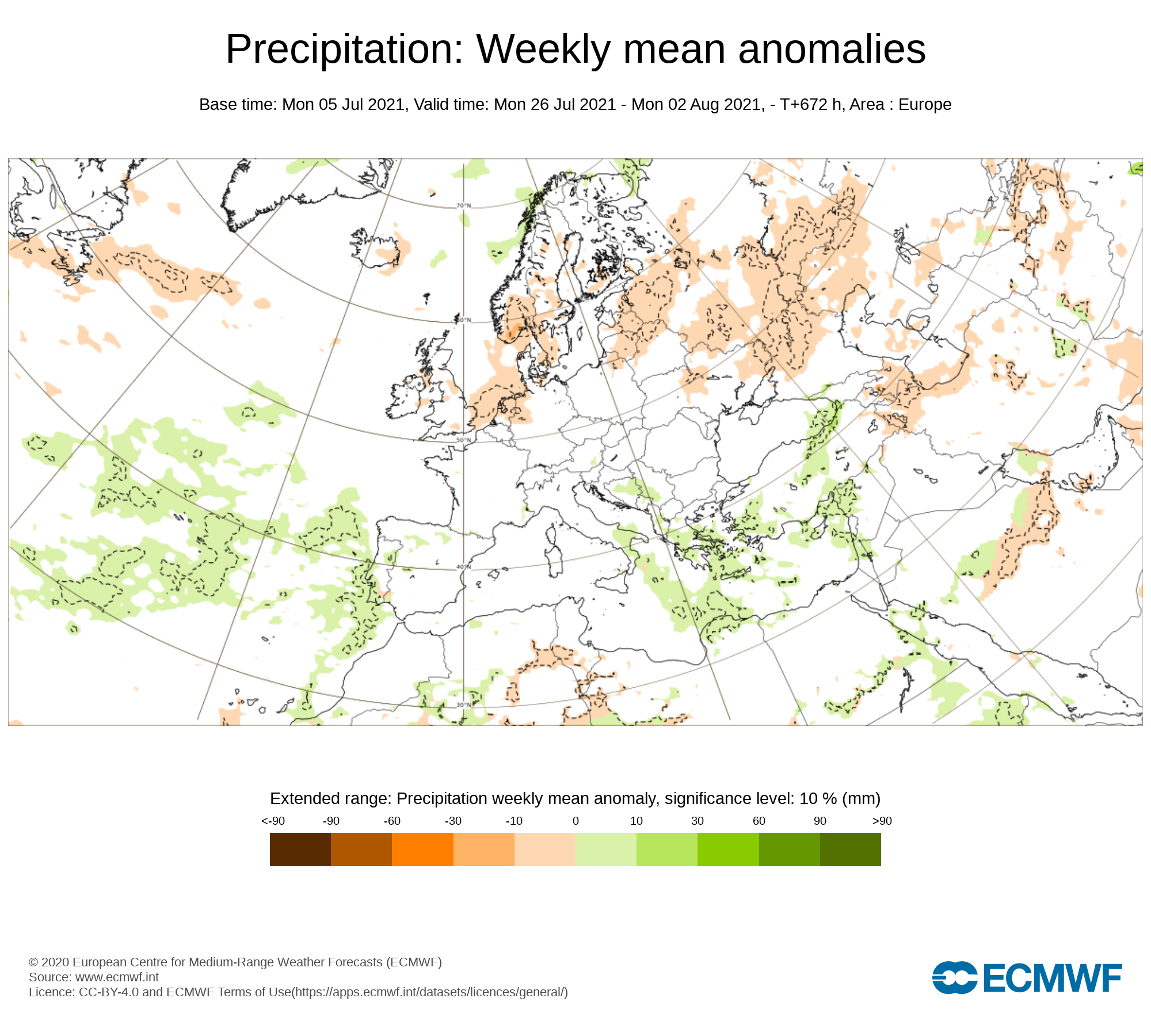
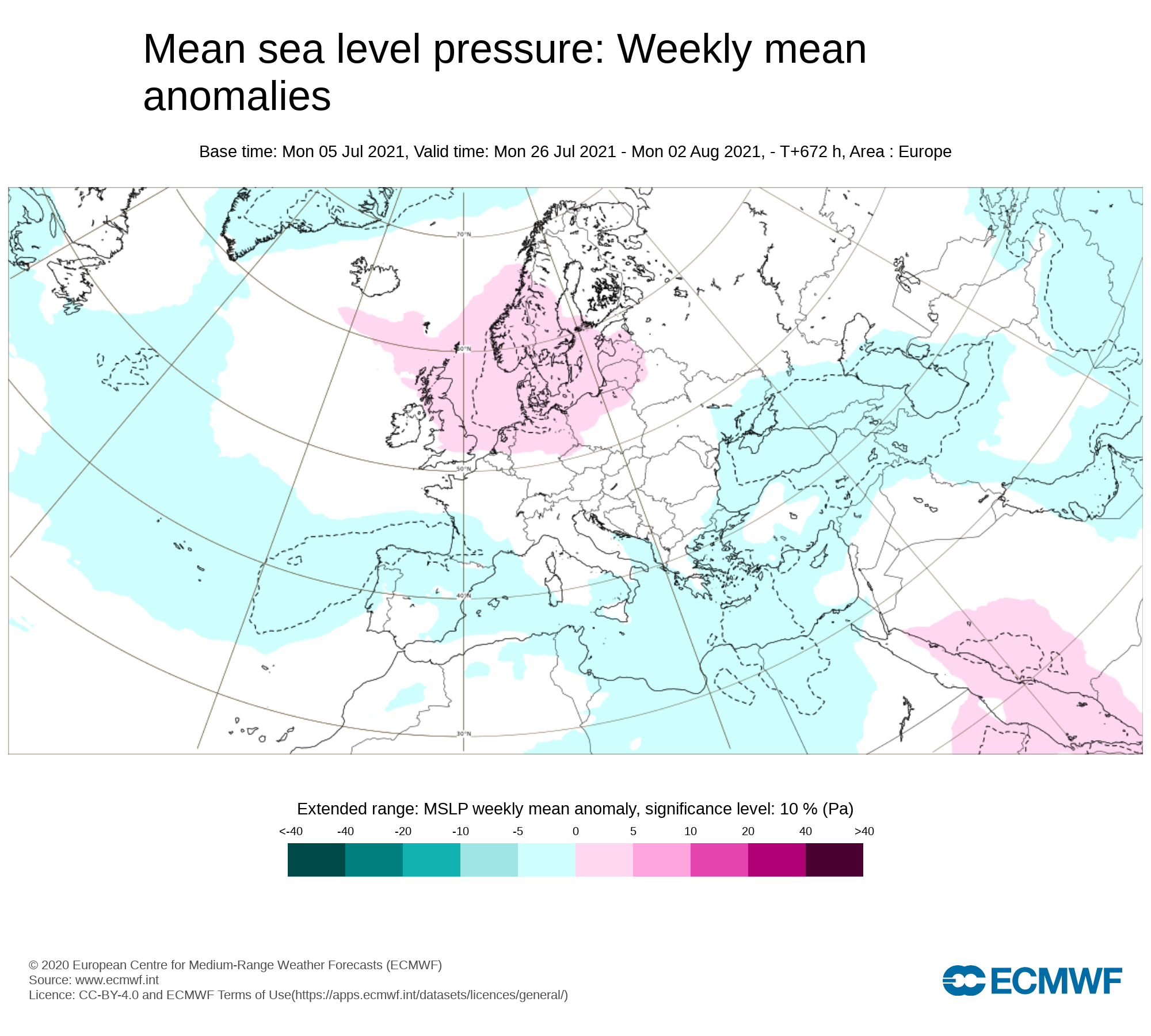
Mean sea level pressure: Weekly mean anomalies
There area no strong signals for this week as higher pressure is signaled to the east of Ireland and lower pressure to the west with Ireland possibly sitting somewhere between both.
Precipitation ( Rainfall): Weekly mean anomalies
Some areas may see drier than normal weather but some places also could be at risk of seen average rainfall amounts.
2m temperature: Weekly mean anomalies
Temperatures are forecast to be above average with warm conditions for week 4.
Wind forecast
There area no strong winds signaled for this week
UV forecast
UV levels will be High to very high in any sunshine with the risk of sun burn even with cooler weather as the sun this time of year is stronger.
Pollen forecast
Pollen levels will be high to very high and possible very high over the week with pollen levels lowest during cloudy and wet weather and highest during any sunny dry periods. Grass pollen the main type


