
Monthly Long Range Forecast Update Ireland - 31st May 2021

Warmer and drier weather this weekend expected across Ireland
The Donegal Weather Channel Monthly Long range forecast issued every week looking up to a month ahead using data from the ECMWF and GFS models.
Please note that the longer range forecasts are more uncertain and should not be used to plan outside activities from over a week out.
Extended Range Output
The output is rather different from the shorter period output of HRES and ENS products. It provides a more general overview of the forecast up to Day 46, focusing mainly on the week-to-week changes in the weather rather than attempting to give unsupportable detail on individual days. Output is mostly in the form of anomalies relative to ER-M-climate and is mainly shown as 7-day means for calendar weeks Monday-Sunday. Specialised products for the extended range also include information on potential tropical cyclone activity and the MJO during the coming month.
SPONSOR THE LONG RANGE FORECAST
If you have a business and would like to sponsor our weekly month long range forecast for a period of 1 week or 1 month please do contact Donegal Weather Channel at info@donegalweatherchannel.ie or message our Facebook page . Donegal Weather Channels service relies on sponsorship/advertising. Without sponsorship/advertising Donegal Weather Channel would not be able to give so many hours and a daily service.

The forecast will be issued by myself Kenneth and i will try to keep it simple making it easy for everyone to understand. If there is a term I use in the forecast which you may not know what it means I will explain what I am talking about .
Before I start with the long range forecast I will just explain what we will be looking at and how the forecast will work.
The forecast will be broken up into 4 section Example below :
Week 1 - Monday 31st May 2021 -Monday 7th June 2021
Week 2 - Monday 7th June 2021 -Monday 14th June 2021
Week 3 - Monday 14th June 2021 -Monday 21st June 2021
Week 4 - Monday 21st June 2021 -Monday 28th June 2021
Things we will look at in the forecast:
Mean sea level pressure: Weekly mean anomalies
2m temperature: Weekly mean anomalies
Wind
Precipitation: Weekly mean anomalies (eg. rainfall and snowfall for a example.
Dust forecast ( Only in Week 1)
UV forecast outlook
Potential Pollen Levels

Forecaster - Kenneth Mc Donagh
Week 1 - Monday 31st May 2021 -Monday 7th June 2021
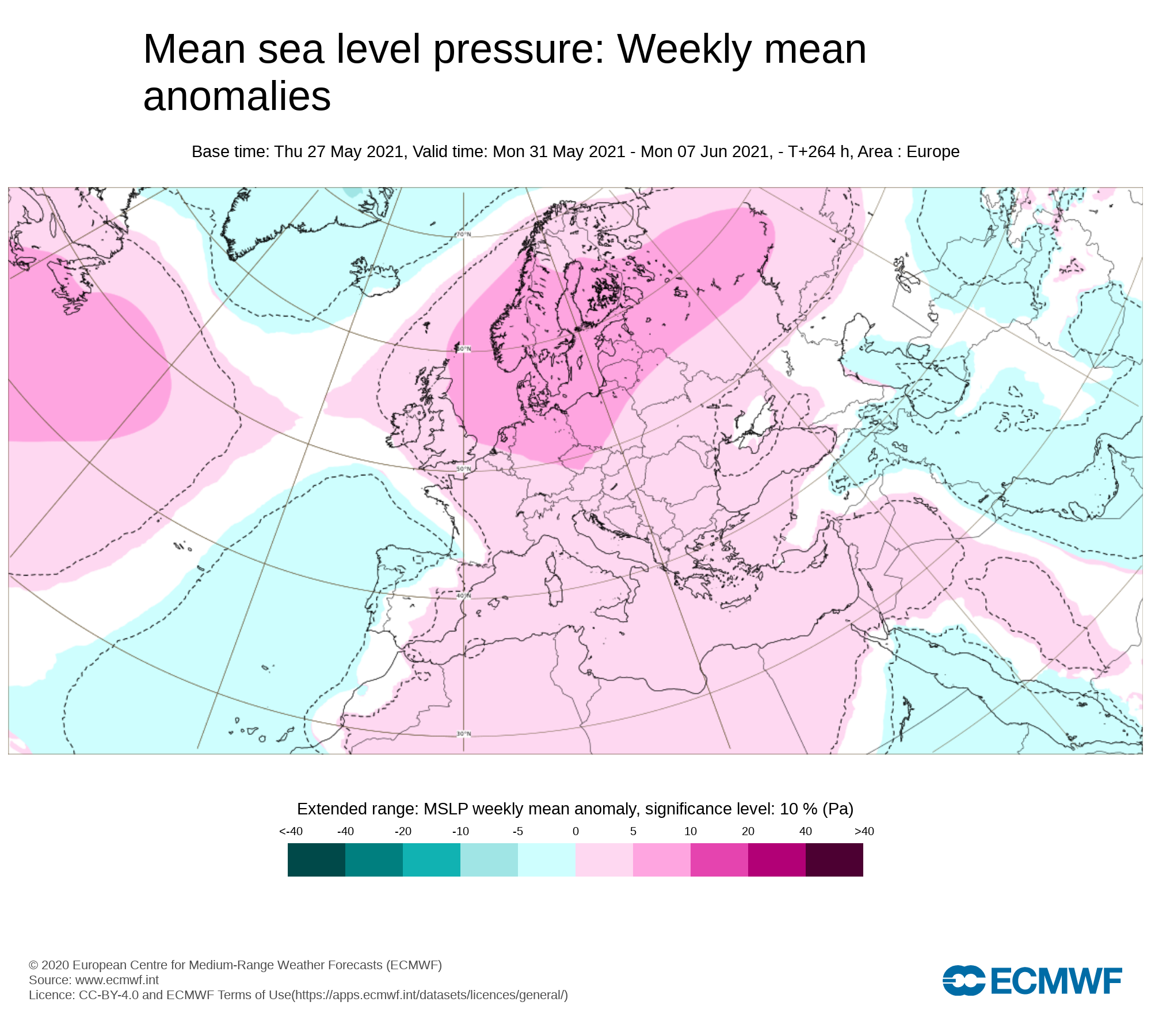
Mean sea level pressure: Weekly mean anomalies
Higher pressure than average across Ireland early this week but a area of low pressure will move northwards across Ireland on Wednesday moving out of the Bay of Biscay. Towards the end of the week and into this weekend higher pressure building again across Ireland.
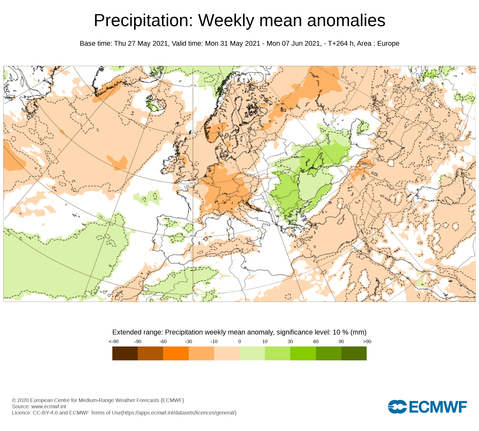
Precipitation ( Rainfall ): Weekly mean anomalies
Much of Ireland will see below average rainfall amounts this week with the northern half of Ireland recording the lowest rainfall amounts over the week just gone by with north Donegal been the driest part of Ireland with only 6mm of rain recorded at Malin Head. Parts of west Munster and west Connacht will see average or just below average rainfall amounts this week.
The wettest day this week will be Wednesday with a interesting setup as an area of low pressure look set to track northwards over Ireland moving out of the bay of Biscay bringing heavy rain and showers. With such a set up it may bring a risk of elevated thunderstorm across Ireland. This weather set up is known as a Spanish plume. The Spanish Plume is a weather pattern in which a plume of warm air moves from the Iberian plateau or the Sahara to northwest Europe giving rise to severe thunderstorms. This meteorological pattern can lead to extreme high temperatures and intense rainfall during the summer months, with potential for flash flooding & damaging hail storms. The latest set up looks like a low scale plume but if we had this in the middle of June, July or August it would lead to more intense conditions. Donegal Weather Channel will monitor things over the next 48 hours and issue a update in due course.
At present Thursday looks like a mostly dry day for many areas but a few scattered showers may develop in Atlantic coastal counites over the afternoon. Friday will see showery rain move in from the Atlantic moving eastwards across Ireland but fizzling out before it gets into some eastern areas which may stay largely dry but cloudy.
The latest outlook is for a band of rain to cross Ireland on Saturday with a drier day on Sunday with some bright and sunny spells.
Rainfall amounts between Monday 31st May to Sunday 6th June 2021
Ulster - 5mm to 20mm ( Highest amounts in west Ulster over the mountains)
Connacht - 10mm to 40mm ( Highest amounts in west Connacht especially over high ground areas)
Munster - 10 mm to 40mm (Highest amounts west Munster especially across higher ground areas)
Leinster - 5 mm to 30mm (Highest amounts in south Leinster over the mountains)
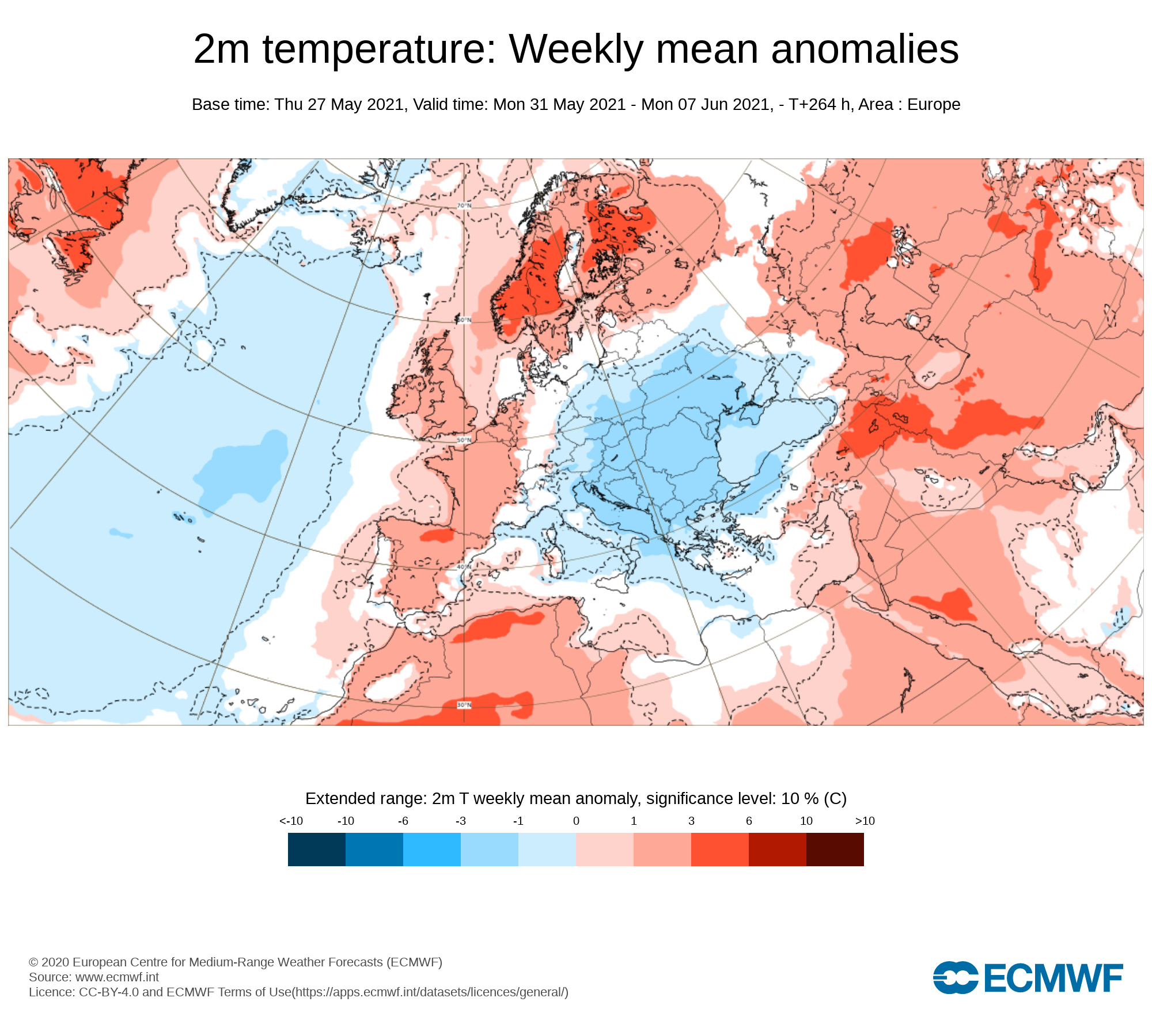
Temperature: Weekly mean anomalies
Temperatures over this week (week 1) will be normal across Ireland. There will be no risk of frost this week . Overall day time temperatures will range between 14C/20C warmest on Monday, Tuesday and Wednesday but a little cooler on Thursday and Friday with temperatures recovering a little over the weekend into the high teens in some places.
Wind forecast
No Strong winds are expected this week.
UV forecast
UV levels will be Moderate to high this week risk of sun burn possible.
Pollen Forecast
Pollen levels will be moderate to high over the week with pollen levels lowest during cloudy and wet weather and highest during any sunny & dry periods. The main type of pollen will be grass this week.
Dust forecast
Dust levels will be low across Ireland during week 1.
Week 2 - Monday 7th June 2021 -Monday 14th June 2021
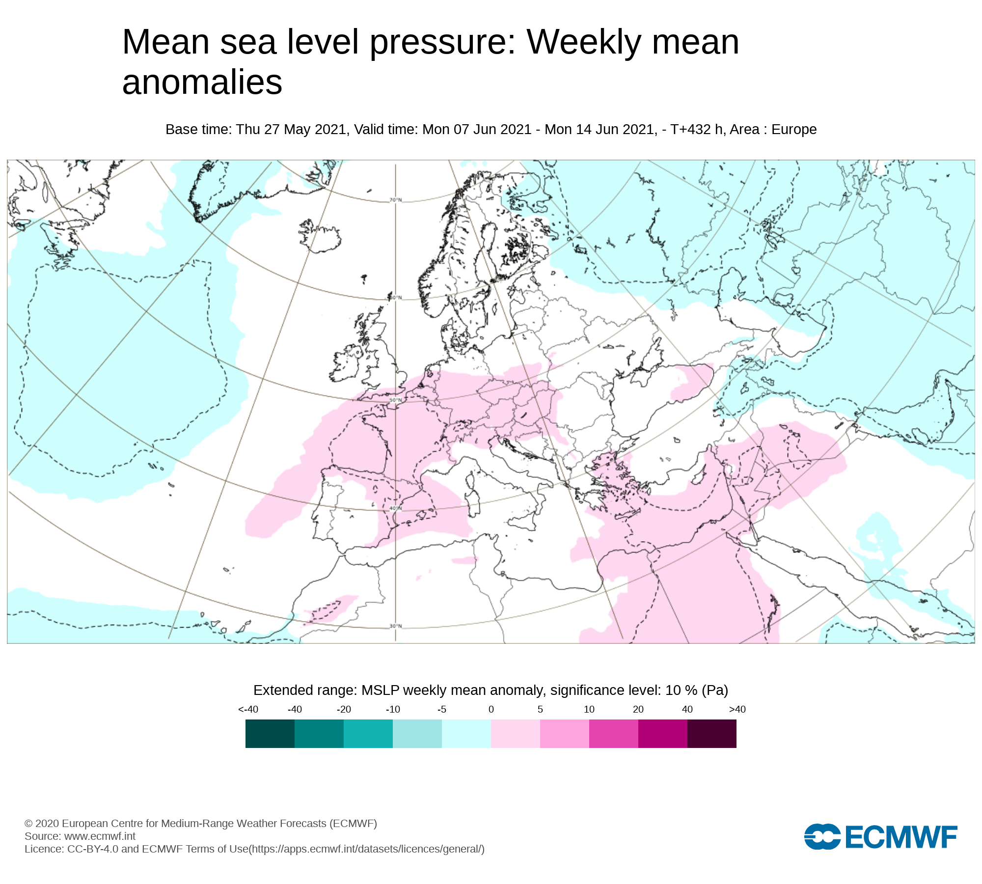
Mean sea level pressure: Weekly mean anomalies
The latest outlook from the ECMWF long range forecast shows higher pressure than normal near Ireland which will keep the weather on the more settled side but not always dry.
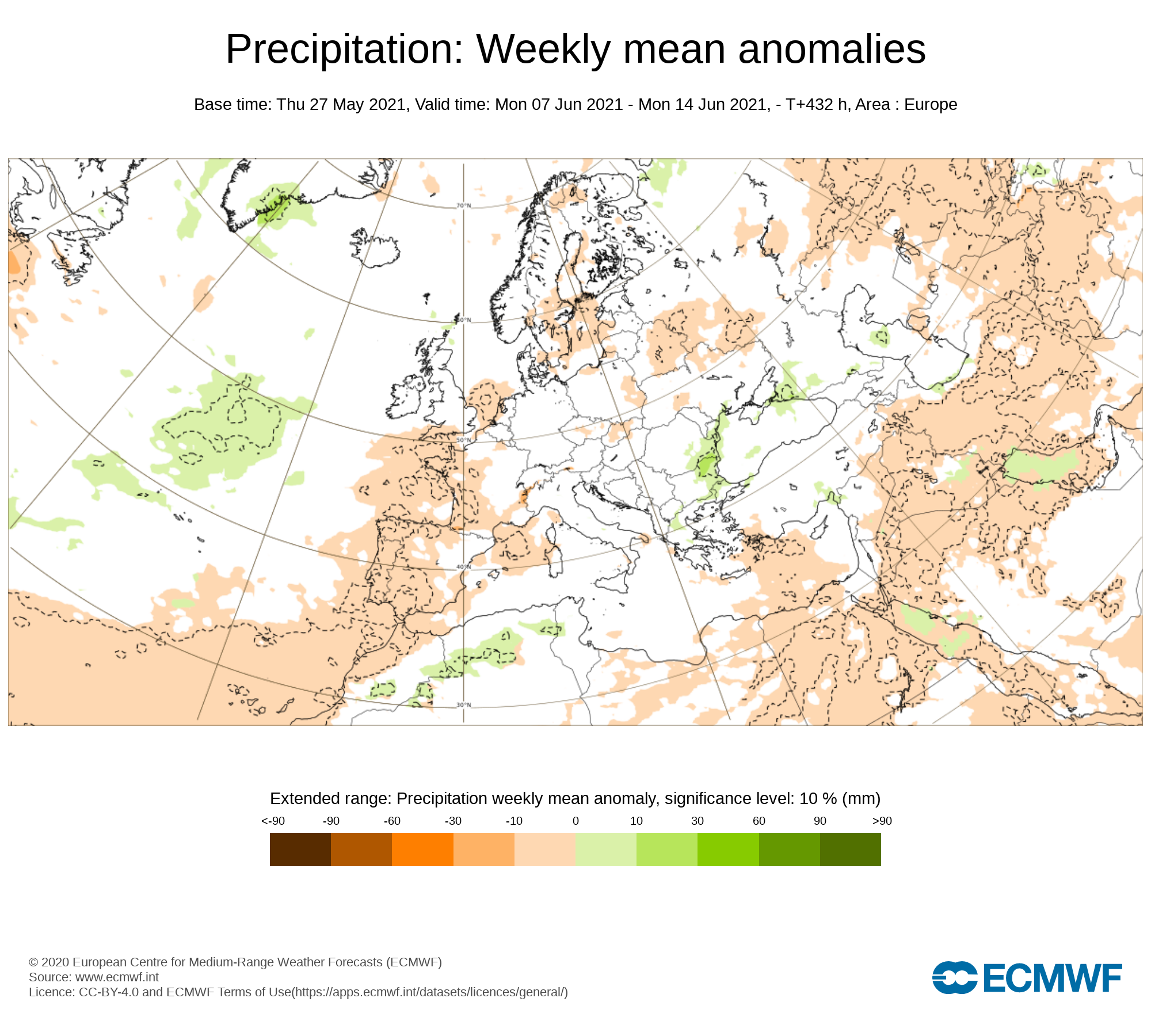
Precipitation ( Rainfall): Weekly mean anomalies
The latest trend for this week shows rainfall amounts near average or just below for many places but not fully dry with the chance of some showers over the week some which could come in the form of thunderstorms. During this week or near the end of it we may see a plume of warmer air which will bring a rather active thundery few days.
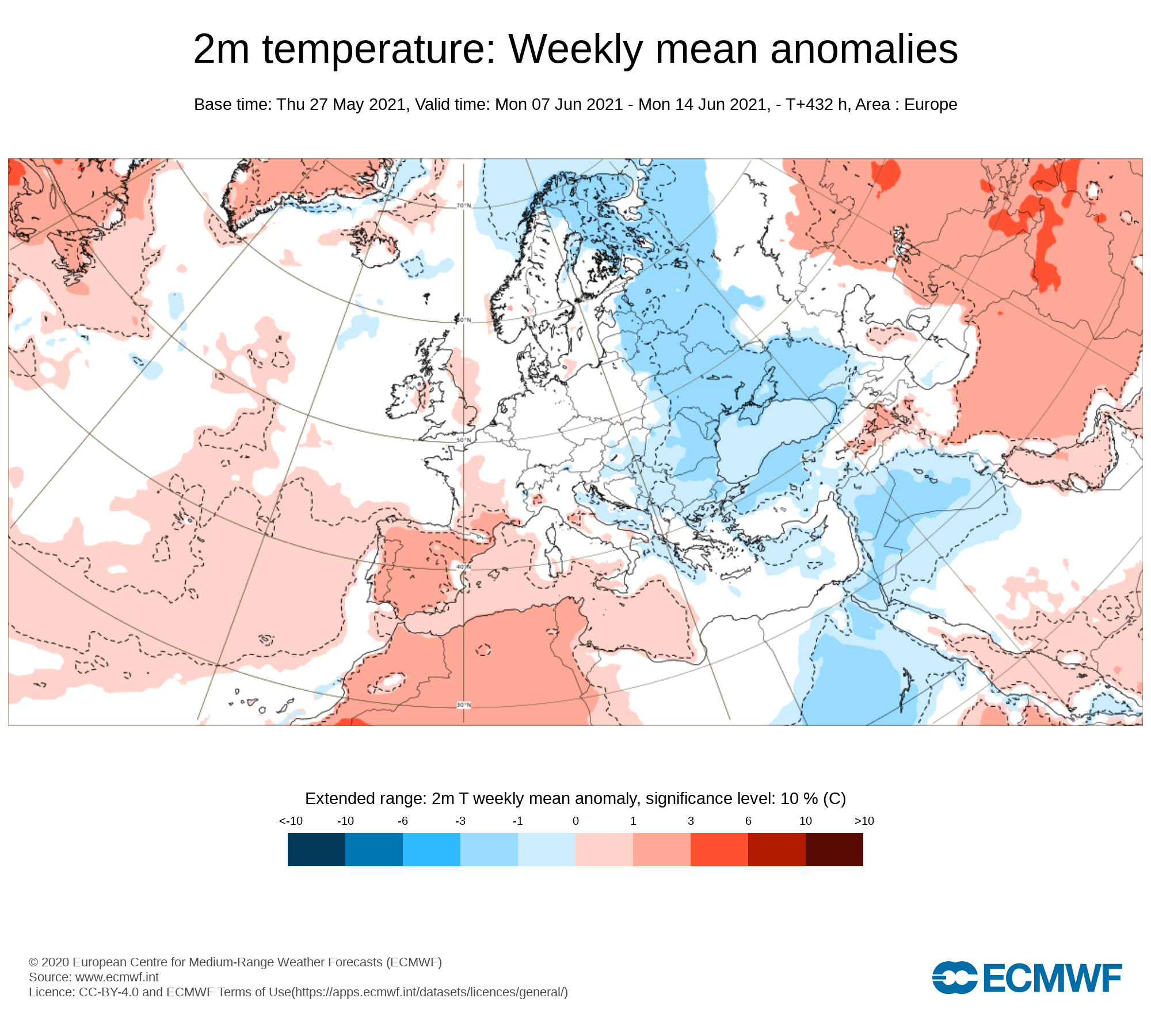
2m temperature: Weekly mean anomalies - Wind
Temperatures look set to be in the mid to high teens over the week and possibly rising a little near the end of week 2 and over next weekend back into the low 20s with the (GFS American forecast model) playing with the idea of a much warmer plume of air moving up from the southwest coming out of mainland Europe .
Wind Forecast
At present there looks like there will be no risk of strong winds over week 2
UV forecast
UV levels will be Moderate to high and possibly very high in any sunshine with the risk of sun burn.
Pollen Forecast
Pollen levels will be moderate to high over the week with pollen levels lowest during cloudy and wet weather and highest during any sunny dry periods. Grass pollen will be the main type.
Week 3 - Monday 14th June 2021 -Monday 21st June 2021
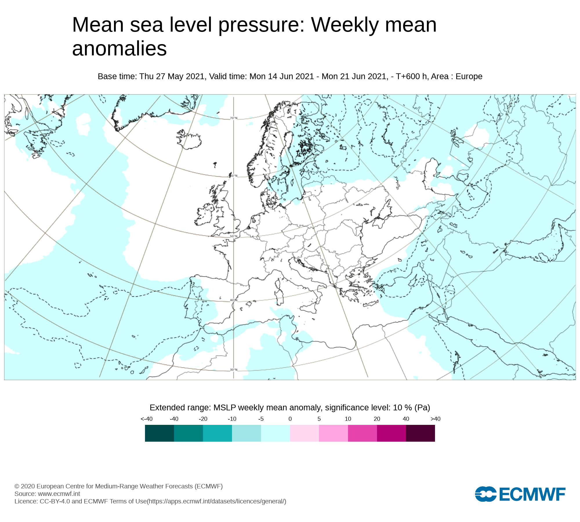
Mean sea level pressure: Weekly mean anomalies
Confidence in this week is rather low and more uncertain. The latest signal from the long range models are for a southwesterly airflow.
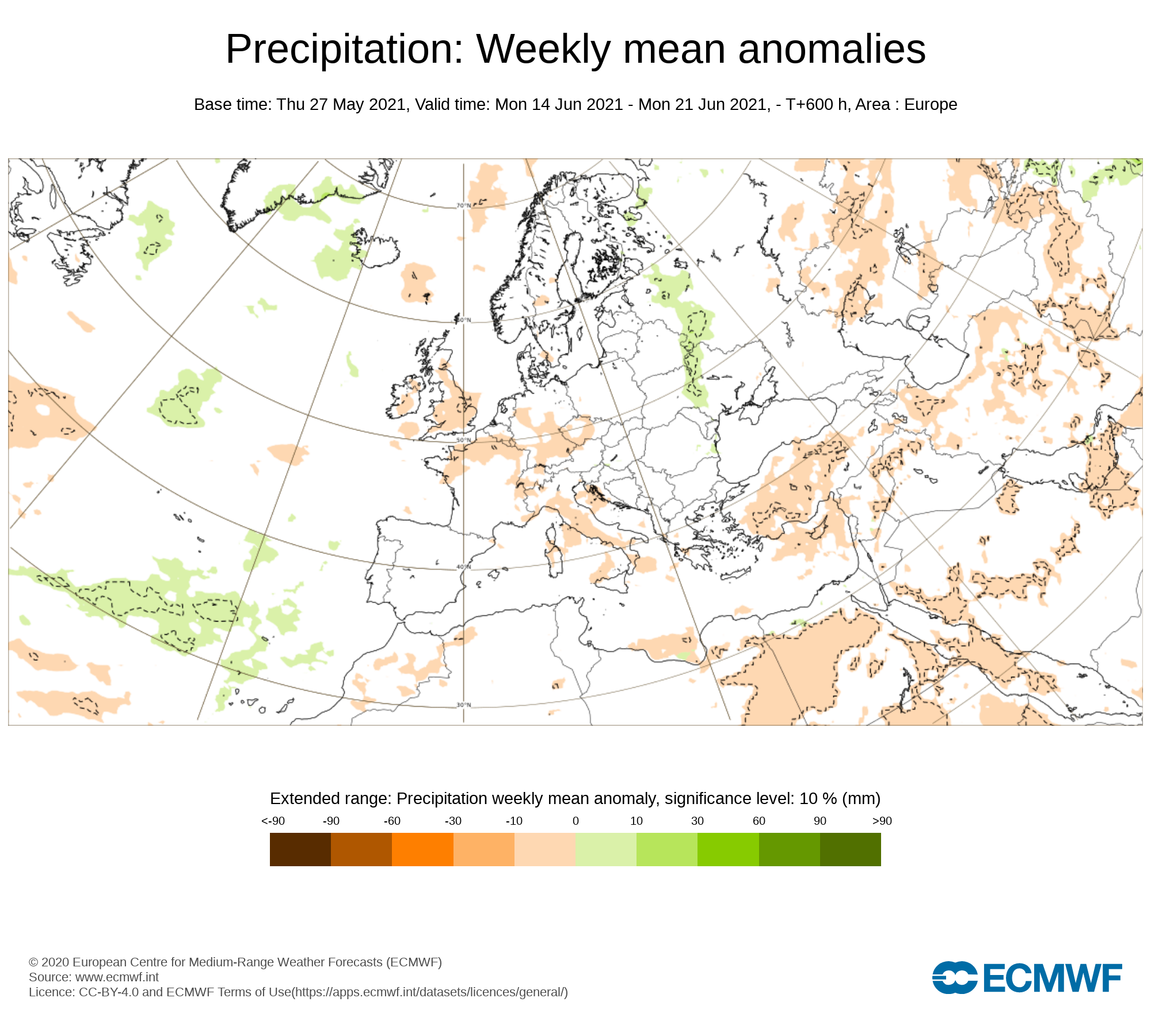
Precipitation ( Rainfall): Weekly mean anomalies
Confidence in this week is rather low and more uncertain but the latest signal is for below average rainfall amounts which would mean a lot dry weather but if any warm plumes move up over Ireland it may bring the risk of thunderstorms at stages over the week.
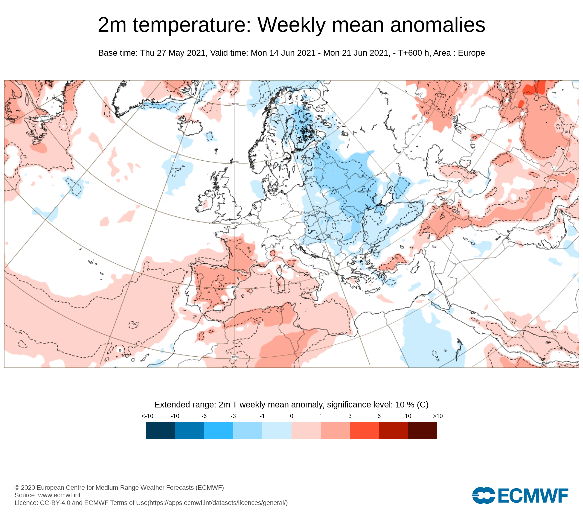
2m temperature: Weekly mean anomalies
Again confidence in this week is rather low but the latest long range forecast from the ECMWF model indicates temperatures near normal for this time of year. High teens to mid 20s.
Wind forecast
There are no signs of any strong winds this week.
UV forecast
UV levels will be Moderate, High to very high in any sunshine with the risk of sun burn.
Pollen forecast
Pollen levels will be moderate, high to very over the week with pollen levels lowest during cloudy and wet weather and highest during any sunny dry periods. Grass pollen will be the main type
Week 4 - Monday 21st June 2021 -Monday 28th June 2021
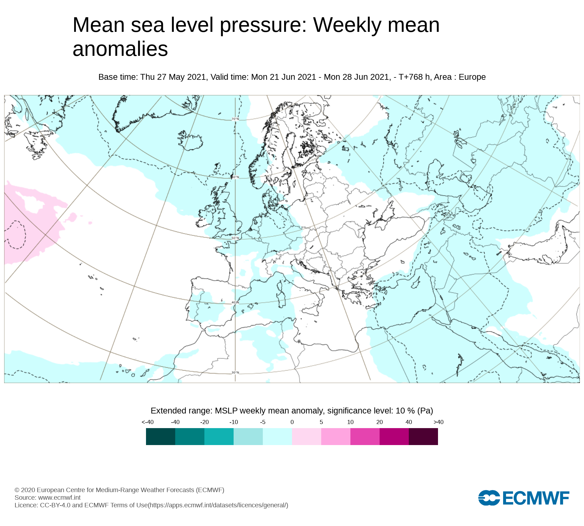
Mean sea level pressure: Weekly mean anomalies
And finally week 4 confidence is even lower as you can see from the above pressure chart attached it shows lower pressure than average across Ireland which could mean a return to more unsettled weather
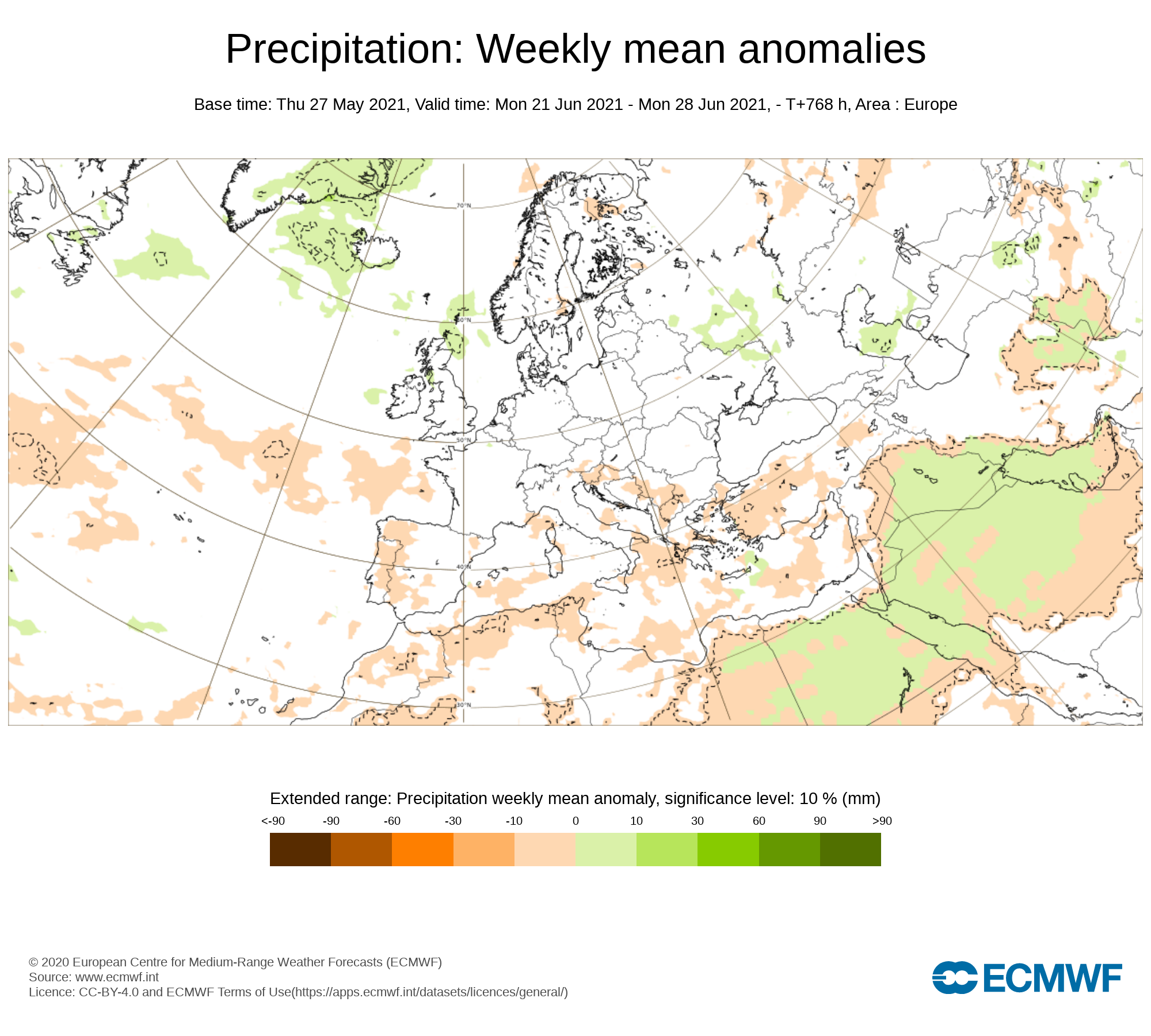
Precipitation ( Rainfall): Weekly mean anomalies
With lower pressure than average this would indicate spells of wet & blustery weather for week 4
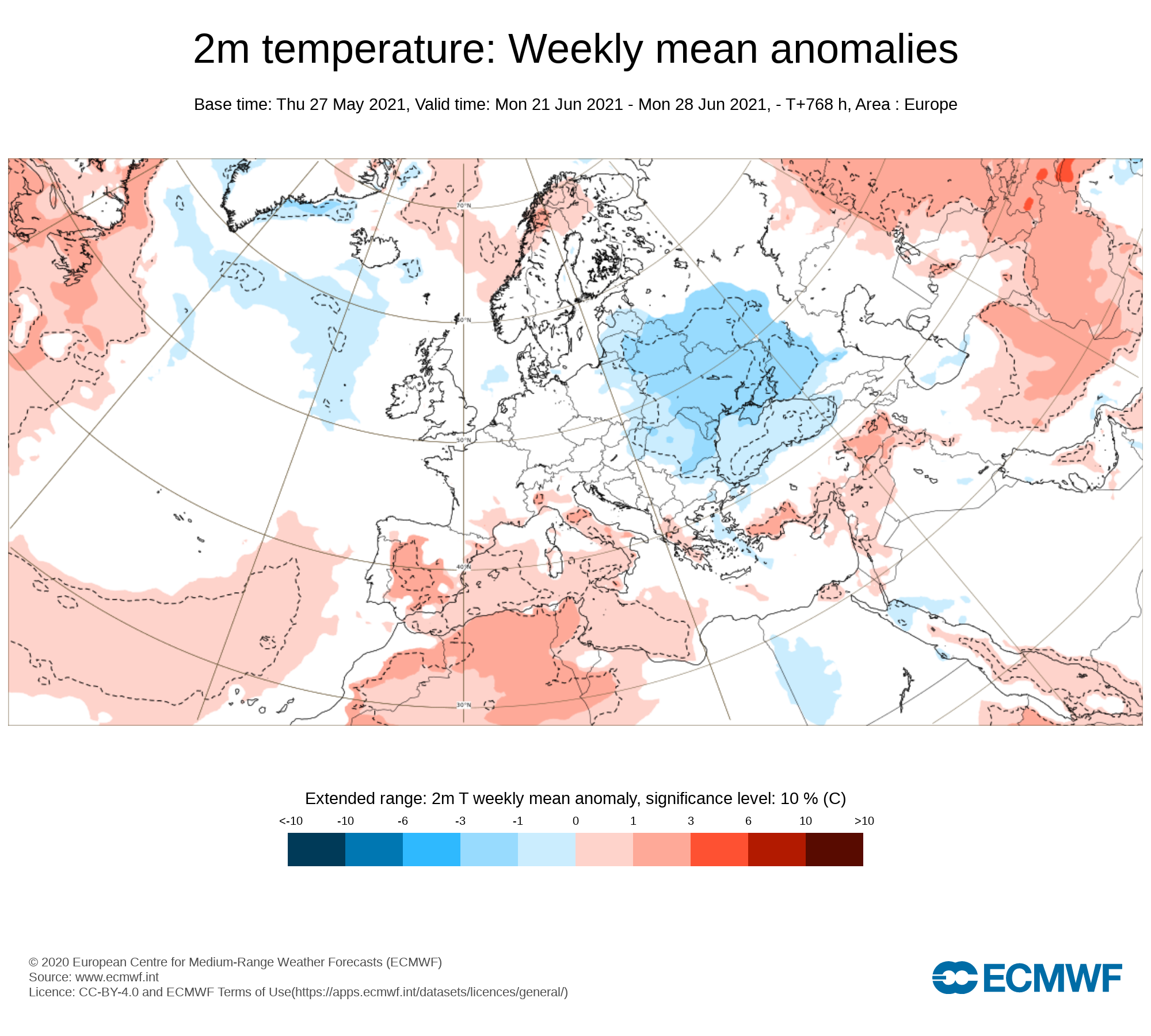
2m temperature: Weekly mean anomalies
With the lower pressure this will also bring the risk of a more westerly or northwesterly airflow bring cooler temperatures than average for this time of year.
Wind forecast
There may be some windy conditions this week but no significant wind storms are likely.
UV forecast
UV levels will be Moderate, High in any sunshine with the risk of sun burn even with cooler weather as the sun this time of year is stronger.
Pollen forecast
Pollen levels will be moderate to high over the week with pollen levels lowest during cloudy and wet weather and highest during any sunny dry periods. Grass pollen the main type


