Monthly Long Range Forecast Update Ireland - 17th May 2021
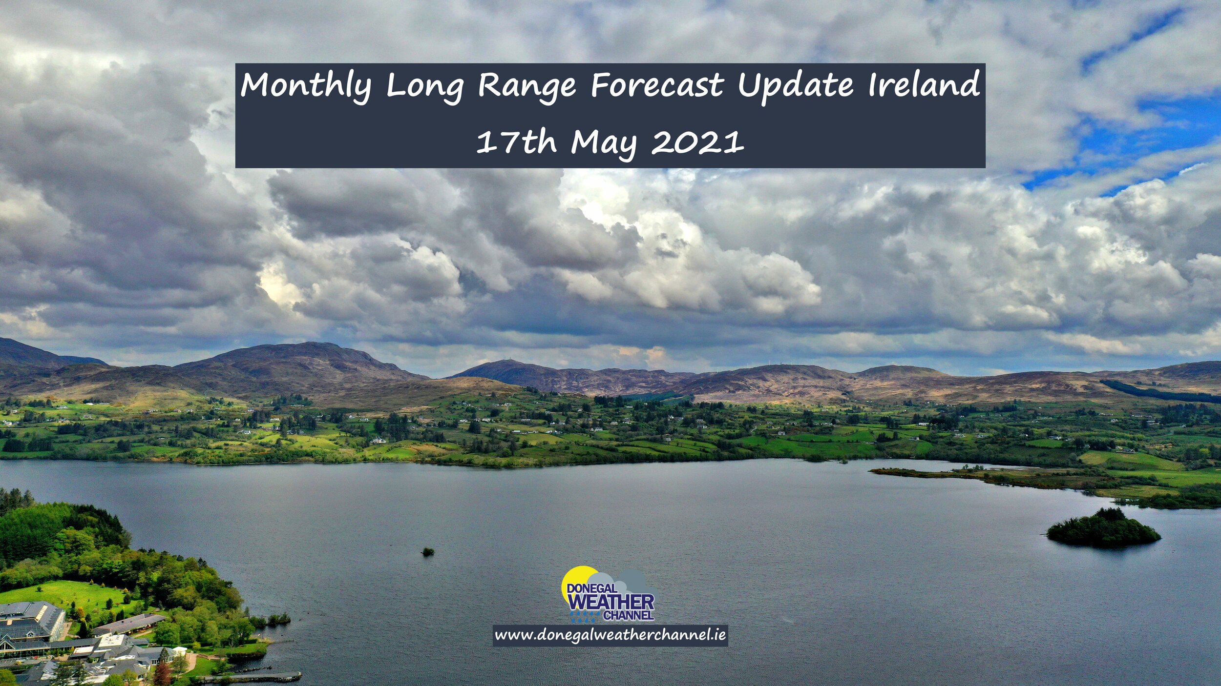
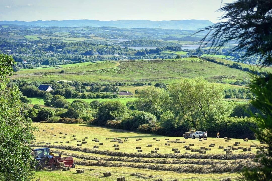
Lough Eske, Donegal on Thursday 13th May 2021 by Kenneth Mc Donagh Photography
The Donegal Weather Channel Monthly Long range forecast issued every week looking up to a month ahead using data from the ECMWF and GFS models.
Please note that the longer range forecasts are more uncertain and should not be used to plan outside activities from over a week out.
Extended Range Output
The output is rather different from the shorter period output of HRES and ENS products. It provides a more general overview of the forecast up to Day 46, focusing mainly on the week-to-week changes in the weather rather than attempting to give unsupportable detail on individual days. Output is mostly in the form of anomalies relative to ER-M-climate and is mainly shown as 7-day means for calendar weeks Monday-Sunday. Specialised products for the extended range also include information on potential tropical cyclone activity and the MJO during the coming month.
SPONSOR THE LONG RANGE FORECAST
If you have a business and would like to sponsor our weekly month long range forecast for a period of 1 week or 1 month please do contact Donegal Weather Channel at info@donegalweatherchannel.ie or message our Facebook page . Donegal Weather Channels service relies on sponsorship/advertising. Without sponsorship/advertising Donegal Weather Channel would not be able to give so many hours and a daily service.


The forecast will be issued by myself Kenneth and i will try to keep it simple making it easy for everyone to understand. If there is a term I use in the forecast which you may not know what it means I will explain what I am talking about .
Before I start with the long range forecast I will just explain what we will be looking at and how the forecast will work.
The forecast will be broken up into 4 section Example below :
Week 1 - Monday 17th May 2021 -Monday 24th May 2021
Week 2 - Monday 24th May 2021 -Monday 31st May 2021
Week 3 - Monday 31st May 2021 -Monday 7th June 2021
Week 4 - Monday 7th June 2021 -Monday 14th June 2021
Things we will look at in the forecast:
Mean sea level pressure: Weekly mean anomalies
2m temperature: Weekly mean anomalies
Wind
Precipitation: Weekly mean anomalies (eg. rainfall and snowfall for a example.
Dust forecast ( Only in Week 1)
UV forecast outlook
Potential Pollen Levels

Forecaster - Kenneth Mc Donagh
Week 1 - Monday 17th May 2021 - Monday 24th May 2021
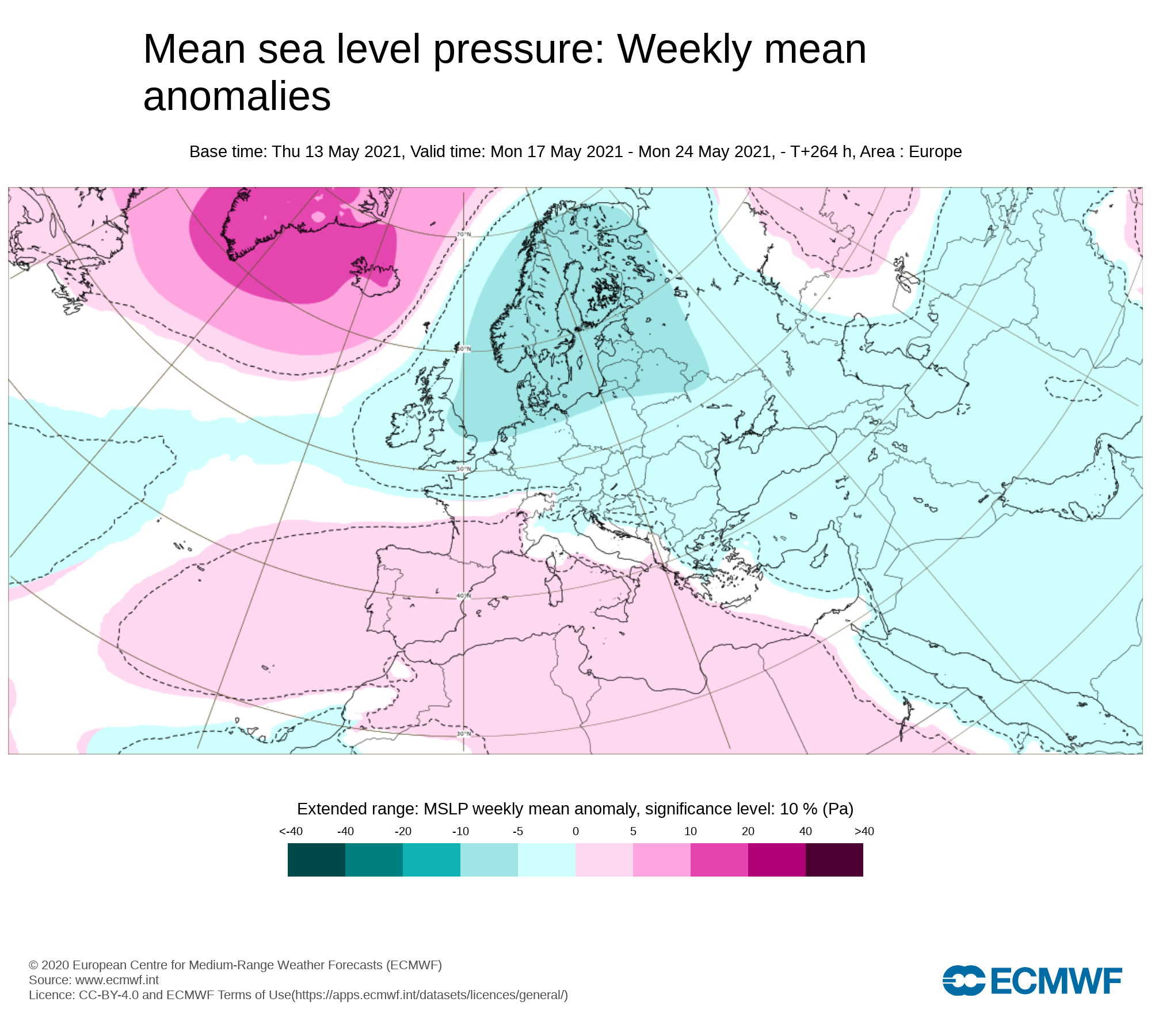
Mean sea level pressure: Weekly mean anomalies
Lower pressure than average across Ireland this week ( Week1 ) this will bring the risk of heavy showers in places at times. Some parts of Ireland will also see good bright and sunny spells.
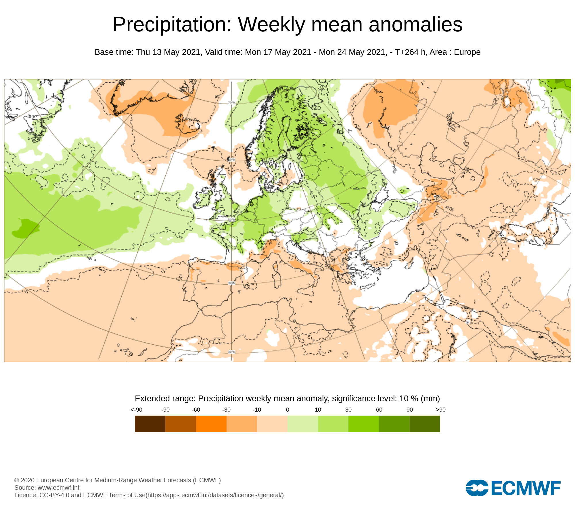
Precipitation ( Rainfall): Weekly mean anomalies
Rainfall amounts over week 1 will be above average again across Ireland but this will very from place to places due to the showers coming in the form of thundery downpours up until mid week , At the moment the lowest rainfall amounts look set to be across the south and east of Ireland with the highest amounts across Connacht and west Munster. Further showers some which will develop into thunderstorms will develop again on Tuesday and Wednesday some which will see the risk of hail and some spot flooding locally in areas due to how slow moving these showers will be. Later Wednesday and Thursday a spell of rain will effect Ireland associated with an area of low pressure which is forecast to track over the country later Wednesday, Thursday and clearing on Friday to the east over the UK. Some heavy falls of rain look possible in places on Wednesday night and Thursday especially across southwestern and the western half of Ireland where some localised flooding will be possible. As that area of low pressure clears to the east on Friday the day will then see a showery mix of rain with sunshine between any showers, Some of the showers may developing into isolated thunderstorms giving very heavy downpours in places. This weekend also look set to see further rainfall with showers again expected on Saturday some which will be thundery and at this stage the northern half of Ireland seen the heaviest of these but many places also see rather nice sunny spells this Saturday especially the southern half of the country. The latest outlook for Sunday into Monday is for another low pressure system to cross Ireland bringing some rain and heavy thundery downpours. Rainfall amounts this week will be around 2 to 3 times above average in places especially across the west and southwest.
Tuesday Thunderstorm risk
The main risk of thunderstorm activity on Tuesday will be across Munster, Leinster and south/east Ulster. Warnings are likely to be issued for the risk of Thunderstorms, Heavy downpours, hail and flooding
Wednesday risk Thunderstorm risk
The main risk of thunderstorm activity on Wednesday will be across North Connacht & Ulster. Warnings are likely to be issued for the risk of Thunderstorms, Heavy downpours, hail and flooding
Rainfall amounts between Tuesday 17th May to Sunday 23rd May 2021
Ulster - 30mm to 50mm ( Highest amounts in mid & east Ulster)
Connacht - 40mm to 70mm ( Highest amounts in west and southwest Connacht especially over high ground areas)
Munster - 30 mm to 65mm (Highest amounts in southeast & west Munster especially across higher ground areas)
Leinster - 30 mm to 40mm (Highest amounts in north Leinster and the mountains of Leinster)
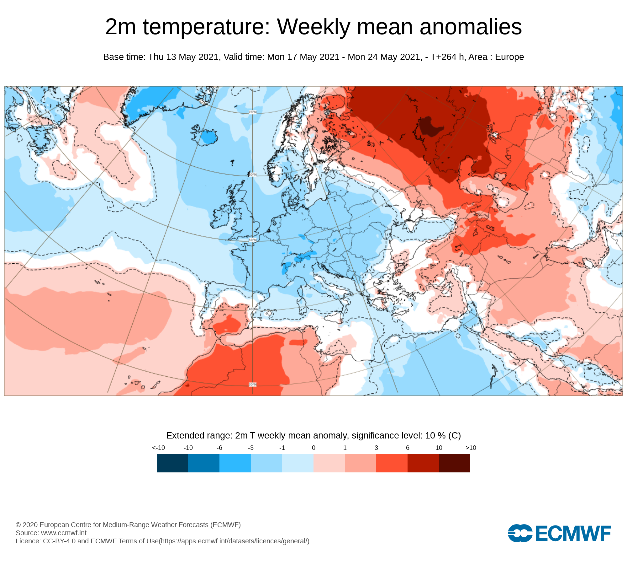
Temperature: Weekly mean anomalies
Temperatures over this week (week 1) will be below normal across Ireland between 1C to 2C below. There will be no risk of frost this week . Overall day time temperatures will range between 10C to 14C/15C up until mid week but a littler lower near the end of this week.
Wind forecast
⚠️ Strong winds alert ⚠️
An area of low pressure is set to track over Ireland later Wednesday and Thursday and clear to the east of Ireland on Friday. Strong southwest to westerly winds will effect Ireland on Thursday morning, afternoon and evening before easing overnight warnings are likely to be issued for places with the southern & western half of Ireland looking most at risk at present
UV forecast
Even with a cooler week than average for this time of year expected UV levels will be Moderate in any sunshine with the risk of sun burn possible.
Pollen Forecast
Pollen levels will be moderate to high over the week with pollen levels lowest during cloudy and wet weather and highest during any sunny & dry periods. The main type of pollen will be tree this week.
Dust forecast
Dust levels will be low across Ireland during week 1.
Week 2 - Monday 24th May 2021 -Monday 31st May 2021
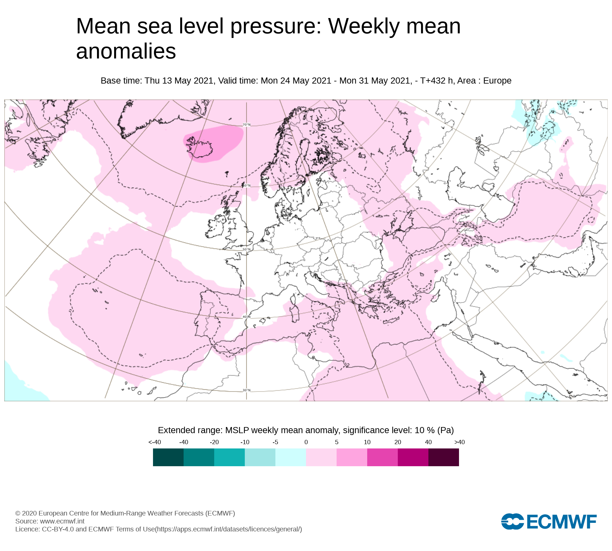
Mean sea level pressure: Weekly mean anomalies
The latest outlook heading into week 2 is for just below average pressure to start the week with heavy thundery showers but higher pressure building from midweek across Ireland with a change in the weather pattern to a more settled and possibly warmer one by Friday and the weekend. You will have seen Donegal Weather Channels updates last week which has indicated this change which still is showing on both the ECMWF & GFS weather models.
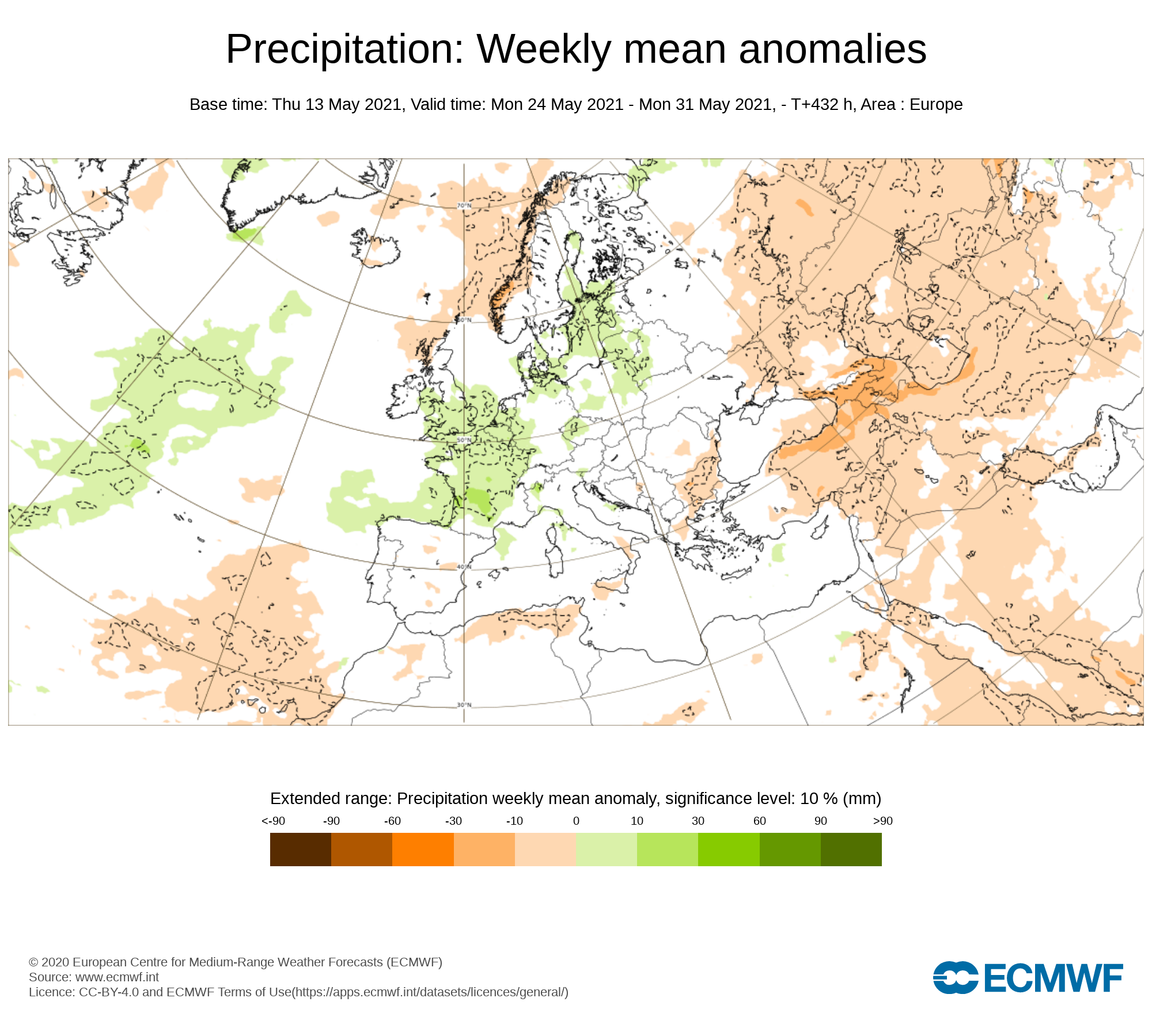
Precipitation ( Rainfall): Weekly mean anomalies
At present rainfall amounts look set to be average or below average over week 2 with much of any rainfall coming early in the week. From midweek the trend is for drier weather and little or no rainfall heading into the end of the week and over next weekend.
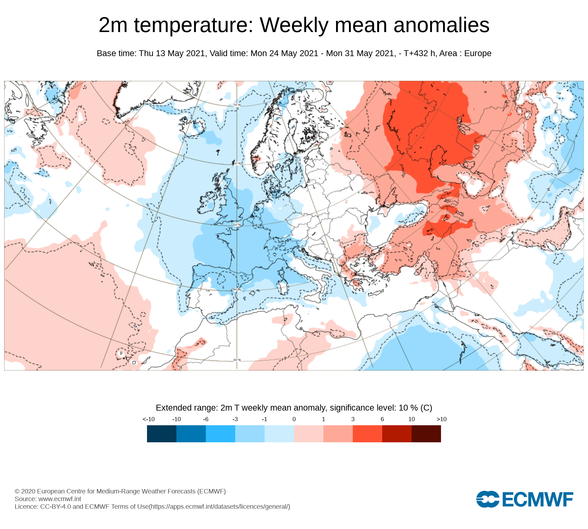
2m temperature: Weekly mean anomalies - Wind
Temperatures look set to be average over week 2 and possibly slightly above near the end of the week. Daytime temperatures early in the week will range between 10 to 15C but from mid week into next weekend the latest signals are for a east to southeast airflow with temperatures rising into the high teen and low 20s with the warmest conditions likely across the west and northwest of Ireland with a onshore southeast to easterly breeze keeping temperatures in the eastern half of Ireland that bit cooler.
Wind Forecast
There are no signs on any strong winds this week with the weather set to become more settled and high pressure building bringing rather settled weather from mid week onwards.
UV forecast
UV levels will be Moderate to high in any sunshine with the risk of sun burn.
Pollen Forecast
Pollen levels will be high to very high over the week with pollen levels lowest during cloudy and wet weather and highest during any sunny dry periods.. Grass pollen also is likely then start to rise this week especially in any warmer weather.
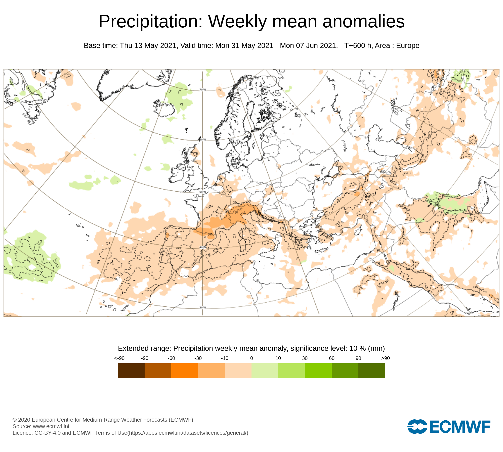
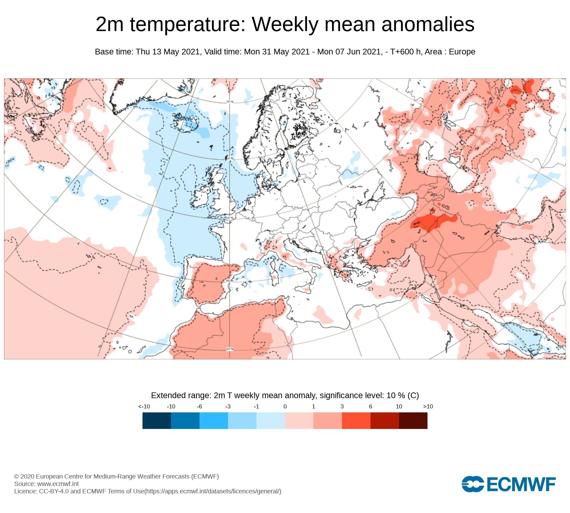
Week 3 - Monday 31st May 2021 -Monday 7th June 2021
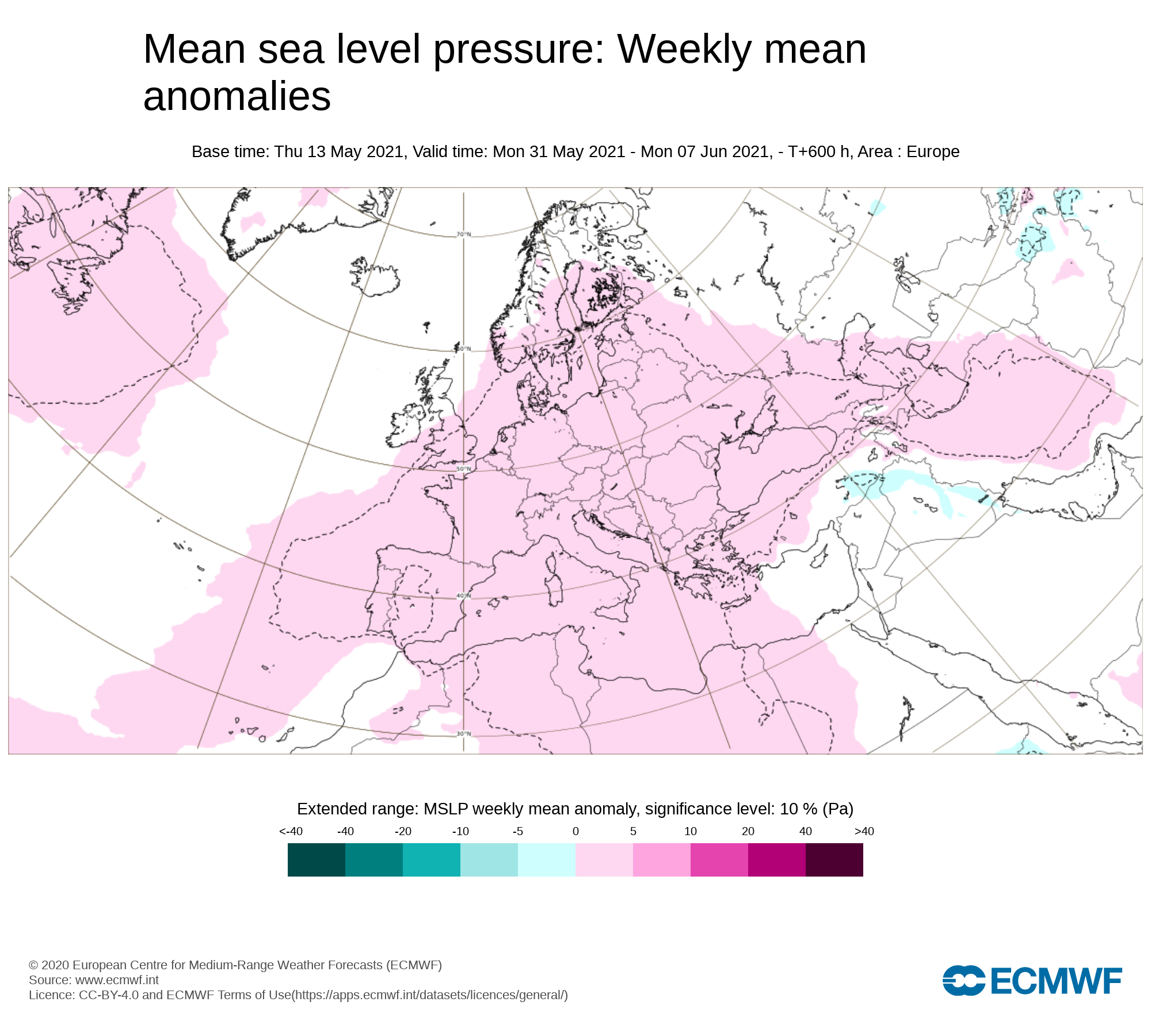
Mean sea level pressure: Weekly mean anomalies
The forecast for this period is a little more uncertain but the current signal is for high pressure to sit closeor over Ireland . This will bring rather dry and settled conditions with good sunshine but showers cant be ruled out this week.
Precipitation ( Rainfall): Weekly mean anomalies
Some showers look possible this week but overall many areas will be largely dry with below average rainfall over the week.
2m temperature: Weekly mean anomalies
Temperatures at present this week look set to range in the mid to high teens across Ireland which would be around average for Ireland for this week. Some places may see temperatures rise into the low 20s
Wind forecast
There are no signs of any strong winds this week with the weather set to become more settled and high pressure building bringing rather settled weather.
UV forecast
UV levels will be Moderate to high in any sunshine with the risk of sun burn possible.
Pollen forecast
Pollen levels will be high to very high over the week with pollen levels lowest during cloudy and wet weather and highest during any sunny dry periods.. Grass pollen also is likely then start to rise this week especially in any warmer weather.
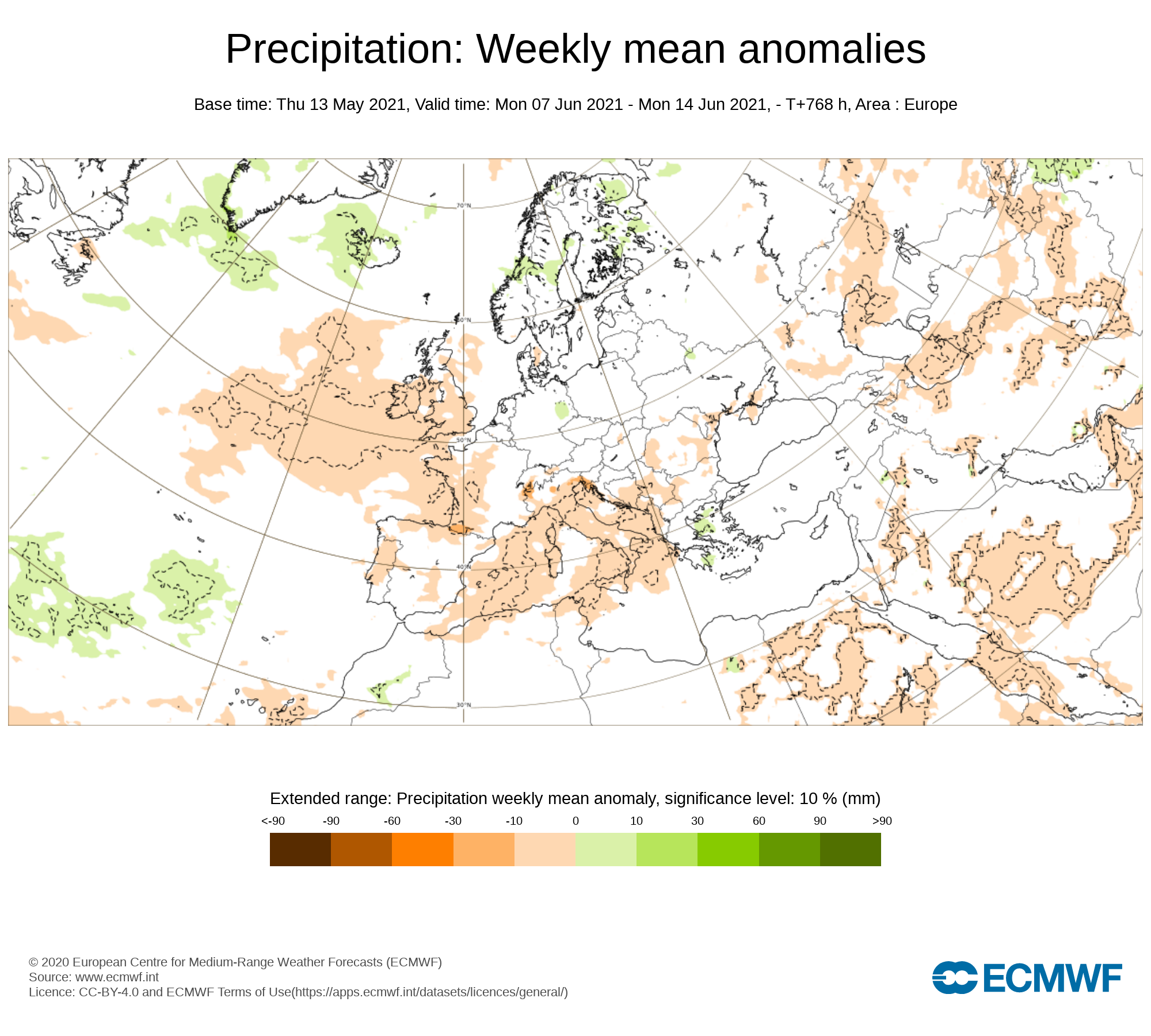
Week 4 - Monday 7th June 2021 -Monday 14th June 2021
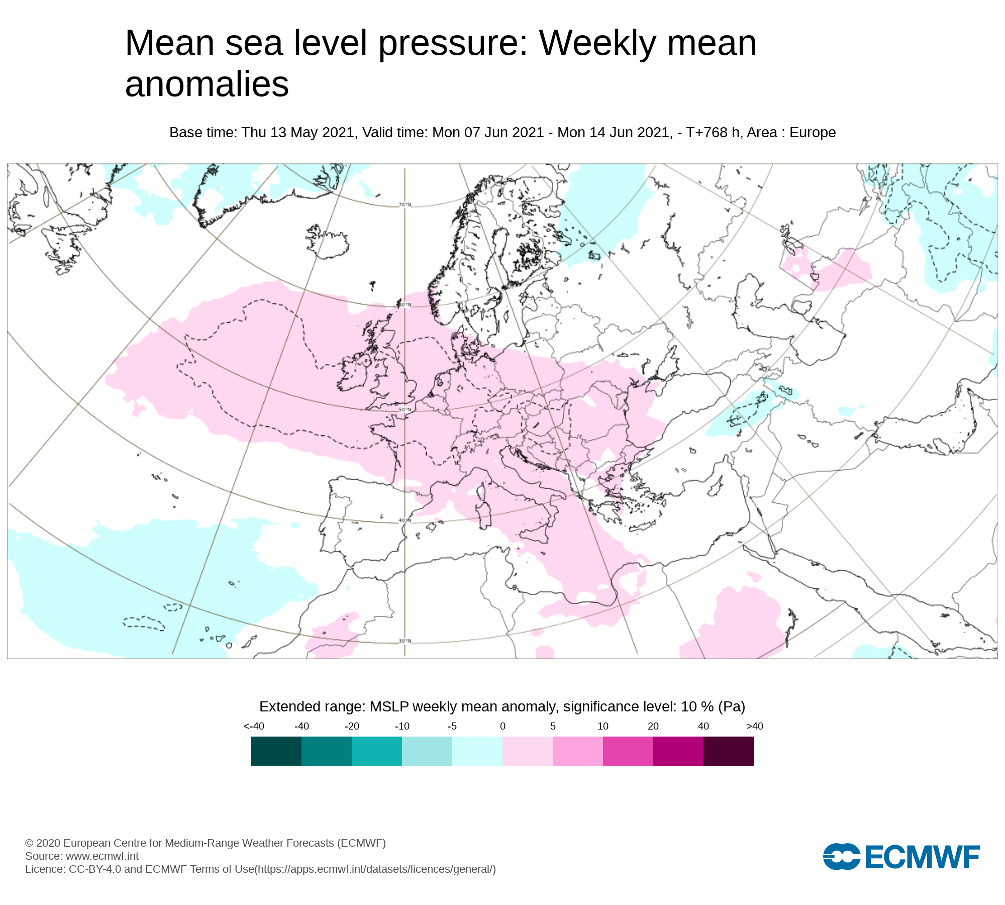
Mean sea level pressure: Weekly mean anomalies
Confidence in this week is rather low and more uncertain. The latest signals are for high pressure to dominate across Ireland during week 4
Precipitation ( Rainfall): Weekly mean anomalies
With high pressure showing for this week rainfall amounts also are forecast to below average with a dry week for much of Ireland possible but again confidence in this week is rather low and uncertain
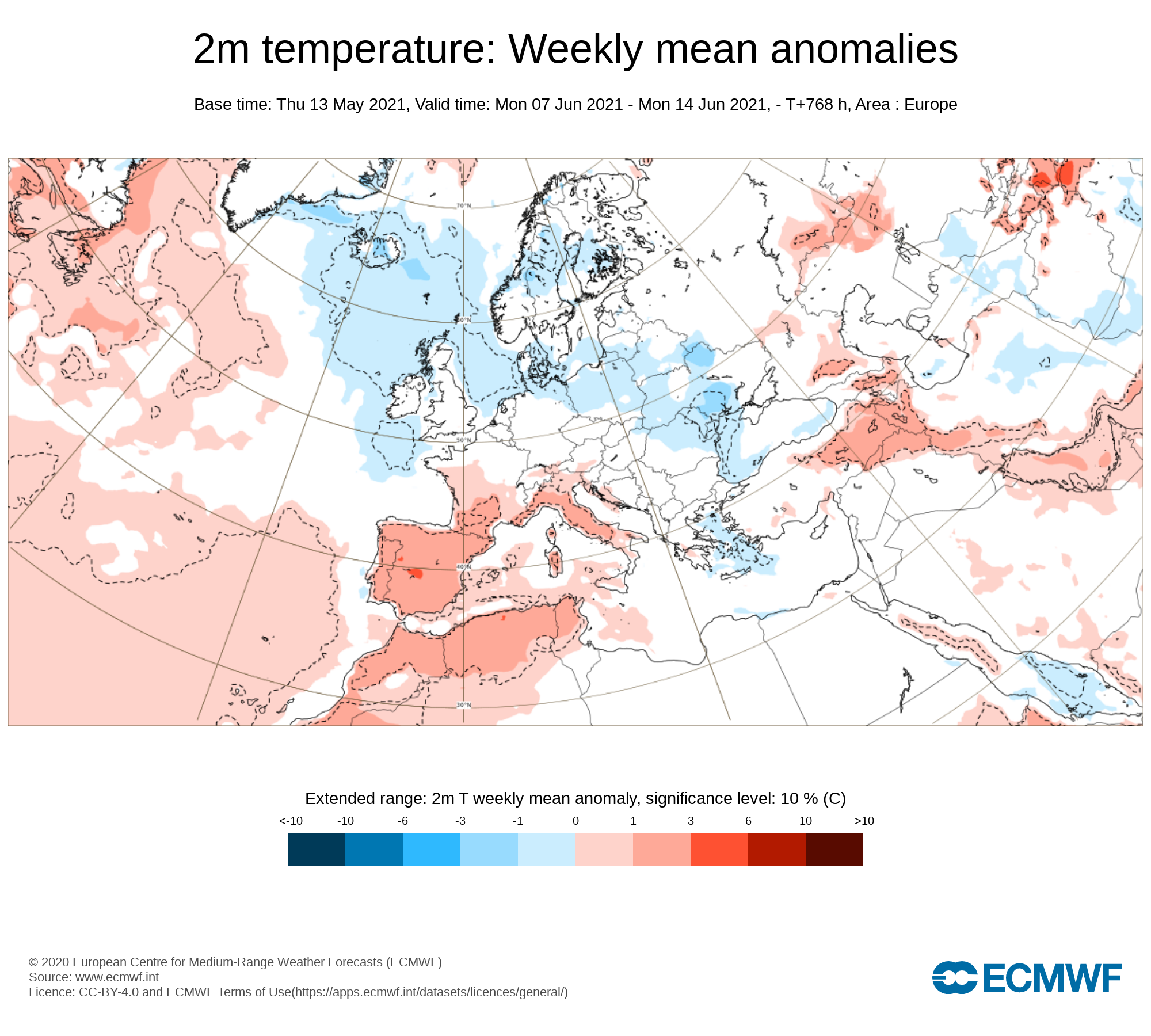
2m temperature: Weekly mean anomalies
Temperatures would be near normal in the high teens to low 20s in places during week 4.
Wind forecast
There are no signs of any strong winds this week with settled weather and high pressure building bringing rather settled weather.
UV forecast
UV levels will be Moderate, High to Very High in any sunshine with the risk of sun burn.
Pollen forecast
Pollen levels will be high to very high over the week with pollen levels lowest during cloudy and wet weather and highest during any sunny dry periods. Grass pollen also is likely to be the main pollen type this week