
Turning cold again later this week and weekend with lows of -5C and further snowfall

This week has started of on the cold side with a cold Arctic airmass moving down across Ireland later Sunday with snow showers in places on Monday and Tuesday with some parts of Ulster waking up to some snow on the ground this morning.
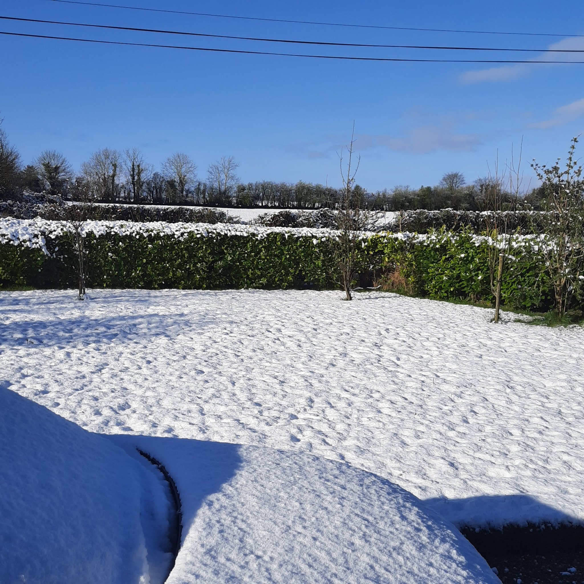
A dusting of snow in Killygordon, Donegal this morning. Images by Nigel McKelvey
Wednesday and Thursday will turn that bit milder with highs of 7C to 11C some rain and drizzle will effect mainly parts of the west and north with drier weather across the south and east where the best of any sunny breaks will be. Winds will turn more westerly in direction with the Windchill also easing.

A change back to colder weather Thursday night
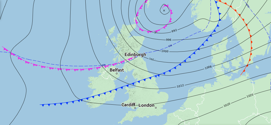
Cold front moves southwards across Ireland and the UK
Thursday evening and night will see a cold front move southwards across Ireland which can be seen on the chart above. As this moves southwards a narrow band of rain will also head southwards with some heavy falls across northwestern and northern counties for a time in the evening.

Rain will move southwards across Ireland on Thursday night into the early hours of Friday morning but as it does so it will become lighter and patchy in nature. Drier weather will develop across the northern half of Ireland around midnight when that rain clears southwards out of Ulster and north Connnacht.
As the cold front and rain clears to the south cold Arctic air will again flood southwards across Ireland with some area seen some frost and icy patches before dawn Friday morning with lows of -1C to 4C.

Frost in places by Dawn Friday morning

Turning even colder on Friday and this weekend with severe frosts
Friday and this weekend will turn even cold again with wind turning northerly bring down that very cold Arctic air. it will be unseasonable cold later this week and weekend and will see temperatures drop to between 3 or 4 degrees below normal, with sharp to severe frosts occurring later this week and over the weekend.
Friday night into Saturday morning will see very cold conditions with a sharp to severe frost and lows of 0C to -5C.

Very cold on Friday night and Saturday morning
Saturday night into Sunday morning will see very cold conditions again with a sharp to severe frost and lows of 0C to -5C.

Further snow showers in places again on Friday and this weekend
With that very unseasonable cold air later this week and weekend it will bring with it a unstable airmass which will see falls of hail, sleet and snow in places with some areas even possibly waking up on Saturday or Sunday morning to a light dusting of snow. High risk of snow stating on the ground will be the night and morning hours when it is much colder and no sun around to melt it. Any on the ground will be short lived.
Some of the showers over the end of this week and weekend may produce some isolated thunderstorms
The Chart below shows the risk of some isolated accumulations in places this weekend.

The risk of some small snow accumulations this weekend
Not all bad some good sunshine this weekend also.
Its not all that bad there will be good sunshine also later this week and over the weekend between any showers. Day time temperatures will range between 5C to 9C on Friday, Saturday and Sunday
Gardeners and crop growers should be on alert as there will be damaging frosts. The greatest risk being to vulnerable young crops.
OUTLOOK AFTER THIS WEEKEND
As we head into next week the latest outlook is for the weather to stay on the cold side with some frosts at night. there will be some showers over the week with some possible isolated thunderstorms also early in the week.
There is some uncertainty on the long term forecast but the latest outlook on both the ECMWF and GFS models show that the weather will stay on the cool to cold side with the risk of frost later in the week and next weekend again. However the latest indication show a lot of drier weather later next week and next weekend.
You can find all the latest weather warnings and forecasts by downloading our app from the google play store by clicking below

LATEST NEWS


