
Mostly dry conditions with high pressure in place for the rest of the week but turning unsettled this weekend
Some good news on the weather this morning and that is that the trend on the longer range forecast outlooks from the ECMWF and GFS is for the rest of the month to finish with a lot of dry conditions but not totally rain free. The month looks set to finish with high pressure dominating.
Below we will look at this further but first a forecast update on the rest of this week and weekend

Tuesday
Tuesday will be a dry day for many places with good sunny spells but over the afternoon some showers will develop across Ulster with the risk of some thundery downpours. Across the rest of Ireland it will remain dry with nice sun shine. It will be warmer than recent days especially in the sunshine which will make it feel that bit warmer again. Temperatures will range between 10C to 13C.
Overnight Tuesday will be dry with clear spells with calm conditions which will lead to fog forming overnight with reduced visibly on the road network. It will be cool also with a nip in the air and the risk of some frost with lows of -1C to 2C coldest in the east and north.
Wednesday
Misty and foggy to start in places on Wednesday morning but clearing to good bright and sunny spells later in the morning and over the early afternoon. Later Wednesday afternoon and evening will see some cloud develop with the slight risk of a isolated showers in the northeast and east. Temperatures will range between 10C to 13C.
Overnight will see clear spells again with near calm conditions again which will allow mist and fog to form which will lead to reduced visibly on the road network. Overnight temperatures will range between 0C to 4C with a slight risk of frost in some eastern areas.

Thursday
Mist and fog clearing on Thursday morning with nice bright and sunny spells. Thursday afternoon and evening with be mostly dry for many areas with good sunshine but a few isolated showers may develop across eastern areas for a time. Temperatures will range between 10C to 13C.
Thursday night will remain dry with clear spells to start but cloud overnight will increase from the Atlantic moving west to east.
Friday
Cloud increasing from the west Friday morning with a cloudy day everywhere later in the morning and over the afternoon some light rain or drizzle looks set to effect western and northwestern parts but there is some uncertainty on this yet as high pressure may keep the rain of to the west of Ireland. The latest indication is for drier weather away from western and northwestern counties but cloudy. Temperatures on Friday between 9C to 12C
Friday night will see some light rain or drizzle across across western southwestern and western counites but elsewhere it will be cloudy and drier.
WEEKEND
Saturday
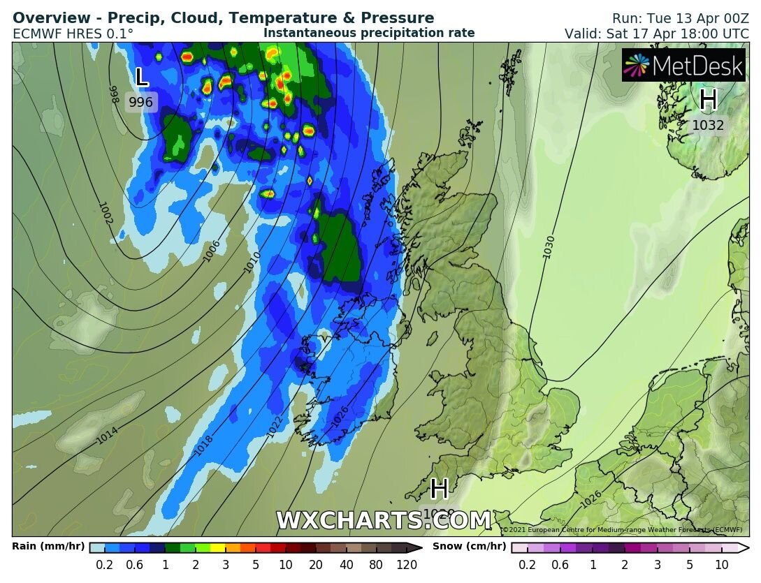
Rain countrywide on Saturday
A spell of rain will move into the southwest and west on Saturday morning extending northeastwards during Saturday afternoon and evening with a wet day for the whole country. As the rain moves eastwards it will become more lighter and patchy. Temperatures will range between 8C to 12C.
Cloudy overnight with light patch outbreaks of rain in places. The night will be frost free.
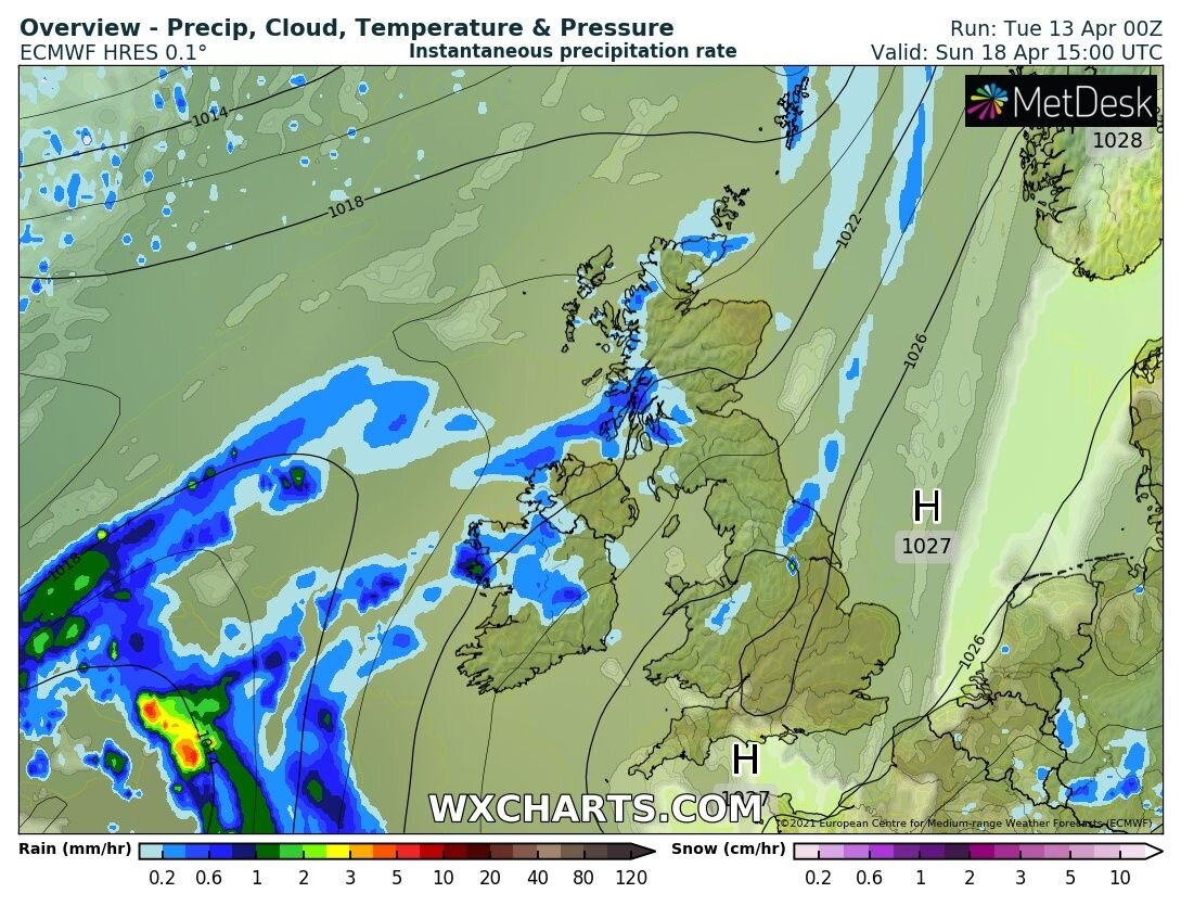
Sunday
Temperature forecast Saturday night and Sunday morning
Outbreaks of rain on Sunday across Ireland with cloudy conditions nationwide again. Temperatures will range between 7C to 12C. Further outbreaks of rain overnight Sunday heaviest across the west and northwest
Monday
Monday will be another wet day across western, northwestern and northern counties away from the areas it will be drier but cloudy Temperatures again will range around 8C to to 12C.
Rainfall amounts

Rainfall amounts Between Tuesday 13th April 2021 to Monday 19th April 2021
Highest rainfall amounts in the west and northwest - Rainfall amounts over the next week will be lower than average for many parts of Ireland with the highest amounts between Tuesday to next Monday across western and northwestern counites where amounts will be around average with between 10mm to 30mm much of that rain will fall Saturday to Monday.
Driest in the south and east - The driest conditions over the coming 7 days will be across the south and east with only around 2mm to 10mm of rain there.
Turning drier from next Tuesday the 20th of April
From next Tuesday the latest outlook is for the weather to turn more settled again with high pressure building across Ireland again. The latest outlook is for bright and sunny conditions
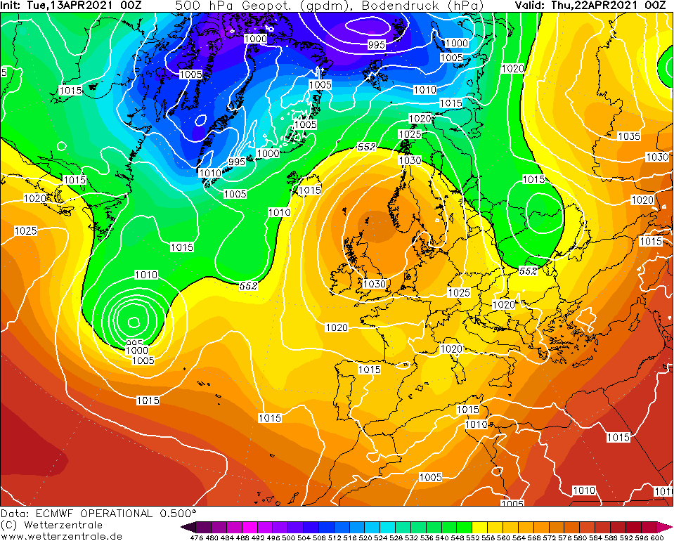
High pressure builds to the northeast of Ireland next week with drier conditions and good sunshine. The latest outlook is for southeasterly winds which would mean temperatures will be that bit warmer also around 10C to 16C.
Long range forecast for the rest of April
The long range forecast outlook look rather good on the ECMWF and GFS models showing a nice end to April with high pressure dominating the weather.
The chart below is taken from the ECMWF weather model long range outlook which shows the pressure over Ireland between Monday the 19th of April to Monday the 26th of April and shows high pressure than average.

Monday the 19th of April to Monday the 26th of April
PINK/PURPLE : Higher than average - GREEN/BLUE - Lower than average
The week between 26th of April and 3rd of May has high pressure not as strong and near average pressure across Ireland which can be seen on the below chart
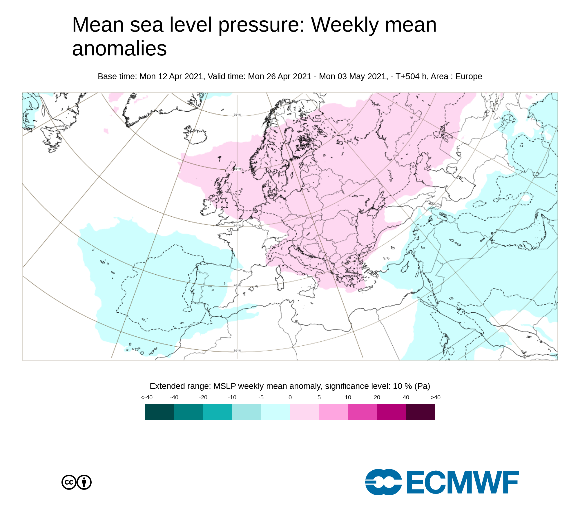
Monday the 26th of April to Monday the 3rd of May
PINK/PURPLE : Higher than average - GREEN/BLUE - Lower than average
Kenneth from the Donegal Weather Channel
You can find all the latest weather warnings and forecasts by downloading our app from the google play store by clicking below

LATEST NEWS


