
A risk of heavy snowfall in parts of Ireland on Wednesday night as band of rain spread northwards

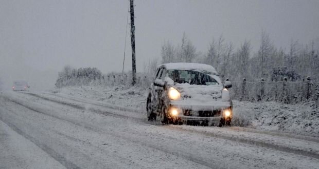
A car drives along a snow covered road near Knock in Co Mayo. Photograph: Paul Mealey
Some wintry falls of hail, sleet and snow on Wednesday morning mainly across western and northern parts of Ireland before showers fizzle out later in the morning with bright and sunny spells for some.
Wednesday afternoon will be dry for many parts of Ireland especially the midlands and north as a brief area of higher pressure builds.
Temperatures on Wednesday will range between 4C to 8C.

Drier and brighter weather later Wednesday morning and early afternoon across the country but cloudier over southern parts
Continues below


After midday Wednesday and over the early afternoon cloudy will start to increase across the southern half of Ireland with a band of rain closely following behind pushing into the southwest and south of Ireland later in the afternoon and evening.
Across Ulster there will be good bright and sunny spells with dry conditions over the afternoon but cloud will also increase over the northern half of Ireland as that band of rain progresses northwards.

A band of rain starting to spread into the southwest and south of Ireland at around 3pm Wednesday with sunny bright and sunny spells over Ulster.
Continues below
To start Wednesday night there will be heavy rainfall across Munster and coastal areas of Connacht with the risk of spot flooding.

9pm Wednesday night heavy rainfall across Munster, south Leinster and west Connacht.
Between 9PM and Midnight that spell of rain will spread over the rest of Ireland over Leinster and Ulster but as it does so it bumps into colder air across the Connacht and Ulster and could fall as heavy snow for a time on Wednesday night and early Thursday morning just after midnight with the risk of some accumulations in places especially across the northwest and north of Ireland

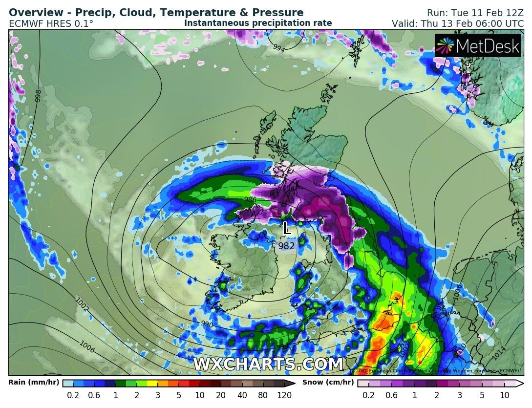
The ECMWF model showing heavy snow in part of north connacht and west ulster on Wednesday night giving possible accumulations

As the band of rain spread north it hit colder air over Ulster with the risk of heavy snowfall
Any precipitation then clears to the north on Thursday before sunrise but some very poor road conditions could occur across the Ulster.
Continues below
Come Wednesday night it will be more of a nowcast situation based on temperatures across Ulster and Connacht on where sees snowfall. Temperatures on Wednesday night will range around -1C to 2C across parts of Connacht and Ulster and 1C of a difference could be the difference on where sees snow and where sees a mix of rain and sleet.
Munster and Leinster will see falls of rain with the risk of spot flooding but a mix of sleet or wet snow cant be ruled out across north Leinster.
Some accumulations of between 3cm to 6cm across Ulster look possible in some low level areas but not all with up to 10cm or more over the higher ground areas and mountains.
Another snow and ice warning could be issued on Wednesday around midday depending on what the latest models show and if a warning is issued it will be more than likely be between the times of 8PM Wednesday and 10am Thursday morning.


Click on the tabs below to view the new forecasts available under the forecast section.
2019 CALENDAR NOW ON SALE


2019 Calendar now on sale
You can now purchase the Donegal Weather Channel Calendar 2019. You can purchase the Calendar from the online store
All calendars will be posted out in the middle of November with only a limited amount available. Calendars can be purchased anywhere across the world.


The stunning Leitir Mhic An Bhaird (Lettermacaward) Donegal during May 2018

Vivid Rainbow from up on Breezy mountain South Donegal

I was in Albufeira Portugal I was waiting for the full moon to come up and it did not let me down.
The orange and red tints that the Moon sometimes take on rising and setting are caused by the particles in the Earth's atmosphere. When light (or more specifically, packets of light called photons) from an astronomical object passes through the Earth's atmosphere, it scatters off of particles in the latter.

What a unbelievable night and morning out storm chasing, These number of thunderstorms had to be the best in years as most of the lightning was CG bolts. I even manage to captures Two to three CG bolts in one shot.

One of the most beautiful views of Slieve league From sea and got some nice photos.
Photos from this angle I have not seen yet and it was wonderful to finally capture that moment.