Monthly Long Range Forecast Update Ireland - 27th April 2021
Photo of Mullaghmore, Sligo by Kenneth Mc Donagh Photography
This week Donegal Weather Channel launches it first weekly monthly long range forecast for Ireland which will look at the possible weather conditions or trends up to 4 weeks down the road. Weather forecasting over the years has become much easier but is still a very tricky subject due to the amount of dynamics involved.
Yesterday Donegal Weather Channel first notified the public on it plans to start a new weekly updated forecast for up to 4 weeks ahead. Forecasting more than 5 to 7 days ahead is very tricky and the further out you look the more complex and uncertainty there is within the forecast. Some times we can look at trends and some of the longer range models which can give us a hint and can be right looking at the longer term period.
Please note that the longer range forecasts are more uncertain and will not always be right.
SPONSOR THE LONG RANGE FORECAST
If you have a business and would like to sponsor our weekly month long range forecast for a period of 1 week or 1 month please do contact Donegal Weather Channel at info@donegalweatherchannel.ie or message our Facebook page . Donegal Weather Channels service relies on sponsorship/advertising. Without sponsorship/advertising Donegal Weather Channel would not be able to give so many hours and a daily service.


The forecast will be issued by myself Kenneth and i will try to keep it simple making it easy for everyone to understand. If there is a term I use in the forecast which you may not know what it means I will explain what I am talking about .
Before I start with the long range forecast I will just explain what we will be looking at and how the forecast will work.
The forecast will be broken up into 4 section Example below :
Week 1 - Monday 26th April 2021 -Monday 3rd May 2021
Week 2 - Monday 3rd May2021 -Monday 10th May 2021
Week 3 - Monday 10th May 2021 -Monday 17th May 2021
Week 4 - Monday 17th May 2021 -Monday 24th May 2021
Things we will look at in the forecast:
Mean sea level pressure: Weekly mean anomalies
2m temperature: Weekly mean anomalies
Wind
Precipitation: Weekly mean anomalies (eg. rainfall and snowfall for a example.
Dust forecast ( Only in Week 1)

Forecaster - Kenneth Mc Donagh
Week 1 - Monday 26th April 2021 -Monday 3rd May 2021
Mean sea level pressure: Weekly mean anomalies
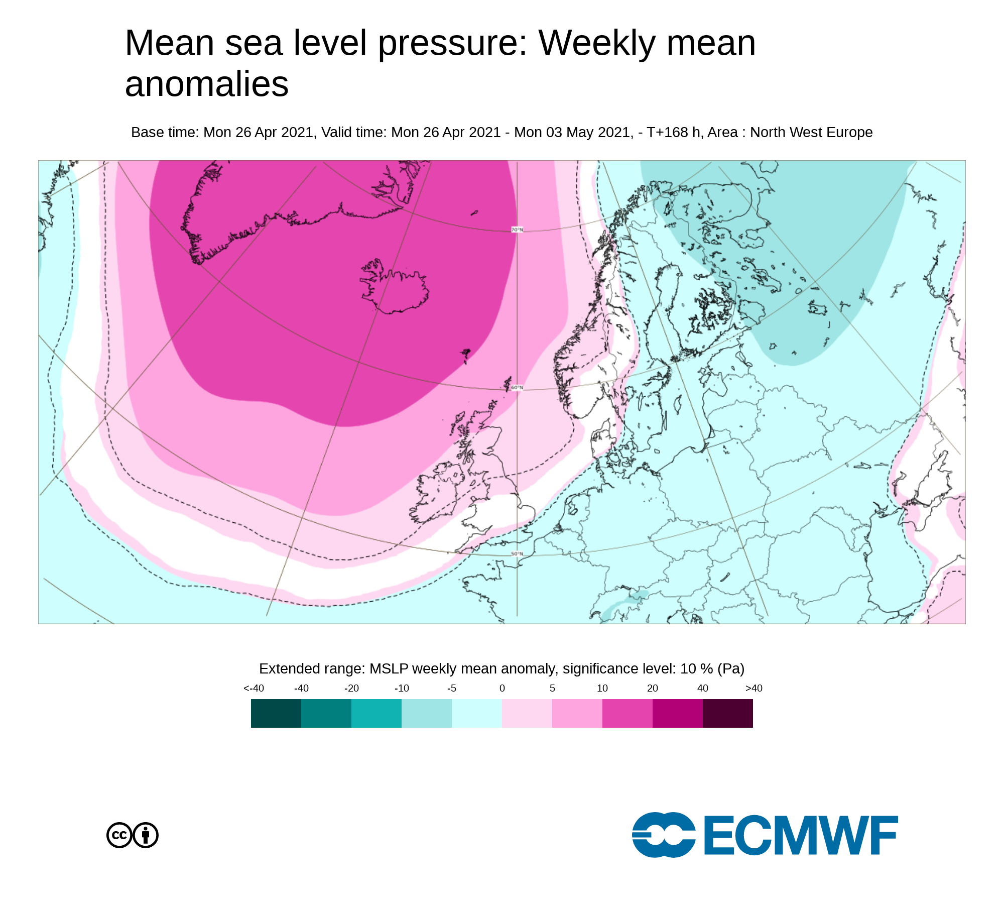
Higher pressure than average to the north of Ireland during this week will mean a lot of dry weather across Ireland but not fully dry. Lower pressure to the south of of Ireland will keep weather fronts at bay at least up until the end of the May Bank holiday weekend.
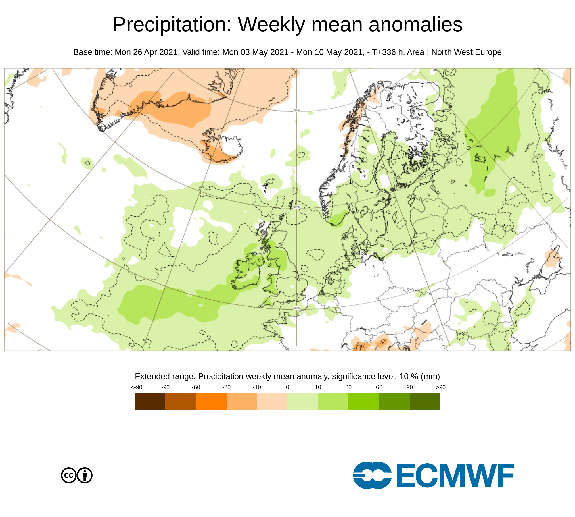
Precipitation ( Rainfall): Weekly mean anomalies
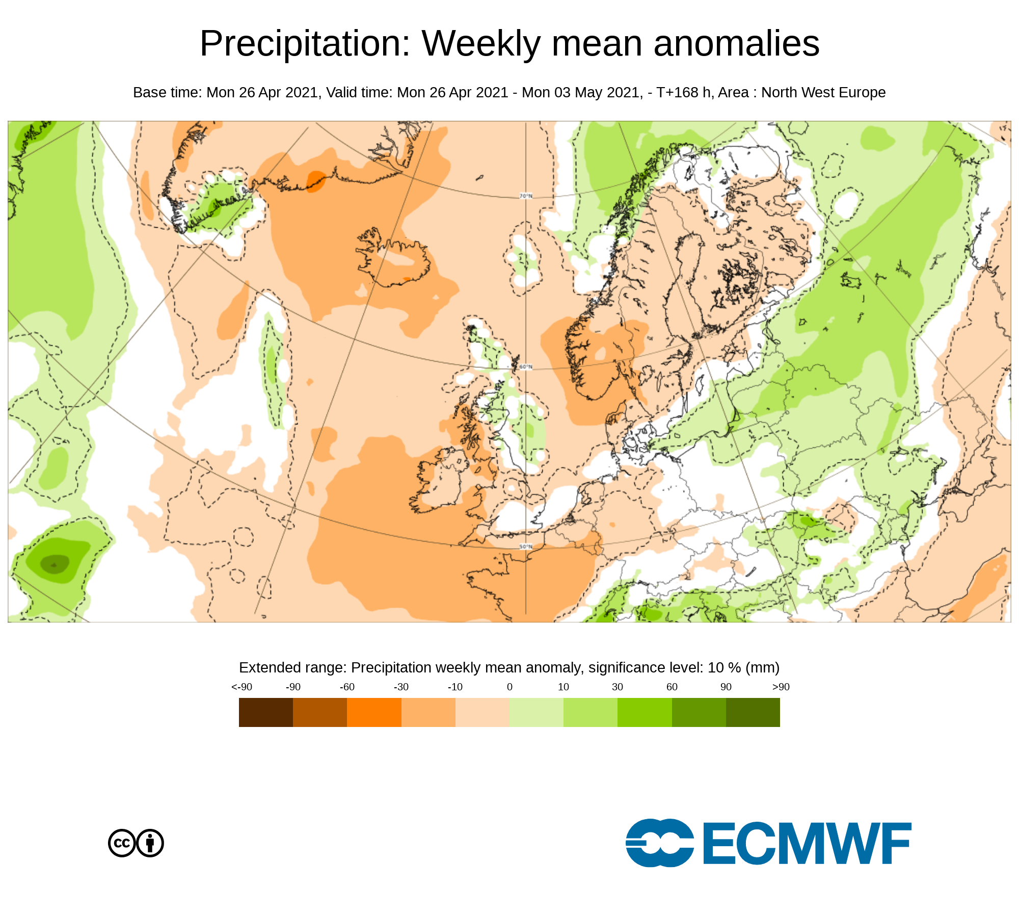
Rainfall amounts over week 1 will be below average between 10% to 30% below, Lowest rainfall amounts across the west of Ireland. Any rainfall over the week will come in the way of showers.
Rainfall amounts up until Sunday 2nd May 2021
Ulster - 5mm to 20mm ( Highest amounts in central and southeast Ulster)
Connacht - 5mm to 15mm
Munster - 15mm to 30mm
Leinster - 5mm to 25mm (Highest amounts in the south of Leinster)
2m temperature: Weekly mean anomalies - Wind
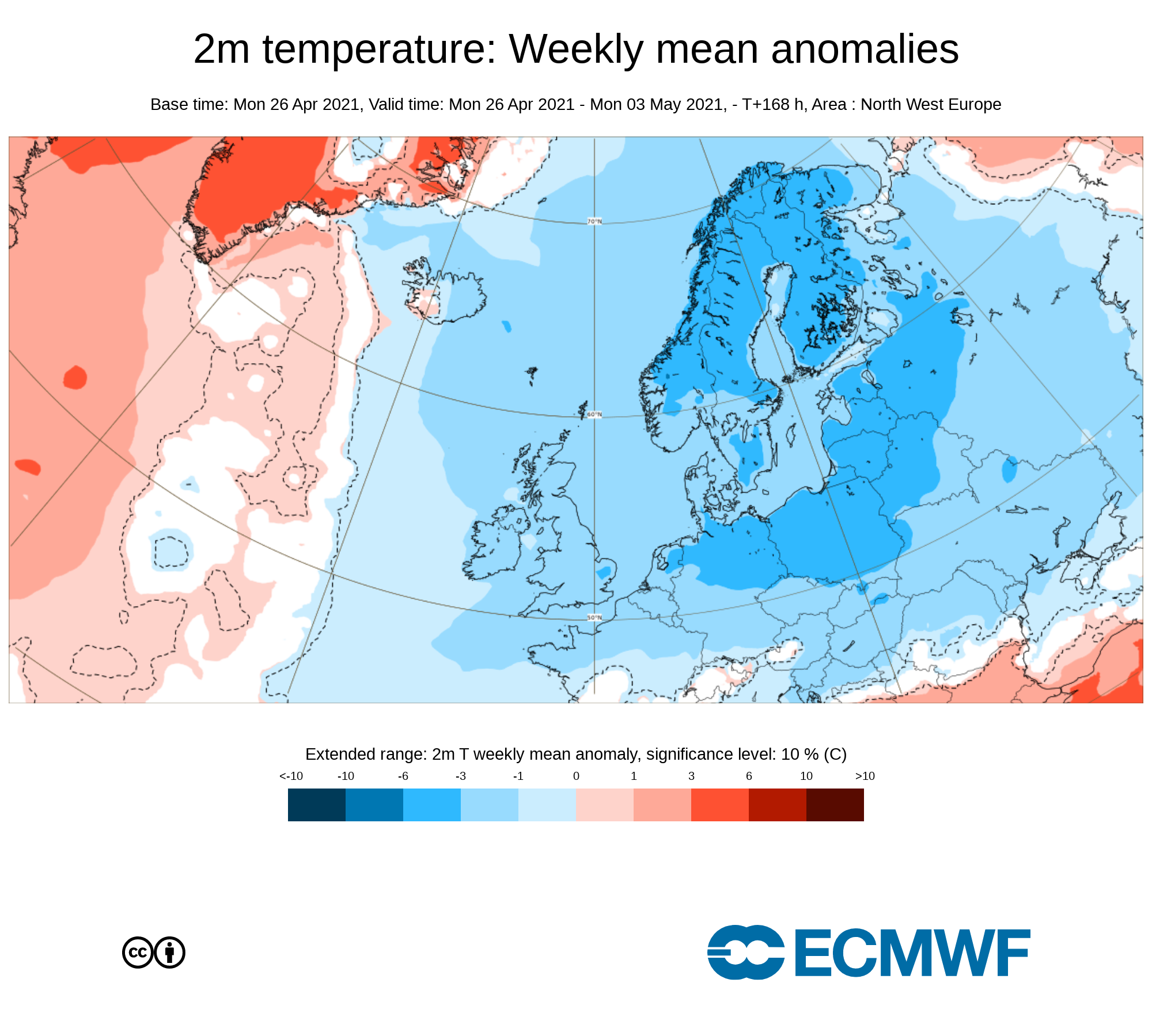
Temperatures over week 1 will be below average across the whole country around 3C below average. Some frost may be possible at stage during the week at nights with lows of around -1C. Overall day time temperatures will range between 8C to 12C up until Sunday the 2nd of May.
WIND
No strong winds are expected over this week but it may become windy into the start of week 2.
Forecasters final note on week 1
Overall week 1 will be rather settled with no real hazards our impacts from the weather that the public need to worry about. Even with the risk of some frost during the week temperatures will not dip low enough for farmer or gardeners to be concerned about.
Even with a cooler week than average for this time of year expected UV levels will be Moderate in any sunshine with the risk of sun burn possible.
Pollen levels will be low to moderate over the week with pollen levels lowest during cloudy and wet weather and highest during any sunny dry periods. The main type of pollen will be tree this week.
Dust levels will be low across Ireland during week 1.
Week 2 - Monday 3rd May 2021 -Monday 10th May 2021
Mean sea level pressure: Weekly mean anomalies
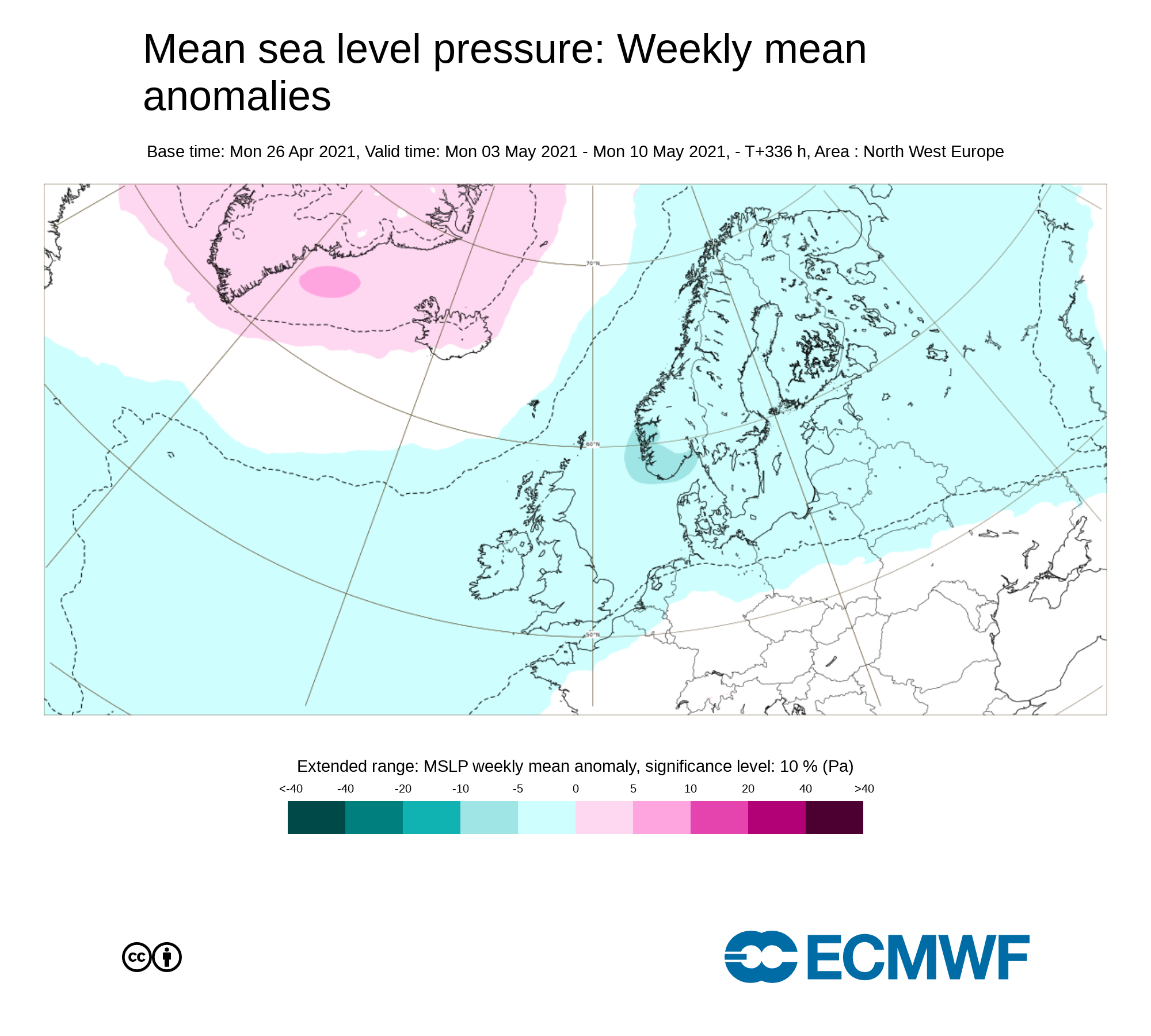
Lower pressure than average across Ireland this week will mean a lot more unsettled conditions across Ireland with weather fronts moving in of the Atlantic bring wet and possibly windy conditions at times.
Precipitation ( Rainfall): Weekly mean anomalies
With a return to more unsettled conditions this will mean heavy pulses of rainfall will move in from the Atlantic over week 2. Some flooding could be a issue especially over the second half of week 2.
Rainfall amounts will be 10% to 30% above average.
2m temperature: Weekly mean anomalies - Wind

Temperatures over week 2 will be near normal to just below average across Ireland. The risk of frost will only be slight. Overall day time temperatures will range between 8C to 12C up until Monday the 10th of May.
WIND
Some strong wind will be possible early in the week at this stage possibly on bank holiday Monday with strong west to northwest winds for places and gales along the coast as a area of low pressure will pass close to Ireland. There will be the risk of further strong wind over the week but no massive storms are expected looking at the latest outlook.
Forecasters final note on week 2
Overall week 2 will be rather unsettled week with periods of heavy rainfall from Monday the 3rd of may onwards Some flooding will also occur near the end of the week with this been the main risk and hazard over the week.
Even with a cooler week than average for this time of year expected UV levels will be Moderate in any sunshine with the risk of sun burn possible.
Pollen levels will be low to moderate over the week with pollen levels lowest during cloudy and wet weather and highest during any sunny dry periods. The main type of pollen will be tree this week.
Week 3 - Monday 10th May 2021 -Monday 17th May 2021
Mean sea level pressure: Weekly mean anomalies
The forecast for this period is a little more uncertain but the current signal is for lower than average pressure to sit across Ireland on week 3. This again will mean unsettled conditions across the country. There is signals high pressure may try to build later in the week over the weekend of week 3.
Precipitation ( Rainfall): Weekly mean anomalies
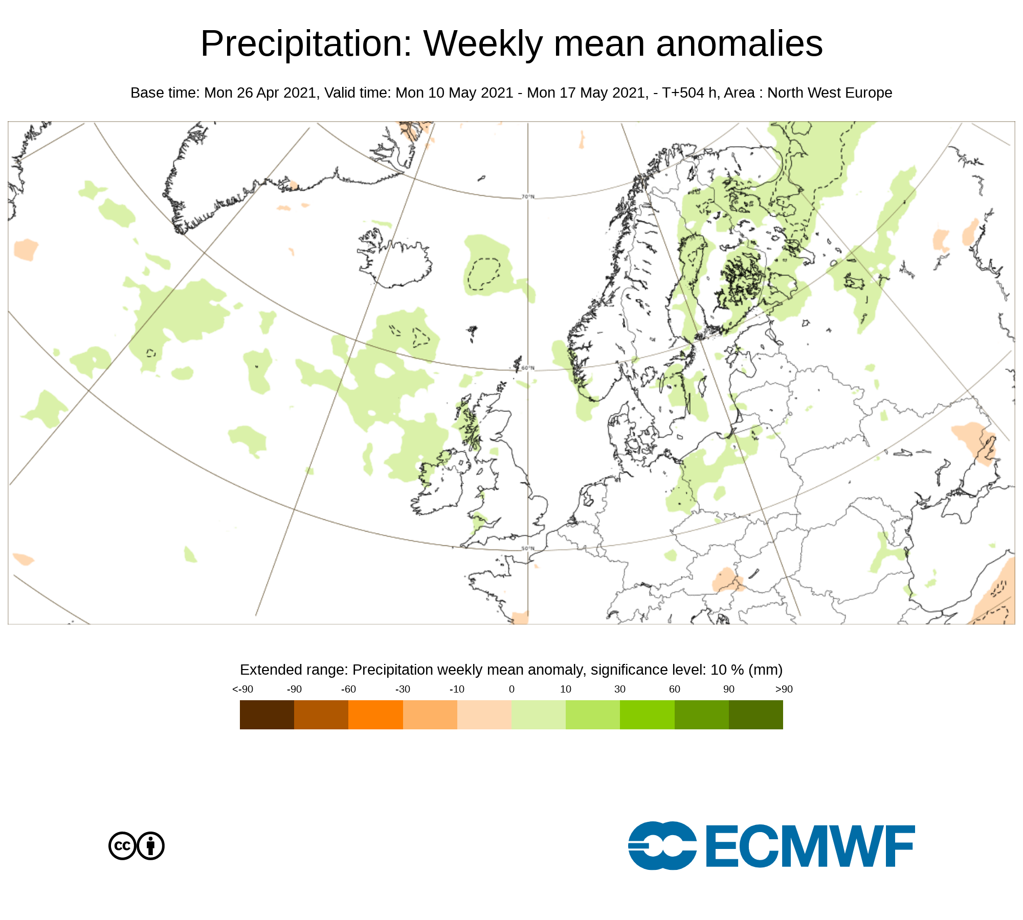
Over week 3 confidence in the forecast is that bit lower but the current signals from the ECMWF & GFS forecast models is for further unsettled conations to start the week with further heavy pulses of rainfall. Over week 3 the latest signs are for it to start wetter and possibly ending on a drier not but again this is uncertain.
The latest output from models show rainfall amounts this week been 10% to 30% above average.
2m temperature: Weekly mean anomalies

Temperatures over week 3 will be near normal across Ireland. The risk of frost will only be slight. Overall day time temperatures will range between 10C to 14C up until Monday the 17th of May.
WIND
Some strong winds will be possible this week but overall not causing an major problems
Forecasters final note on week 3
Overall week 3 will be rather unsettled week with periods of heavy rainfall from Monday the 10th of may with some flooding also possible. There are some signs high pressure may build later in week 3.
Even with a cooler week than average for this time of year expected UV levels will be Moderate in any sunshine with the risk of sun burn possible.
Pollen levels will be low to moderate over the week with pollen levels lowest during cloudy and wet weather and highest during any sunny dry periods.. Grass pollen may start to rise this week.
Week 4 - Monday 17th May 2021 -Monday 24th May 2021
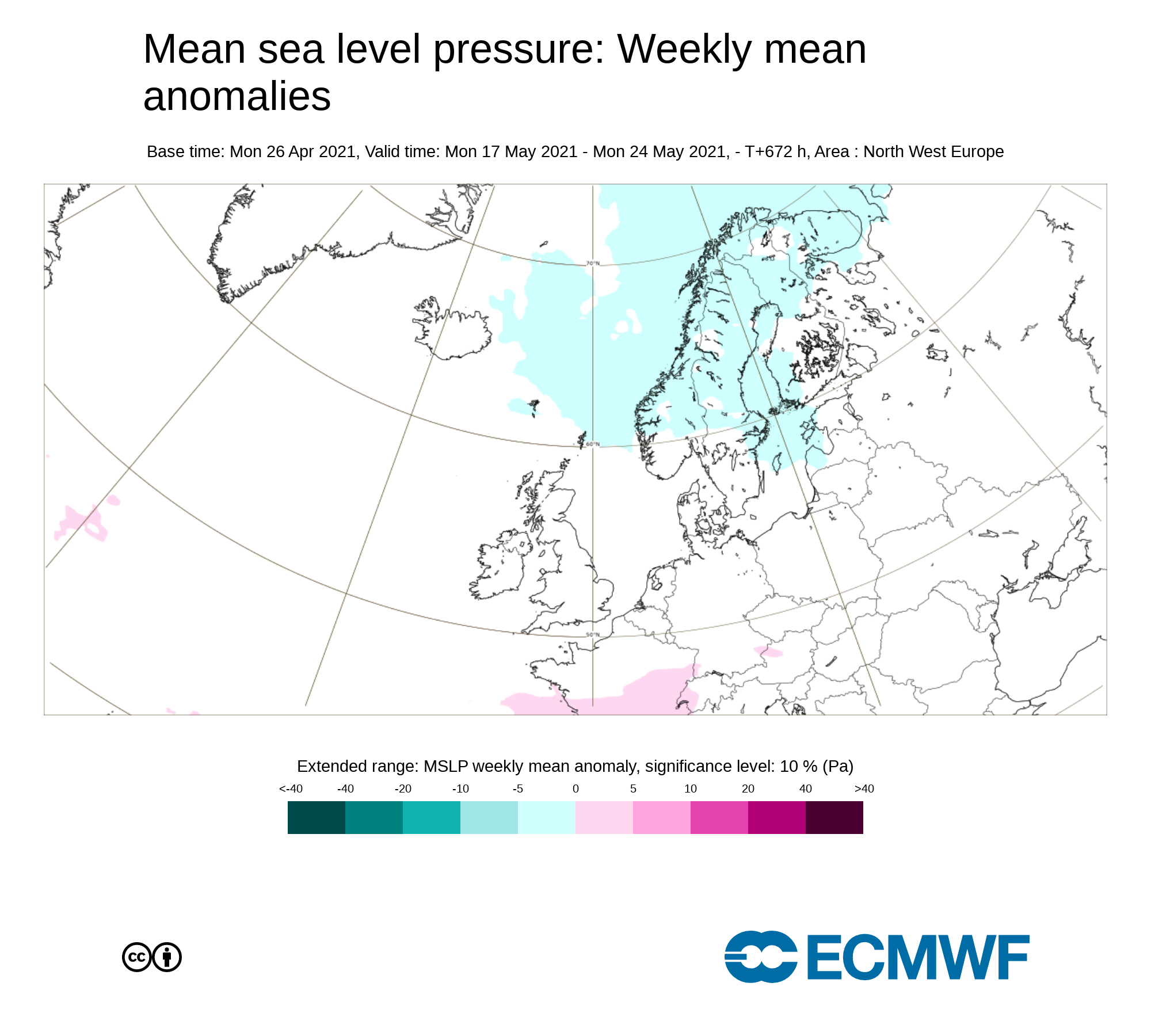
Mean sea level pressure: Weekly mean anomalies

Confidence in this week is rather low and uncertain. There are some signals for higher pressure to the south of Ireland and lower pressure to the north of Ireland. High pressure may build over week 3 from the southeast and south much more settled conditions.
Precipitation ( Rainfall): Weekly mean anomalies
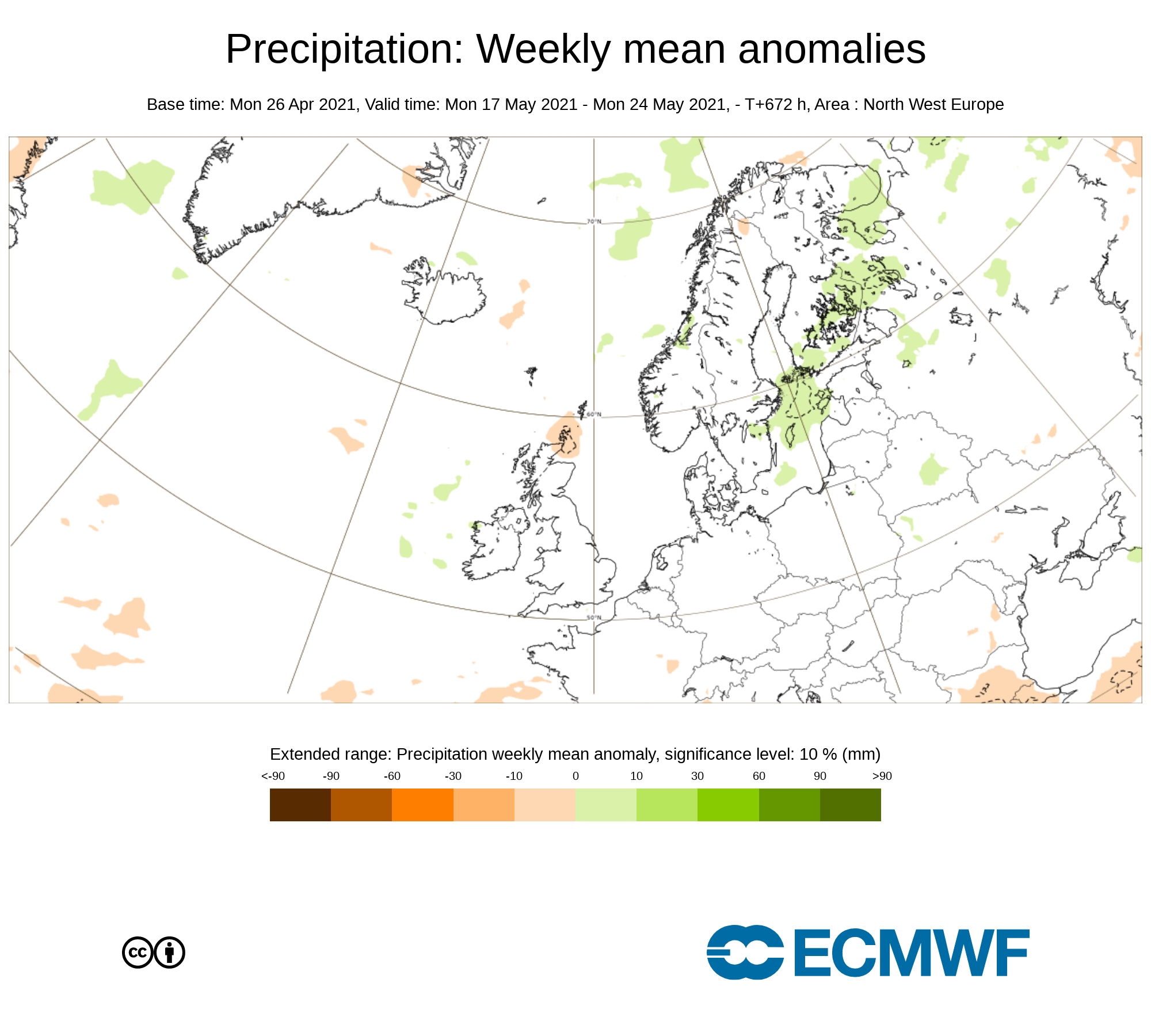
Again Confidence is rather low for this week but the latest signal is for near normal or just below average rainfall amounts for week 4. If high pressure build then much drier weather will prevail.
2m temperature: Weekly mean anomalies
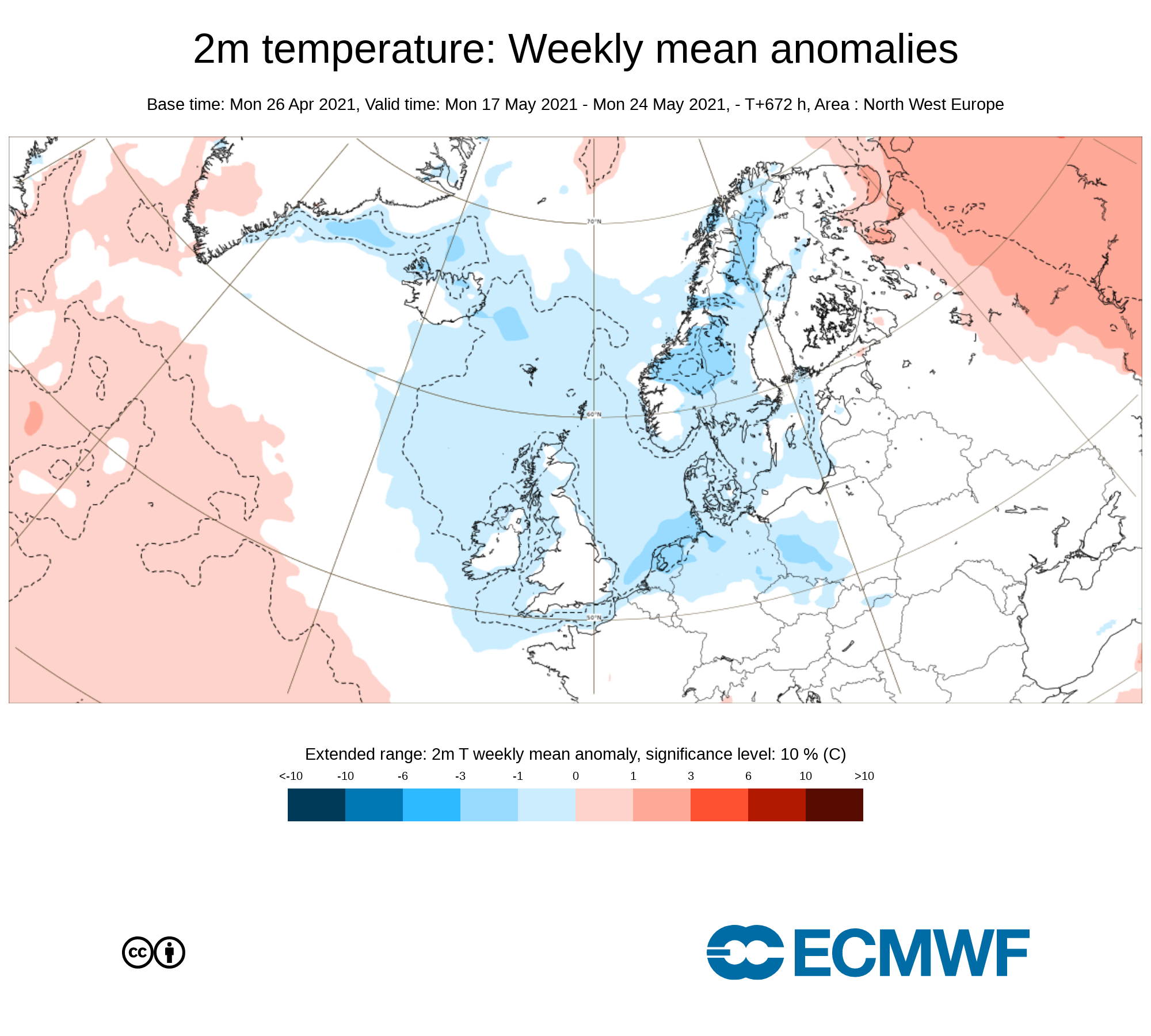
Again Confidence is rather low for this week but the latest signal is for Temperatures over week 4 been near normal across Ireland. Temperatures overall in the low to mid teens with no signs of any real good warm conditions
WIND
Winds will be much lighter this week especially if high pressure manages to build
Forecasters final note on week 3
With low confidence the latest signal for week 4 is for possible higher pressure and rainfall amount near normal or below in some places.
Even with a cooler week than average for this time of year expected UV levels will be Moderate in any sunshine with the risk of sun burn possible.
Pollen levels will be low to moderate over the week with pollen levels lowest during cloudy and wet weather and highest during any sunny dry periods.. Grass pollen should start to rise this week.
Sign up to our Newsletter