
Monthly Long Range Forecast Update Ireland - 14th June until 12th July 2021

The Donegal Weather Channel Monthly Long range forecast issued every week looking up to a month ahead using data from the ECMWF and GFS models.
Please note that the longer range forecasts are more uncertain and should not be used to plan outside activities from over a week out.
Extended Range Output
The output is rather different from the shorter period output of HRES and ENS products. It provides a more general overview of the forecast up to Day 46, focusing mainly on the week-to-week changes in the weather rather than attempting to give unsupportable detail on individual days. Output is mostly in the form of anomalies relative to ER-M-climate and is mainly shown as 7-day means for calendar weeks Monday-Sunday. Specialised products for the extended range also include information on potential tropical cyclone activity and the MJO during the coming month.
SPONSOR THE LONG RANGE FORECAST
If you have a business and would like to sponsor our weekly month long range forecast for a period of 1 week or 1 month please do contact Donegal Weather Channel at info@donegalweatherchannel.ie or message our Facebook page . Donegal Weather Channels service relies on sponsorship/advertising. Without sponsorship/advertising Donegal Weather Channel would not be able to give so many hours and a daily service.

The forecast will be issued by myself Kenneth and i will try to keep it simple making it easy for everyone to understand. If there is a term I use in the forecast which you may not know what it means I will explain what I am talking about .
Before I start with the long range forecast I will just explain what we will be looking at and how the forecast will work.
The forecast will be broken up into 4 section Example below :
Week 1 - Monday 14th June 2021 -Monday 21st June 2021
Week 2 - Monday 21st June 2021 -Monday 28th June 2021
Week 3 - Monday 28th June 2021 -Monday 05th July 2021
Week 4 - Monday 5th July 2021 -Monday 12th July 2021
Things we will look at in the forecast:
Mean sea level pressure: Weekly mean anomalies
2m temperature: Weekly mean anomalies
Wind
Precipitation: Weekly mean anomalies (eg. rainfall and snowfall for a example.
Dust forecast ( Only in Week 1)
UV forecast outlook
Potential Pollen Levels

Forecaster - Kenneth Mc Donagh
Week 1 - Monday 14th June 2021 -Monday 21st June 2021
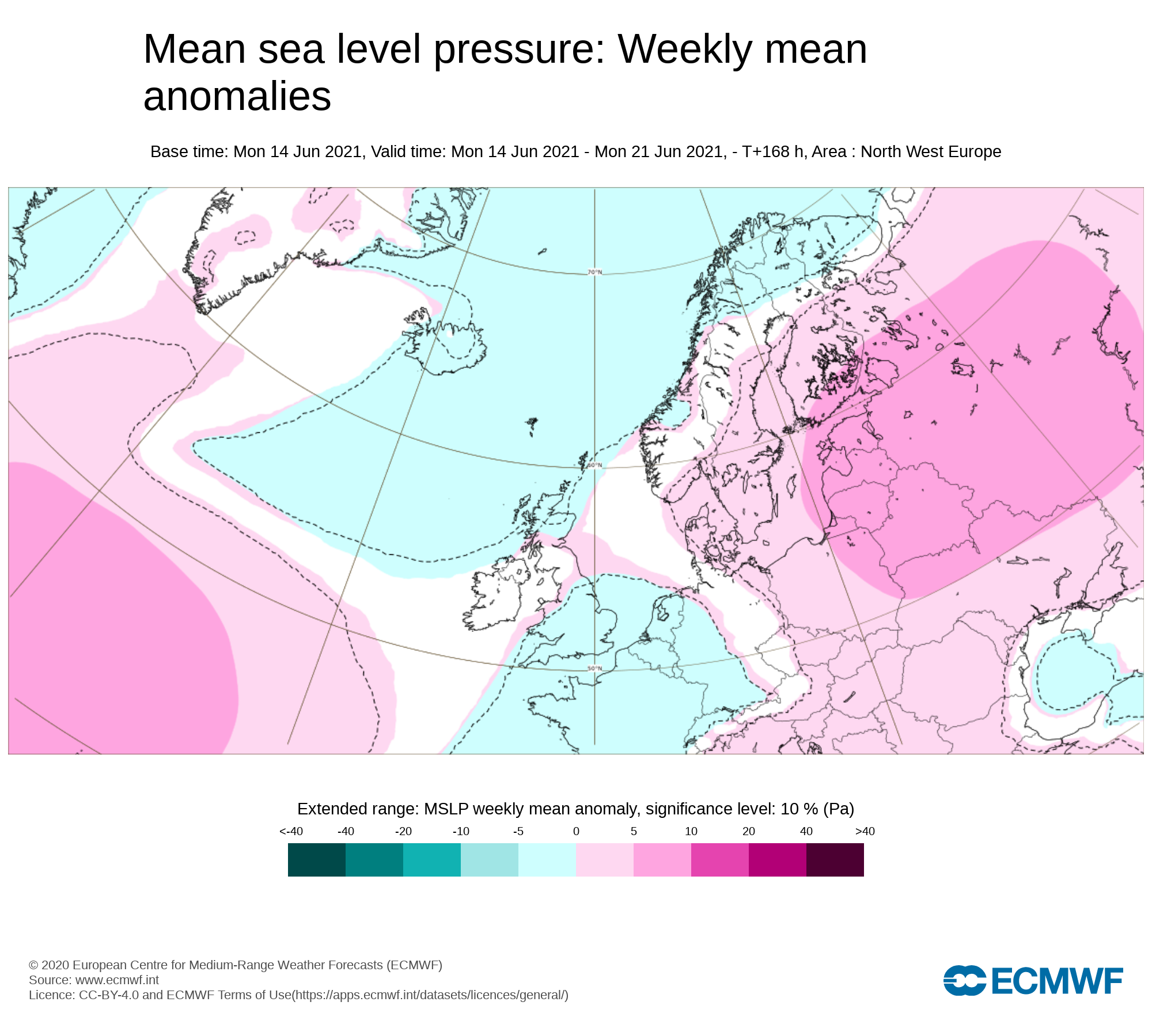
Mean sea level pressure: Weekly mean anomalies
Over week 1 low pressure will mainly dominate the weather across Ireland
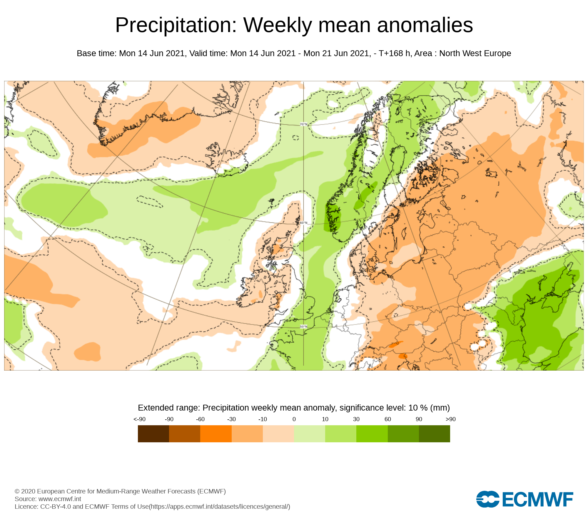
Precipitation ( Rainfall ): Weekly mean anomalies
Rainfall amounts over the week gone by where well below average across Ireland. Amounts range from trace 0.2mm to 15.2mm. The east and midlands was driest with 0.2mm recorded at Dublin airport. Across the northwest and southwest rainfall amounts where just under average.
Over the coming week rainfall amounts are expected to below normal again for much of Ireland . The only exception is northwestern , western and southwestern counites which will see near normal rainfall amounts over the coming week. The east and southeast of Ireland will be the driest parts of Ireland this week with some areas there receiving very little rainfall over the coming 7 days.
Tuesday, Saturday and Sunday will see the most rain this week.
Rain on Tuesday morning across the west and northwest will clear but during Tuesday afternoon and evening further rain is expected across western and northern parts of Ireland with some heavier spots of rain at time across western and northwestern coastal counites. The rain will spread west to east across Ireland overnight Tuesday and start to fizzle out and become more patchy across the east and southeast.
Wednesday, Thursday and Friday will be largely dry day across Ireland but there will be some scattered showers mainly across the southwest, west and northwest.
The latest outlook is for a spell of rain to move across Ireland Saturday evening and overnight with some heavier falls in the western half of Ireland. The latest indication is for drier weather to following across the west and northwest on Sunday afternoon but rain lingering across the eastern half of Ireland for much of the day and evening before clearing overnight Sunday. There is some uncertainty on this at the moment so keep a eye on the national forecast for updates over the week.
Rainfall amounts between Tuesday 15th June to Sunday 20th June 2021
ULSTER
Across much Ulster rainfall amounts are expected to be below average this coming week. Highest amounts will be across west Ulster mainly across Donegal over the higher ground areas with between 10mm to 30mm expected there. Across the rest of Ulster amounts will range between 5mm to 15m lowest amounts in the east of Ulster.
CONNACHT
Away from west Connacht rainfall amounts are expected to be below average this coming week. Highest amounts will be across west Connacht mainly across Galway & Mayo over the higher ground areas with between 20mm to 40mm. Across the rest of Connacht amounts will range between 10mm to 15mm lowest amounts in the east and northeast of Connacht.
MUNSTER
Away from west Munster rainfall amounts are expected to be below average this coming week. Highest amounts will be across west Munster mainly across west/south Kerry & south/west Cork over the higher ground areas with between 15mm to 30mm. Across the rest of Munster amounts will range between 10mm to 15mm lowest amounts in the east Munster.
LEINSTER
Overall Leinster will be the driest province this week with only between 5mm to 10mm. it will be driest in the southeast and the east of Leinster with the highest rainfall amounts across the west of the province.
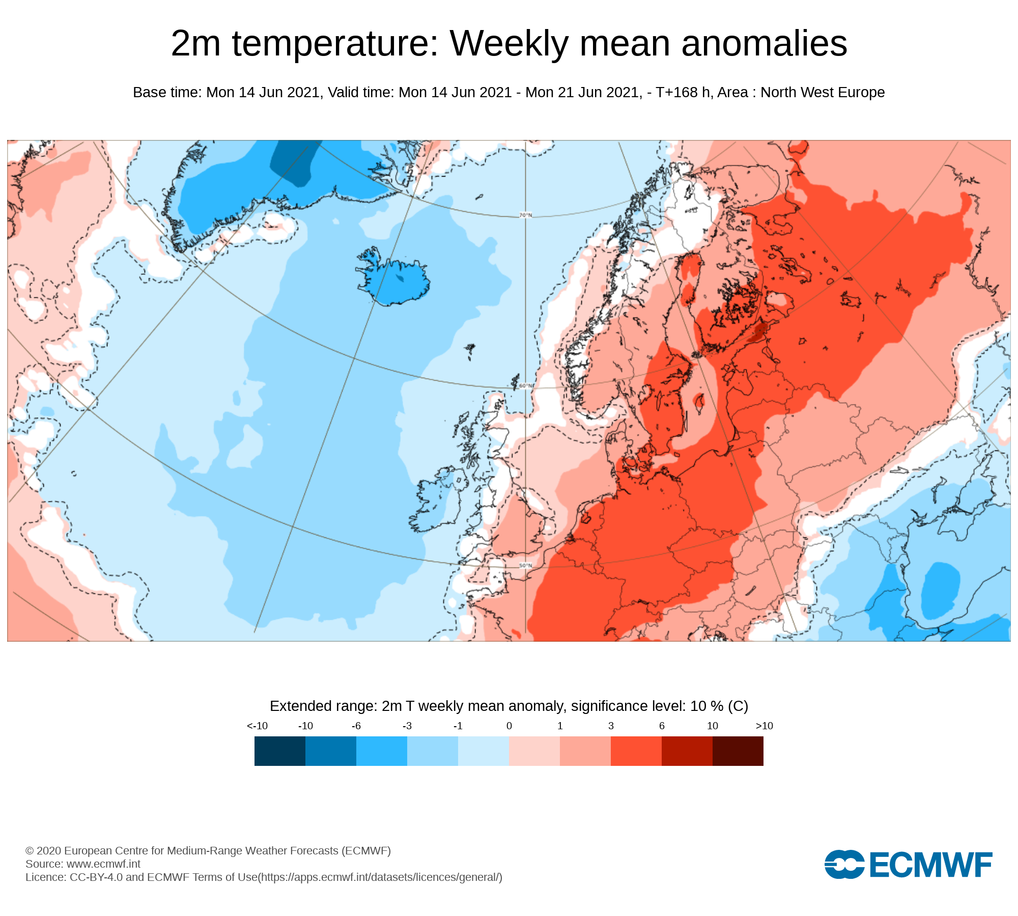
Temperature: Weekly mean anomalies
Temperatures over this week (week 1) will be below average across Ireland. There will be no risk of frost this week . Day time temperatures will be in the mid to high teens coolest in the western and northwestern areas warmest across the east.
Wind forecast
Tuesday will see rather gusty winds over the day with stronger winds along coastal areas. Wind will be below the warning threshold.
UV forecast
UV levels will be high this week .
Pollen Forecast
Pollen levels will be moderate to high over the week with pollen levels lowest during cloudy and wet weather and highest during any sunny & dry periods. The main type of pollen will be grass this week.
Dust forecast
Dust levels will be low across Ireland during week 1.
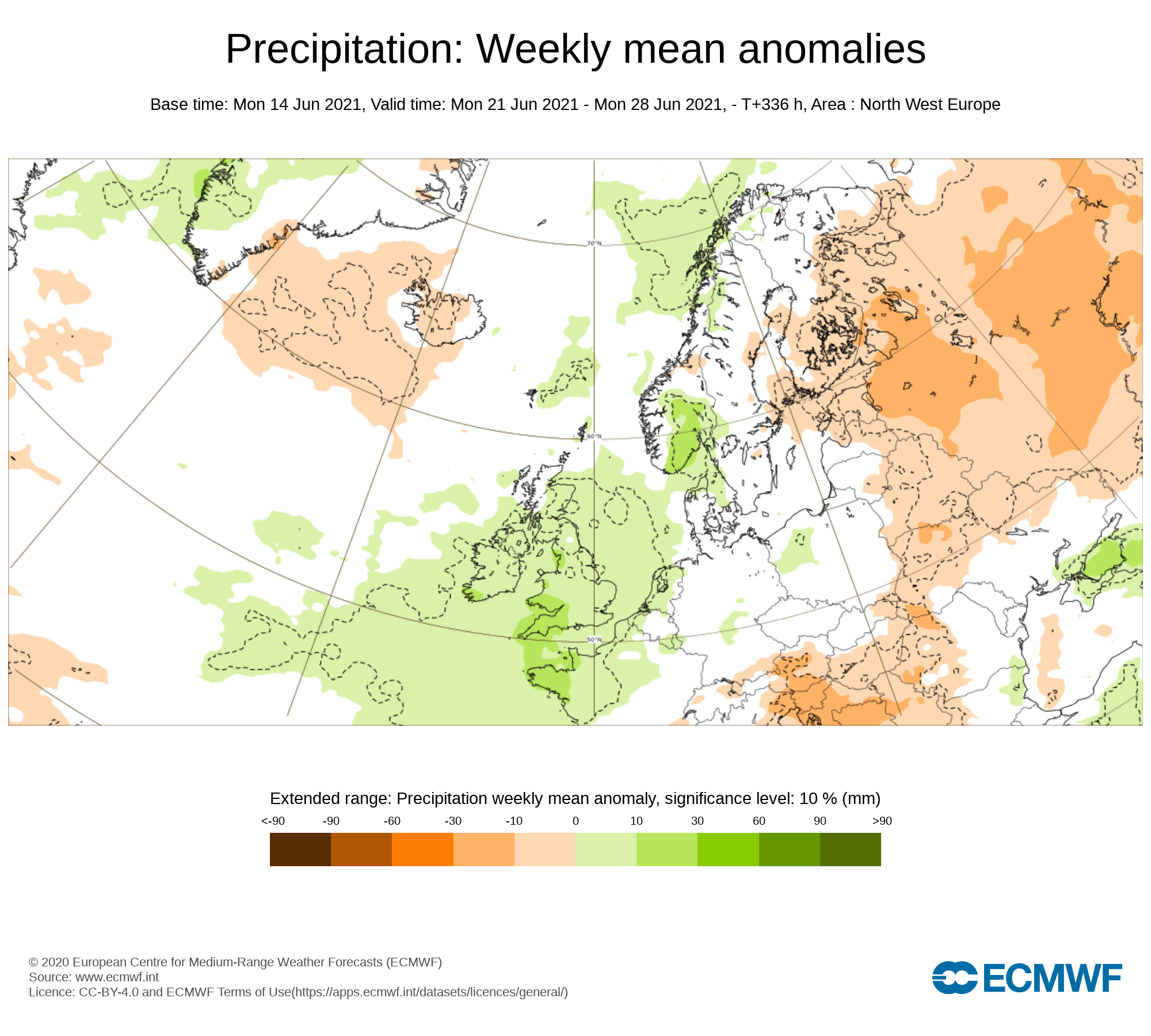
Week 2 - Monday 21st June 2021 -Monday 28th June 2021
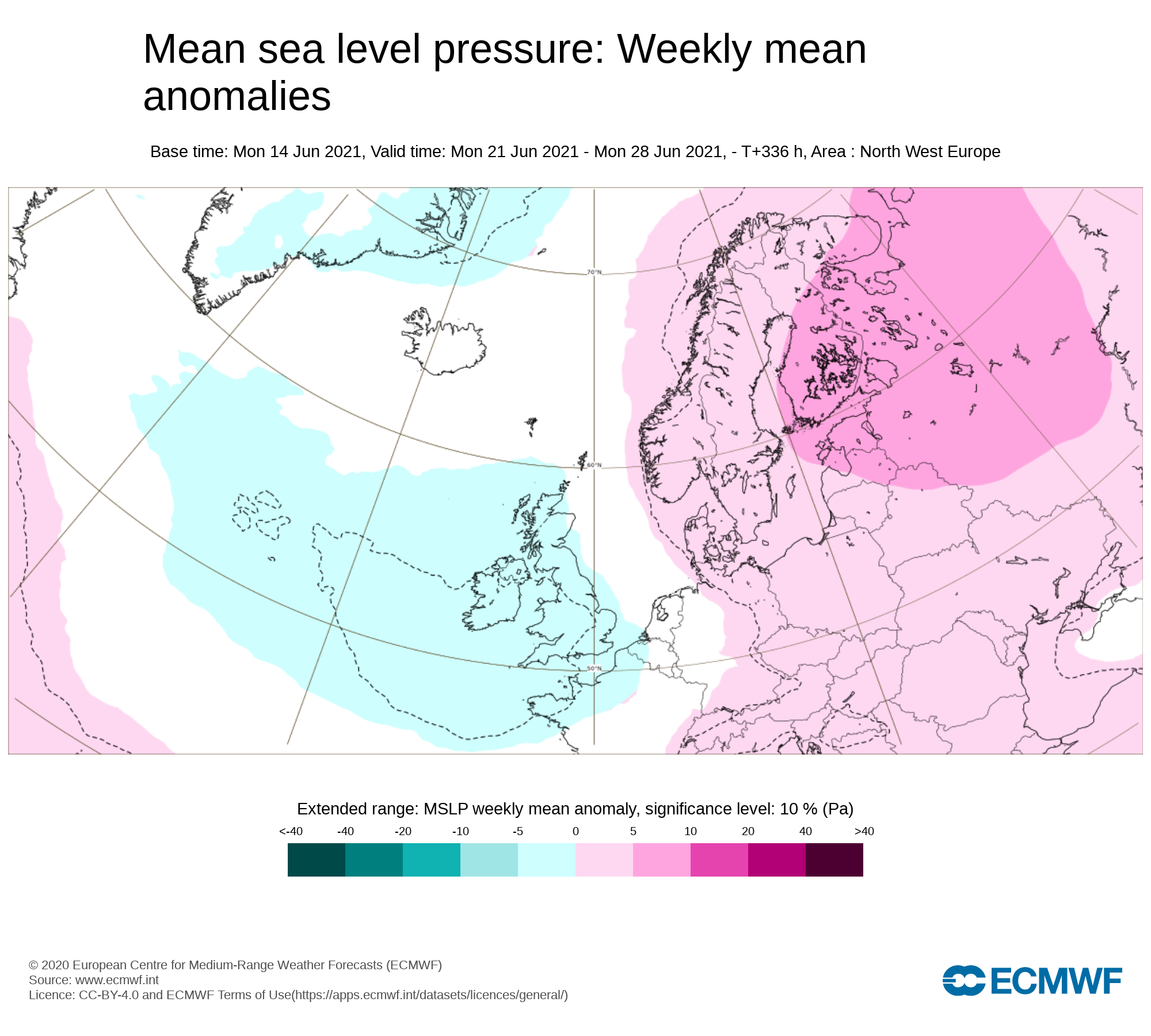
Mean sea level pressure: Weekly mean anomalies
The latest outlook from the ECMWF long range forecast shows low pressure over Ireland over week 2 which would bring unsettled weather at times. There airflow will be westerly.
Precipitation ( Rainfall): Weekly mean anomalies
The latest trend for this week shows rainfall amounts average or above average across parts of Ireland. during week 2. The main risk of rain coming from low pressure systems moving close or across Ireland.
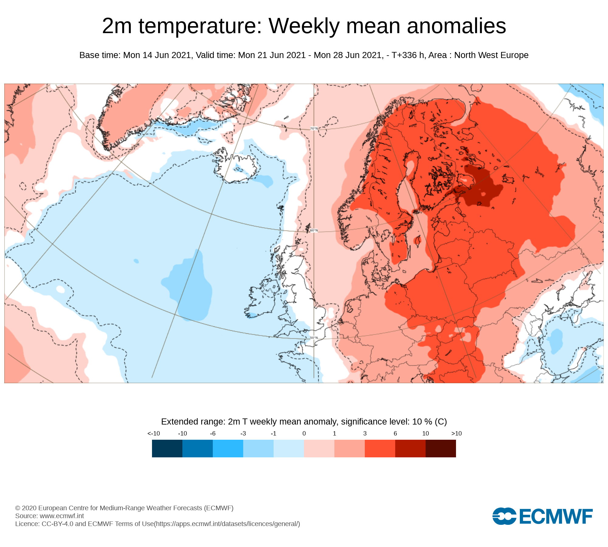
2m temperature: Weekly mean anomalies
This week is currently looking like temperatures will be average or just below average across Ireland. Temperaruse in the mid to high teens and possible low teen across some western coastal areas.
Wind Forecast
The will be the risk of some gusty winds this week but no significant wind is forecast.
UV forecast
UV levels will be high in any sunshine with the risk of sun burn even in cooler than average conditions.
Pollen Forecast
Pollen levels will be moderate to high over the week with pollen levels lowest during cloudy and wet weather and highest during any sunny dry periods. Grass pollen will be the main type.
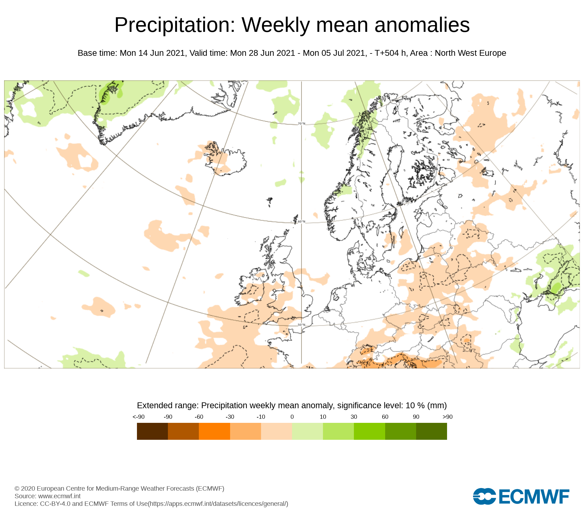
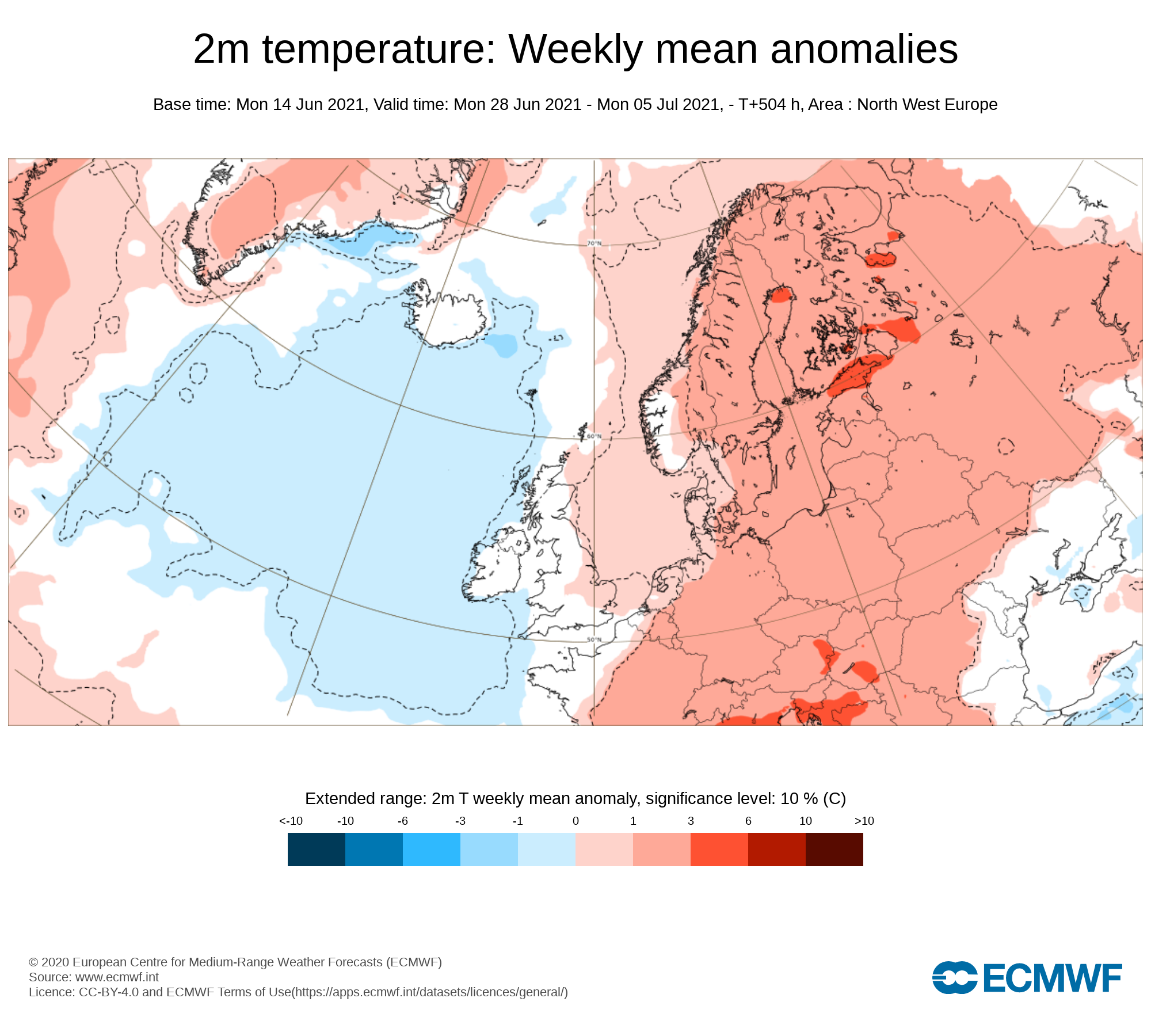
Week 3 - Monday 28th June 2021 -Monday 05th July 2021
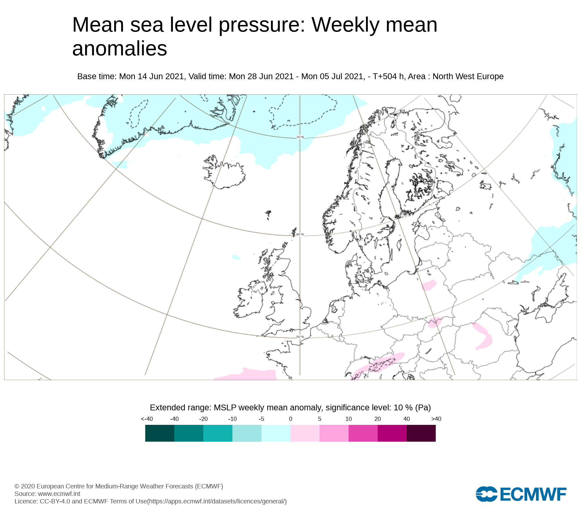
Mean sea level pressure: Weekly mean anomalies
Confidence in this week is rather low and more uncertain. Higher pressure is indicated to sit to the south of Ireland with lower pressure to the north. There are some signals that week 3 will become a little more settled with high pressure building.
Precipitation ( Rainfall): Weekly mean anomalies
Confidence in this week is rather low and more uncertain but the latest signal is for average or just below rainfall amounts.
2m temperature: Weekly mean anomalies
Again confidence in this week is rather low but the latest long range forecast from the ECMWF model indicates temperatures near normal for this time of year in the mid teens to high teens possibly into the low 20s in places.
Wind forecast
There are no strong signals for windy conditions over week 3
UV forecast
UV levels will be Moderate to High in any sunshine with the risk of sun burn.
Pollen forecast
Pollen levels will be moderate, high to very high over the week with pollen levels lowest during cloudy and wet weather and highest during any sunny dry periods. Grass pollen will be the main type
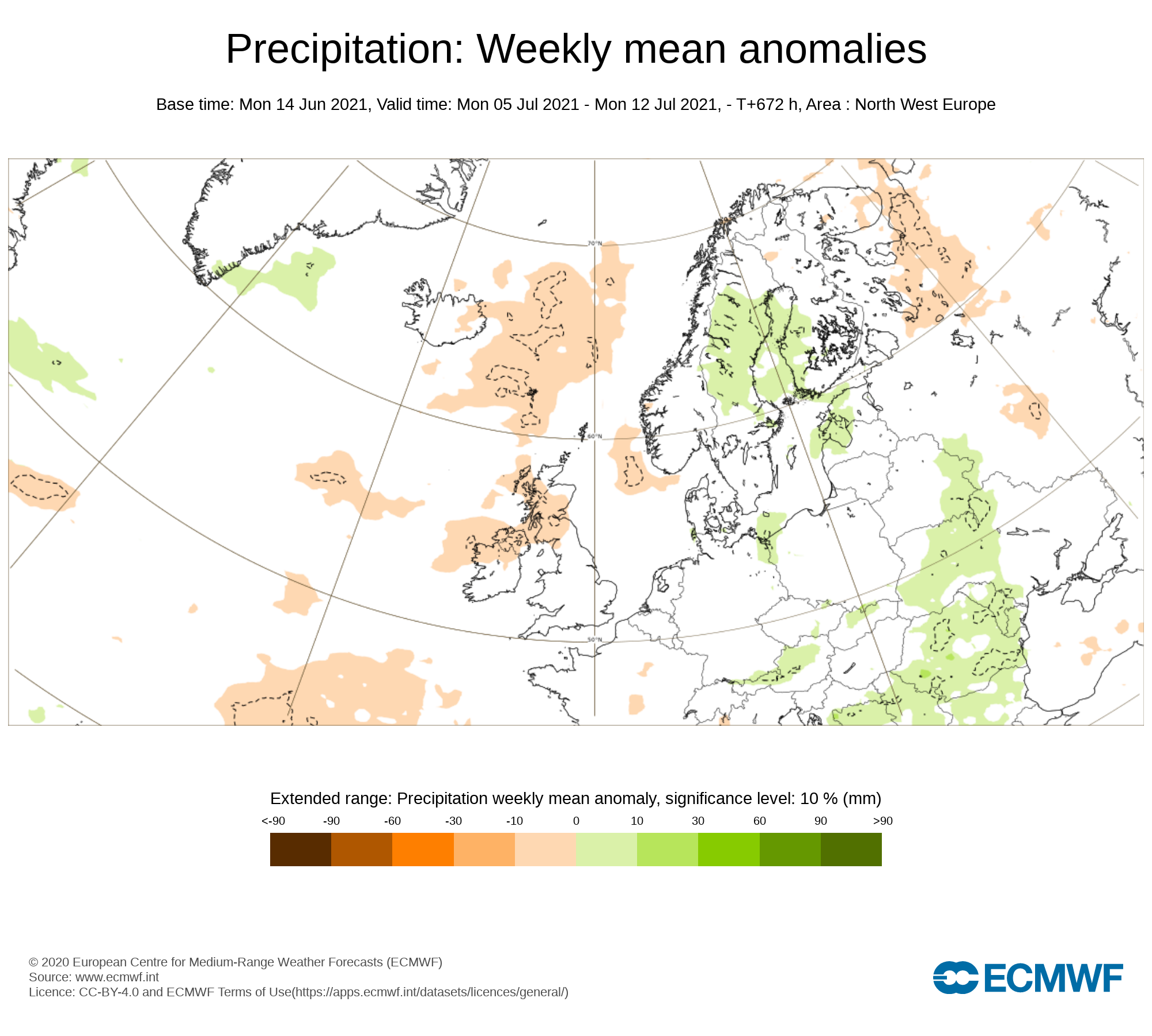
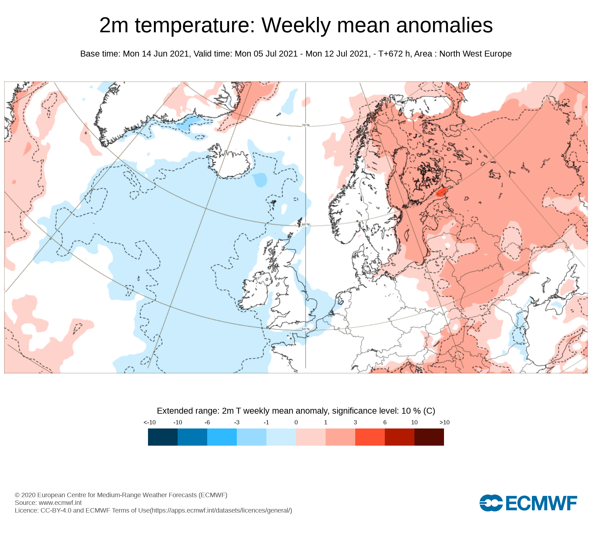
Week 4 - Monday 5th July 2021 -Monday 12th July 2021
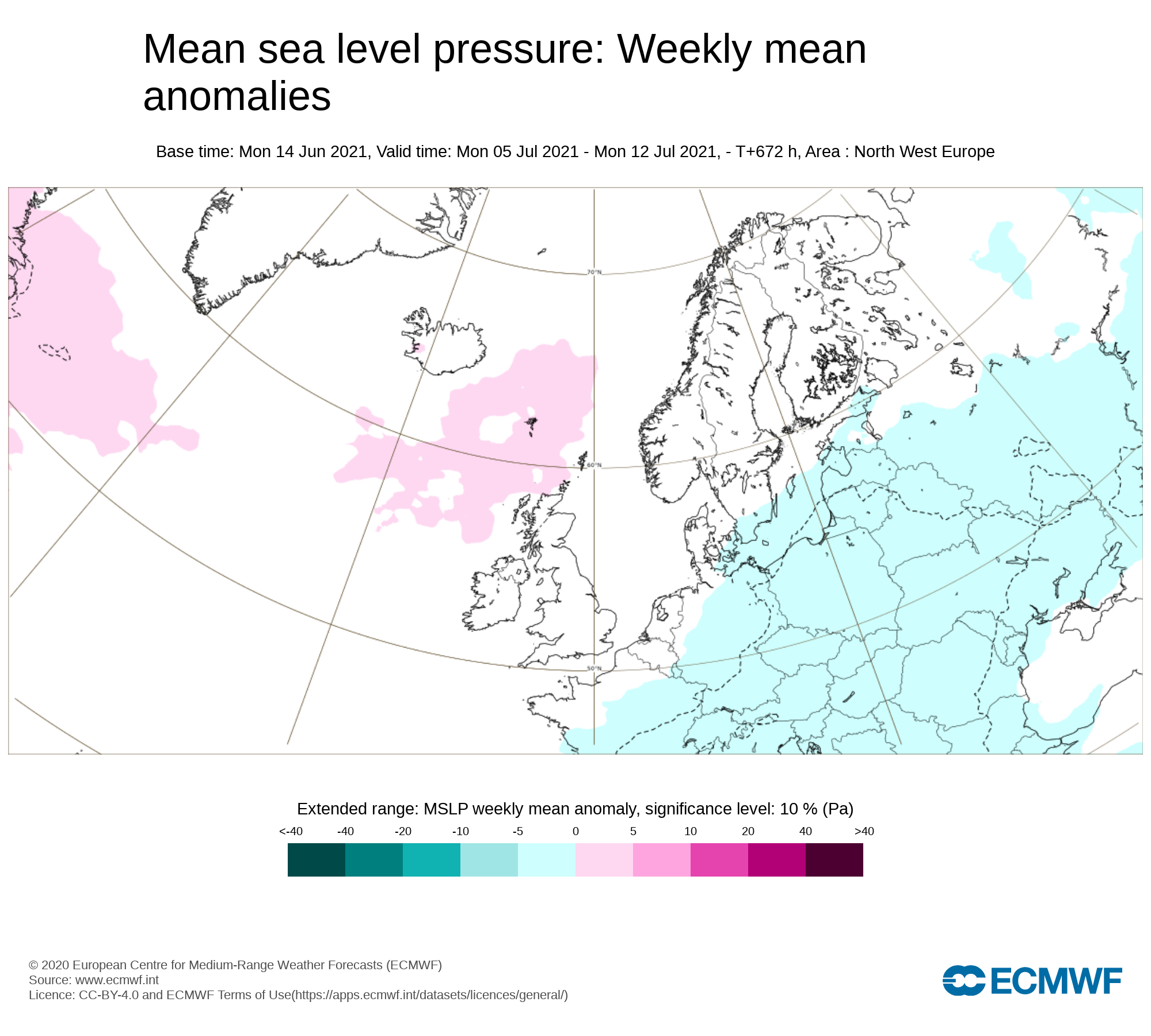
Mean sea level pressure: Weekly mean anomalies
And finally week 4 confidence is even lower as you can see from the above pressure chart attached but the latest signal is for higher pressure across Ireland bring a lot of drier weather across the country with largely settled weather.
Precipitation ( Rainfall): Weekly mean anomalies
Below average rainfall amounts are signaled for week 4 across Ireland with a lot of settled weather.
2m temperature: Weekly mean anomalies
Again confidence in this week is rather low but the latest long range forecast from the ECMWF model indicates temperatures near normal for this time of year in the high teens to low 20s possible into the mid 20s.
Wind forecast
No strong winds are signaled for this week
UV forecast
UV levels will be Moderate to High and possibly very high in any sunshine with the risk of sun burn even with cooler weather as the sun this time of year is stronger.
Pollen forecast
Pollen levels will be moderate to high and possible very high over the week with pollen levels lowest during cloudy and wet weather and highest during any sunny dry periods. Grass pollen the main type


