
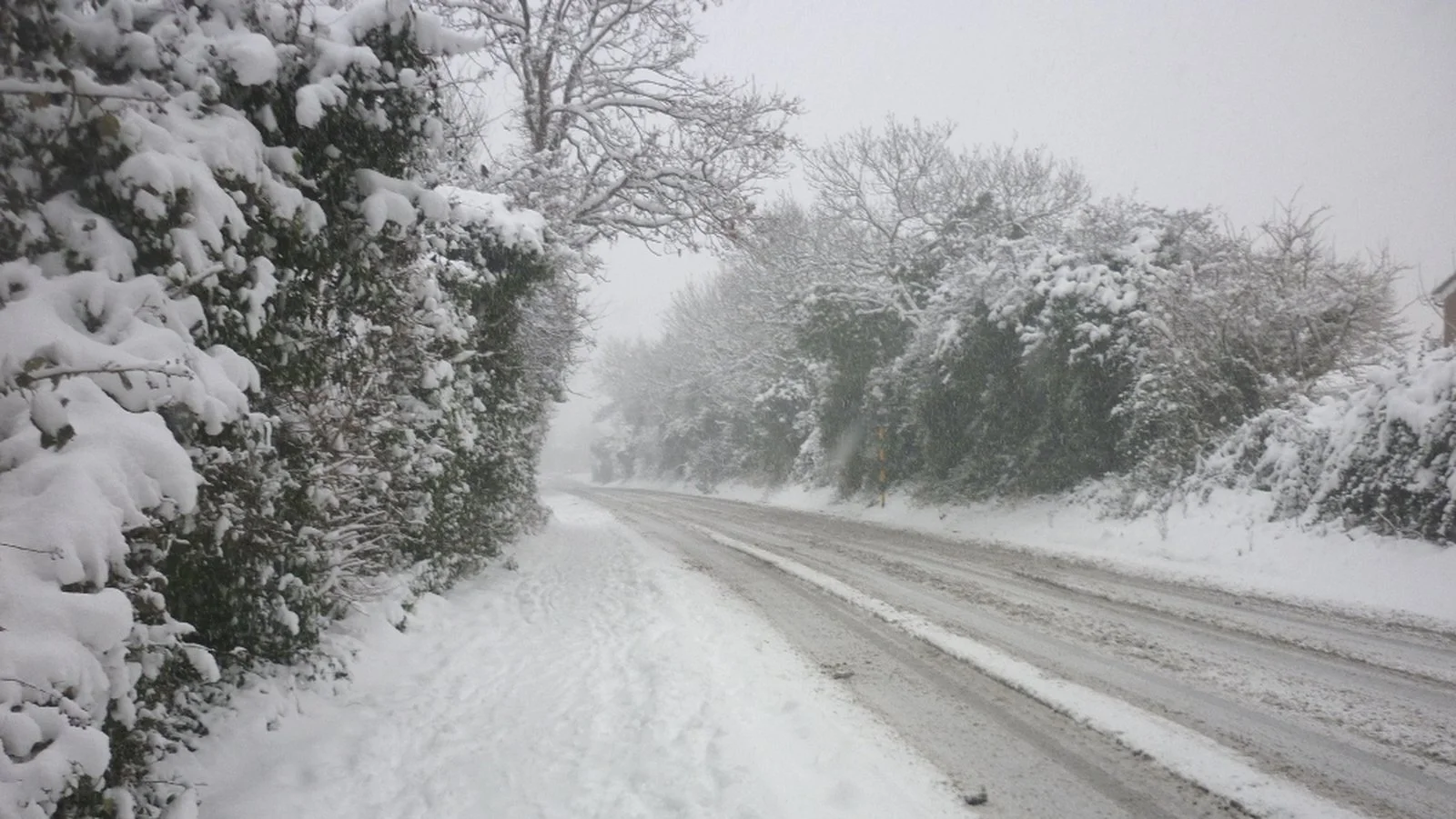
Storm Justine named with snowfall expected for parts of Ireland this weekend
A new high impact storm, the tenth since the season began on October 1, will arrive this Friday under the name of Justine, after being appointed by the Portuguese Institute for the sea and the atmosphere that expects strong winds, rain, fogs and very high temperatures for the time.
As reported by the spokeswoman for the State Meteorological Agency (AEMET) Beatriz Hervella has explained that ‘Justine’ has been named because possibly it will affect the Azores Islands (Portugal) with strong winds and then it will reach the Peninsula.
It is, as specified, the fifth storm named so far this year within the Southwest European group that includes Spain, Portugal, France and Belgium. This, according to the spokeswoman “It is a record, as there has never been a month with so many appointments before.”

In fact, he points out that since February 2020 there had not been a month with four appointments and this month of January 2021 there are already five. However, he points out that this is the fourth year in which storms have been named, so surpassing the previous marks is relatively easy.
Thus, Hervella points out that it will be necessary to follow Justine’s evolution, because after deepening quickly and intensely during the last hours on Friday and on Saturday, it will affect the Peninsula, especially the northwestern quadrant and later the Cantabrian coast, and will cause “strong” winds, locally persistent rainfall, rough seas and thermal decline.
On the other hand, while Justine arrives, for the moment the spokesperson expects the atmospheric situation to be dominated by high pressures and a warm flow, especially humid from the southwest.

SNOWFALL RISK THIS WEEKEND SATURDAY AND SUNDAY
Storm Justine which is due to bring strong winds and heavy rain to Portugal and Spain on Friday will also bring a spell of heavy rain across Ireland but across Ireland this will also bring the risk of snowfall due to the colder air sitting across the northern half of Ireland on Saturday which will be a cold day especially across the northern half of the country. Image attached shows storm Justine

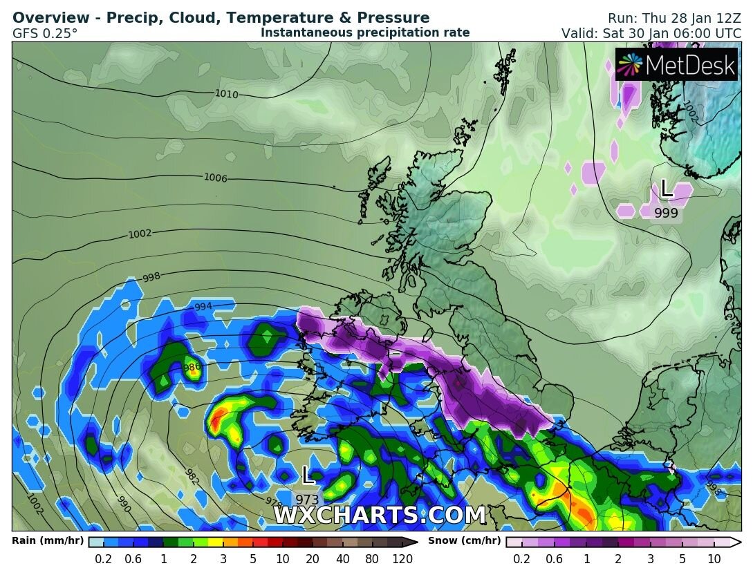
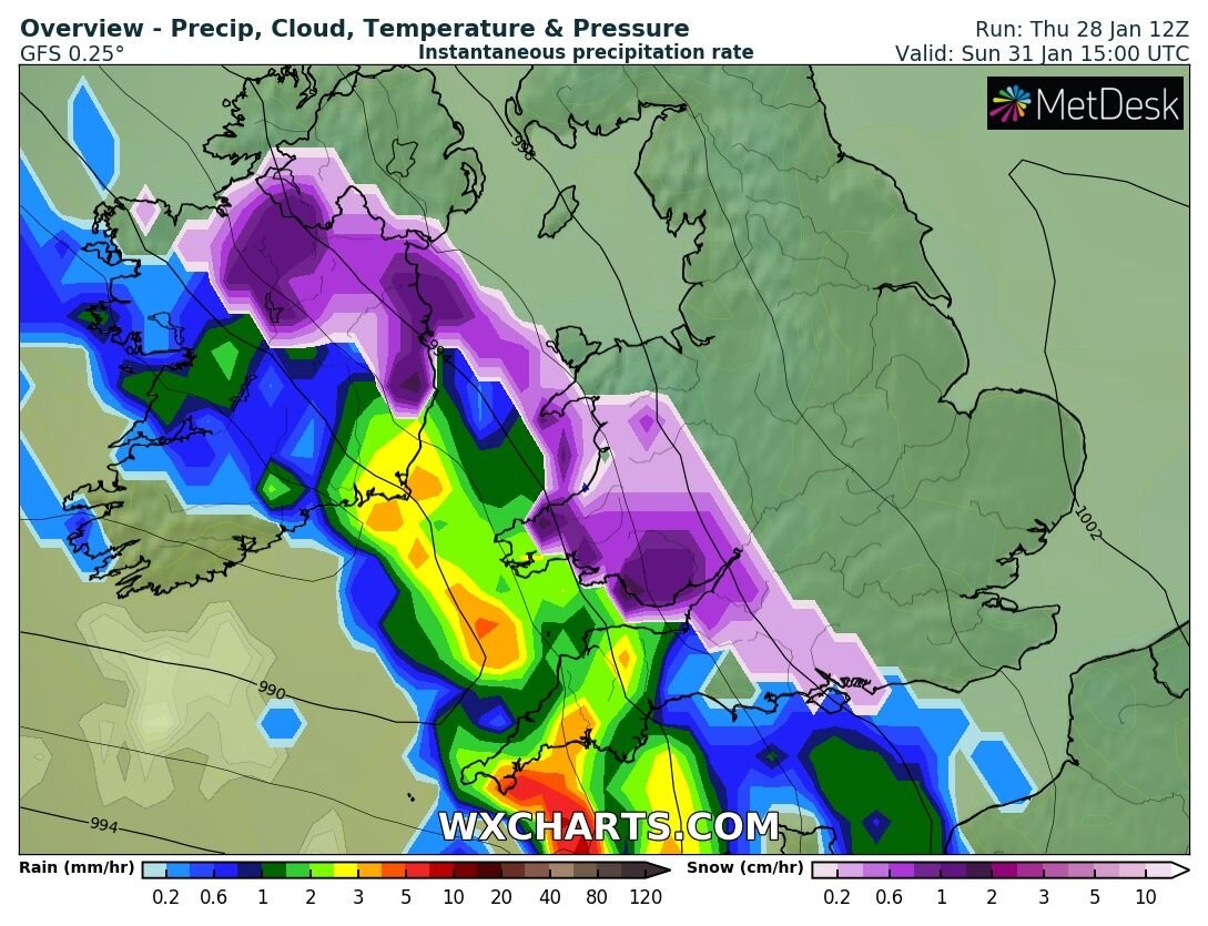
On Friday night a spell of rain will move into the southwest of Ireland this band of rain will be associated with Storm Justine with the center of the low just passing to the south of Ireland. The band of rain will spread northeastwards in direction on Saturday morning reaching into North Connacht and south Ulster before possibly stalling and turning to sleet and snow in places as it hit the colder air across the northern half of Ireland.
The latest GFS model shows this on the latest 12z run this evening something the morning 00z ECMWF model run also hinted at. The latest ECMWF 12Z runs this evening shows more of a mix of rain and Sleet to lower levels with snow over higher ground areas.
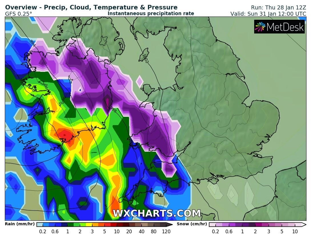
Latest GFS 12Z model run attached below showing the risk of sleet or snow on the northern edge of the band of rain across North Connacht, south Ulster and North Leinster Saturday morning
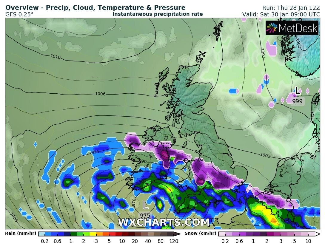
Latest ECMWF 12Z model run attached below showing more of a risk of rain and sleet on the northern edge of the band of rain on Saturday morning with snow over the hills and mountains.

OUTCOME SATURDAY
The most likely outcome on Saturday is for rainfall for much of Leinster, Munster and Connacht. Across Ulster it looks set to stay mostly dry apart from a few southern parts of Ulster where that rain may be more of a mix of sleet and rain with snow over higher ground areas but no big amounts expected. Across the higher ground areas of Leinster like Mount Leinster, Dublin Mountains, Wicklow Mountains and Sallys Gap conditions area more favorable for heavy snowfall on Saturday morning and early afternoon as the system clears to the southwest. Very poor conditions are expected in these higher parts with any roads becoming impassable.
Becoming dry then over the later afternoon countrywide with some brighter conditions. Turning cold overnight with frost and ice across Ulster, Connacht and Leinster with lows of -3C to 1C. Across Munster it will also be cold with lows of 0C to 4C.

BIGGER CHANCE OF SNOWFALL ON SUNDAY
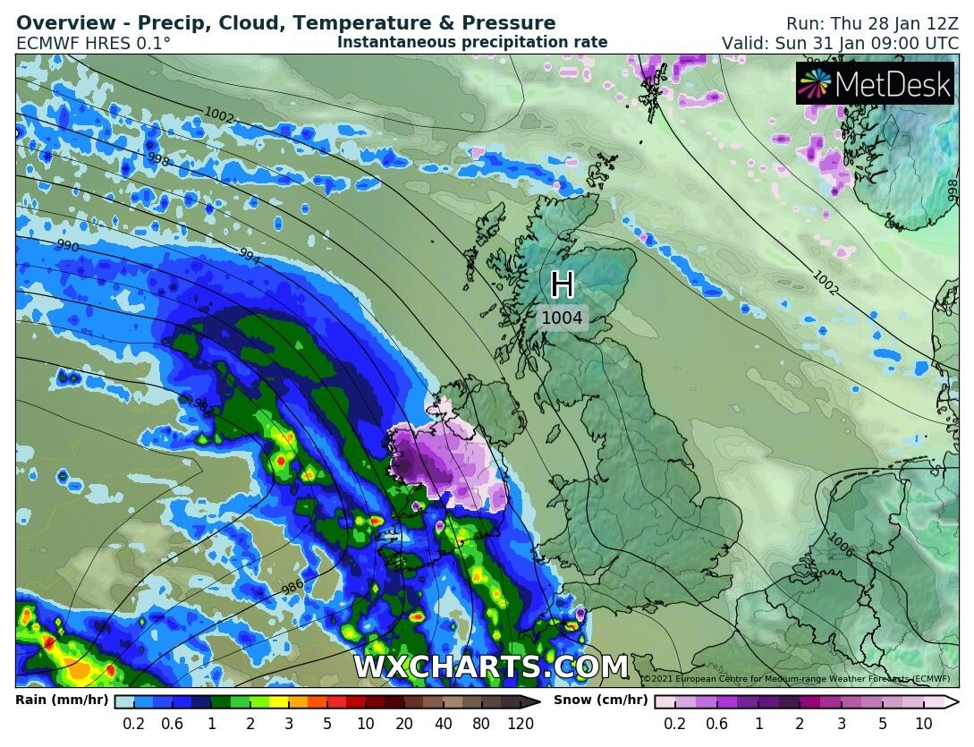
The ECMWF Model has been very consistent over the week showing the risk of heavy falls of snow for places on Sunday morning and over the afternoon as another area of low pressure brings in another band of rain turning to snow for places.
The GFS Model today has also been showing this risk today which has given a little bit more clarity in the forecast for Sunday but still some Uncertainty.
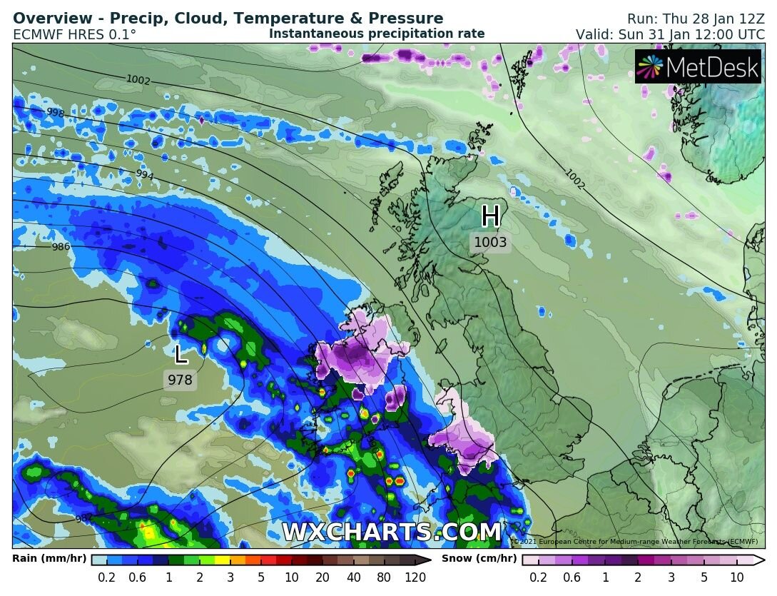
Attached image is from the ECMWF MODEL this evening showing the band of rain and snow passing over Ireland on Sunday with parts of the Connacht, Leinster and Ulster receiving some snowfall.
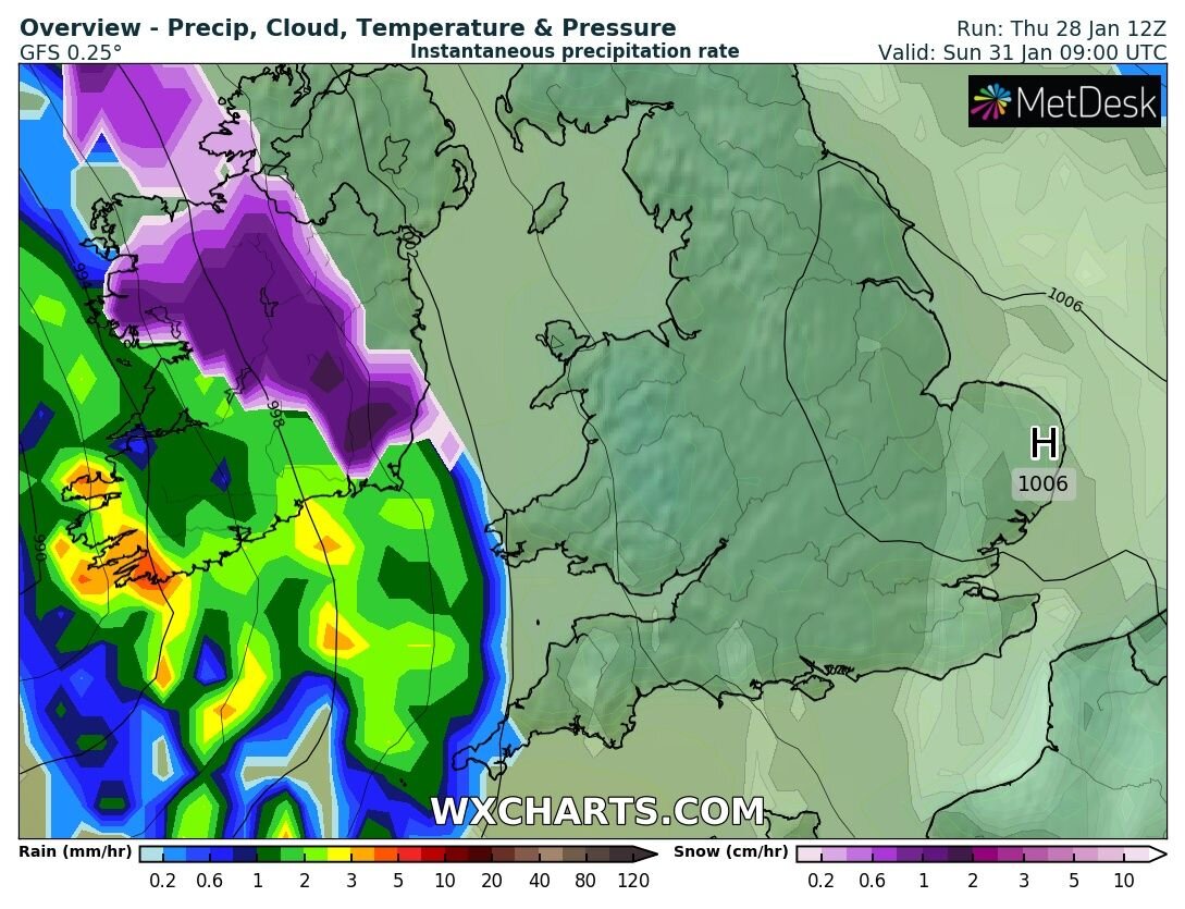
The attached chart below is from the GFS for Sunday morning showing heavy snow over Connacht, Leinster and south Ulster.
So then when we look at the ECMWF model and the GFS model both show a period of snow for places on Sunday morning and possibly over the afternoon also. The ECMWF brings the risk over all of Ulster, Connacht and North Leinster but the GFS shows the snow not making it passed south Ulster and the reason for this is due to the GFS bringing the colder air that bit further south across Ireland. Below you can find both charts showing the upper air temperatures at 850hPa
ECMWF 850hPa TEMPERATURES

ECMWF 850hPa TEMPERATURES
GFS 850hPa TEMPERATURES

GFS 850hPa TEMPERATURES
The latest output from the ECMWF model shows some areas across Connacht and Ulster receiving between 2cm to 6cm on Sunday morning. If you look then across the southeast it shows up to 26cm in places there but this is over higher ground areas like the mountains of Dublin and Wicklow.

Some further falls of snow could occur again later Sunday and Monday across the northwest of Ireland before it turns milder again next Tuesday and Wednesday.
The trend then coming towards the end of next week and next weekend is for Colder air to push down across Ireland with many models showing a change to a much colder airmass with a northeast to east airflow giving very cold night time temperatures but this will have to verify yet.
You can find all the latest weather warnings and forecasts by downloading our app from the google play store by clicking below

LATEST NEWS


