
Cold outbreak of Arctic air could hit Ireland over the Easter weekend with snow showers
The forecast over this weekend with looking rather unsettled across Ireland and look set to remain unsettled up until Tuesday when we then look set to see a change to dry conditions from Wednesday and to end next week. Friday this week seen a colder airmass across Ireland with falls of snow reported in parts of Ulster, Connacht and Munster but it did not cause much harm and thawed rather quickly.
As we head into the Easter weekend forecasting models show a outbreak of very cold air moving down from the north or arctic region.

Starting with this Saturday afternoon and evening outbreaks of rain will move in from the Atlantic with some heavier pulses across the west and northwest especially this evening and tonight. It will also turn rather windy this evening and tonight across western and northwestern counites mean speeds of 50 to 65 km/h with gusts of up to 100 km/h a Status Yellow wind warning is currently in place for Donegal, Mayo and Galway 17:00hrs Saturday until 02:00 Sunday.
Sunday will be another wet and blustery day with further heavy showers again the highest totals of rain in the west and northwest.

A status yellow rainfall warning may be issued for some western and northwestern counites for later Sunday into Monday where some rainfall amounts of up to 30mm may occur especially across Donegal, Galway and Mayo where some flooding will also occur.
Rainfall totals will be highest in the west and northwest and lowest in the southeast and far east.
Below chart shows rainfall totals from Today Saturday 27th March up until Monday 29th March 2020

On Monday afternoon and evening rain will then clear to the northwest with drier weather developing for many places but it will remain rather cloudy.
Overnight Monday looks set to be dry for much of Ireland with cloudy conditions however some mist and drizzle will be possible in some western areas.
On Tuesday evening an another spell of rain then looks to try and move from the northwest but most of the forecast models outlook show is stalling over western, northwestern and northern counties Tuesday night into early Wednesday morning and fizzling out.
Temperatures Sunday will range between 10C to 14C but warmer on Monday and Tuesday where temperatures will rise between 12C to 18C warmest in the south and east of Ireland.
TURING DRIER ON WEDENSDAY AND LATER NEXT WEEK

The good news as we head into the Easter weekend is that it will turn drier across the whole country with good bright and sunny spell developing as high pressure builds across Ireland from Wednesday until next Saturday. Temperatures will range between 10C to 14C on Wednesday and Thursday but turning colder with day time temperatures of between 8C to 10C with frost looking possible overnight with lows possibly falling to around -2C.
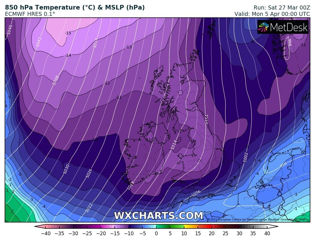
Signs of much colder Arctic air arriving Easter Sunday

As we get to the end of next weekend both the main forecast models the GFS & ECMWF show a very cold unstable arctic Airmass moving down across Ireland on Easter and Sunday and Monday and with a unstable airmass it will bring showers and with such cold airmass these would fall as snow with northern and western areas at the highest risk.
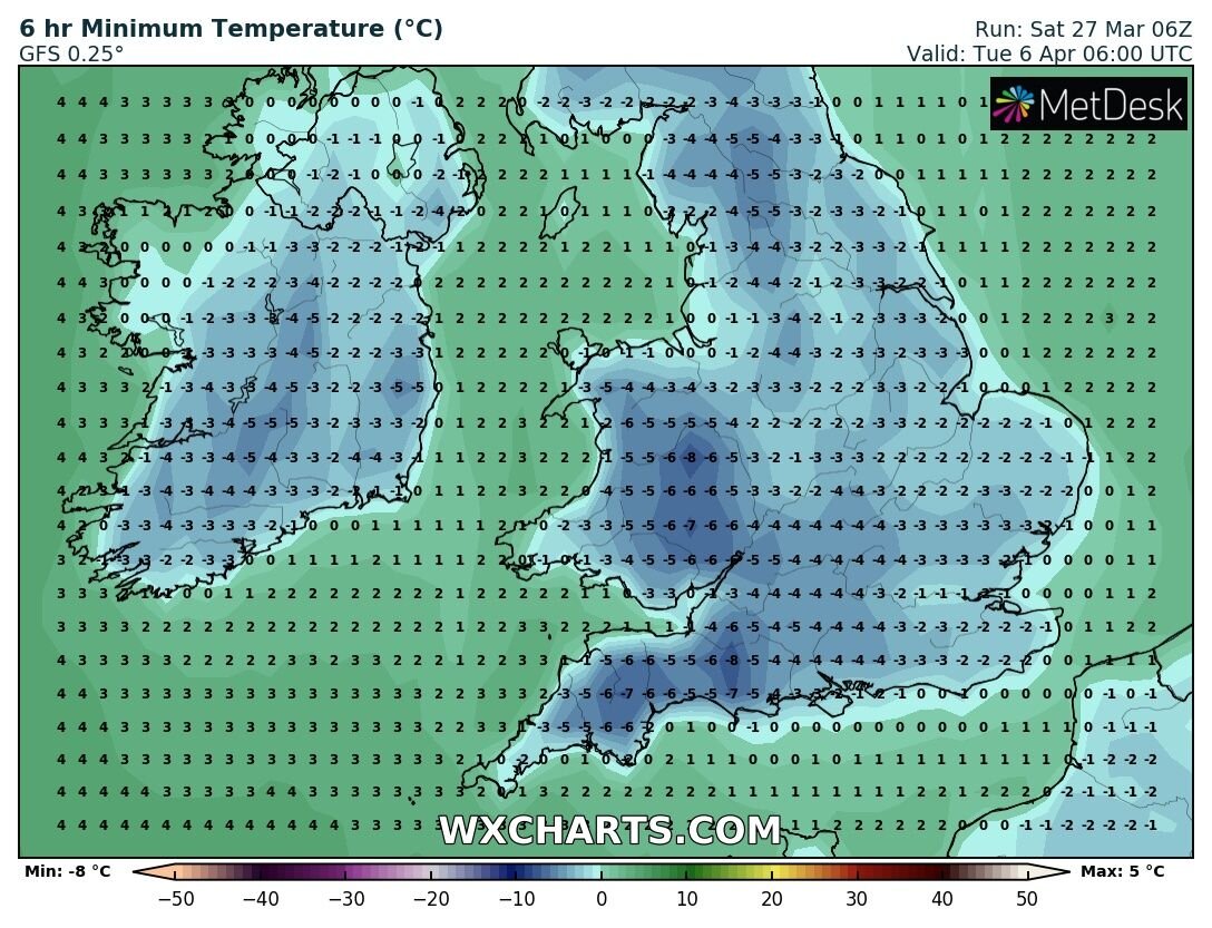
GFS model showing very low night time air temperatures over the end of the Easter weekend.
Overnight temperatures could falls as low as -3C to -5C giving a severe ground frost for places. Snow in March and April. I will have another update early next week where is will give more detail on the possible risk of colder conditions later next weekend.
You can find all the latest weather warnings and forecasts by downloading our app from the google play store by clicking below

LATEST NEWS


