
STORM HECTOR LIVE UPDATES

STORM HECTOR LIVE UPDATES

Check this Page for the latest updates on storm Hector over the next few hours

INFORMATION ON STORM HECTOR
A orange and yellow weather warning is in place for Strong winds Wednesday night and Thursday morning.
Storm Hector was named on Wednesday Morning 13th June 2018 by Met Eireann. Storm Hector is a small Atlantic depression (area of low pressure) which was formed when the jet stream moved back southwards over Ireland and the UK. Hector is a small storm and fast Atlantic depression but a fairly powerful one to and with theses small storms they can pack quite a punch when overland.
Strongest winds will be over Ulster, Connacht and west Munster with mean wind speeds of 60km/hr to 80km/hr can be expected and gusts between 110km/hr to 125km/hr.
Over Leinster and the rest of Munster mean wind speed up to 50km/hr to 70km/hr can be expected and gusts between 80km/hr to 110km/hr.
With trees in full leaf this time of year this will become a hazard and act as a sail making it easier for tree to come down over the warning period. High sided vehicles should also beware of very strong cross winds with some Longer journey times and cancellations likely, as road, rail, air and ferry services may be affected.
Damage to buildings from strong winds is also likely with flooding likely around coastal areas over the time period as the strong wind will collide with high tides. Coastal areas along the Atlantic sea bored are at the highest risk especially from around the coasts of Clare, Galway, Mayo , Sligo & Donegal.
There is also a risk to life due to the risk of Flying debris which may also cause injury.
CONTINUES BELOW


WHEN WILL THE STRONG WIND HIT?
Peak times for Orange warning areas
The strongest winds will arrive into the areas of Clare, Kerry and Galway around Midnight and then into the rest of Connacht after 3am Thursday morning.
Strong winds will then arrive into northern Connacht Mayo, Sligo, Leitrim and Donegal after 4:30am Thursday morning and over the rest of Ulster after 5:30am.
Winds will increase in all areas after Midnight with strong gusts across Ireland the rest of the warning areas. Wind will then ease around 8am to 10am on Thursday morning.
LIVE UPDATES WILL APPEAR UNDER HERE OVER THE COMING HOURS
Refresh page for latest updates
Update 8:28Am 14/06/2018
⚠️ ROAD CLOSED - foyle bridge derry⚠️
The Foyle bridge will reopen this morning once the strong winds has passed
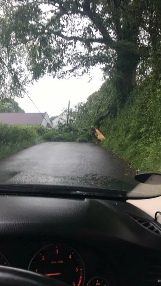
Update 8:21Am 14/06/2018⚠️ ROAD CLOSED - GRANNIES GAP, MUFF, DONEGAL ⚠️
Grannies gap Muff, Donegal is closed with a tree down and no power.
It ok to laugh go one its actually a place for people who don't know that
Thanks to Sinead Quigley for sending on the photo

Update 7:40Am 14/06/2018
⚠️ ROAD ALERT - sCROGGY rOAD lIMAVADY ROAD UPDATE ⚠️
Tree down on the Scroggy roadLimavady, top of Whitehill park

Jemma Campbell
Update 7:33Am 14/06/2018
⚠️ ROAD ALERT - marble arch ROAD UPDATE ⚠️
There are a number of trees down on the marble arch road this morning Co. Fermanagh.

Update 7:25Am 14/06/2018
⚠️ road ALERT - letterkenny to lifford road donegal⚠️
There are tree down on the Letterkenny to Lifford road this morning and blocking the road.
Travel with caution in the area
Update 7:20Am 14/06/2018
⚠️ road ALERT - loughmuch road, omagh, tyrone ⚠️
Trees down on Loughmuck road, omagh. Power line down with it to. Stay clear.
Travel with caution
Thanks to Danny for reporting on snapchat. You can follow Donegal Weather Channel on snapchat at - donegalweatherc
Update 6:49Am 14/06/2018
⚠️ flood ALERT - donegal town ⚠️
There has been some flooding which has occurred along the car park at the pier in the town this morning due to strong winds, high tide and waves.
Update 6:45Am 14/06/2018
⚠️ ROAD ALERT - DRUMAHOE CO.DERRY ⚠️
There is 1 tree down at the Drumahoe Co.Derry this morning
Travel with caution in the area
Update 6:40Am 14/06/2018
⚠️ ROAD ALERT - BELFRAY HOTEL CO.DERRY ⚠️
There is 2 trees down at the Belfray hotel Co.Derry this morning
Travel with caution in the area
Update 6:35Am 14/06/2018
⚠️ ROAD ALERT - FOREGLEN ROAD CO.DERRY ⚠️
There is 3 trees town Foreglen Road Co.Derry this morning
Travel with caution in the area
Update 6:33Am 14/06/2018
⚠️ ROAD ALERT - GLENSHANE PASS ⚠️
There is a tree town on the Glenshane pass this morning
Travel with caution in the area
Update 6:05Am 14/06/2018
A number of areas across Donegal now with no power Ballyshannon, Laghey, Cashelard Moville, Rossgeir, Gweedore, Dungloe & Killybegs at up to 2000 homes affected.
Update 5:58Am 14/06/2018
⚠️ ROAD ALERT - donegal town ⚠️
There is a tree town between Abbotts Donegal Town and The Abbey vocational school on a bend
Travel with caution in the area
Update 5:15Am 14/06/2018
⚠️ ROAD ALERT - FERMANAGH SHORE ROAD UPDATE ⚠️
There is A number trees down on the shore road this morning about 2 miles from beleek Co. Fermanagh.
There also a number of trees down on the same road just outside of Enniskillen Town block parts of the road.
Travel with caution
Update 4:06Am 14/06/2018
Update 4:06Am 14/06/2018
Wind are now peaking across Connacht this morning and will peak across Donegal after 4am when storm hector passes by the peak will last for up to 2 hours when wind will be at there strongest. Across the rest of Ulster winds will peak 4am to 7am.
Update 4:03Am 14/06/2018
10,000 homes with out power this morning across pars of Ireland
There are now over 10,000 homes with out power this morning as of 3.44am due to strong winds from Storm Hector worst affected areas so far have been Ulster and Connacht with a small number of home in Munster also with no power.
The worst affected area in Ireland is Glenamaddy Co.Galway where 5255 customers have lost power.
There are currently power cuts in the county's of Donegal, Mayo, Galway, Roscommon Cavan, Galway, Limerick, Cork, Fermanagh, Tyrone & Antirm.
Update 2:12Am 14/06/2018
3680 homes with out power this morning across ireland
In Gweedore, Donegal up to 12 customers have been affected.
In Ardnaree, Mayo up to 203 customers have been affected.
In Cavan up to 33 customers have been affected.
In Dalton, Mayo up to 2048 customers have been affected.
In Dalton, Mayo up to 2048 customers have been affected.
In Dalton, Salthill Galway up to 193 customers have been affected.
In Dalton, Cong Galway up to 175 customers have been affected.
In Singland, Limerick up to 52 customers have been affected.
In Kesh, Fermanagh up to 642 customers have been affected.
In Portadown , Armagh up to 367 customers have been affected
In Antrim up to 54 customers have been affected.
Update 1:04Am 14/06/2018
galway
power cut in
Salthill, Galway up to 193 customers have been affected.
Update 12:30Am 14/06/2018
DONEGAL,mayo, SLIGO, Roscommon & Cavan
A number of homes in the county's of Donegal, Sligo ,Roscommon , Mayo and Cavan have lost power tonight due to a increase in winds. Wind gusts along the west coast have already reached 94km/hr at Belmullet (Mayo) with a mean wind speed of 74km/hr.
In Gweedore, Donegal up to 12 customers have been affected.
In Ardnaree, Mayo up to 203 customers have been affected.
In Castlerea, Roscommon up to 23 customers have been affected.
In Collooney, Sligo up to 278 customers have been affected.
In Cavan up to 33 customers have been affected.

Update 11:50pm 13/06/2018
mayo
Winds have now began to increase over the west Coast of Ireland with the Highest gust so far at 94km/hr in Belmullet (Mayo) with a mean wind speed of 74km/hr.

Update 10:54pm 13/06/2018
GALWAY, mayo,sligo,leitrim & donegal
This low pressure system has been named Storm Hector. It is a fast moving storm that will hit the west coast tonight and track across north Leinster overnight. OPW have issued a high tide advisory with coastal surges expected for Donegal Bay and other areas along the west coast. Coastal areas are most at risk from the impact of Storm Hector.
Update 10:38pm 13/06/2018
GALWAY
As a precaution, the roads from Beech Court on Grattan Rd. to D'Arcy Roundabout and the promenade from D'Arcy Roundabout to the Threadneedle Road junction will be closed from 7.30pm on 13/06/'18 until 7.30am on 14/06/'18.
Overtopping at Salthill is likely overnight and high water levels are anticipated at Spanish Arch at high tide at 6am on Thursday 14 th June 2018 .
Both Toft carpark and the promenade carpark will also be closed in this time period.
Galway City Council Roads crews will monitor conditions and will be on stand-by to respond/clean-up, as required.
Update 10:13pm 13/06/2018
GALWAY
Overtopping along Grattan Rd & the Prom is likely overnight. Road closures will be in place from Beech Court to Threadneedle Rd from 7.30pm to 7.30am
Update 10:00pm 13/06/2018
DONEGAL
Donegal County Council have announced that the Bay view car park along Key street in Donegal town will close this evening due to Storm Hector approaching, Due to storm Hector been a fast moving storm depression there is a risk of flooding at high tide.
