

LATEST WEATHER WARnINGS & ADVISORIES IRELAND
NATIONAL WEATHER WARNINGS
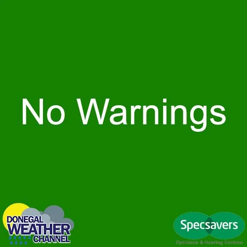
🟢Green - No weather warnings in place
🟡Yellow - Not unusual weather. Localised danger.
🟠Orange/Amber - Infrequent. Dangerous/disruptive.
🔴Red - Rare. Extremely dangerous/destructive.
WEATHER WARNINGS
APRIL 2024
SUNDAY 28TH APRIL 2024

🟡Status Yellow - Thunderstorm warning for Leinster, Cavan, Monaghan, Tipperary, Waterford
Met Éireann Weather Warning
Chance of thunderstorms in the heavier downpours.
Valid: 18:54 Sunday 28/04/2024 to 21:30 Sunday 28/04/2024
Issued: 18:54 Sunday 28/04/2024
WEATHER ADVISORY

🔵 NO Weather Advisory
MARINE WARNINGS

🛥️Small Craft warning for all coasts of Ireland
South to southwest winds will reach force 6 or higher.
Valid: 00:00 Wednesday 10/04/2024 to 08:00 Thursday 11/04/2024
Issued: 06:27 Monday 08/04/2024
Updated: 16:25 Tuesday 09/04/2024
ENVIRONMENTAL ADVISORIES
🟢NO ENVIRONMENTAL WARNINGS

All weather warnings issued for Republic Ireland are issued by Met Eireann the national Forecaster for Ireland.
All weather warnings issued for Northern Ireland are issued by Met Office UK the national Forecaster for Northern Ireland.
Warnings and advisories can also be issued by Donegal Weather Channel


WEATHER WARNINGS EXPLANATION MET ÉIREANN
The issue of Weather Warnings is perhaps the most important function of any National Meteorological Service and lies at the heart of the suite of Public Weather Services provided to citizens by Met Éireann. The core rationale for issuing Weather Warnings is to protect the lives and livelihoods of all of the nation’s citizens, and to mitigate damage to property and disturbance to economic activity at times of severe weather.
The philosophy underlying the issuance of Weather Warnings by National Meteorological Services has developed considerably over the past few decades. Internationally, much research has been carried out on the effects of extreme weather, and this has led to an increased focus on the “Impacts” of extreme weather rather than on the statistical meteorological rarity of the extremities themselves. Thus the timing and location of the occurrence of extreme weather can significantly affect the impact which extreme weather may have on society, or on the economy.
Another international development of significance is the maturing of the MeteoAlarm system, (see www.meteoalarm.eu) which implies greater co-ordination of warnings across Europe and the coherence of warnings across national boundaries. This has led to the adoption of a common European framework and terminology for the presentation of Weather Warnings, and the alignment of national Weather Warnings Systems with the international MeteoAlarm framework where this is possible.
Nationally, the development of the Major Emergency Management framework and the designation of Local Authorities, the HSE and An Garda Siochána as the “Principal Response Agencies” (PRAs) with respect to emergency situations (of which a significant percentage will be the result of severe weather) has brought structure and formality to the allocation of responsibility for Emergency Response.
In response to these developments, the Weather Warnings system provided by Met Éireann has been updated and aligned fully with European best practice and with MeteoAlarm.
HOW ARE THE WEATHER WARNINGS CATEGORISED?
Weather Warnings are presented in three categories:
STATUS YELLOW – Weather Alert – Be Aware The concept behind YELLOW level weather alerts is to notify those who are at risk because of their location and/or activity, and to allow them to take preventative action. It is implicit that YELLOW level weather alerts are for weather conditions that do not pose an immediate threat to the general population, but only to those exposed to risk by nature of their location and/or activity.
STATUS ORANGE – Weather Warning – Be Prepared This category of ORANGE level weather warnings is for weather conditions which have the capacity to impact significantly on people in the affected areas. The issue of an Orange level weather warning implies that all recipients in the affected areas should prepare themselves in an appropriate way for the anticipated conditions.
STATUS RED – Severe Weather Warning – Take Action The issue of RED level severe weather warnings should be a comparatively rare event and implies that recipients take action to protect themselves and/or their properties; this could be by moving their families out of the danger zone temporarily; by staying indoors; or by other specific actions aimed at mitigating the effects of the weather conditions.
WHAT WEATHER CONDITIONS ARE WARNED FOR?
Hazards deriving from the following weather-related types are covered by Met Éireann’s weather warnings system:
Wind
Rain
Snow
Low Temperatures
Fog
High Temperatures
Thunderstorms
Coastal Wind Warnings
The system also covers warnings for the following weather-related phenomena (which will all be classified as YELLOW level – Weather Alerts only)
Potato Blight (May to September only)
UV / Sunburn (May to September only)
Pollen Levels (May to July only)
WHEN WILL WEATHER ALERTS/WARNINGS BE ISSUED?
Weather Alerts and Warnings will be issued whenever weather conditions meeting the detailed thresholds defined below are anticipated within a 48-hr period. There will be judgement required on the part of the forecaster who must weigh up the possible severity of the weather conditions and the likelihood of their occurrence. However on some occasions (weekends, holiday periods) it may be necessary to issue Weather Warnings beyond this 48-hr horizon, if sufficient certainty derives from examination of the weather charts. Normally, however, a Weather Advisory (see below) will be used to flag severe weather beyond 48hrs and Advisories will normally anticipate only “Orange” or “Red” criteria weather hazards.
Given that the thrust of the Weather Warnings service is on potential “Impacts” of weather rather than on the numerical values attained by the weather elements themselves, it may on occasion be appropriate to issue warnings at a level higher than that strictly justified by the anticipated weather elements. An example would be when heavy rain was expected which might not quite meet the “Orange Warning” criteria but which might give rise to significant flooding because of already saturated ground, or because of a combination of rain, wind and tide in a coastal location.
WEATHER ADVISORIES
Weather Advisories may be issued to provide early information on potential hazardous weather beyond the 48hr horizon. They may also be employed when a sum of weather elements acting together create a significant hazard, e.g. winds which may not be up to warnings strength but which, when combined with high tides and significant swell, generate a risk of flooding. Another possible use would be to advise of wind speed and direction on occasions of Volcanic Ash contamination. They might also be used to advise of expected significant medium-term accumulations of rain during a very unsettled period when soils are known to be saturated. The issue of Weather Warnings and Weather Advisories is at all times down to the judgement of the Met Éireann forecasters.
WEATHER WARNING CRITERIA
The criteria for the different warnings levels (Yellow, Orange, Red) and the different weather elements (Rain, Wind etc) are laid out in the tables below.
Categories of Severe Weather encompassed by the National Weather Warnings System, together with the associated criteria:
Weather Element Criteria for Red – Severe Weather Warnings
Wind Mean Speeds in excess of 80 km/h Gusts Speeds in excess of 130 km/h
Rain
70mm or greater in 24 hrs
50mm or greater in 12 hrs
40mm or greater in 6 hrsSnow/Ice Significant falls of snow likely to cause accumulations of 8 cm or greater below 250 m AMSL. Slippery paths and roads due to accumulation of ice on untreated surfaces; situation likely to worsen.
Low Temperatures Minima of minus 10C or lower expected. Maxima of minus 2C or lower expected.
Fog No Criterion – not displayed
High Temperature As Orange criterion, but persisting for two or more consecutive nights.
Thunderstorms No Criterion – not displayed
Coastal Wind Warnings Violent Storm Force 11 or greater. (Mean Speeds)
Weather Element Criteria for Orange – Weather Warnings
Wind Mean Speeds between 65 and 80 km/h Gusts between 110 and 130 km/h
Rain
50mm – 70mm in 24 hrs
40mm – 50mm in 12 hrs
30mm – 40mm in 6 hrsSnow/Ice Significant falls of snow likely to cause accumulations of 3 cm or greater below 250m AMSL. Slippery paths and roads due to accumulation of ice on untreated surfaces; situation stable.
Low Temperatures Minima of minus 5C to minus 9C expected. Maxima of 0C or minus 1C expected.
Fog Dense fog likely to cause a widespread and significant driving hazard on national primary routes.
High Temperature Maxima in excess of 30C and minima in excess of 20C expected in a 24hr period
Thunderstorms Widespread thundery activity over an area of several counties.
Coastal Wind Warnings Storm Force 10. (Mean Speeds)
Weather Element Criteria for Yellow – Weather Alerts
Wind Mean Speeds between 50 and 65 km/h Gusts between 90 and 110 km/h
Rain
30mm – 50mm in 24 hrs
25mm – 40mm in 12 hrs
20mm – 30mm in 6 hrsSnow/Ice Scattered snow showers giving accumulations of less than 3 cm below 250m AMSL. Slippery paths and roads due to accumulation of ice on untreated surfaces; situation improving.
Low Temperatures Minima of minus 3C or minus 4C expected. Maxima of plus 1C or plus 2C expected.
Fog No Criterion.
High Temperature Maxima in excess of 27C expected.
Thunderstorms No Criterion.
Coastal Wind Warnings Gale Force 8 or Strong Gale Force 9. (Mean Speeds)
Weather Element Criteria for Green (i.e. no significant hazardous weather)
Wind Gusts less than 80 km/hr.
Rain
Less than 30mm in 24 hrs
Less than 25mm in 12 hrs.
Less than 20mm in 6 hrs.Snow/Ice No snow, or some snow showers possible, mainly above 250m altitude.
Low Temperature Minima higher than minus 3C and maxima higher than plus 2C.
Fog None.
Thunderstorms None
High Temperature Maxima less than 27C
Coastal Wind Warnings Winds less than Gale Force.