
RISK OF IT TURNING COLDER AT THE START OF NEXT WEEK WITH WINTRY SHOWERS


Temperatures across Europe this morning
A number of weather models are showing a increase chance of colder conditions over the 3rd and 4th week of January , when i say cold i am not talking about a beast from the east like some sources and papers have been hyping up over the month of December.
The latest GFS and ECMWF model runs today are showing a fast flowing northwesterly airflow early next week which will see air temperatures also drop down to single figures by day with the increase risk of frost and icy conditions over the night time and morning hours.
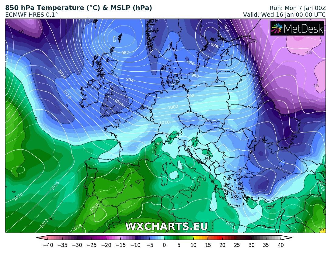
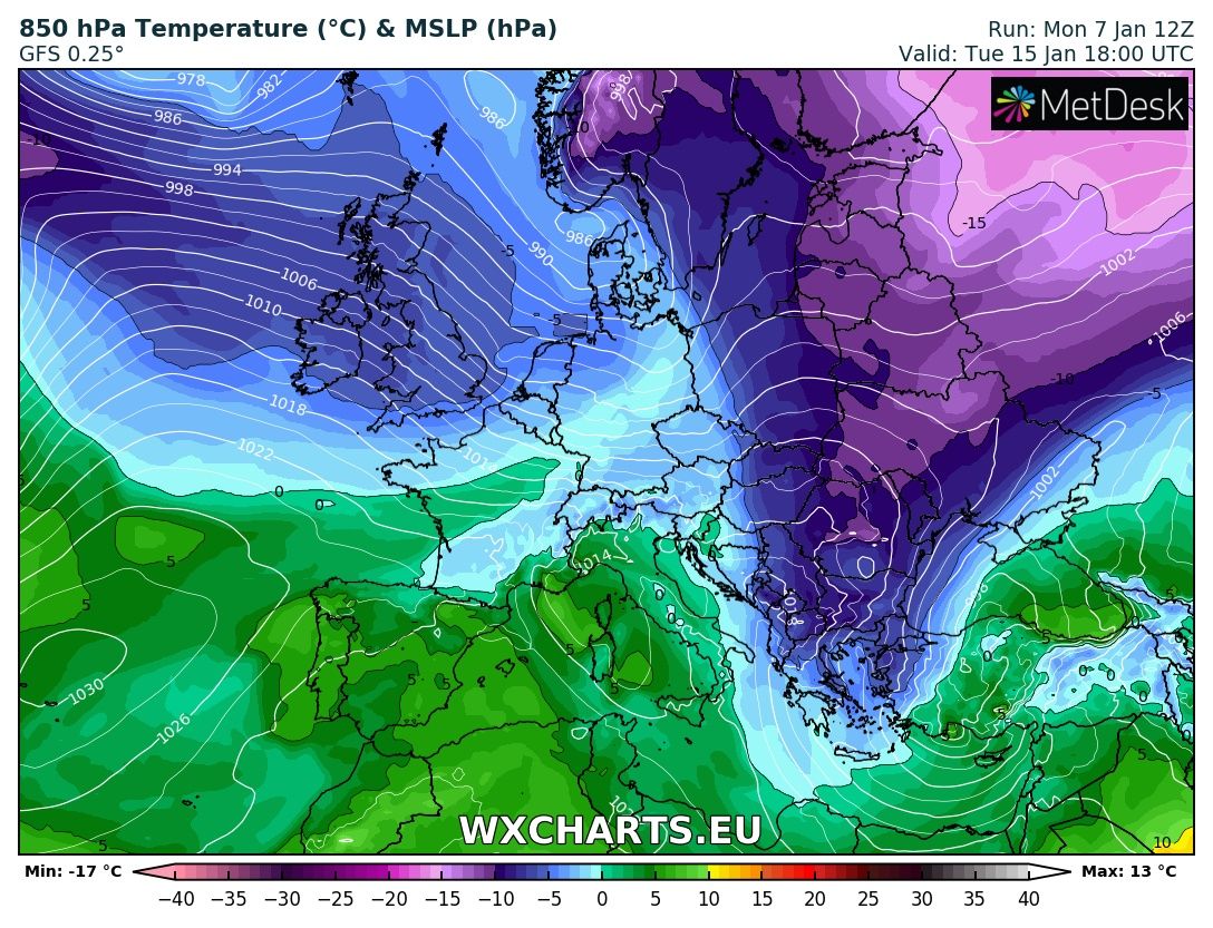
Attached above is the latest 850 hPa Temperatures chart early next week from both the GFS model and the ECMWF model which shows temperatures at around 1300-1500 metres above the ground.
There will be the risk of wintry showers early next week too looking at the latest runs that off Hail, Sleet and snow. There will be a higher threat of theses showers over northern and northwestern parts of Ireland with snow possible over higher ground and some low levels areas too mostly inland.
Continues below


Beyond the early stages of next week temperatures look as the will rise again for a few days but become colder again later in the week but there is a lot of uncertainty yet after early next week..
The latest update from the CFS , and GFS operational runs show the risk of northern blocking over the last few days of January and into February which would increase the chance of colder weather. Anyone talking about beasts from the east folks best you do is ignore because there are not signs of such weather in the coming 10 days.
I will continue to keep a eye on the weather for early next week and update again later in the week.

2019 CALENDAR NOW ON SALE


2019 Calendar now on sale
You can now purchase the Donegal Weather Channel Calendar 2019. You can purchase the Calendar from the online store
All calendars will be posted out in the middle of November with only a limited amount available. Calendars can be purchased anywhere across the world.


The stunning Leitir Mhic An Bhaird (Lettermacaward) Donegal during May 2018

Vivid Rainbow from up on Breezy mountain South Donegal


I was in Albufeira Portugal I was waiting for the full moon to come up and it did not let me down.
The orange and red tints that the Moon sometimes take on rising and setting are caused by the particles in the Earth's atmosphere. When light (or more specifically, packets of light called photons) from an astronomical object passes through the Earth's atmosphere, it scatters off of particles in the latter.

What a unbelievable night and morning out storm chasing, These number of thunderstorms had to be the best in years as most of the lightning was CG bolts. I even manage to captures Two to three CG bolts in one shot.

One of the most beautiful views of Slieve league From sea and got some nice photos.
Photos from this angle I have not seen yet and it was wonderful to finally capture that moment.
Follow Donegal Weather Channel on other social media platforms by clicking the icons below


