
FIRST WEEK OF SEPTEMBER SET TO START OF DRY AND A LITTLE WARMER

Rainfall passing over Ireland on Tuesday with sunny spells following behind.
The start of September is now on track to start of dry at least for the first 7 days of the month anyways as high pressure comes back and settles over Ireland.
Early September over the years as we have seen in the past is a very reliable time of the year for seen anti cyclonic weather but not every year. Last September was a rather cool one.
Looking at the 8 months of 2018 so far January to August all months have been warmer than average expect February and March which was a colder than average.
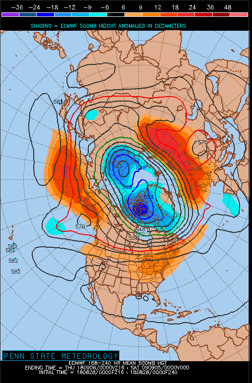
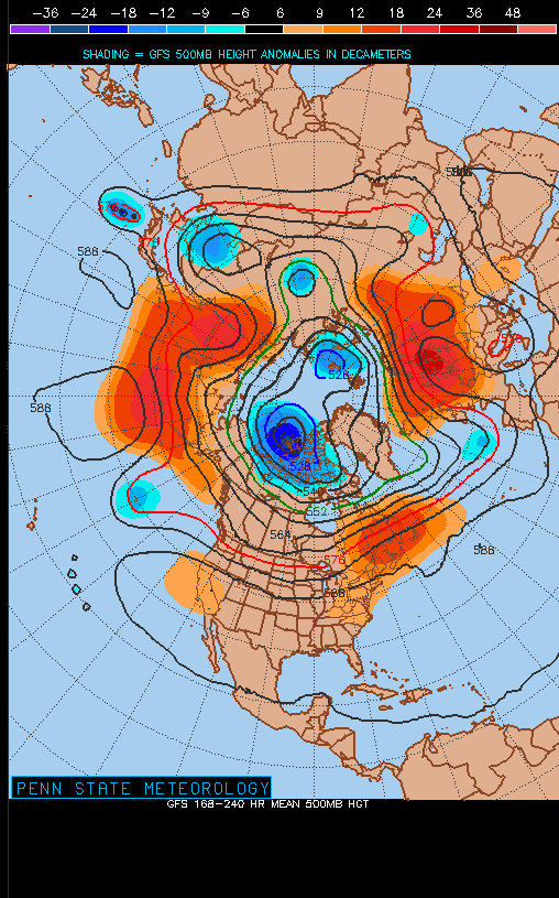
Below I have attached the 500mbr 00z Height Anomaly Charts from both the GFS & ECMWF model which shows above average heights (High pressure) over Ireland and the UK as well as over Scandinavia over the first week of September. Red on the Image and chart is above average heights (High pressure) and blue is below average heights (Low pressure)
GFS 500mbr 00z Height Anomaly Charts
ECMWF 500mbr 00z Height Anomaly Charts
CONTINUES BELOW

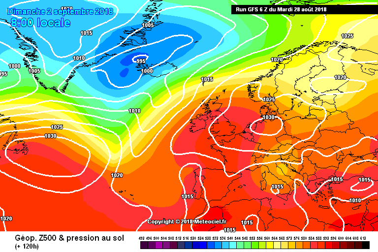
LATEST GFS MODEL OUTLOOK
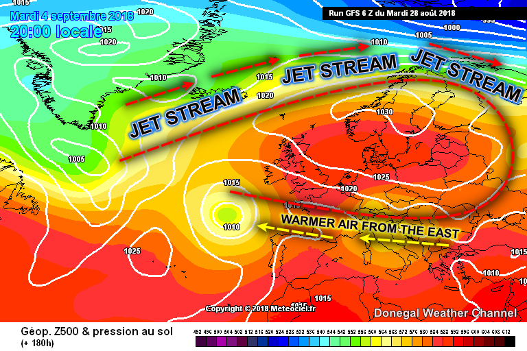
Attached above is the latest run from the GFS model today which show high pressure setting up over Ireland and the UK and the center of the high pressure over Scandinavia. This would be ideal for a rise in temperatures as the Jet stream is well north of Ireland and the UK and instead leads to a easterly flow which would bring warmer and drier conditions from mainland Europe due to the anti cyclonic high over Scandinavia blocking out the westerly's and Atlantic.
Looking at the Gfs model it shows the high building over this weekend with mostly dry weather developing across Ireland. Temperatures this weekend will be between 18C to 22C across the country.
At present looking at the GFS model for next week it will become warm again with temperatures in the low 20s to mid 20s but this will all depend the flow and wind direction we see. So if we see a easterly like the GFS is shown then it would be perfect.
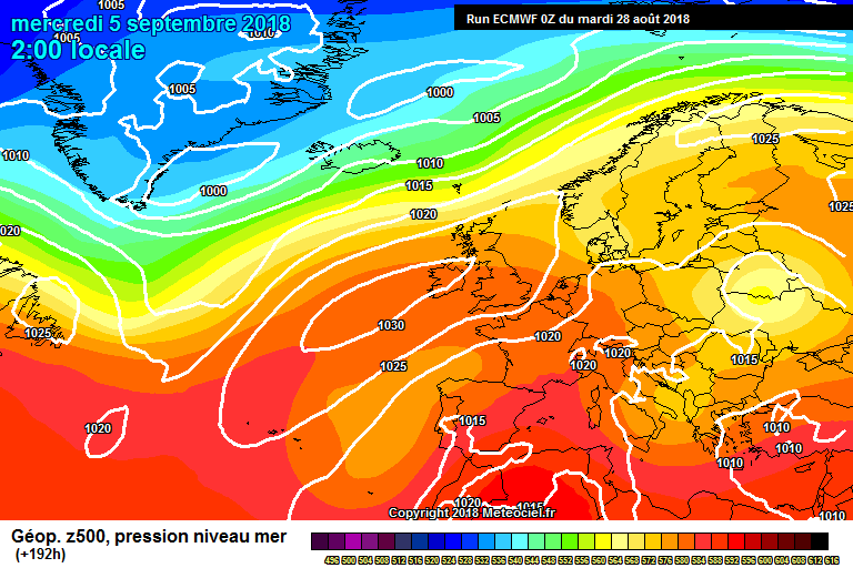
LATEST ECMWF MODEL OUTLOOK
The latest ECMWF model show high pressure and anti cyclonic weather also next week but earlier in the week it has the center of the high of to the west of Ireland and over the country which would mean cooler conditions with temperatures only peaking at around 20C. Over the end of the week it has the high pressure drifting into Scandinavia just like the GFS leading to a easterly airflow which would also indicate of a rise in temperatures later on over the week and next weekend.
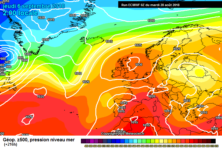
High pressure moving into Scandinavia and sitting over Ireland leading to warmer conditions around mid week and at the end of next week
How long this high then sits in place is the big question. Some times these highs can take two to 3 weeks to break down. And some times the can only last a few days. Looking at the GEM model it also shows near the same outlook as the GFS model for the start of September.
Rainfall amounts over the next 7 to 10 days look well below average with very little rain in the forecast showing after Friday.
I will update on this over the end of this week again when the outlook becomes that much clearer and better detail can be giving on the forecast for next week.
If you are looking for updates on next week you can check the National forecast each morning which does be updated on the site with the long term outlook.
Kenneth Mc Donagh from the Donegal Weather Channel
Follow Donegal Weather Channel on other social media platforms by clicking the icons below


