
POWERFUL CATEGORY 4 HURRICANE NAMED LANE HEADING FOR HAWAII

(Image: Central Pacific Hurricane Center)
Hurricane Lane continues its march toward the islands as a massive Category 4 storm and is threatening to bring strong winds, torrential rains and monster surf to parts of the state beginning Wednesday.
The Big Island and Maui County remain under a hurricane warning, while Oahu and Kauai County are under a hurricane watch.
A hurricane warning means that hurricane conditions are expected within 36 hours, while a hurricane watch is issued when hurricane conditions are possible within 48 hours.
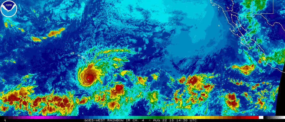
At 11 a.m. Wednesday, the Central Pacific Hurricane Center said Hurricane Lane was still a powerful Category 4 storm, packing maximum sustained winds near 155 mph with higher gusts.
Lane was centered about 285 miles south of Kailua-Kona — or 420 miles south-southeast of Honolulu. It has slowed to just 8 mph.

Track of Hurricane and path
On Wednesday morning, forecasters said Lane had passed south of the Big Island, but stressed that the hurricane is still expected to considerably impact parts of the island, bringing surf, wind and rain.
Lane is moving west-northwest and is expected to make a gradual turn northwest Wednesday, bringing it "dangerously close" to the island chain as a hurricane Thursday through Saturday.
Hurricane-force winds extend 40 miles from the center of the storm, while tropical-storm-force winds extend outward up to 140 miles.
Continues below

Lane continues to be a very impressive hurricane," the Central Pacific Hurricane Center said, in its latest update. "Do not focus on the exact forecast track or intensity for Lane, and be prepared for adjustments to the forecast. Life threatening impacts can extend well away from the center of a hurricane."
Here are specifics on the potential hazards from the storm
Strong winds
Tropical storm conditions are expected on the Big Island and Maui beginning late Wednesday night into early Thursday, with hurricane conditions expected in the warning area Thursday.
Tropical storm conditions are possible on Oahu and Kauai on Thursday; and hurricane conditions are possible late Thursday into Friday.
RAINFALL EXPECTED
Rainfall totals from Lane are expected to hit 10 to 15 inches, and some spots could see rain totals in excess of 20 inches.
Rain bands from Hurricane Lane are moving ashore Wednesday in the Puna and Kau districts. Torrential rains associated with Lane is expected to affect portions of the state late Wednesday into the weekend.
flash flood watch
A flash flood watch is in effect for all islands in anticipation of the heavy rainfall. The watch is in effect through Friday afternoon.
high surf warning
meanwhile, is in effect for south-facing shores of the Big Island, while a high surf advisory has been issued for south-facing shores of all other islands.

The good news: Lane is forecast to slowly weaken over the next 48 hours, though it's still expected to remain a hurricane as it nears the state.
Sea surface temperatures are helping Lane to remain strong. Water temperatures along the forecast track are about 82 degrees, warm enough to support a major hurricane. But a strengthening wind shear is expected to start weakening Lane.
On Tuesday night, Lane became one of only two recorded Category 5 hurricanes to pass within 350 miles of the Big Island's South Point. The last: Hurricane John in 1994.
Saffir-Simpson Scale
Tropical Storm - winds 39-73 mph (34-63 kt)
Category 1 - winds 74-95 mph (64-82 kt)
Category 2 - winds 96-110 mph (83-95 kt)
Category 3 - winds 111-129 mph (96-112 kt)
Category 4 - winds 130-156 mph (113-136 kt)
Category 5 - winds 157 mph and up (137+ kt)
Follow Donegal Weather Channel on other social media platforms by clicking the icons below


