
ANOTHER POSSIBLE STORM AT THE WEEKEND BUT STILL SOME UNCERTAINTY

Risk of heavy rainfall this weekend

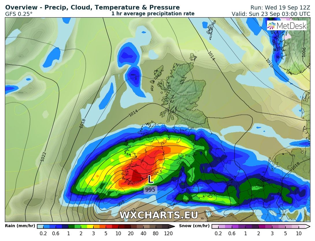
With Storm Ali just after passing Ireland on Wednesday and gusts of up to 143km/hr recorded at Mace Head in Co.Galway at Met Eireanns Weather Station this morning there is a risk of another wet and windy period of weather again this weekend.
Model runs over the past few days was bringing a storm again in from the Atlantic which could bring another spell of disruptive weather across Ireland.
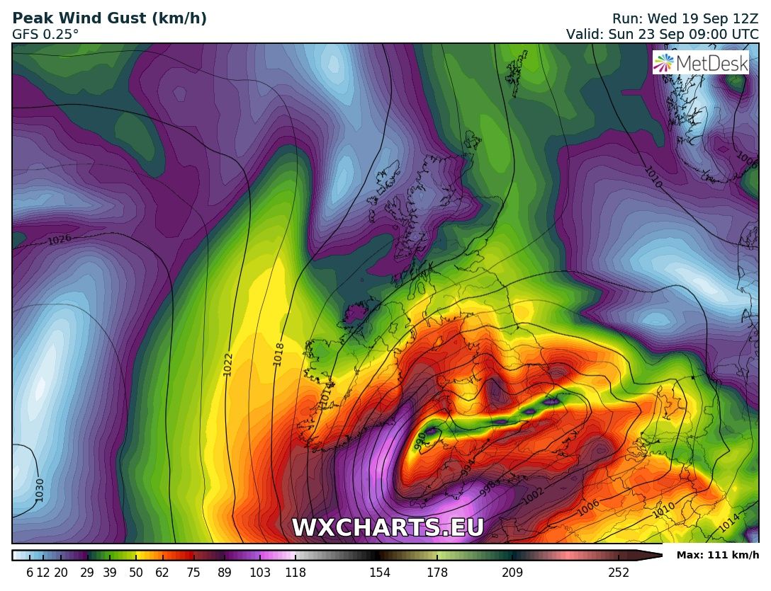
some model runs have the track of the storm over the south of Ireland where the worst of the wind would be if the latest GFS is anything to go by.
Continues below

At present this storm could be named storm with the worst effects from wind currently showing over England. Until the exact path is known of this system it will not be possible to tell where and when it will impact or whether it has any impact at all .
The latest Met Eireann Harmonie model has less of a impact with the ECMWF model showing the same kind of outlook.
At the moment looking at a number of model runs the weekend weather system looks like it will have much more of less impact than storm Ali had today. There will be the risk wind and rainfall warnings be issued in some areas but the chance of another Orange warning been issued in Ireland are lesser this afternoon going the by the latest runs.
I will update on the weekend again tomorrow incase of any changes to the area of low pressure.
Kenneth from the Donegal Weather Channel
CHECK OUT OUR ONLINE STORE


The stunning Leitir Mhic An Bhaird (Lettermacaward) Donegal during May 2018


This was a shot of a sunset i got back on May 2016 from Creevy Donegal Ireland while watching the sunset for over 2 hours.

I was in Albufeira Portugal I was waiting for the full moon to come up and it did not let me down.
The orange and red tints that the Moon sometimes take on rising and setting are caused by the particles in the Earth's atmosphere. When light (or more specifically, packets of light called photons) from an astronomical object passes through the Earth's atmosphere, it scatters off of particles in the latter.

What a unbelievable night and morning out storm chasing, These number of thunderstorms had to be the best in years as most of the lightning was CG bolts. I even manage to captures Two to three CG bolts in one shot.

One of the most beautiful views of Slieve league From sea and got some nice photos.
Photos from this angle I have not seen yet and it was wonderful to finally capture that moment.
Follow Donegal Weather Channel on other social media platforms by clicking the icons below


