
HURRICANE CHRIS LATEST - MAKING ITS WAY ACROSS THE ATLANTIC OVER THE WEEKEND


Latest track of Hurricane Chris which will downgrade to a post tropical storm by Friday morning and to a depression or area of low pressure by Saturday morning once it reaches Iceland.
Hurricane Chris formed late Tuesday afternoon off the U.S. East Coast, the second hurricane of this year's Atlantic hurricane season.
Other than churning up some rough seas along the coast, Chris poses no direct threat to the USA as it races out to sea. It could clip Newfoundland, Canada, later in the week.
As of 5 p.m. EDT, Chris had winds of 85 mph, which makes it a Category 1 hurricane. The center of Chris was 205 miles east-southeast of Cape Hatteras, North Carolina, and was moving to the northeast at 10 mph, the National Hurricane Center said.
Although there are no coastal watches or warnings in effect, ocean swells from the storm "could cause life-threatening surf and rip current conditions" along the U.S. East Coast over the next few days, the hurricane center warned.
Beachgoers in New England may notice roughening surf as the storm passes, according to AccuWeather.
On Monday, in Ocean City, Maryland, the beach patrol made 141 rescues because of strong rip currents.
Chris could make landfall as a post-tropical storm later in the week in southeastern Newfoundland, the Canadian Hurricane Centre said. If the storm's track holds, it will bring heavy rain and strong winds and waves along parts of the coast, the center said.
Continues below

Over the week and weekend Hurricane Chris will lose its strength as it move over the colder waters of the north Atlantic and by Thursday morning will be no more than a post tropical storm.
On Friday and Saturday Chris will then be downgraded to a depression also known as a area of low pressure.

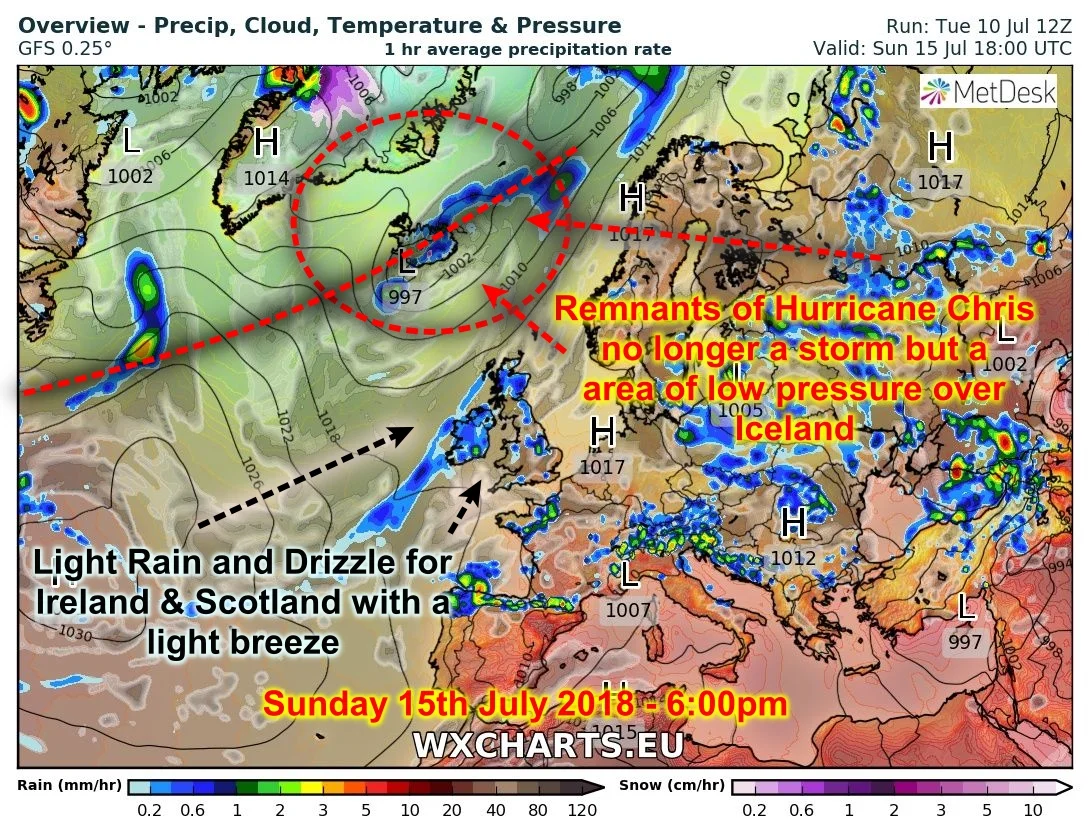
The Remnants of Hurricane Chris no longer will be a storm but a area of low pressure over Iceland. It will stay northwest of Ireland Keeping the weather mainly dry on Saturday apart from the risk of the odd light shower of rain or drizzle later in the day across the west and northwest.

On Sunday it looks set to start dry at this stage but then over the afternoon light rain and drizzle will move in from the west spreading to all areas going by the latest outlook.
The Remnants of Hurricane Chris will then be located over Iceland and at this stage be just a normal area of low pressure. If this storm was to approach from the warmer waters and track in from the south across Ireland it would of had a little more power and much more rain and windier weather. So thankfully it will stay northwest in the colder waters of the north Atlantic losing straightness as it come across the Atlantic from the east coast of the USA.
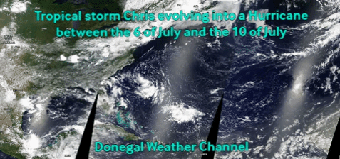
Below you can see the images I have attached of Tropical storm Chris developing into now Hurricane Chris and how quickly it evolved over the last 5 days.
Kenneth from the Donegal Weather Channel
FOLLOW DONEGAL WEATHER CHANNEL ON OTHER SOCIAL MEDIA PLATFORMS BY CLICKING ICONS BELOW


