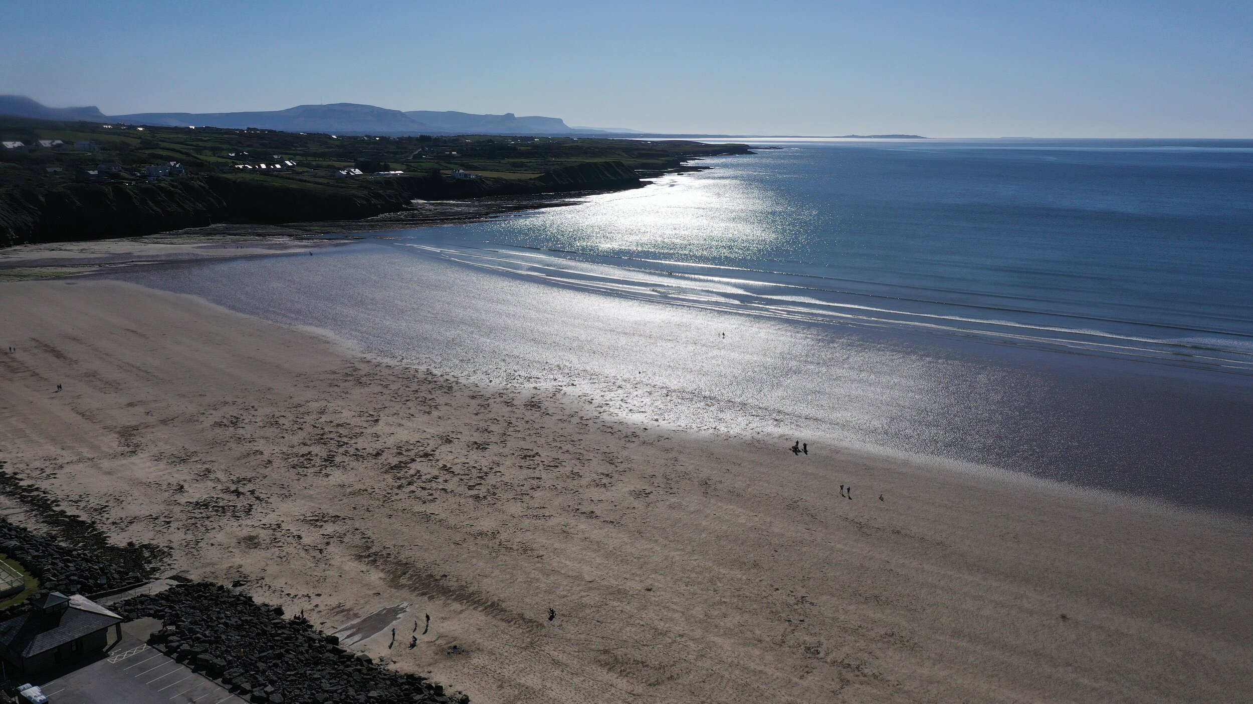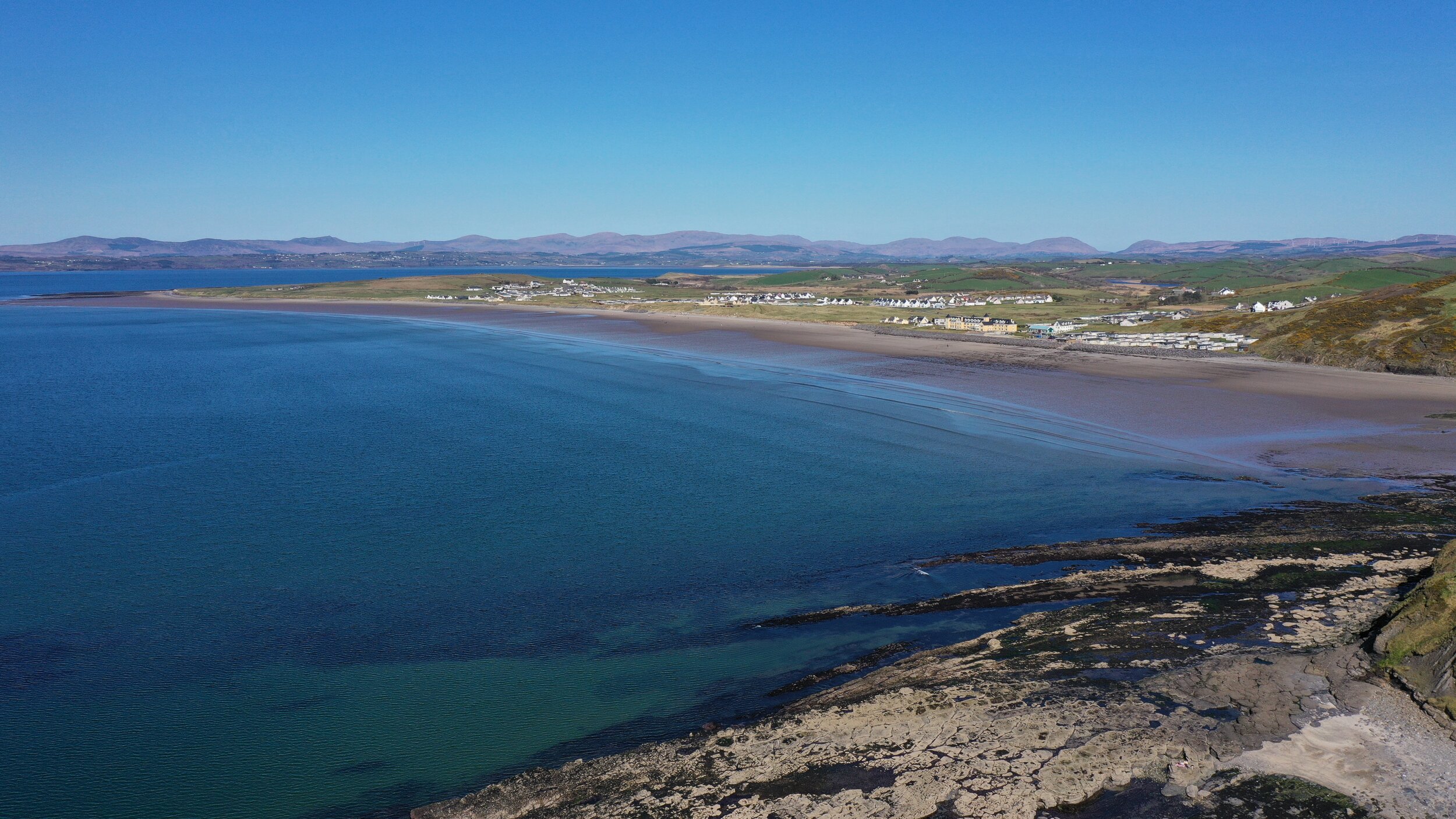
ROSSNOWLAGH BEACH
BEACH
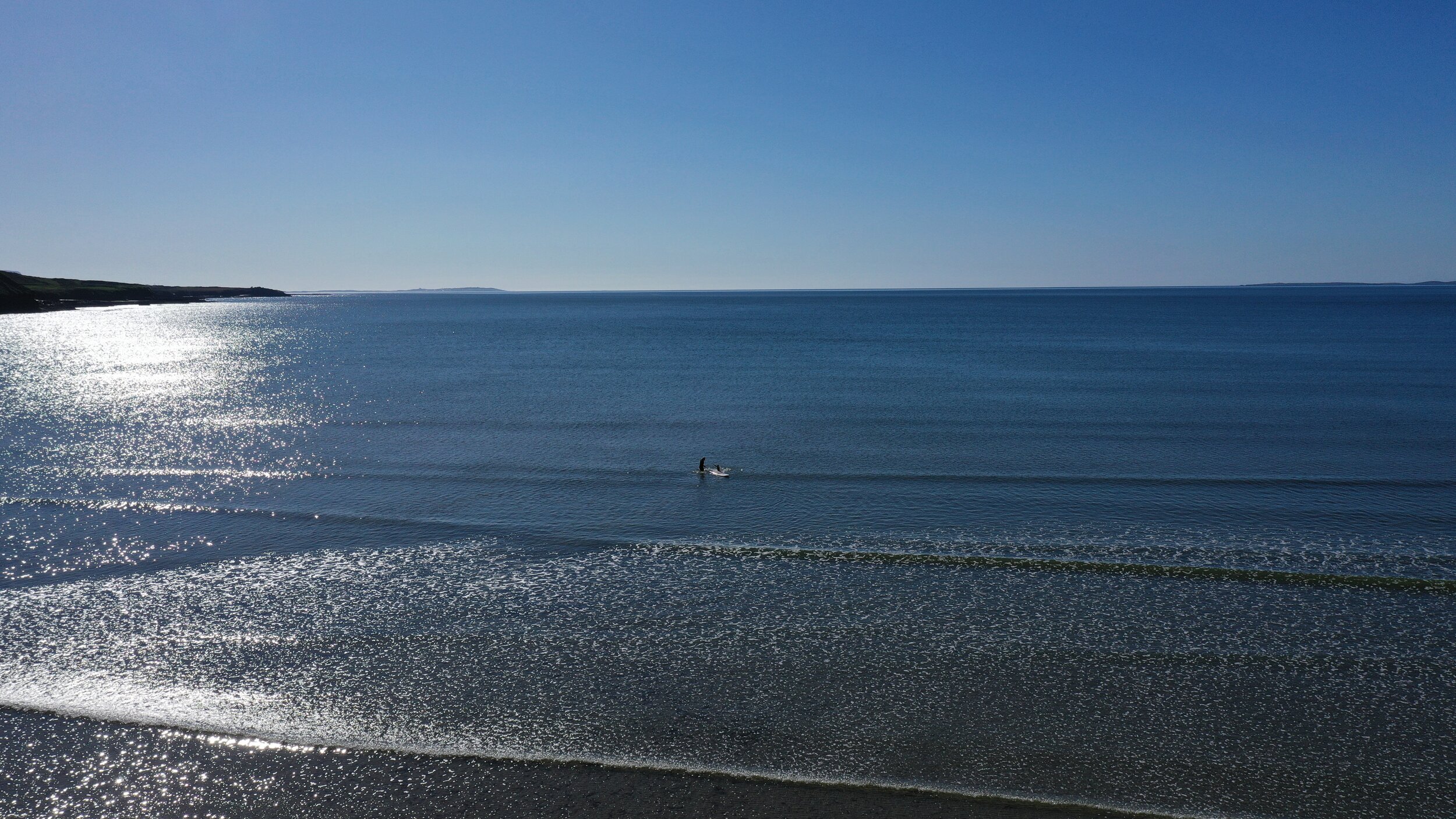
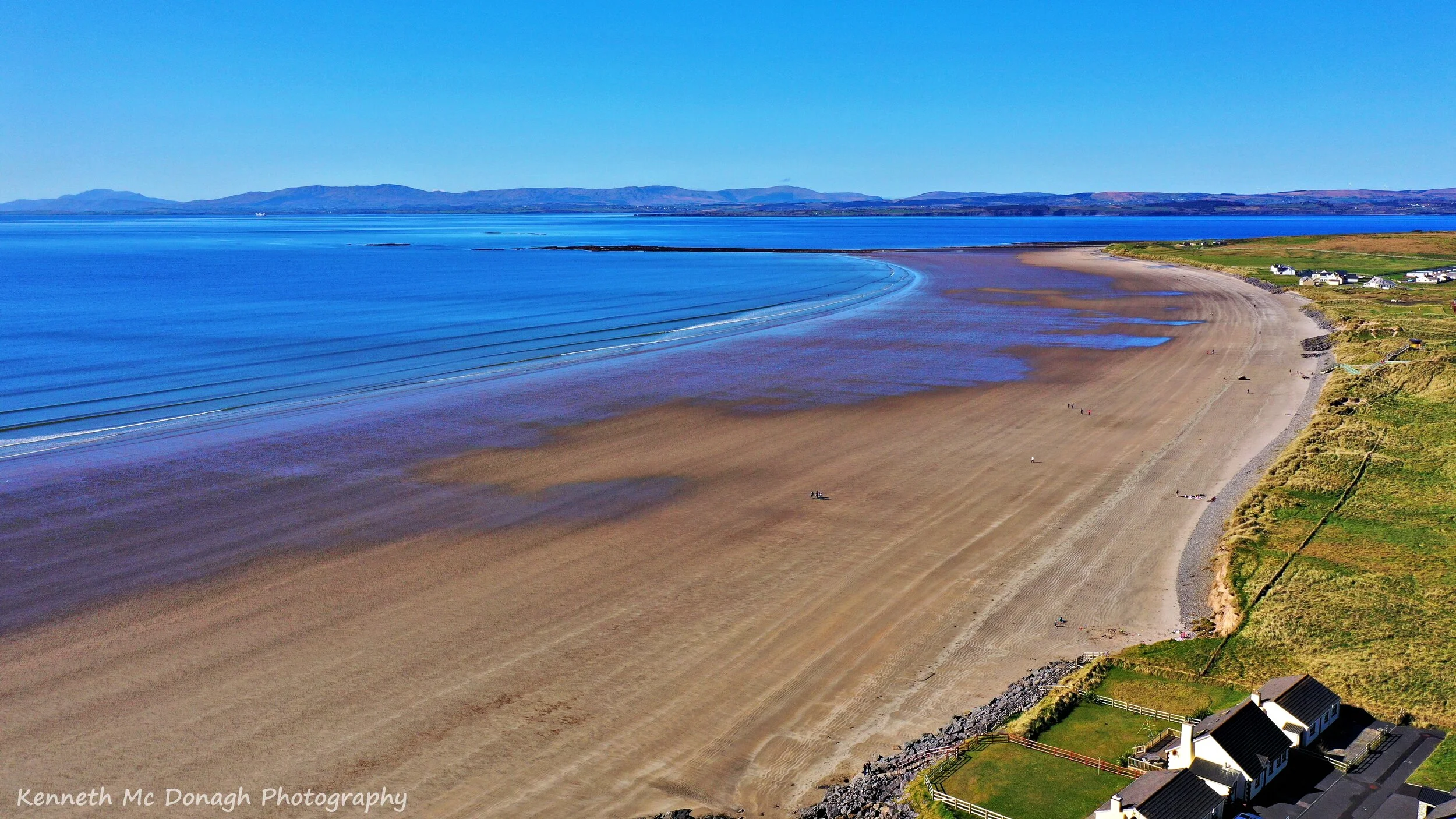
Rossnowlagh (Irish: Ros Neamhlach, meaning "heavenly headland") is a seaside village in south County Donegal, Ireland. It is about 8.5 km (5 miles) north of Ballyshannon and 16 km (10 miles) southwest of Donegal Town. The area's 3 km (2 mile) long beach or 2km if measuring from the cliffs to Carrickfad (long rock in Irish) which juts out from the headland and is visible at low tide. it is frequented by walkers, surfers, wind-surfers, kite-surfers and swimmers.
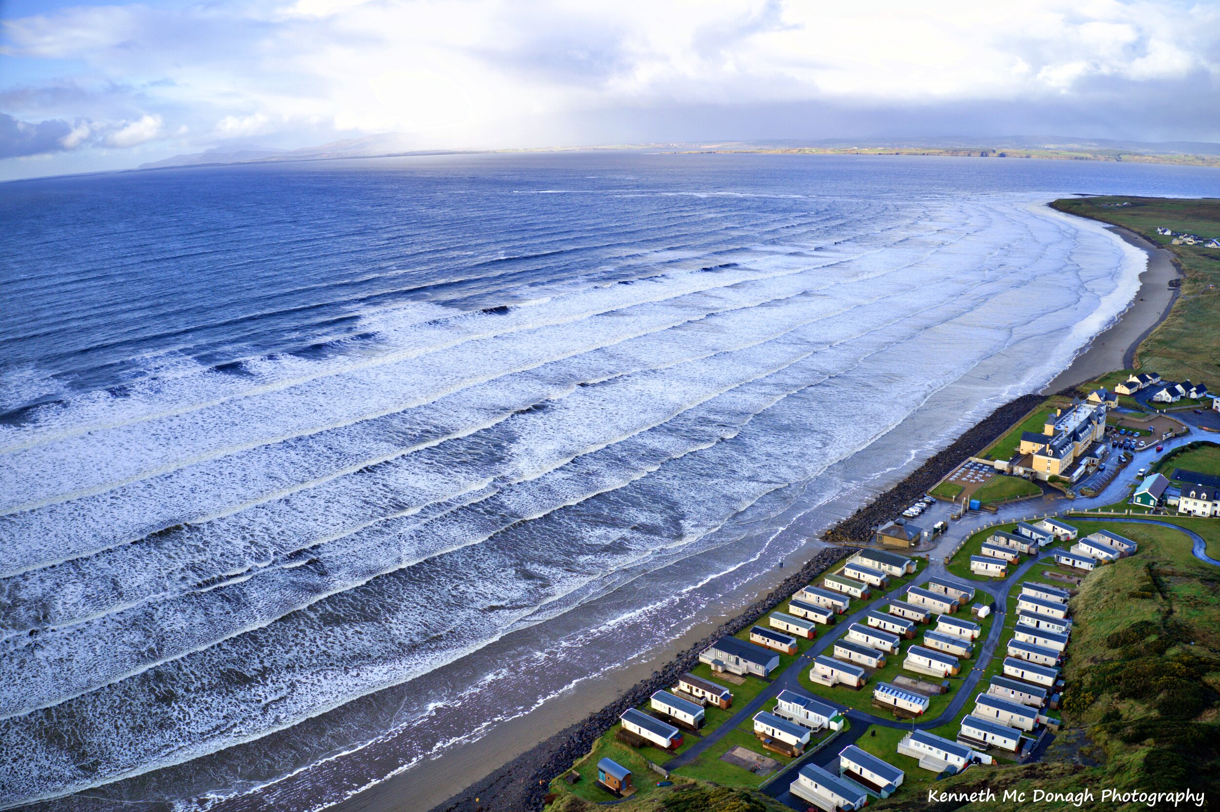
Rossnowlagh is one of Ireland's and Europe's best Blue Flag surfing beaches. As the slowly rising beach faces westward into the Atlantic Ocean, and the fact that Donegal Bay has a funnel-like shape, it can increase the size of the waves, especially in winter when some huge rollers are generated and it has been known to have waves up to 7 metres (20 ft) high. Rossnowlagh has good safe facilities and has excellent water quality.
Rossnowlagh has many visitors during the summer months and most of the beach is accessible by car. Drivers are cautioned however to be aware of soft sand areas where cars can get stuck and to be aware of incoming tides which can move in rapidly and cover most/all of the beach. There may be a Beach Warden on duty and information about full and low tides may be displayed. Drivers on the beach are required to drive very slowly at 15 km/h (10mph) and to be on the lookout for children and other users of the beach.
A soil erosion study of the beach at Rossnowlagh, known officially as Belalt Strand, has been made. The area consists mainly of sandy beach, but also rocky shore platform, sand dunes, grassland, boulder clay cliffs and rock cliffs. Over the last 60 years it has been determined that the central section of the dune front has been eroding at rates up to 0.6 metres (2 ft) per year, with the highest erosion rate between 1951 and 1977. Starting in 1972, short lengths of rock armour were constructed at first in front of the Sandhouse Hotel and with further additions along the shore-line; this stopped the erosion in protected parts but the dune front has a ragged appearance with up to 35 metres (115 ft) of erosion where half of the sandy shoreline has no protection.
Amenities
The main amenity is the extensive beach which is very popular with families. It is frequented by walkers, joggers, sunbathers, surfers, wind-surfers, kite-surfers and swimmers, and is accessible by car via 3 ramps. There is about 3 km (2 miles) of wide sandy beach although it is possible to walk several more kilometres further along the shore and all the way to Murvagh Beach
The Sandhouse Hotel is located adjacent to the beach, with a Surfers Bar attached. Overlooking the beach and on the cliff is the Smuggler's Creek Inn restaurant and bar, and there are several shops in the area, along with a Post-Office and Shop near the Franciscan Friary as well as The Thatch Tea House nearby.
The Franciscan Friary is located up from the southern end of the beach. The Friary has a Visitor Centre and contains the Donegal Historical Society Museum which houses a small collection including stone age flints and old Irish musical instruments. The Friary also has gardens which are open to visitors.
To the south-west further along the cliffs in the distance stands the ruined Kilbarron Castle which is accessible via Creevy.
video
LOCATION
PHOTOS OF THE BEACH