
DARKNESS INTO LIGHT FORECAST FOR IRELAND


The forecast on Saturday morning is looking rather good across Ireland for the Darkness into light walks across country.
Across Ireland tomorrow morning it is looking dry with clear sky for most but also very cool with on going risk of frost over the early morning hours and before dawn as temperatures are set to drop as low as 0C to 5C Across Ireland.
So if your taking part in any of the walks tomorrow morning wrap up.
Continues below


ULSTER
It will be dry across Ulster tomorrow morning for any darkness in to light walks with clear skys but fairly cool for may with the risk of frost. Temperatures will range between 0C to 5C. Coolest away from coasts.
LEINSTER
It will be dry across Leinster tomorrow morning for any darkness in to light walks with clear skys but fairly cool for may with the risk of frost. Temperatures will range between 0C to 5C. Coolest away from coasts.
CONNACHT
It will be dry across Connacht tomorrow morning for any darkness in to light walks with clear sky but fairly cool for may with the risk of frost. Temperatures will range between 0C to 5C. Coolest away from coasts.
MUNSTER
It will be dry across Munster tomorrow morning apart from some southern coastal areas where there may be some light rain for any darkness in to light walks. It will be clear over northern Munster with some cloud over southern parts and will be fairly cool for may with the risk of frost. Temperatures will range between 0C to 5C. Coolest away from coasts.

Rainfall chart from the High res hirlam model for 4am Saturday morning
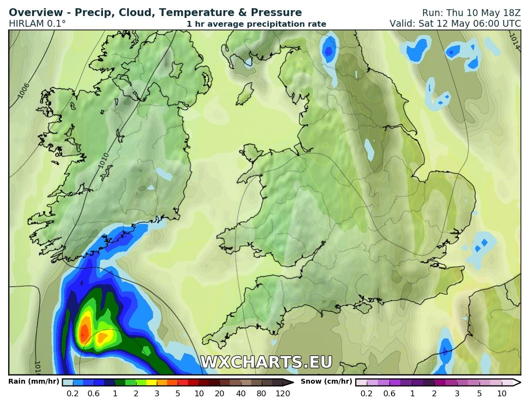
Rainfall chart from the High res hirlam model for 6am Saturday morning

Rainfall chart from the High res hirlam model for 5am Saturday morning

Rainfall chart from the High res hirlam model for 7am Saturday morning